
Mackay Cross City Link
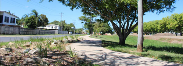
The Mackay Cross City Link is a shared pedestrian and bicycle path running South/West through the Mackay central business district. The path extends 4.8km from Archibald Street to Victoria Street along the old rail corridor.
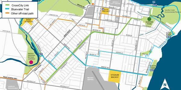
The Cross City Link bisects the Bluewater Trail off-road path, which runs around the outside of the inner city area. The new link also connects with other paths, offering direct, connected, off-road routes for active travel and recreation and facilitating more trips to be taken by walking and bicycle riding.
Download the ‘Rides of the Region’ brochure(PDF, 1.78 MB) published by Mackay Regional Council.
Key facts
- 4.8km long, 2.5m wide shared pedestrian and bicycle pathway crossing Mackay city.
- In 2017 more than 170 people used the path each day.
- Constructed in stages from late 2013 to mid-2014 at a total cost of $1.62m funded jointly by the Queensland Government and Mackay Regional Council.
Benefits
 The Cross City Link makes use of a disused rail corridor and has converted unused land into a valuable community asset. The pathway connects major industrial and residential areas to the Mackay City Centre. It provides a continuous shared path from the CBD to the southwest suburb of Paget and connects to the Bluewater Trail around the city centre.
The off-road pathway connects the communities of South Mackay, East Mackay, West Mackay, and Mackay City Centre to Paget Industrial Area – a high employment location, enabling safe, enjoyable pedestrian and bicycle commutes. It enhances the bicycle riding and walking network throughout Mackay and encourages more journeys to be made by active transport.
Community engagement
Construction of the Cross City Link was an ‘Active Towns’ project in partnership between the State Government and Mackay Regional Council.1 Notably, completion of new active transport infrastructure like the Cross City Link and other pathways was combined with the delivery of supporting programs and facilities. Mackay Regional Council installed secure bicycle parking facilities, park lighting, way-finding and distance signage and mapping, all of which made bicycle riding more user friendly and accessible. Community feedback and requests informed where the supporting infrastructure was provided.
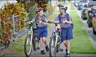
Further, funding enabled the PCYC to upgrade their facilities and provide a bicycle education program for primary school students in a new modified road environment. The PCYC ran free bicycle education courses to help kids become confident riders and older residents to get back on their bikes.
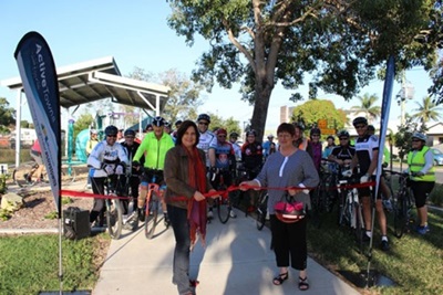
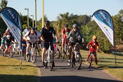
Council also organised fun interactive activities to better connect the community and encourage healthy living. This included a community bike ride alongside local police officers and the facilitation of new social riding groups.
Insights
The Mackay region has a generally flat landscape with a sub-tropical climate, making it ideal for bike riding and walking to get around locally. There are high levels of car ownership and few disincentives to travel by car due to little congestion and ample cheap or free car parking available in the CBD. However, a survey of path users undertaken in March 2017 suggested that the Cross City Link was successfully encouraging riding and walking that would not have otherwise occurred.2 If the path were not present, 11% of pedestrians and 20% bike riders indicated they would not have walked or ridden. Further, almost half the pedestrians surveyed indicated the path had increased how often and far they walked over the previous month.
 A small portion of pedestrians said they would have driven a car if the pathway wasn’t there. It is possible that those shifting from car to bicycle riding, and both riders and walkers who would not otherwise have travelled, have increased their physical activity and therefore improved their health and wellbeing because of the Cross City Link.
The pathway is being utilised by the community, with around 170 people per day counted using the path in 2017. Surveys revealed that half of pedestrians and 30% of bicycle riders used the path at least every weekday and all bicycle riders and most pedestrians used the path at least once a week.2 Path users indicated that they used the path primarily for fitness and recreation, but also for shopping and commuting to work.
More information
For more information, please contact the Cycling and Programs team by emailing Cycling_Infrastructure_Program@tmr.qld.gov.au.
1 Active Towns was a 3-year program from 2012-2015, during which TMR targeted investment in infrastructure and behaviour change events and promotion with the specific objective of achieving a rapid increase in walking and cycling.
2 CDM Research. 2017. Evaluation of the Cross City Link (Mackay). Unpublished report prepared for the Department of Transport and Main Roads.
- Last updated 16 November 2022