
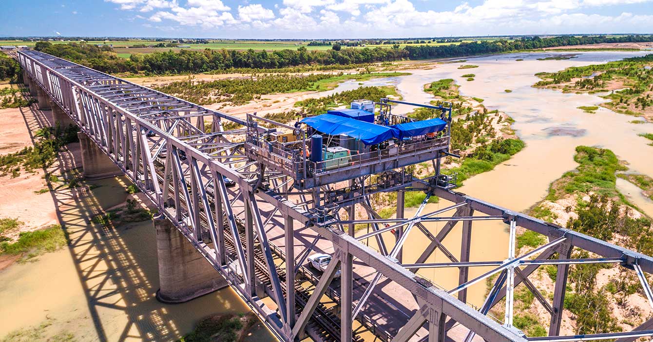
Burdekin River Bridge, rehabilitation program
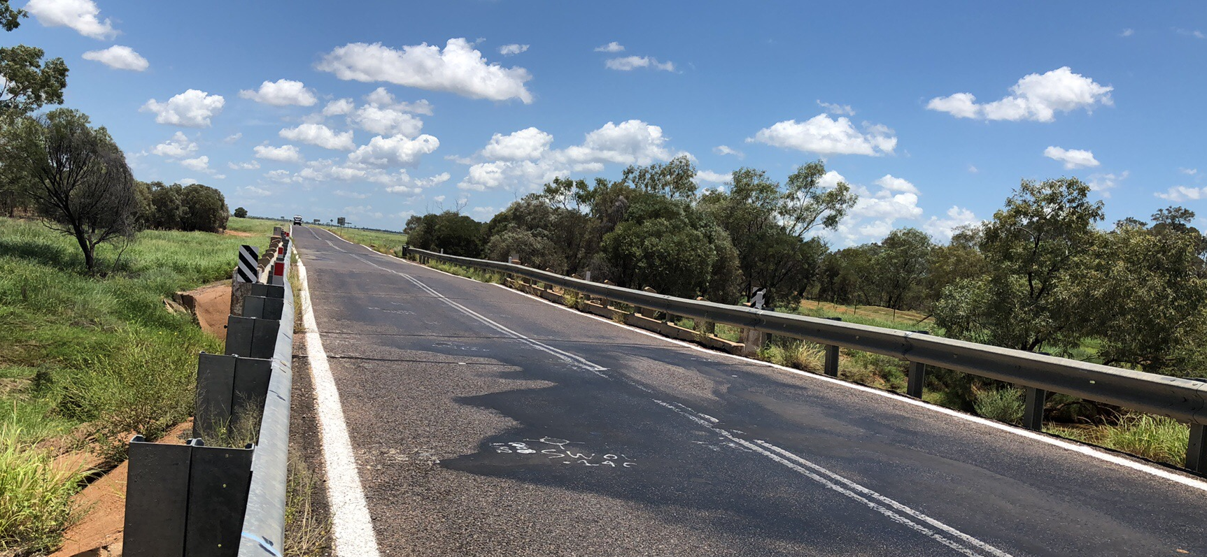
Rehabilitation and maintenance program to preserve the structural integrity of the Burdekin River Bridge. The ongoing program will ensure a safe and durable crossing is maintained for the long-term...
Rehabilitation and maintenance program to preserve the structural integrity of the Burdekin River Bridge. The ongoing program will ensure a safe and durable crossing is maintained for the long-term...
Construction of a new northbound overtaking lane on the Bruce Highway at Fredericksfield and upgrades to the intersection with Mount Inkerman Road...

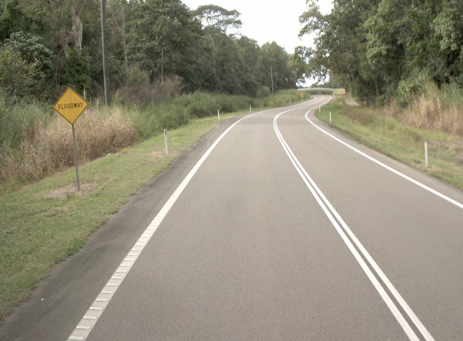
Planning has commenced to improve safety and reduce the time of closure due to flooding on a complex section of the Bruce Highway at the Gairloch floodway, 5km north of Ingham...
The Department of Transport and Main Roads is progressing a project to build a southbound overtaking lane at Smiths Gap on the Bruce Highway. The project will include the construction of a fauna...
A planning study is currently being undertaken to identify and preserve a corridor for a future bypass of Innisfail...
We are progressing a project to upgrade the intersection of the Bruce Highway and Munro Street at Babinda...
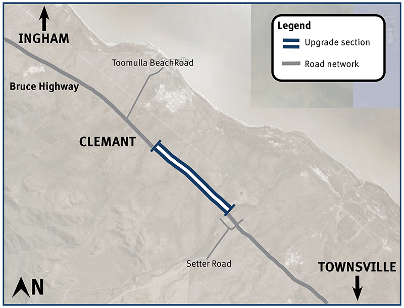
Bruce Highway safety upgrades at Clemant...
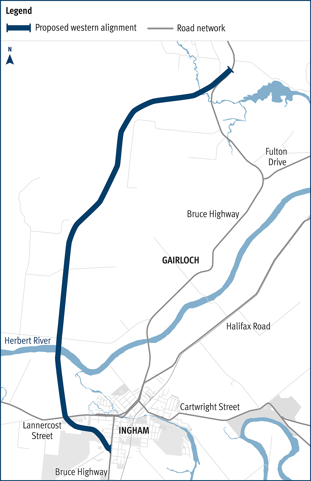
The department has been actively working with the community to address the challenges associated with the Bruce Highway from South of Ingham to the Cardwell Range...
A 10.5km upgrade and duplication of the Bruce Highway between Edmonton and Gordonvale is being delivered. The project is Stage 3 of the Cairns Bruce Highway Upgrade Master Plan released in 2010...
Planning for the Bruce Highway, Cairns Southern Access Corridor, (Stage 5) Foster Road upgrade intersection project will assess and recommend options to upgrade this intersection...
The Cairns Bruce Highway Upgrade master plan was released in 2010. It was the result of a planning study that investigated long term, multi-modal transport planning options to address the impacts of...
We are reinvesting project savings to deliver a new off-road cycleway adjacent to the Bruce Highway consistent with the Cairns Bruce Highway Upgrade Masterplan...
We have commenced planning for a new transit network for Cairns. This planning includes building a network to deliver dedicated public transport spines that will connect the length and breadth of...
The Cairns Transport Study will develop a strategy for the Cairns transport network that supports sustainable, efficient, equitable and affordable transport outcomes consistent with economic, social...
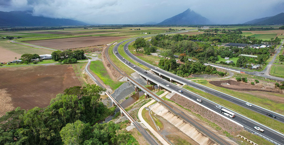
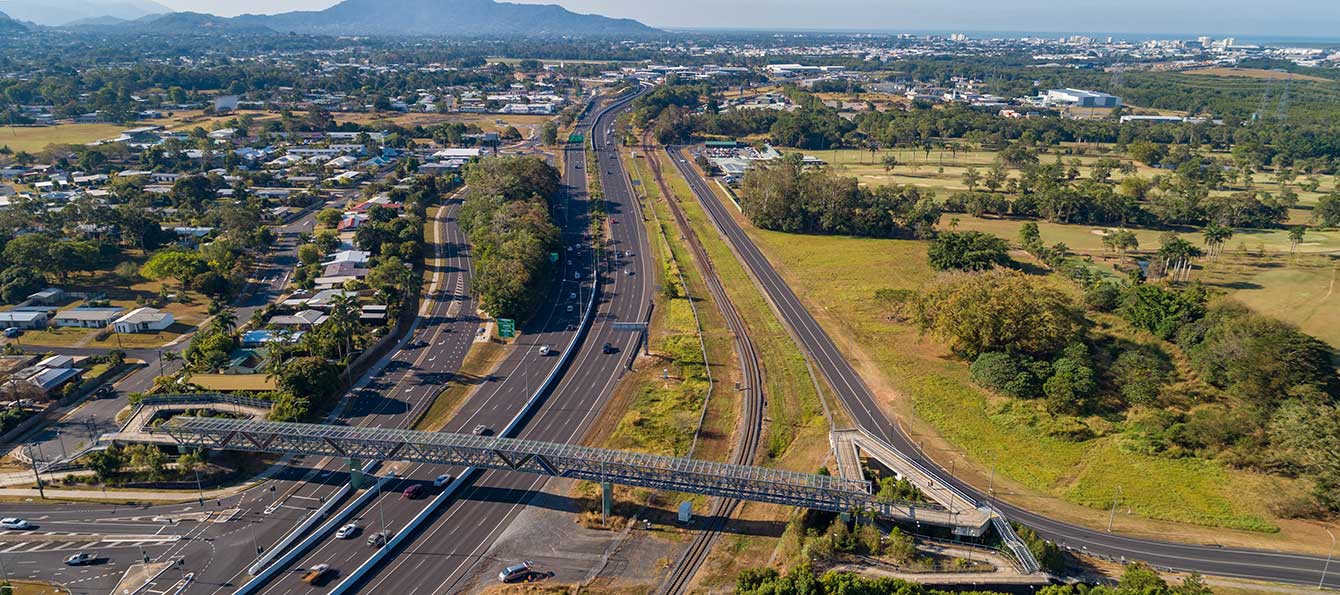
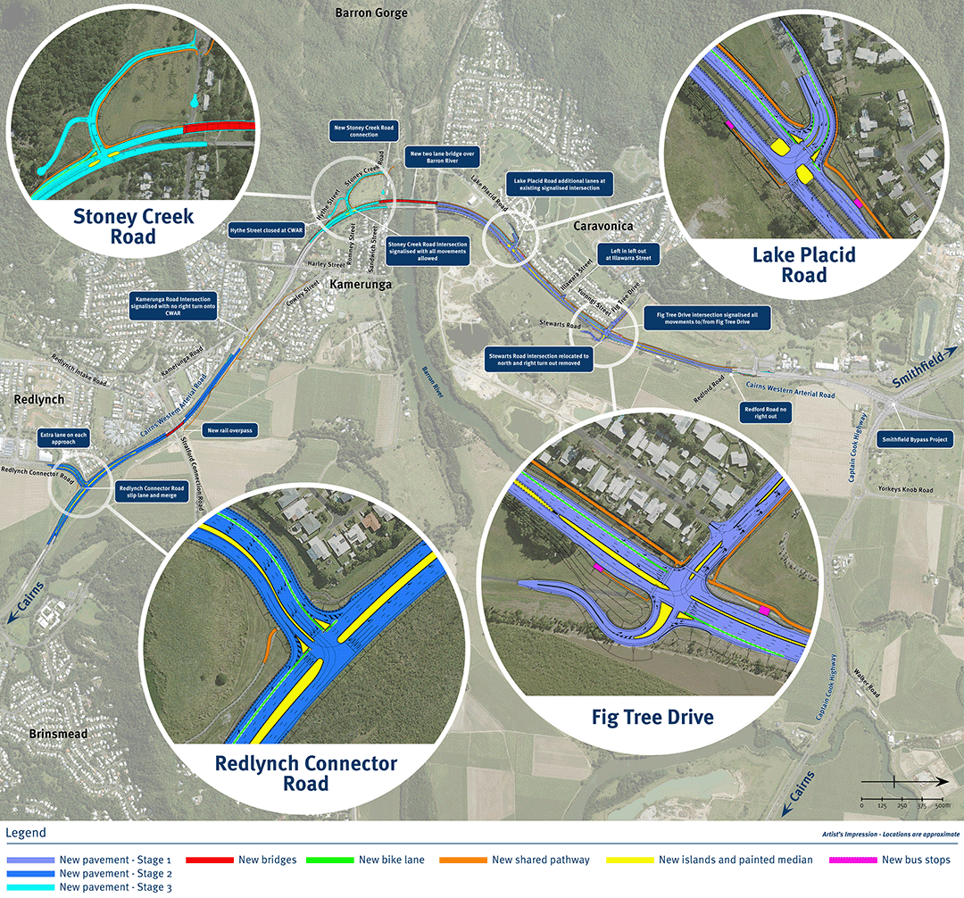
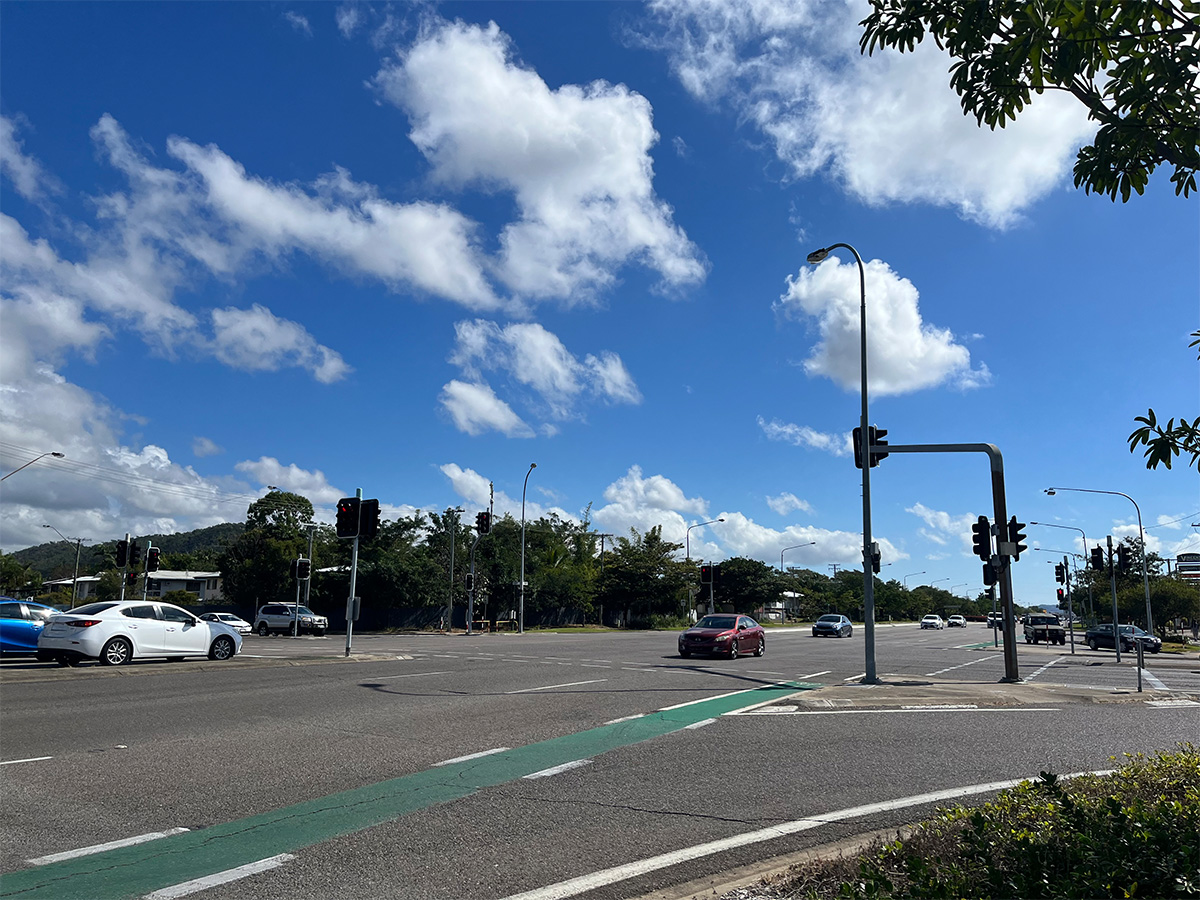
The department is undertaking a $300 million project is being undertaken to duplicate the Cairns Western Arterial Road between Redlynch Connector Road and Captain Cook Highway...
We are undertaking a $1.25 million planning study to look at improving the capacity and efficiency of transport routes between Cairns and the Northern Tablelands...
Cape York Regional Package Stage 2 is a $237.5 million program of works to deliver road infrastructure upgrades on Cape York Peninsula between 2019-2020 and 2023-2024...
We are progressing the planning for a $359 million program of road upgrades on Captain Cook Highway between Cairns and Smithfield...
Safety upgrades will be carried out at various locations along Douglas – Garbutt Road...
The floodway will be upgraded and some minor culverts will be replaced to increase waterway areas to help improve localised flood immunity...
Last updated: 5 February 2024