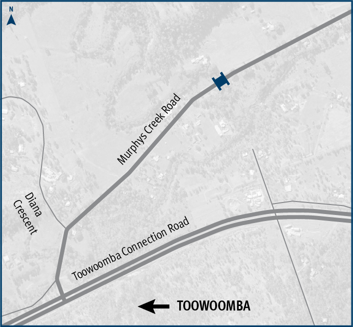
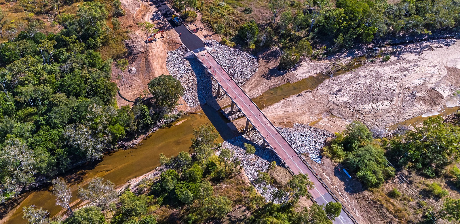
Murphys Creek Road, Rocky Creek Bridge, replace bridge
The Department of Transport and Main Roads is replacing Rocky Creek bridge on Murphys Creek Road at Postmans Ridge, with a two-lane concrete bridge...
The Department of Transport and Main Roads is replacing Rocky Creek bridge on Murphys Creek Road at Postmans Ridge, with a two-lane concrete bridge...
We are reconnecting communities and supporting regional economic recovery after disaster events damaged the state-controlled road network in 2020, 2021 and 2022...
The Toowoomba North South Transport Corridor planning project proposes to protect a transport corridor for future staged multi modal infrastructure development in the long term future...

Pavement widening on the Barwon Highway has been completed to improve road safety, reduce ongoing maintenance...
The design project is investigating safety improvements for a four-kilometre section of the Cunningham Highway between Tregony and Maryvale...
This planning project will establish a long-term vision to provide fit for purpose bike facilities along Taylor Street, Toowoomba, that encourages more people to ride more often...
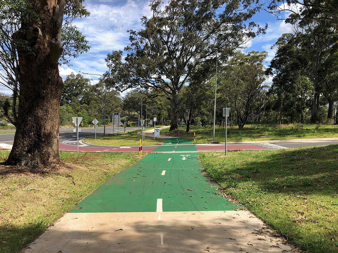
The Highfields Bikeway project involves delivering a bikeway connecting Highfields to Toowoomba to provide a safer and more accessible active transport option...
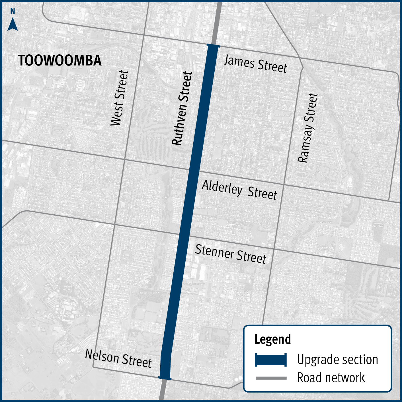
Design and construction project to improve safety and reduce the risk of crashes on Ruthven Street in Toowoomba’s south, between James and Nelson streets...
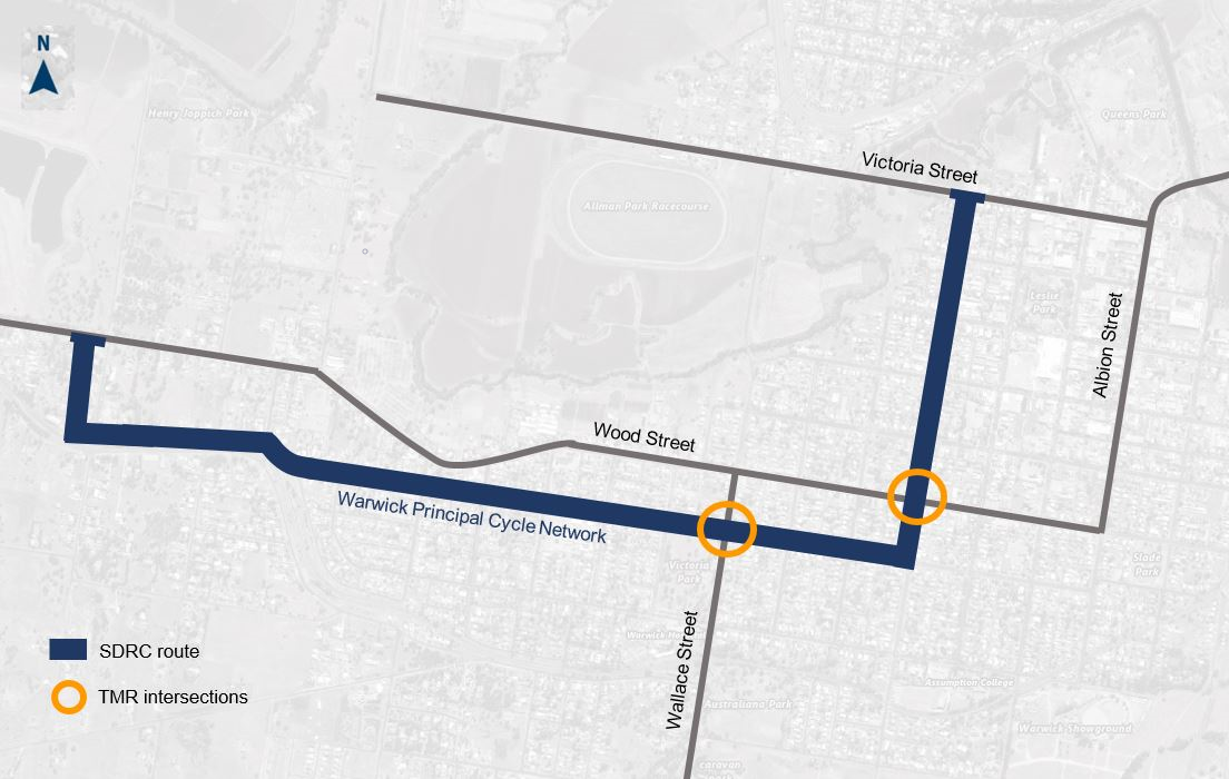
The planning project will establish a long-term vision to provide fit-for-purpose bike facilities along a desirable principal bike route in Warwick that encourages more people to ride more often...