
Isis Highway (Bundaberg – Childers), various locations, improve safety
Isis Highway high risk roads targeted road safety program safety improvements...
Isis Highway high risk roads targeted road safety program safety improvements...

We are preparing a business case to replace the rollingstock on the long distance passenger rail fleet that services western regional Queensland...
The Department of Transport and Main Roads is undertaking detailed design for an upgrade of the Maryborough-Hervey Bay Road and Pialba-Burrum Heads Road intersection in Eli Waters...
Maryborough-Hervey Bay Road/Ibis Boulevard/Fairway Drive intersection upgrade...
The single-lane John Peterson Bridge will be replaced with a higher, safer, more flood-resistant 2-lane structure on an improved alignment...
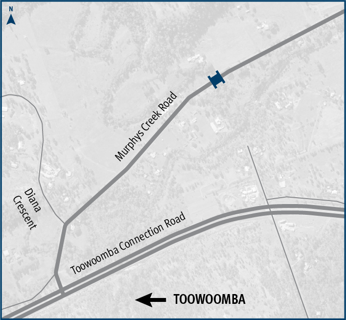
The Department of Transport and Main Roads is replacing Rocky Creek bridge on Murphys Creek Road at Postmans Ridge, with a two-lane concrete bridge...
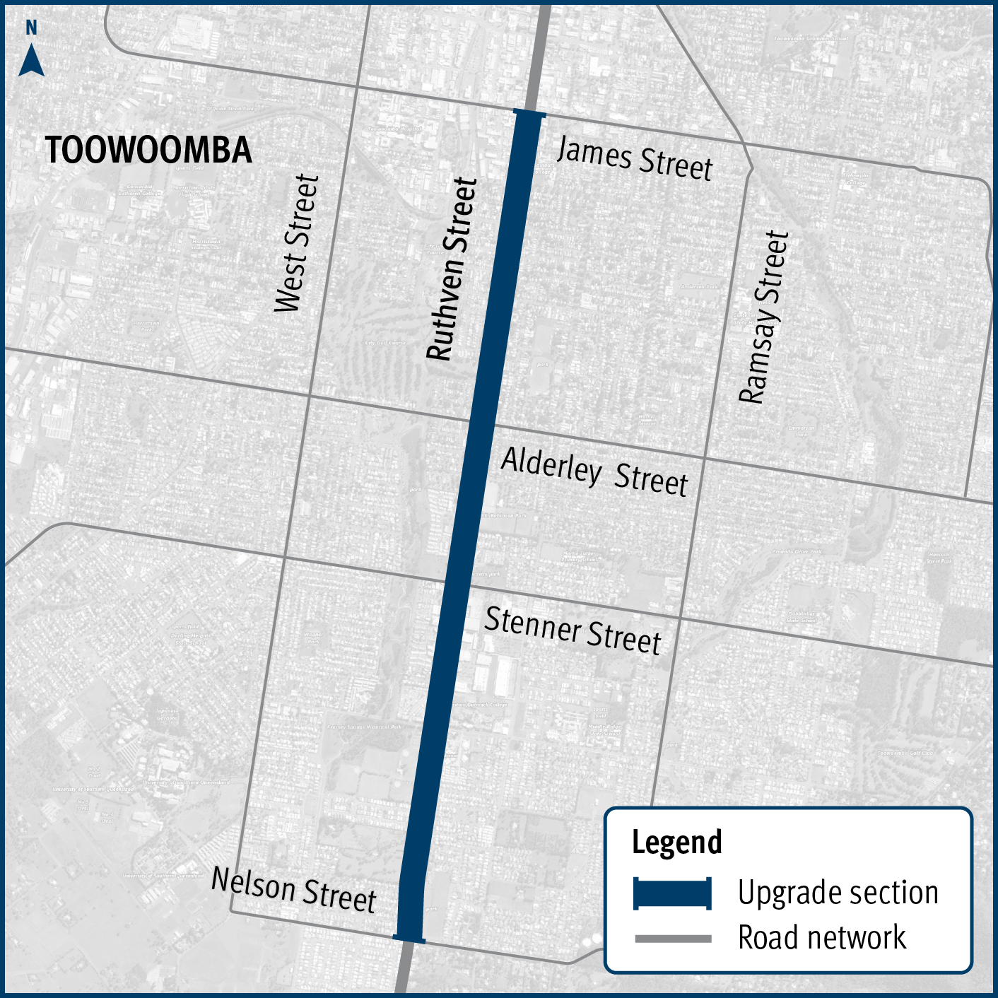
Design and construction project to improve safety and reduce the risk of crashes on Ruthven Street in Toowoomba’s south, between James and Nelson streets...
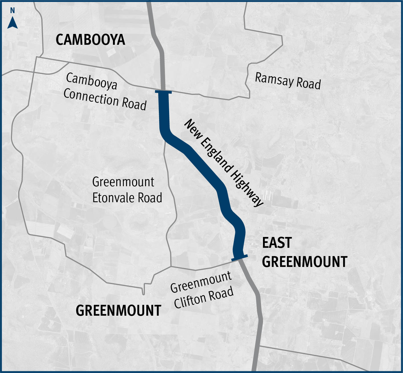
This planning project is investiged options to improve the safety and efficiency of the New England Highway south of Toowoomba, between Hodgson Creek and Cambooya Connection Road...
These planning projects will investigate future infrastructure needs such as road widening to accommodate wide centre lines and overtaking lanes, as well as replacing the Emu Creek culverts...
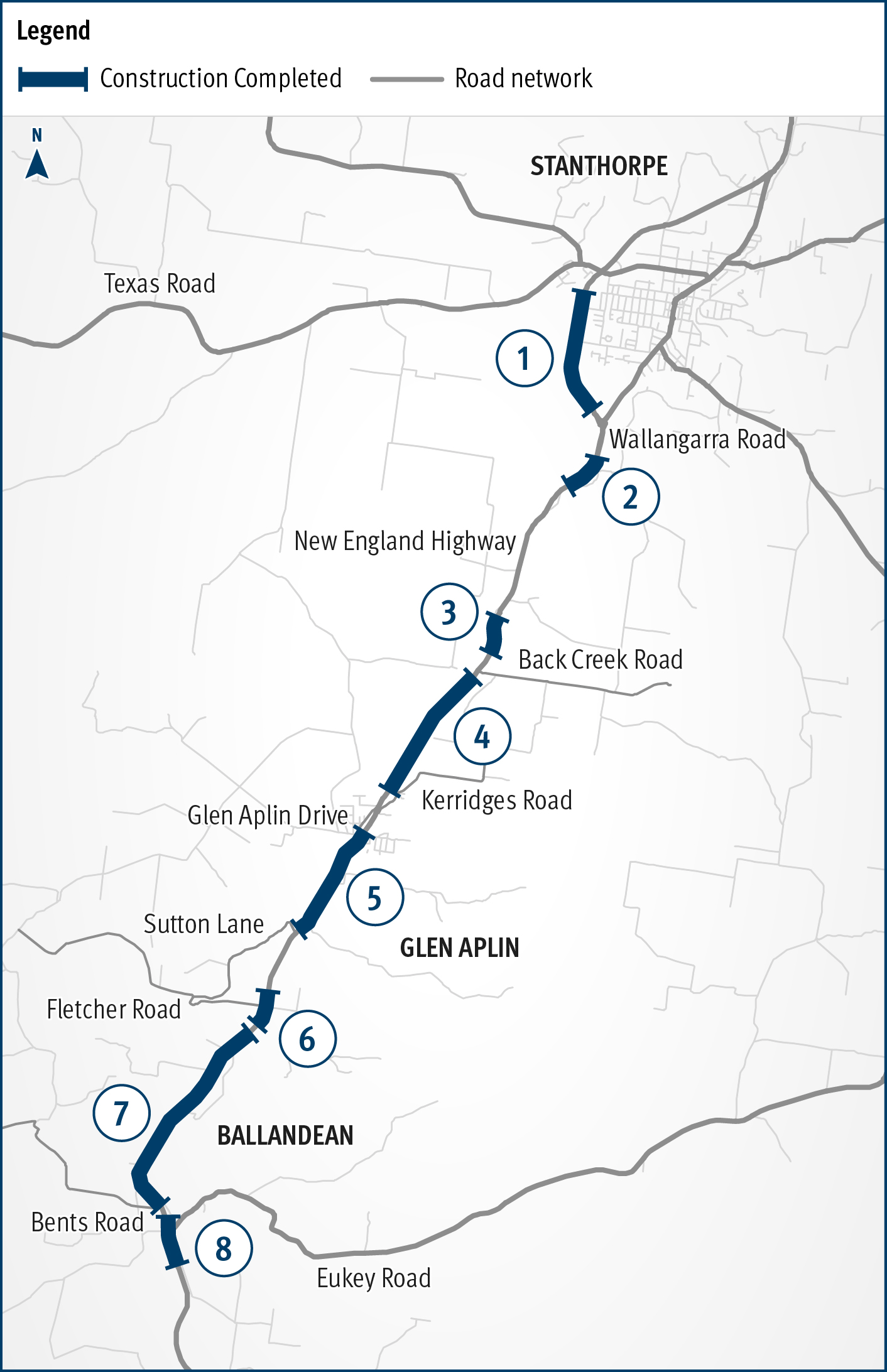
New England Highway Warwick to Wallangarra safety improvements...
Community feedback is being sought to plan improvements to the New England Highway at Cooyar...
The department is working with the Department of Defence to upgrade the entrance to the Borneo Barracks from the New England Highway at Cabarlah...
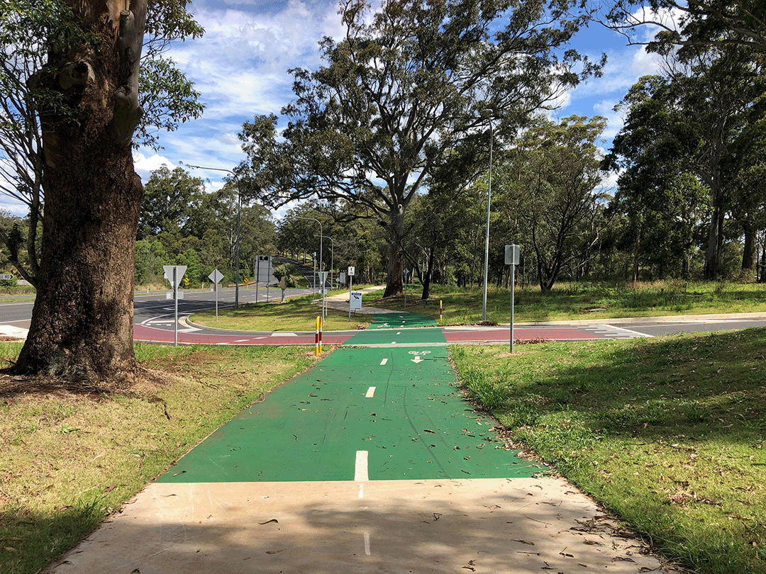
The Highfields Bikeway project involves delivering a bikeway connecting Highfields to Toowoomba to provide a safer and more accessible active transport option...
The New England Highway Pavement Widening project will improve safety and freight efficiency by widening a section of the highway to 10m...
Planning is underway to increase safety, efficiency and reliability of Oakey-Pittsworth Road...
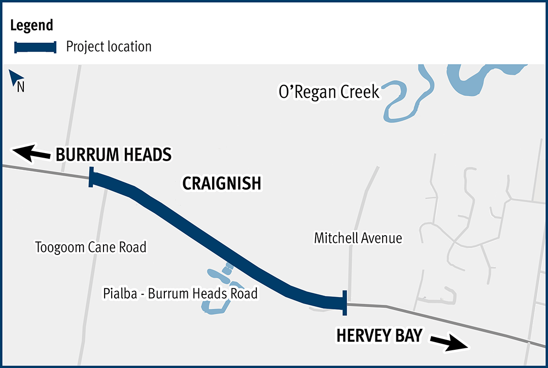
This project aims to improve the flood immunity and reduce flood closure times at the Pialba–Burrum Heads Road crossing...
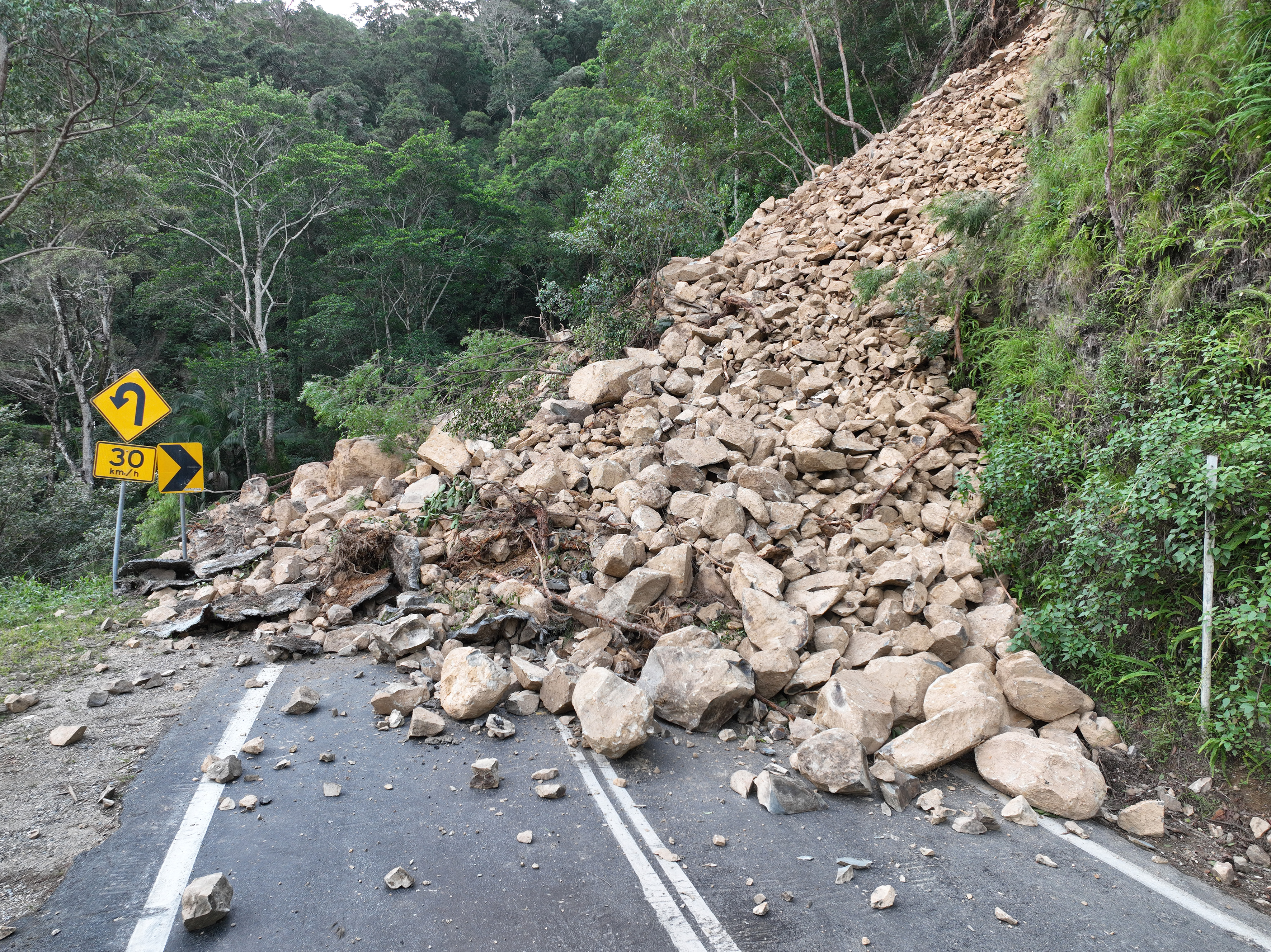
Repairs are underway across South East Queensland after extensive and severe flooding was caused by sustained heavy rainfall in late February 2022...
This planning project will establish a long-term vision to provide fit for purpose bike facilities along Taylor Street, Toowoomba, that encourages more people to ride more often...
This planning project involves developing a business case and concept design for an active transport link between the John French VC Bridge at the New England Highway and Queens Park at Margaret...
The Toowoomba North South Transport Corridor planning project proposes to protect a transport corridor for future staged multi modal infrastructure development in the long term future...
Last updated: 3 October 2023