Pacific Motorway M1 Varsity Lakes to Tugun upgrade
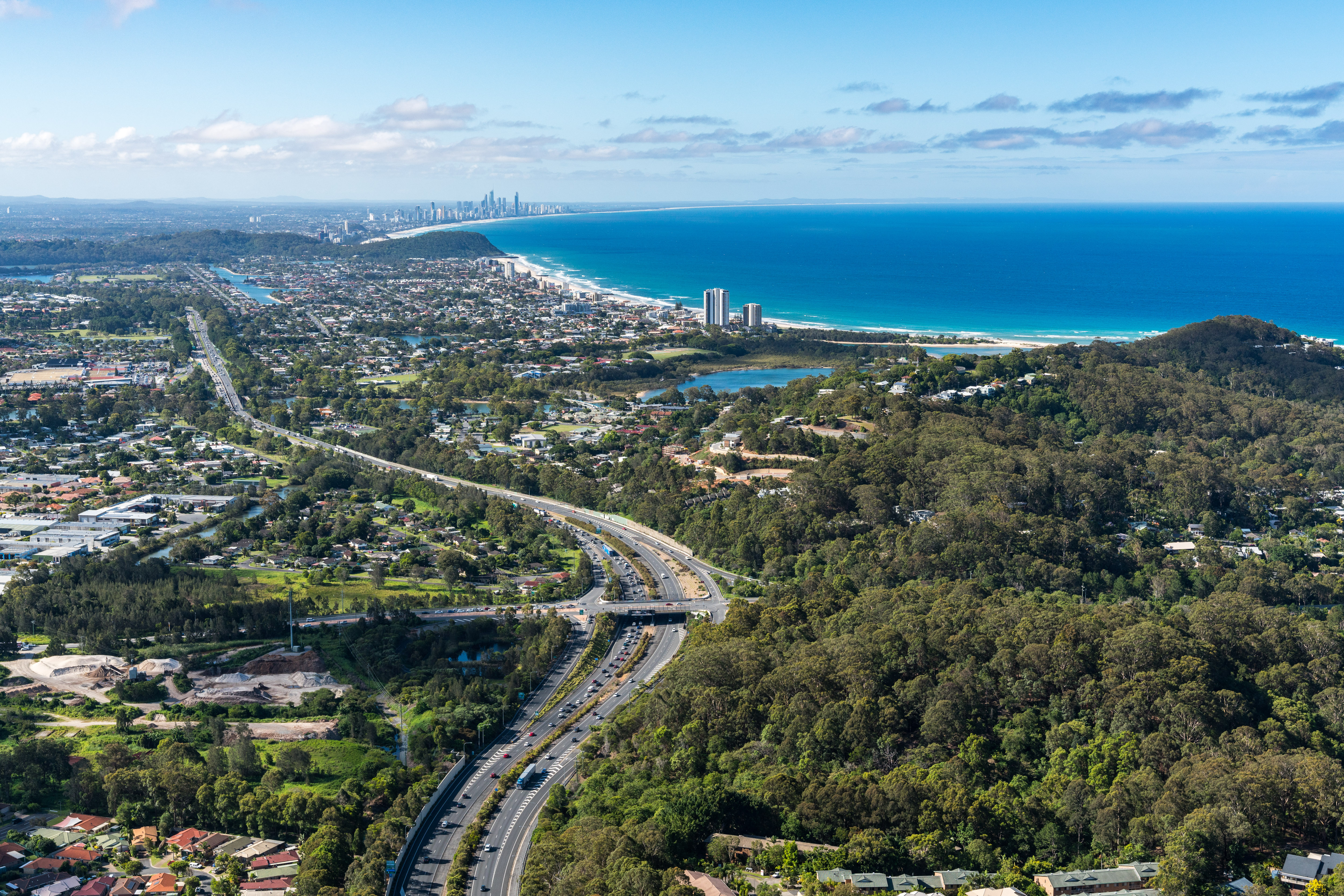
The $1 billion Pacific Motorway Varsity Lakes to Tugun (VL2T) project is being delivered to upgrade 10 kilometres of the M1...
The $1 billion Pacific Motorway Varsity Lakes to Tugun (VL2T) project is being delivered to upgrade 10 kilometres of the M1...
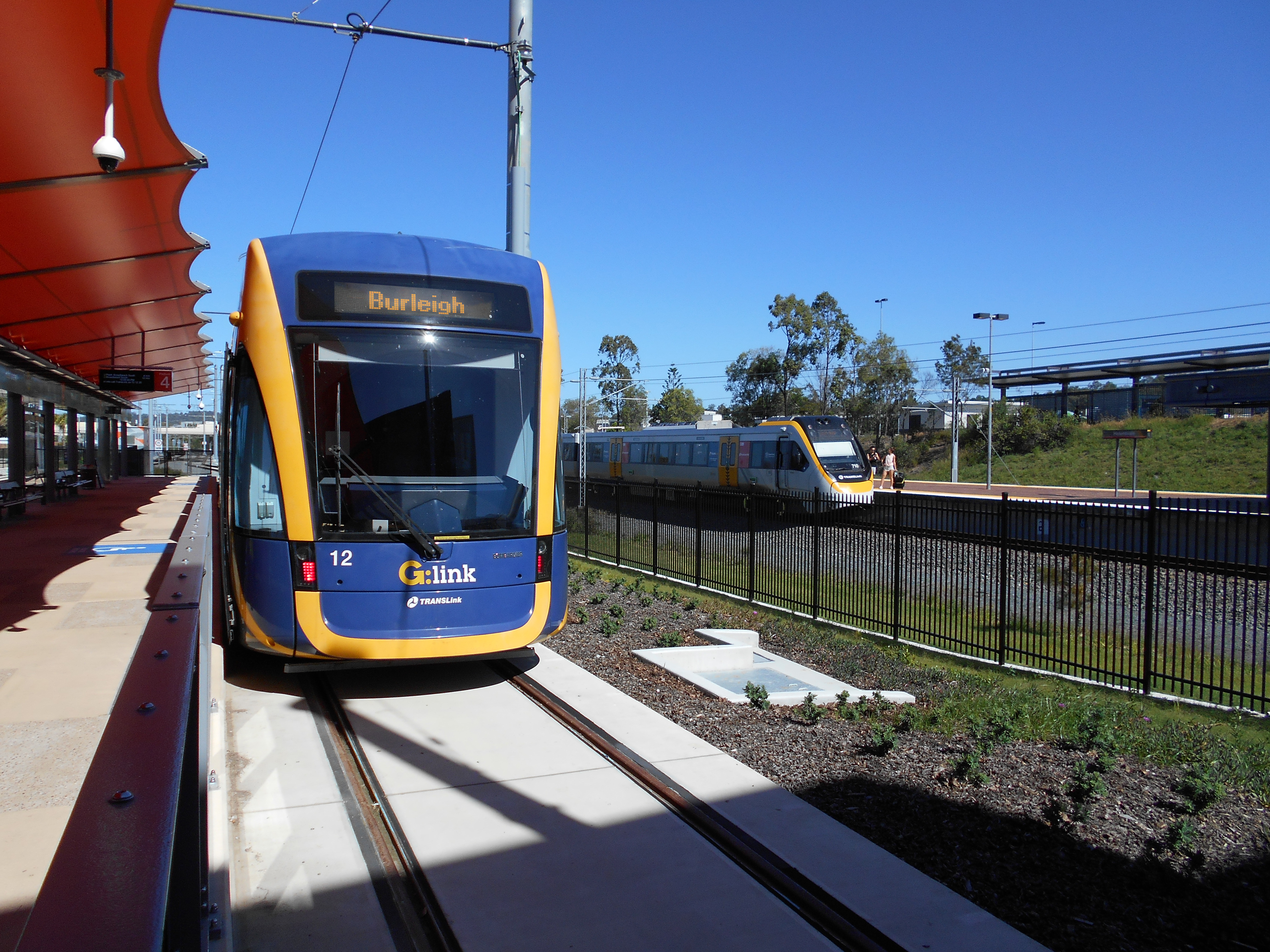
Gold Coast Light Rail Stage 3 will deliver a further 8 stations and relieve congestion in some of the Gold Coast's busiest traffic areas...
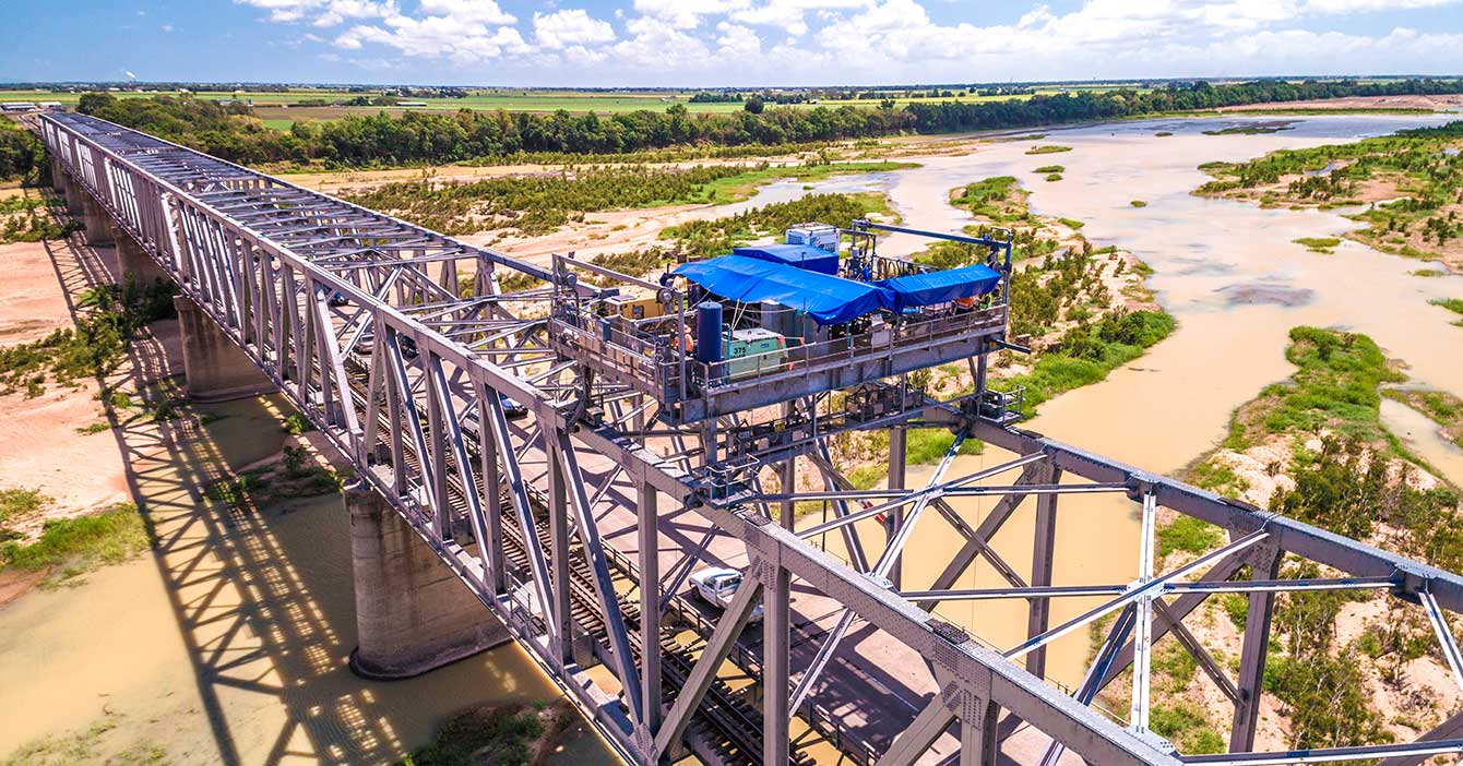
Rehabilitation and maintenance program to preserve the structural integrity of the Burdekin River Bridge. The ongoing program will ensure a safe and durable crossing is maintained for the long-term...
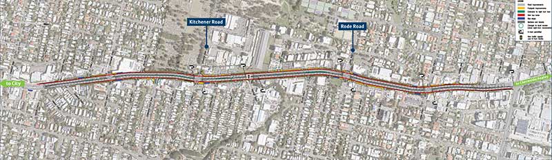
We are undertaking a $110 million package of works to upgrade Cleveland-Redland Bay Road...

The Northern Transitway will provide Brisbane’s north side customers with a safer and more efficient public transport system...
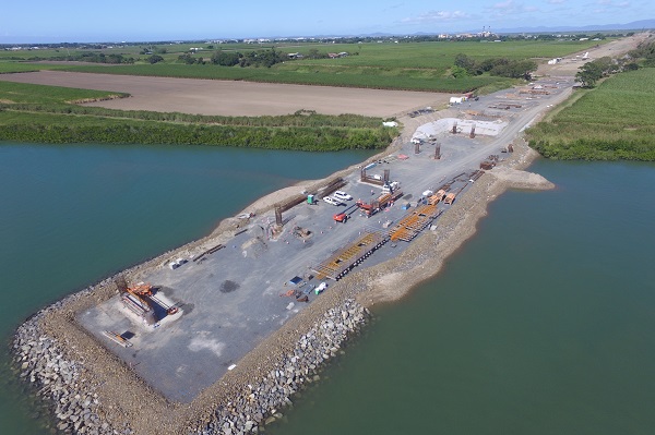
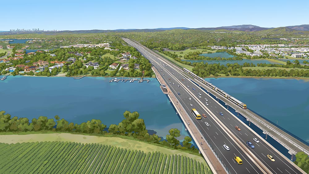
The Coomera Connector is a future state-controlled north-south corridor between Loganholme and Nerang, east of the Pacific Motorway (M1)...
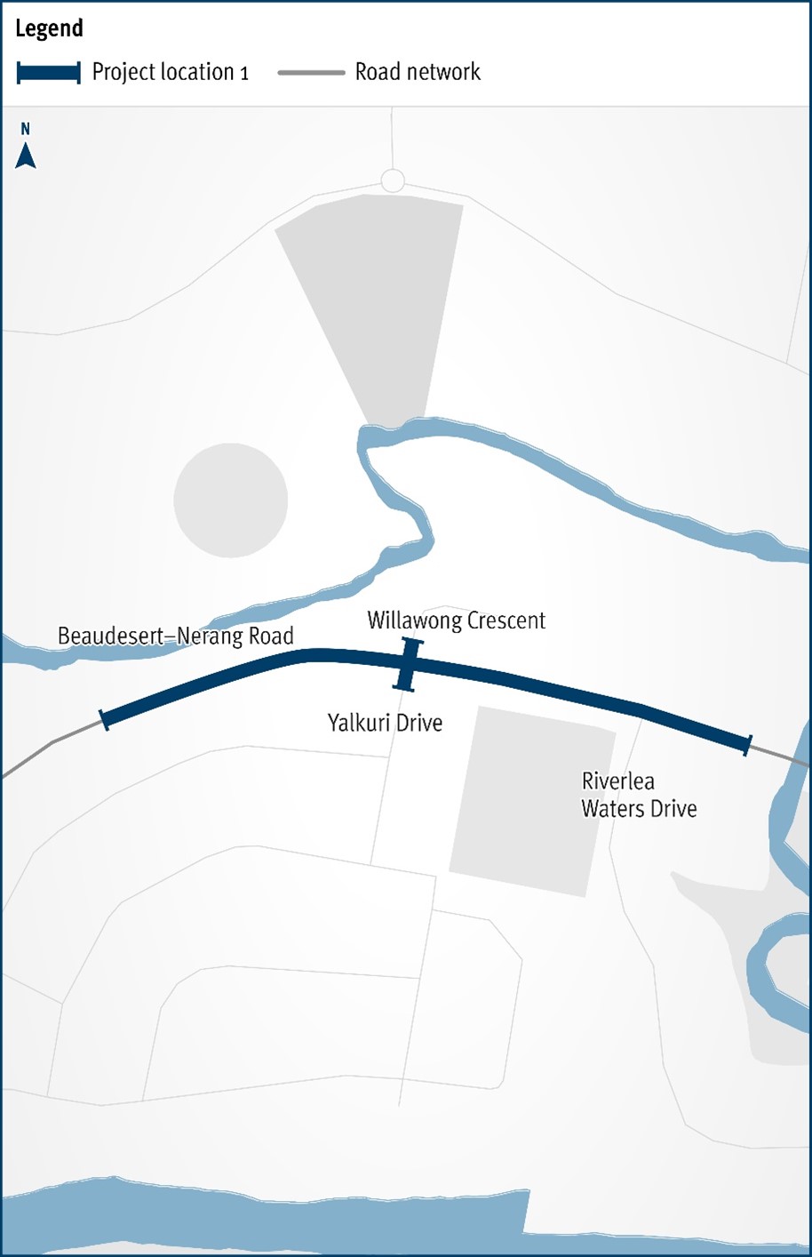
The Department of Transport and Main Roads will be improving the safety and efficiency of the Beaudesert–Nerang Road, Yalkuri Drive and Willawong Crescent intersection at Nerang...
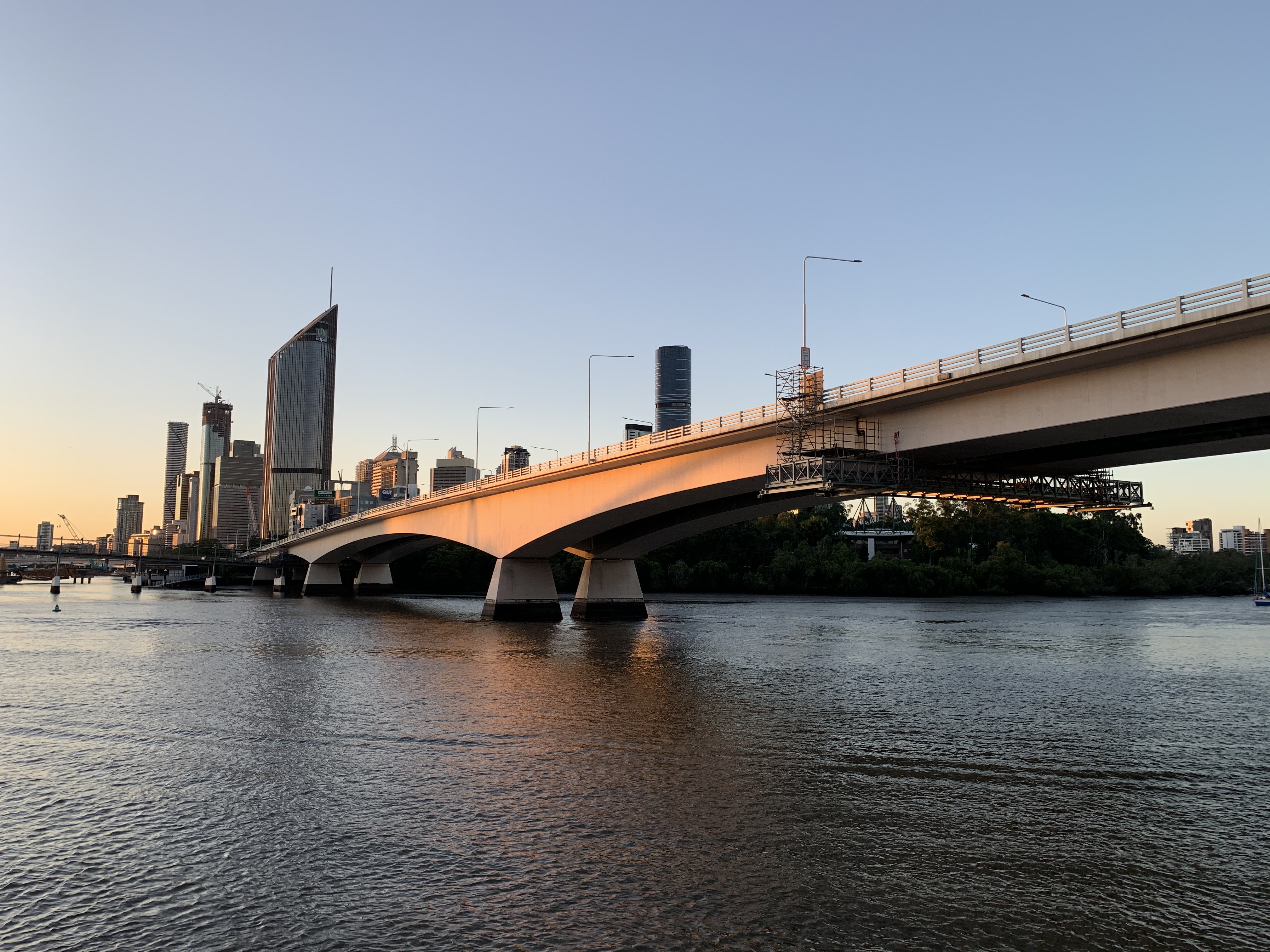
The Department of Transport and Main Roads is currently undertaking maintenance works on the Captain Cook Bridge...
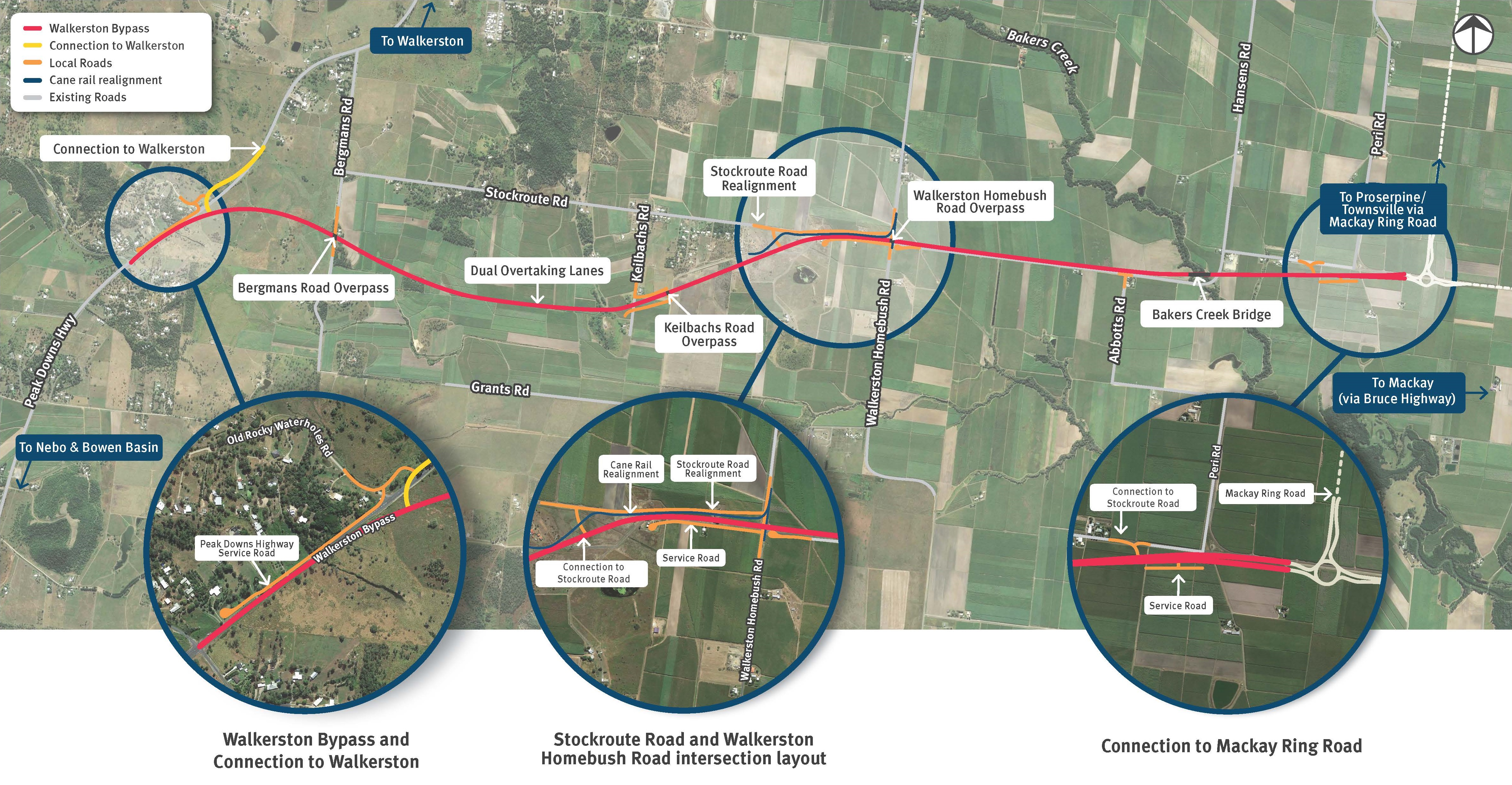
We are building a new 2-lane rural highway to connect Peak Downs Highway west of Walkerston to the Mackay Ring Road near Paget...
The need for the Ring Road was identified to keep pace with the rate of growth of the Mackay area and to better prepare the region for future growth...