

Mackay Whitsunday
Key facts
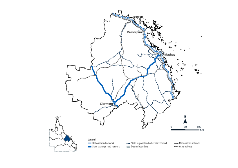
Map
Footnotes
(1) Data source: Queensland Government Statistician's Office (Queensland Treasury), Queensland Regional Profiles. https://www.qgso.qld.gov.au, retrieved 5 February 2026.
(2) The detailed mapping reflects the latest National Land Transport Network (NLTN) Determination 2020 as published.
(3) Figures quoted in this section are not mutually exclusive.
Reflects QTRIP 2026–27 to 2029–30.
Feature image: Flood immunity upgrade in Hamilton Plains, part of the Proserpine - Shute Harbour Road upgrades. Gia and Ngaro peoples.
Last updated: 24 June 2026