
Scenic Valleys Regional Roads and Transport Group
On this page:
- Project story: Ipswich City Council, Springfield-Greenbank Arterial duplication from 2 to 4 lanes
- Project story: Lockyer Valley Regional Council, Postman’s Ridge Road pavement upgrade and widening
- Project story: Scenic Rim Regional Council, Brisbane Street pavement reconstruction, including traffic and pedestrian safety improvements
- Regional Roads and Transport Group members
- Scenic Valleys Regional Roads and Transport Group map
- Transport Infrastructure Development Scheme (TIDS) program details
Project story: Ipswich City Council, Springfield-Greenbank Arterial duplication from 2 to 4 lanes
Submitted by Graeme Martin, Manager, Capital Program Delivery, Ipswich City Council.
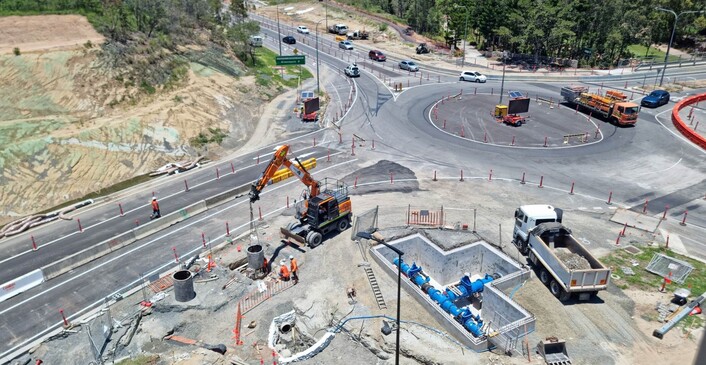
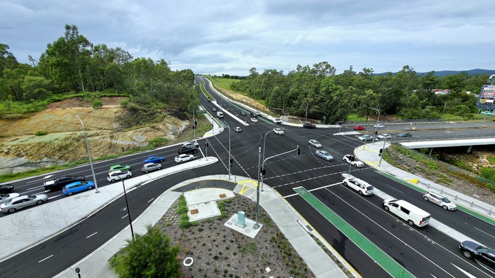
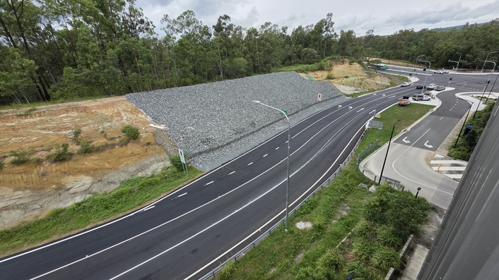
As the largest road network upgrade in the City of Ipswich’s history, the Springfield Parkway and Springfield Greenbank Arterial Duplication is vitally important to improving safety and making travel easier for the growing Springfield community. As a major transport hub, the Springfield Central Road network connects community, business, health, education and sporting precincts every day. To support the future growth and need of the Greater Springfield region, the duplication of Springfield Parkway and Springfield Greenbank Arterial was a high priority for council and the State Government committed to supporting the project and keeping over 30,000 people moving through this busy activity centre each day.
Investing in trunk infrastructure as the backbone of the community was paramount to the delivery of Stage 3 of the project. TIDS funding in unison with a $6.5m contribution from the TMR to upgrade Centenary Motorway Exit 32 has enabled the City of Ipswich to deliver increased road capacity and reduce travel time in a priority delivery area.
Stage 3 key features delivered:
- 3km road duplication from two to four lanes of Springfield Greenbank Arterial from Eden Station Drive to Sinnathamby Boulevard
- upgrades of the Centenary Highway Exit 32 off ramp and Main Street intersection to four lanes
- transformation of roundabout at Centenary Exit 32 off ramp, Springfield Greenbank Arterial and Main Street to a signalised intersection
- dedicated entries and pedestrian crossings for the new Springfield Central Park’n’Ride and Brighton Homes Arena
- new entry and exit points at the Springfield Central Railway Station carpark
- upgrades of the Eden Station Road Signalised Intersection
- rock armouring and stabilisation of 250m of up to 15m high embankment
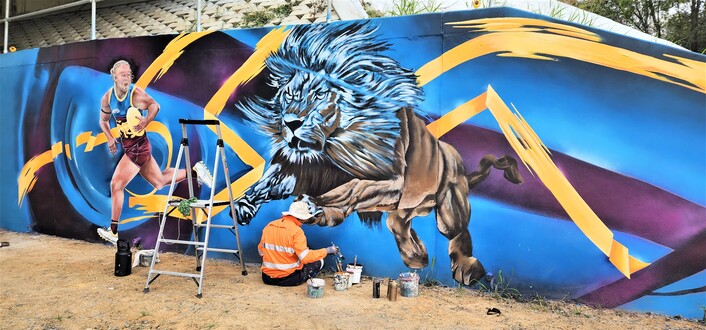
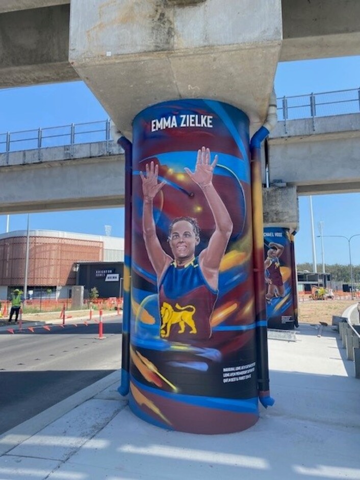
- Centenary bridge abutment upgrade including the Brisbane Lions mural artwork program
- relocation and upgrading of electrical, water, gas and telecommunications utilities
- upgrades and future proofing of drainage and stormwater
- active transport connections with 2m on road cycle lanes and shared pathways for pedestrians, wheelchairs and cycles along the road corridor
- upgrades of street lighting and guard railing to new standards
- increased green zones, shade trees and feature landscaping to soften interfaces and enhance aesthetics

Project story: Lockyer Valley Regional Council, Postman’s Ridge Road pavement upgrade and widening
Submitted by Lockyer Valley Regional Council.
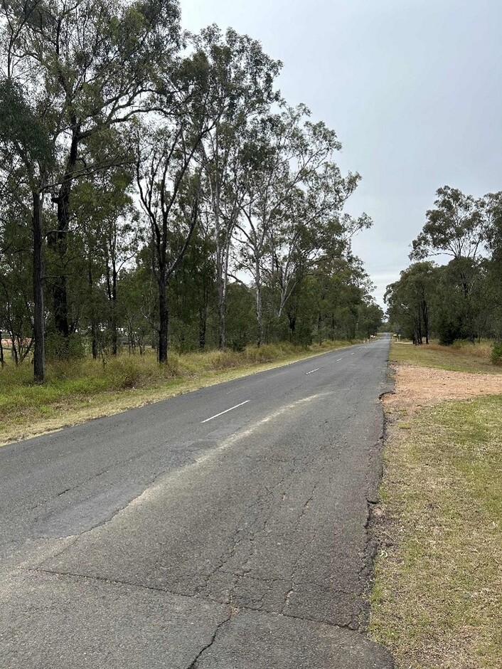
Postman’s Ridge Road is a vital council-controlled Local Road of Regional Significance linking Murphy’s Creek Road and the Warrego Highway at Helidon Spa. Previously, this 7m wide, two-lane sealed road was in poor condition and failing, marked by surface cracking, rutting, and isolated shoves.
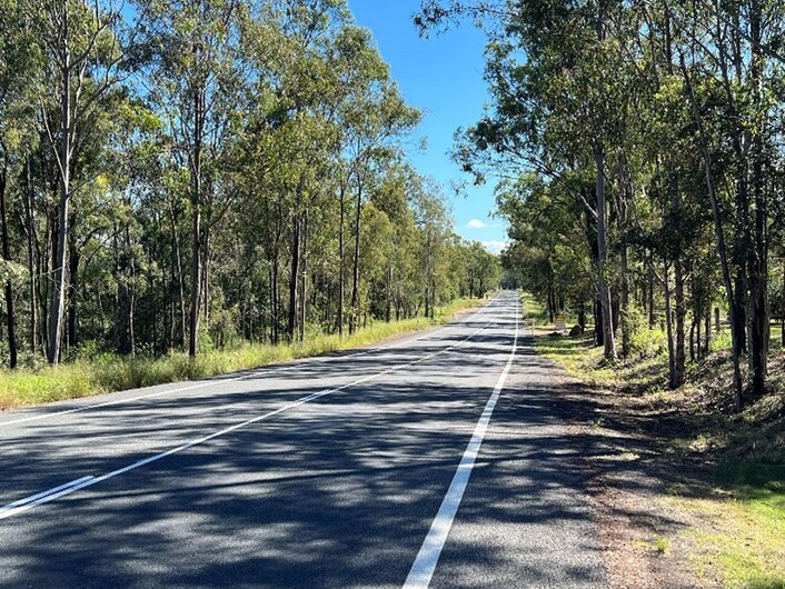
The upgrade project for Postman’s Ridge Road, within the 2024–25 Scenic Valleys RRTG works program, aimed to enhance safety and efficiency for all users. A key objective was to widen the road to accommodate heavy vehicles. Given that Postman’s Ridge Road is a high-speed rural road, these improvements were essential to ensure that larger vehicles could travel safely and efficiently without causing congestion or posing safety risks to other users. This improved traffic flow and reduced the risk of accidents.
The project also involved reconstructing the road pavement, with special attention given to enhancing the durability of the southbound lane, which was more frequently used by heavy vehicles. Recognising that one side of the road bore the brunt of heavy traffic, the project reinforced this side to better withstand the increased load. This targeted improvement ensures that the road can handle the mass and frequency of heavy vehicles without deteriorating quickly, thereby maintaining a smoother and safer surface for all users.
Improving sight distances and intersections along Postman’s Ridge Road was another crucial objective. Limited sight distances posed serious safety risks, especially at intersections and curves. By removing obstacles and vegetation that blocked sight lines, the project has enhanced visibility and reduce the likelihood of accidents.
Overall, the upgrade of Postman’s Ridge Road has significantly improved the functionality and safety of this important road in Helidon Spa, benefiting local communities and businesses. The improvements now ensure a safer, more efficient travel experience for all users, contributing to the region's overall development and prosperity.

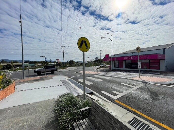
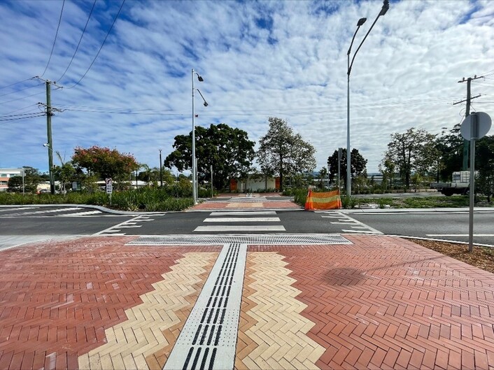
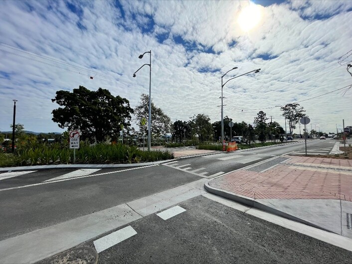
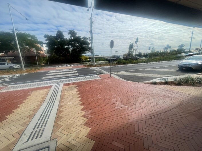
Project story: Scenic Rim Regional Council, Brisbane Street pavement reconstruction, including traffic and pedestrian safety improvements
Submitted by Scenic Rim Regional Council.
Scenic Rim Regional Council delivered the Brisbane Street project to enhance safety, productivity, immunity, and resilience, within the 2024–25 Scenic Valleys RRTG works program. The project was part of the much broader Beaudesert Town Centre Revitalisation Project.
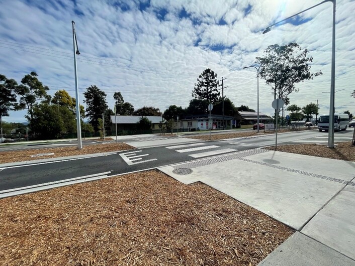
Brisbane Street is a council-controlled Local Road of Regional Significance linking the Mount Lindesay Highway and Beaudesert-Nerang Road directly through Beaudesert’s CBD. The project is a flagship public works initiative that has delivered a safer, more connected, and climate-resilient town centre through strategic infrastructure upgrades and placemaking. Driven by the dual priorities of improving community connectivity and safety, the project reflects best practice in integrated urban design for regional Queensland.
The project involved comprehensive transport upgrades to enhance pedestrian safety, accessibility, and traffic flow. Key features included the Eaglesfield Street roundabout, raised priority crossings, traffic calming devices, and upgraded lighting; all designed to encourage walking and cycling, as well as helping people of all ages feel safer getting around on foot or bike.
The scope of the project included:
- realignment of the road to improve sight distance and approach geometry to the Eaglesfield Street roundabout and the four new pedestrian crossings
- pavement reconstruction and improvement, including subgrade replacement works and resurfacing works
- reduced pavement width to support safer crossing points
- line marking and safety advisory signs throughout the section.
Works were undertaken by external contractor and the project incurred considerable wet weather delays over the construction period.
Regional Roads and Transport Group members
- Ipswich City Council
- Lockyer Valley Regional Council
- Scenic Rim Regional Council
- TMR Metropolitan, South Coast and Darling Downs Districts
Chair: Councillor Michael Hagan, Lockyer Valley Regional Council
Deputy Chair: Councillor Duncan McInnes, Scenic Rim Regional Council
Technical Committee Chair: Matt Lennon, Lockyer Valley Regional Council
Technical Committee Deputy Chair: Michael Burling, Scenic Rim Regional Council
Technical Coordinator: Gerard Read, GWR Civil Engineering Management
Transport Infrastructure Development Scheme 2024-25 Allocation: $2,343,742
Total number of projects: 5
Scenic Valleys Regional Roads and Transport Group map.
Scenic Valleys Regional Roads and Transport Group (RRTG) Transport Infrastructure Development Scheme (TIDS) program details
The following information lists the RRTG TIDS 2024–25 works program by local government, with the project name and the year-to-date TIDS expenditure.
Ipswich City Council
| Project name | Expenditure |
|---|---|
|
Springfield Greenbank Arterial, Eden Station Drive to Sinnathamby Boulevard (Ipswich), construct additional lanes |
$763,159 |
Lockyer Valley Regional Council
| Project name | Expenditure |
|---|---|
|
Postmans Ridge Road (Helidon Spa), 2.05 - 18.40km, widen and upgrade pavement |
$763,159 |
Scenic Rim Regional Council
| Project name | Expenditure |
|---|---|
|
Scenic Valleys RRTG, capability development |
$54,265 |
|
Brisbane Street, Selwyn Street to Short Street (Beaudesert), reconstruct pavement including traffic and pedestrian improvements |
$663,110 |
|
Beechmont Road (Stage 1), 6.08 - 6.58km, reconstruct pavement |
$100,049 |
- Last updated
- 17 October 2025