Bicentennial Bikeway
The Bicentennial Bikeway is an active transport superhighway running alongside the Brisbane River. The 4.8km off-road bikeway enables safe walking, bike riding and scooting for people of all ages and abilities, from Toowong to the Brisbane CBD.

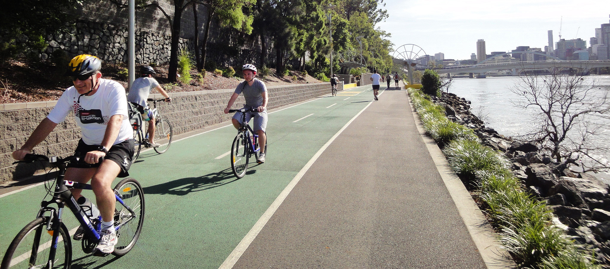
Bike riders, joggers and walkers using the Bicentennial Bikeway
The Queensland Government and Brisbane City Council jointly funded major upgrades of the Bicentennial Bikeway between 2009 and 2015.
The Bicentennial Bikeway is the busiest bike riding and pedestrian pathway in Brisbane, and one of the busiest in Australia. In 2020, an average of 5,284 people (3,461 bike riders and 1,823 walkers) used the bikeway each day.
View fullscreen map through external site Bike citizens | Visit Cycling Brisbane for more information about the bikeway
Routes are suggested only. You are responsible for your own safety while using Queensland's bikeway network. The Department accepts no responsibility for any incorrect or out of date data presented.
Key facts
- The bikeway is a 4.8km off-road pathway from Toowong to Brisbane city—providing access to South Bank, Kangaroo Point and New Farm through connecting bridges and pathways.
- The bikeway was constructed in smooth asphalt—the bike-only path has a green surface treatment to clearly identify the bike path from pedestrian space.
- The bikeway is an important transport connection—it's a high-capacity active transport corridor, easing inner-city traffic congestion and creating an accessible and connected Brisbane city.
Benefits
- The Bicentennial Bikeway is a key link in Brisbane's active transport network. It is located along the Brisbane River and connects Toowong to the Brisbane CBD.
- The Bicentennial Bikeway provides access to South Bank, Brisbane CBD, Kangaroo Point and New Farm through connecting bridges and pathways.
- More than 1.9 million people used the pathway in 2020—as recorded by an electronic counter near the Go Between Bridge.

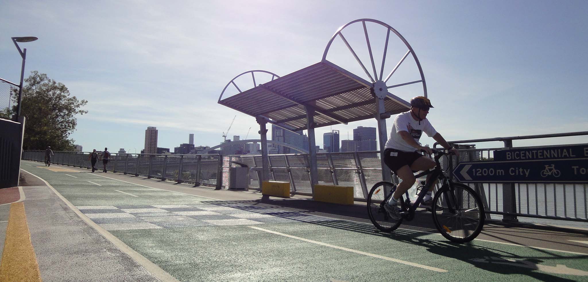
Bike rider using Bicentennial Bikeway
Upgrade works
The Bicentennial Bikeway upgrades were delivered in several stages:
- Stage 1—Park Road to Little Cribb Street underpass, Milton
- Stage 2—Lang Parade to Land Street underpass, Auchenflower
- Stage 3—Lang Parade to Park Road, Milton
- Stage 4—Land Street underpass to Regatta Park, Toowong.
The pathway is heavily used by bike riders and walkers during mornings and evenings. To improve safety and comfort, the 3m-wide path was widened to create separated bike and pedestrian paths. Work was completed progressively between 2009 and 2015 to create:
- 3.5m 2-way bike-only path
- 2m pedestrian-only path.

Path widening and segregation of walkers and bike riders
The path was constructed in smooth asphalt, with bike rider and pedestrian space clearly identified through the use of:
- symbols
- line marking
- green coloured pavement on the bike path.
Intersections were clearly defined using give-way lines and signs to minimise conflict and confusion. Entry and exit ramps and tunnels were also upgraded.
Other design features included:
- rest areas
- drinking fountains
- landscaping
- lighting
- comprehensive directional signs
- distance markers
- significant shade trees were retained where possible.
These features encourage use of the bikeway, as well as support an enjoyable experience for bike riders and walkers.
Insights
In October 2015, we conducted research with residents and path users to gain insight into use of the pathway.1
Survey results showed bike trips were made for these reasons:
- commuting—around 40%
- recreation—slightly over 40%
- errands, shopping or social visits—remaining 20%.
The pathway upgrades have encouraged walking and bike riding, and enabled people to switch from driving or public transport to using active transport by providing:
- access to a safe and scenic off-road pathway
- access to connections to the Brisbane CBD and other inner-city areas.
- option for people who are not comfortable riding on the road or footpath.
This shift to active transport reduces traffic congestion along this corridor and provides the opportunity for increased physical activity.

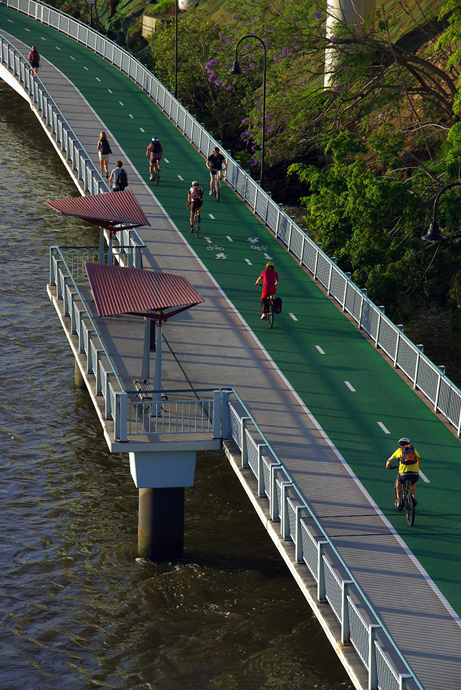
People walking and riding bikes on the Bicentennial Bikeway beside the Brisbane River (Image credit: Murray Henman)
Survey responses showed most users felt more comfortable using the path with walkers and bike riders separated, demonstrating the value of the upgrade works.1 Following completion of the improvement works, 50% of walkers and 82% of bike riders surveyed, indicated they ride or walk more often.

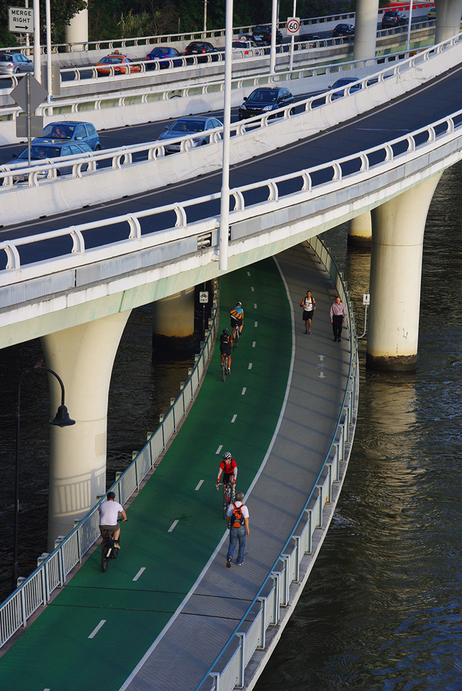
Bicentennial Bikeway and Riverside Expressway (Image credit: Murray Henman)
Construction challenges
The Bicentennial Bikeway is located between Coronation Drive, one of Brisbane's busiest roads, and the Brisbane River. Access to some sections of the pathway was only possible via narrow ramps from Coronation Drive. During Stage 3 construction, a 110-tonne crawler crane operated from a river barge to complete bridge piling works and precast beam installation.
Despite the construction, access for path users was maintained during the entire project from 5am to 8pm. Diversions and traffic controls were provided through the work zones and separate crews often worked through the night while the pathway was closed to traffic.
Stage 4 was one of the most technical and complex stages, and involved the construction of:
- suspended concrete pathways
- lookout decks
- fibre-composite ramps
- piling works.
A 2.8m-wide passage for path users was maintained during Stage 4 construction. Landmark flora like the Moreton Bay Fig and various state-controlled marine plants (such as mangroves and marine couch) required continual protection throughout the works.
Works involved the reconstruction and widening of the existing pathway to improve safety and increase capacity. The upgrades also increased flood immunity as parts of the pathway were subject to flooding during king tides.
More than a bikeway
The Bicentennial Bikeway is one of the best known, and most used bikeways and pedestrian paths in Brisbane. The pathway facilitates social and cultural connection with the Brisbane River, allowing people to enjoy the scenery as part of their commute or recreation.
The Bicentennial Bikeway is also an important transport connection and operates as a high-capacity active transport corridor, easing inner-city traffic congestion and helping to create a more accessible and connected Brisbane city.
The bikeway will connect with updated facilities being delivered through the Queen's Wharf Brisbane development.
The design of a new separated bicycle and pedestrian walkway on the Bicentennial Bikeway between Kurilpa Bridge and Victoria Bridge will commence in 2022–23.
More information
- Read more about the Bicentennial Bikeway—Kurilpa Bridge to Victoria Bridge
- Read more about Queen's Wharf Brisbane
- Email the Cycling and Walking team on Cycling_Infrastructure_Program@tmr.qld.gov.au
1 CDM Research. 2016. Measuring the Benefits of Active Travel. Report prepared for the Department of Transport and Main Roads. Available on our Infrastructure benefit evaluations page.
- Last updated 16 September 2022

