Showing results 1-10 of 47

Sort results
Sort results
  1. Bundaberg Integrated Transport Strategy, planning

    The project will develop a strategic level transport plan for local and state roads in the Bundaberg Regional Council area...

    No image supplied
  2. Gatton-Helidon Road, pavement widening

    Detailed design is underway to improve safety on Gatton-Helidon Road...

    No image supplied
  3. Carnarvon Highway (Mungindi – St George), widen and seal

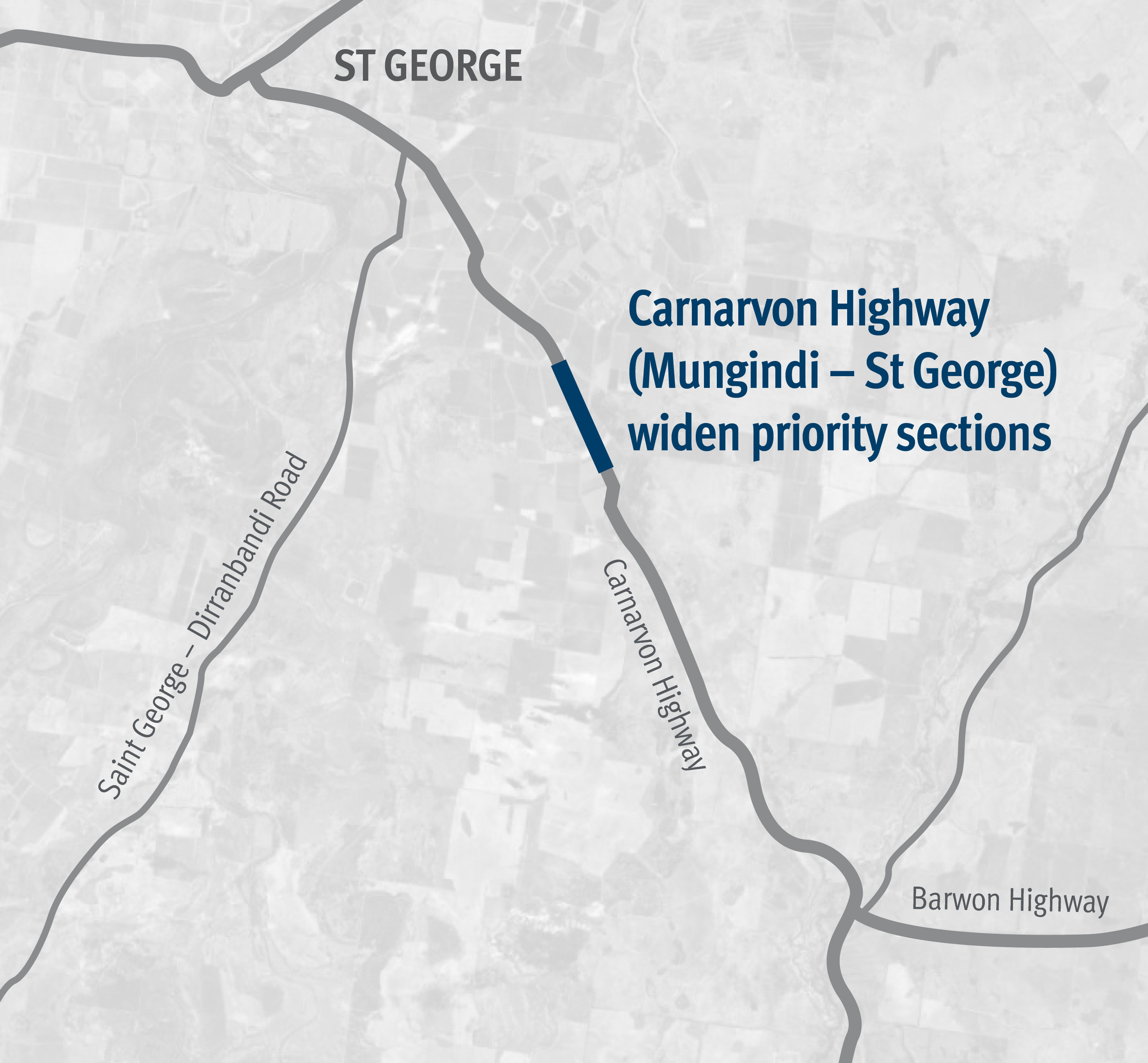
    Works involved pavement widening and sealing between 81.71km and 84.99km east of St George...

    Carnarvon Highway Mungindi St George project map
  4. Long-distance passenger rail business case

    We are preparing a business case to replace the rollingstock on the long distance passenger rail fleet that services western regional Queensland...

    No image supplied
  5. Maryborough-Hervey Bay Road, Ibis Boulevard and Fairway Drive, intersection upgrade, business case

    Maryborough-Hervey Bay Road/Ibis Boulevard/Fairway Drive intersection upgrade...

    No image supplied
  6. New England Highway (Yarraman - Toowoomba), Back Creek bridge, upgrade bridge and approaches, planning

    Community feedback is being sought to plan improvements to the New England Highway at Cooyar...

    No image supplied
  7. New England Highway (Yarraman - Toowoomba), Borneo Barracks (Cabarlah), construct turning lanes

    The department is working with the Department of Defence to upgrade the entrance to the Borneo Barracks from the New England Highway at Cabarlah...

    No image supplied
  8. Southern Queensland 2022 flood reconstruction works

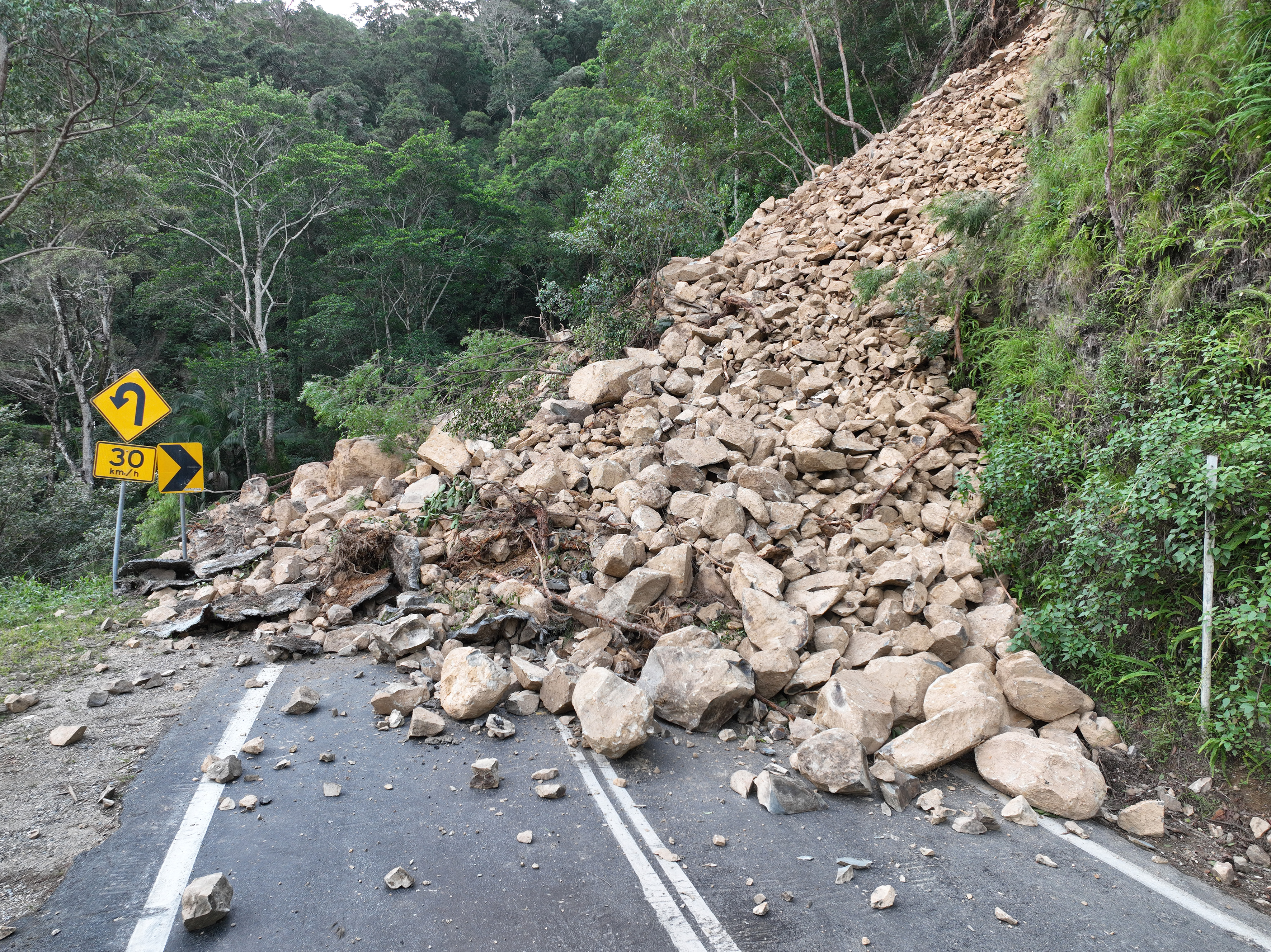
    Repairs are underway across South East Queensland after extensive and severe flooding was caused by sustained heavy rainfall in late February 2022...

    Landslip on Gold Coast - Springbrook Road
  9. Carnarvon Highway (Injune - Rolleston), Dawson River bridge upgrade

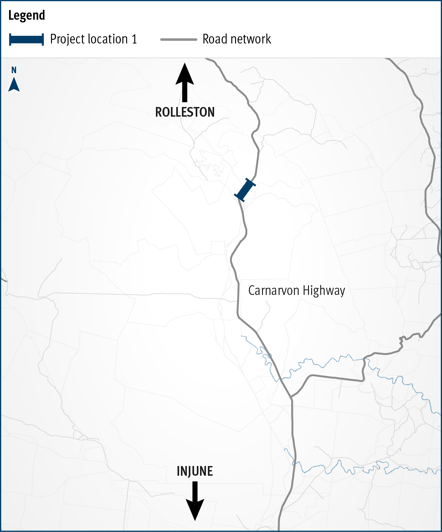
    The Carnarvon Highway (Injune - Rolleston), Dawson River bridge upgrade project will improve safety and network efficiencies by realigning the approaches and widening the existing structure...

    Carnarvon Highway Injune Rolleston Dawson River bridge upgrade
  10. Booral Road and Boundary Road (Urangan), intersection upgrade

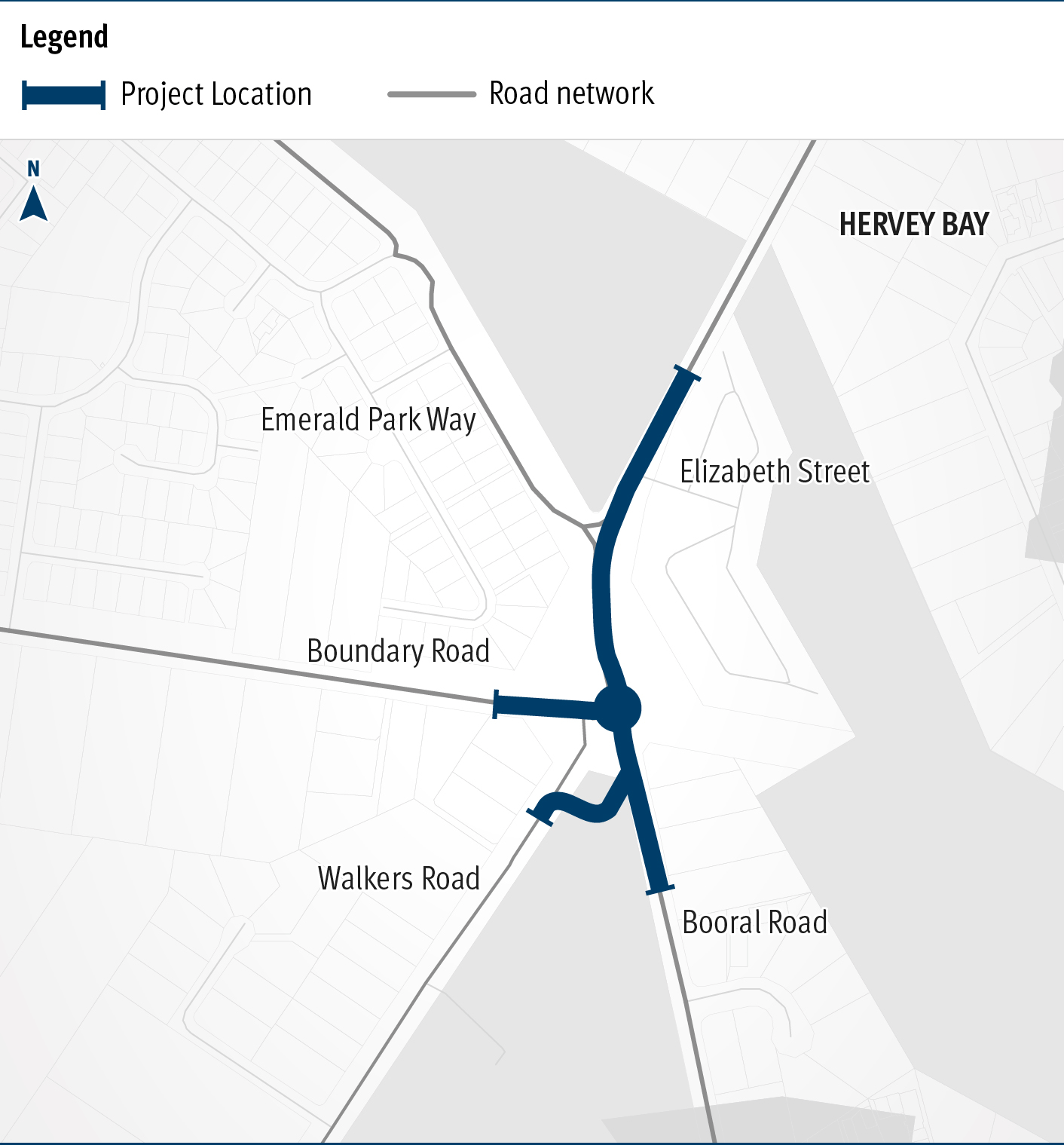
    Detailed design is underway for a proposed upgrade of the Booral Road and Boundary Road intersection...

    The map shows the locality of the proposed Booral Road and Boundary Road intersection upgrade. Hervey Bay is located north-east of the project location. A solid blue line indicates the project extent, which encompasses the Booral Road and Boundary Road intersection, and also extends along Booral Road to the north past the Emerald Park Way intersection and to the south along Booral Road past the proposed new Walkers Road intersection. Walkers Road has been realigned to access Booral Road to the south of the Booral Road and Boundary Road intersection. The local road network, including where Booral Road turns into Elizabeth Street, is also highlighted on the map.
Previous Page (disabled)
  1. Page 1
  2. Page 2
  3. ...
  4. Page 5