
Bruce Highway (Gympie – Maryborough), Tiaro Bypass, construct four lane bypass
We are improving flood immunity, safety and efficiency on the Bruce Highway at Tiaro...
We are improving flood immunity, safety and efficiency on the Bruce Highway at Tiaro...

Isis Highway high risk roads targeted road safety program safety improvements...
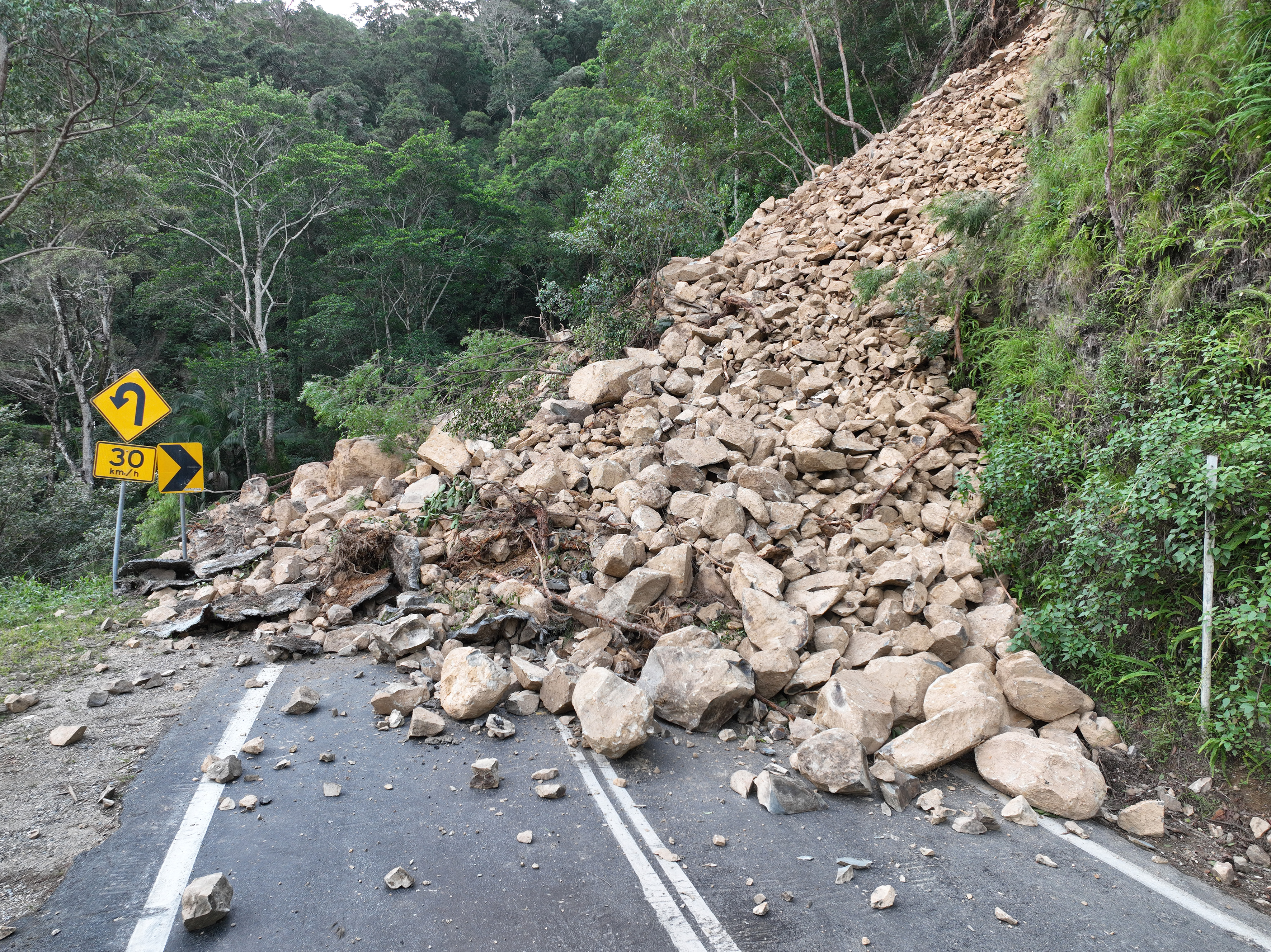
Repairs are underway across South East Queensland after extensive and severe flooding was caused by sustained heavy rainfall in late February 2022...
Detailed design is underway for active transport bridge structures and pathway to provide connectivity of the Principal Cycle Network from Gympie's southside into the Gympie CBD and surrounds...
Maryborough-Hervey Bay Road/Ibis Boulevard/Fairway Drive intersection upgrade...
A combined funding amount of $16 million has been allocated under the Australian Government's Road Safety Program and the State Road Network Upgrades investment program to progressively seal sections...
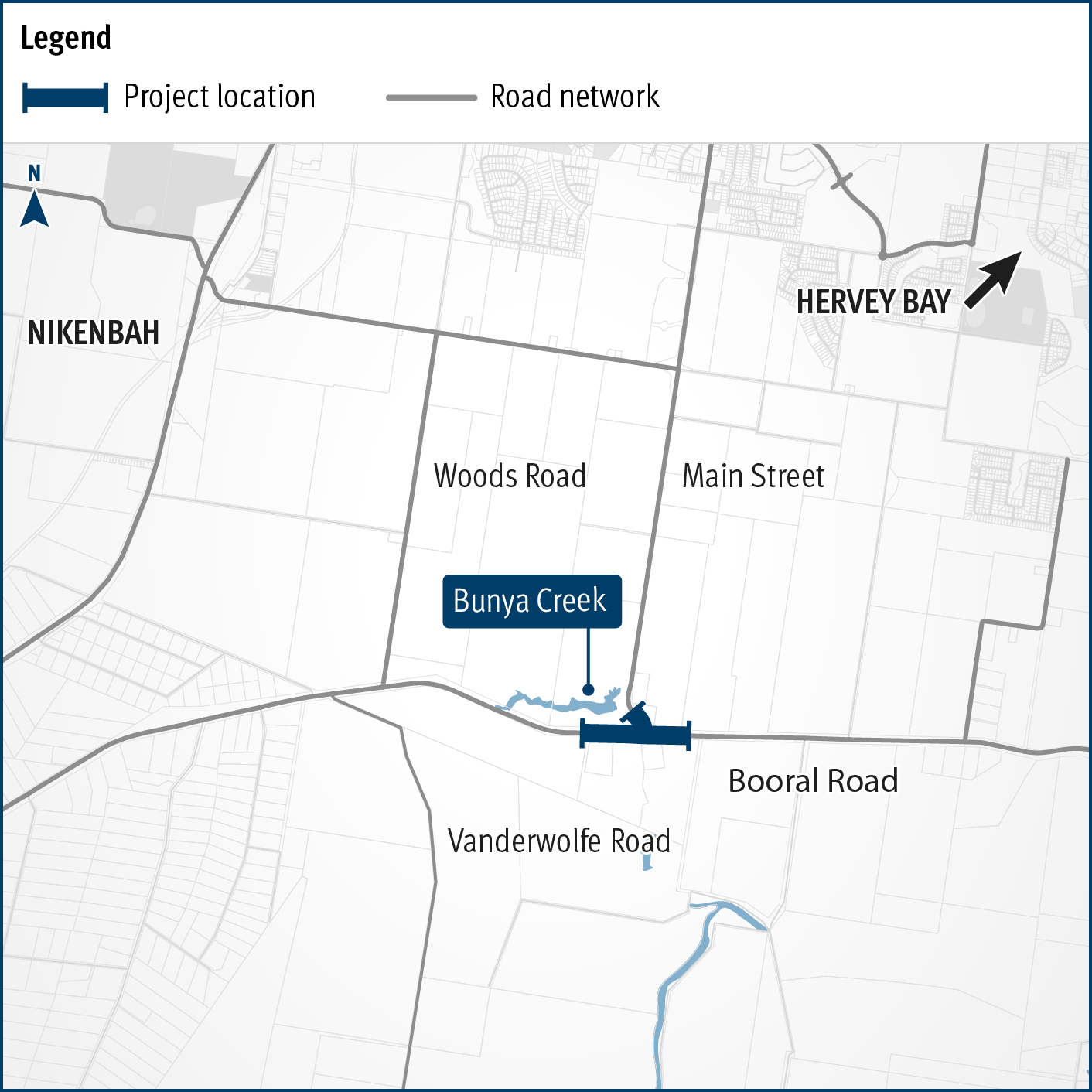
Planning is underway to improve flood immunity and safety on a section of Booral Road at Bunya Creek, including the Main Street intersection...
The project will develop a strategic level transport plan for local and state roads in the Bundaberg Regional Council area...
The department is developing a strategy for future rail projects between Brisbane and Gympie North...
Improving the flood immunity and resilience of the state-controlled road network at 27 priority sites...