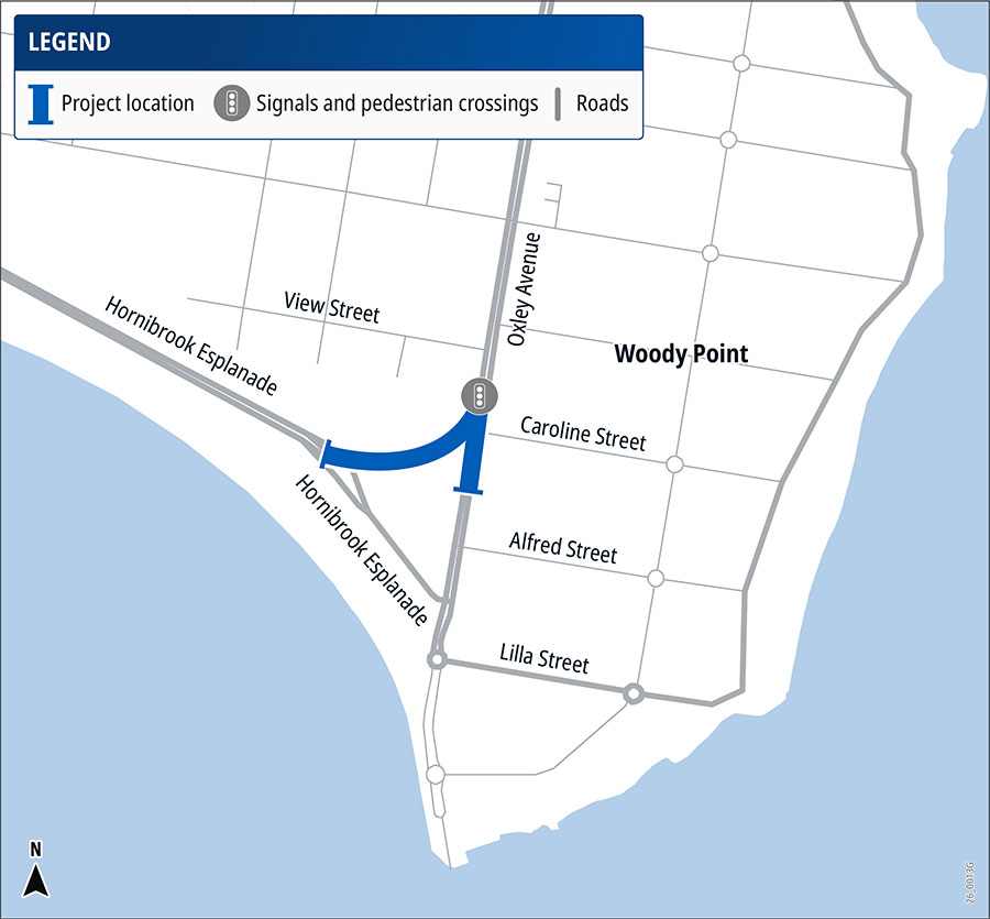
Brighton – Redcliffe Road (Hornibrook Esplanade) and Oxley Avenue (Woody Point) intersection, improve safety
The Queensland Government is planning safety improvements at the intersection of Hornibrook Esplanade and Oxley Avenue, Woody Point, to address a history of serious crashes involving drivers failing to give way.
The project includes installing traffic signals and changing traffic movements to reduce vehicle conflict points, improve pedestrian access and support safer bike riding connections to the Woody Point foreshore.
The project is being delivered as part of the Queensland Government's Targeted Road Safety Program through the Safer Roads Sooner initiative.
Benefits
- Improves safety
- Improves network efficiency
- Accessibility
- Better active transport
Key features
- New traffic signals to better manage traffic movements and provide safer pedestrian crossings.
- Removal of the right-turn into Hornibrook Esplanade for traffic travelling from Clontarf to reduce the risk of crashes with opposing westbound traffic.
- One-way operation of Hornibrook Esplanade, accessed via Oxley Avenue, while maintaining two-way access to Crockatt Park car park.
- Upgraded pedestrian facilities, including signalised crossings, a give way sign and raised median threshold at Caroline Street, and improved kerb ramps connecting to the foreshore.
- Marked bike lanes and upgraded crossing facilities to improve conditions for bike riders and pedestrians.
- Road lighting, where required, to improve visibility for road users.
Funding
This project is listed in QTRIP 2026–27 to 2029–30. It is funded by the Queensland Government's Targeted Road Safety Program via the Safer Roads Sooner initiative (SRS).
Investment ID: 3053007
Current status
Detailed design is underway and is expected to be completed in early 2027, following consideration of community feedback on the proposed intersection improvements. Construction timing to be confirmed once design is complete.
Community engagement
Community feedback has helped inform a revised design for the intersection. The project team will continue to engage with stakeholders and the community throughout project development.
Please email [email protected] to register for updates.
Project location map