
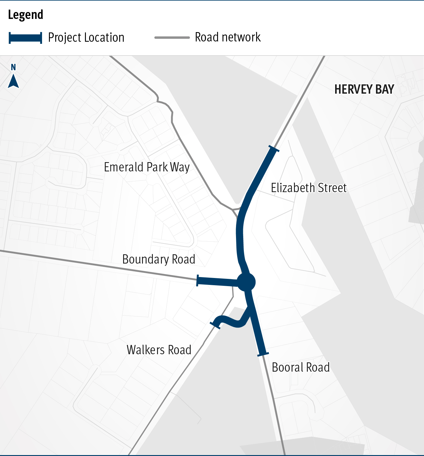
Booral Road and Boundary Road (Urangan), intersection upgrade
Detailed design is underway for a proposed upgrade of the Booral Road and Boundary Road intersection...
Detailed design is underway for a proposed upgrade of the Booral Road and Boundary Road intersection...
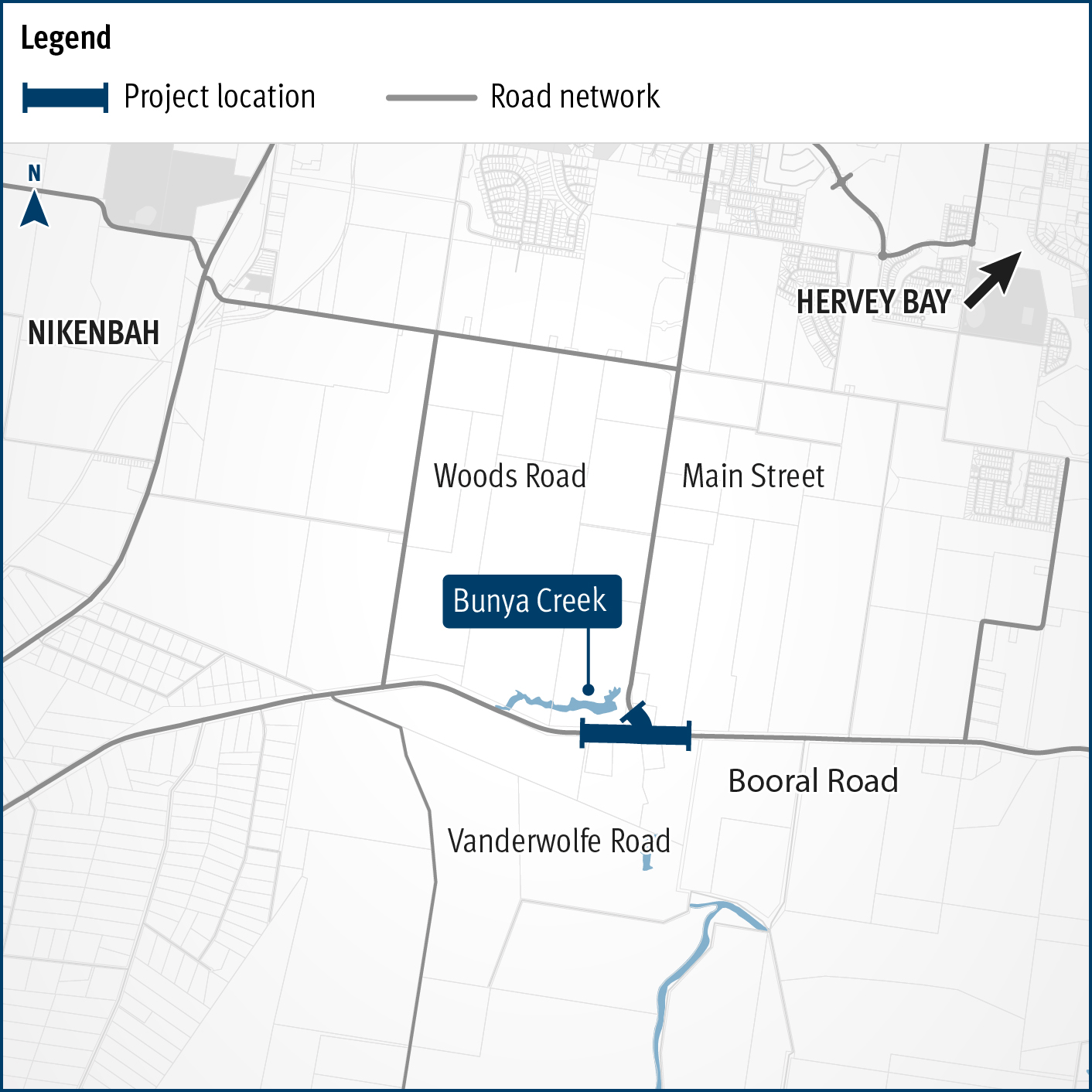
Planning is underway to improve flood immunity and safety on a section of Booral Road at Bunya Creek, including the Main Street intersection...
The $1 billion Section D: Woondum to Curra (C2CD) project is a new 26km, 4-lane divided highway between the existing Bruce Highway interchange at Woondum, south of Gympie and Curra...

We are improving flood immunity, safety and efficiency on the Bruce Highway at Tiaro...

This project will provide Intelligent Transport System infrastructure at various locations along the Bruce Highway to achieve the project vision of sharing of real time situational awareness with road...
This project involves a 62km realignment and upgrade of the Bruce Highway to 4 lanes between Cooroy and Curra and is among Queensland's highest priority road projects...
The project will develop a strategic level transport plan for local and state roads in the Bundaberg Regional Council area...
D'Aguilar Highway safety improvements – Nanango to Kingaroy...
The department and Fraser Coast Regional Council are working together to identify future transport initiatives in the Fraser Coast local government area to enhance movement to, from, and within the...
The Queensland Government is improving the safety and efficiency of 3 intersections along Goodwood Road in Bundaberg and Kinkuna...
Detailed design is underway for active transport bridge structures and pathway to provide connectivity of the Principal Cycle Network from Gympie's southside into the Gympie CBD and surrounds...
The department will be constructing an at-grade road on the Isis Highway at Biggenden to upgrade the ageing timber bridge overpass. The road will deliver safety, capacity, and efficiency improvements...
Isis Highway high risk roads targeted road safety program safety improvements...
Isis Highway Targeted Road Safety Program will improve safety of the Isis Highway by separating through and turning traffic on the Isis Highway and reducing the likelihood of off road and head on type...
The Department of Transport and Main Roads is undertaking detailed design for an upgrade of the Maryborough-Hervey Bay Road and Pialba-Burrum Heads Road intersection in Eli Waters...
The department has commenced planning for a future upgrade of the Maryborough–Hervey Bay Road and Ariadne Street intersection to improve road safety and traffic efficiency in the area...
Maryborough–Hervey Bay Road intersection upgrades and safety works...
A combined funding amount of $16 million has been allocated under the Australian Government's Road Safety Program and the State Road Network Upgrades investment program to progressively seal sections...
The Next Generation Traffic Signalling Program involves the rollout of new traffic signal controllers to replace the existing controllers...
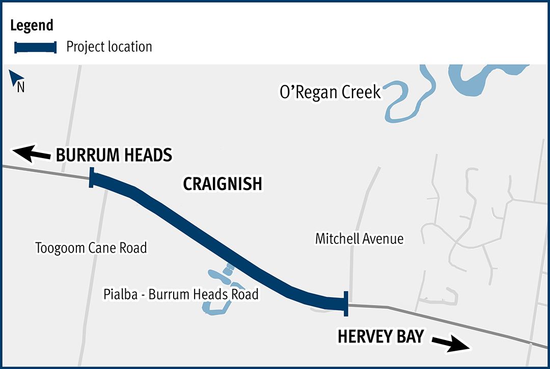
This project aims to improve the flood immunity and reduce flood closure times at the Pialba–Burrum Heads Road crossing...
Last updated: 5 March 2026