
Bruce Highway (Cooroy to Curra) Section D
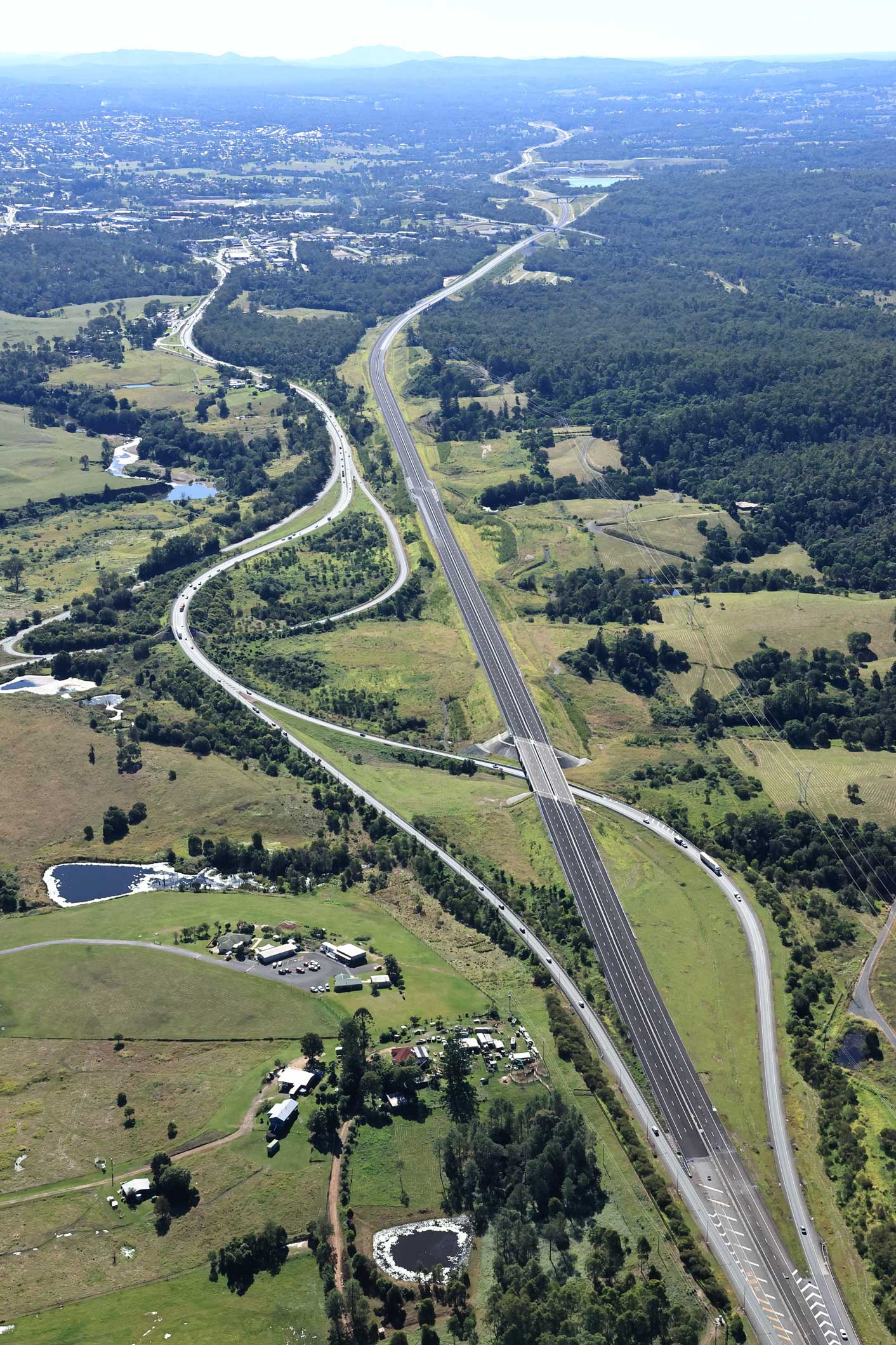
The $1.162 billion Section D: Woondum to Curra project is a new 26km, 4-lane divided highway between the existing Bruce Highway interchange at Woondum, south of Gympie and Curra.
The Section D (Gympie Bypass) project was delivered in 2 construction contracts.
Visualisation video of final design
Benefits
- Increases traffic flow
- Increases capacity
- Improves safety
- Improves flood immunity
- Reduces travel time
- Contributes to economy
- Contributes to regional growth
Key features
- Improved traffic flow, as the new highway avoids 53 intersections (including 9 signalised intersections) and 106 property accesses which contributed to safety and congestion issues on the old Bruce Highway.
- Improved safety and capacity through the separation of long-distance traffic from local traffic. This has reduced traffic volumes on the highway travelling through Gympie.
- Greatly reduced head-on crashes by providing a divided 4-lane highway.
- Significantly improved flood immunity compared with the old Bruce Highway, which has traditionally experienced frequent closures in the Gympie CBD and north and south of Gympie due to flooding.
- Improved travel times by having the new highway posted at 110km/h (the old Bruce Highway is 80km/h and 60km/h through Gympie).
Funding
This project is jointly funded by the Australian and Queensland governments. Investment ID 686965
- Total investment
- $1.162 billion
- Australian Government
- $929.6 million
- Queensland Government
- $232.4 million
Current status
The Gympie Bypass was delivered in 2 major construction contracts:- Contract 1: Woondum interchange to Sandy Creek Road (Bielby Holdings and BMD Group Joint Venture)
- Contract 2: Sandy Creek Road to Curra (CPB Contractors)
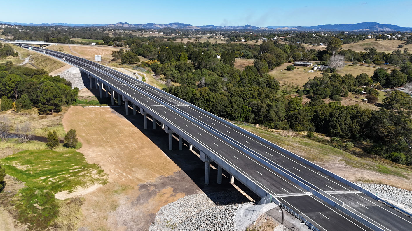
There are 42 bridges at 23 locations along the Gympie Bypass. More than 6 million cubic metres of earth was moved from cuts to fill areas. This raised the new section of highway to a level that has increased flood immunity to withstand a 1-in-100-year flood event.
Major construction began in October 2020, with the new highway opening to traffic on 16 October 2024.
Woondum interchange looking north (existing Bruce Highway on left - new Bruce Highway under construction on right)
Six Mile Creek bridges
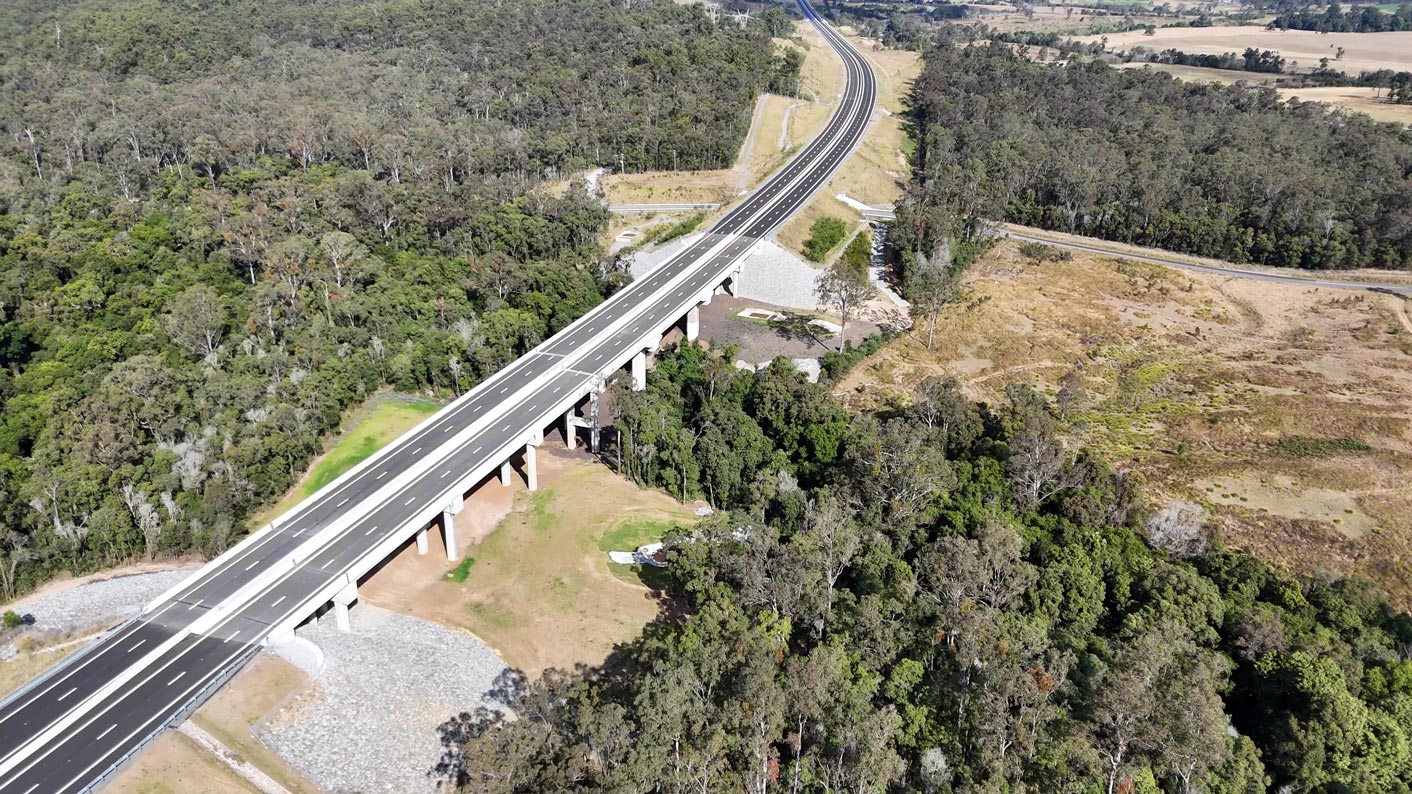
Deep Creek bridges
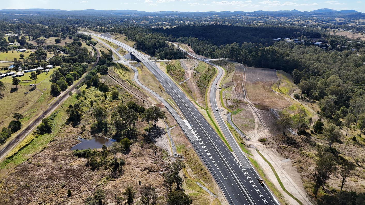
New Flood Road interchange


An all-movements interchange at Flood Road caters for locals and industry, enabling heavy vehicles to access commercial and industrial areas east and west of the new highway.
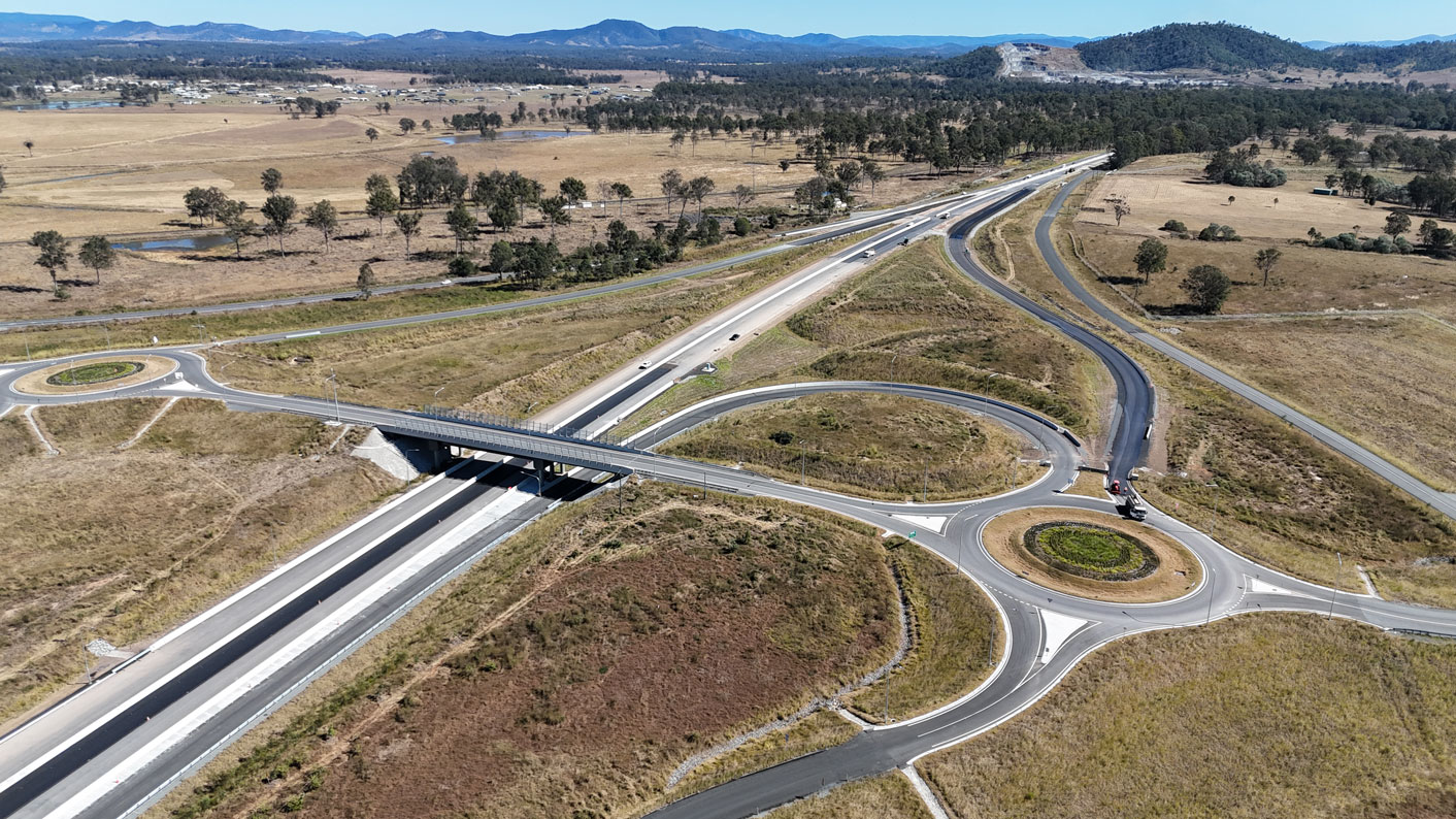
New Gympie interchange

An all movements interchange at Gympie Connection Road caters for commuters travelling to Gympie or the Cooloola Coast from the new highway. Traffic signals are located at each exit ramp and entry ramp intersection with Gympie Connection Road to manage safe flow of traffic between the new highway and the local road network.
New Curra interchange
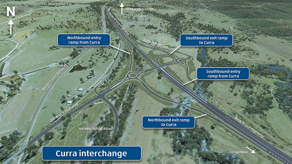
An all movements interchange just north of Curra connects the new 4-lane highway with the existing 2-lane Bruce Highway. The interchange is north of the existing Harvey Siding Road and Bruce Highway intersection. It has local connections to Harvey Siding and Ashfords roads.
Drone video of construction of the Six Mile Creek bridge: July 2021
Bruce Highway (Cooroy to Curra) Section D—Earthworks update: September 2022
Bruce Highway (Cooroy to Curra) Section D-Time lapse of Flood Road interchange construction: 27 March 2023
Environment
Compliance reports
Environment Protection and Biosecurity Conservation Act 1999 (EPBC Act) compliance reports for the Bruce Highway Cooroy to Curra (Section D: Woondum to Curra):
Compliance Report 01 (December 2021)
Compliance Report 02 (December 2022)
Compliance Report 03 (December 2023)
Compliance Report 04 (December 2024)
Compliance Report 05 (December 2025)
Environmental reports
- Bruce Highway Cooroy to Curra (Section D: Woondum to Curra): Baseline Assessment Report - 2020
- Bruce Highway Cooroy to Curra (Section D: Woondum to Curra): lowland rainforest offset strategy
- Bruce Highway Cooroy to Curra (Section D: Woondum to Curra): notice of variation - conditions 3 and 7
- Bruce Highway Cooroy to Curra (Section D: Woondum to Curra): final decision notice September 2019
- Bruce Highway Cooroy to Curra (Section D: Woondum to Curra): EPBC Act Referral - public consultation summary
- Bruce Highway Cooroy to Curra (Section D: Woondum to Curra): preliminary documentation May 2018
- Bruce Highway Cooroy to Curra (Section D: Woondum to Curra): EPBC Act referral April 2017
- Bruce Highway Cooroy to Curra (Section D: Woondum to Curra): referral form
