Caboolture - Beachmere Road, improve safety
Construction is complete on safety improvements for Caboolture – Beachmere Road (locally known as Beachmere Road) to enhance overall driving conditions.
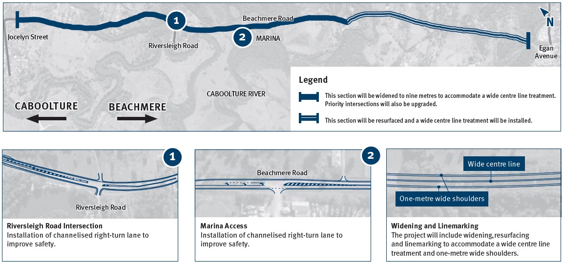
A widened road, dedicated right-turn lanes and wide centre line treatment are enhancing safety for all road users. The improved linemarking and shoulders are providing extra space for vehicles to pass on-road bike riders more safely.
With new dedicated right-turn lanes at Riversleigh Road and at the Marina, traffic flow has improved, reducing delays and congestion at these intersections. Through traffic is able to continue unimpeded, contributing to better overall safety and network efficiency.
The completion of this project has improved safety for all road users, improved travel times and journey reliability, and increased regional connectivity to support economic growth.
Benefits
- Improves safety
- Improves network efficiency
- Contributes to economy
- Improves ride quality
Key features
- Asphalt surfacing between Jocelyn Street, Caboolture and Adcock Road, Beachmere.
- Road widening between Jocelyn Street and King Johns Creek.
- A wide centre line treatment to provide additional separation to vehicles travelling in opposite directions.
- Shoulder widening to provide greater separation between cars and bike riders.
- Culvert replacement and widening.
- Dedicated right-turn lanes at Riversleigh Road and Montys Marina intersections.
Funding
This project is fully funded by the Queensland Government.
Caboolture - Beachmere Road, planning. Investment ID 1776640
Caboolture - Beachmere Road, improve safety. Investment ID 1810490
- Total investment
- $20.775 million
- Queensland Government
- $20.775 million
Current status
Construction is complete.
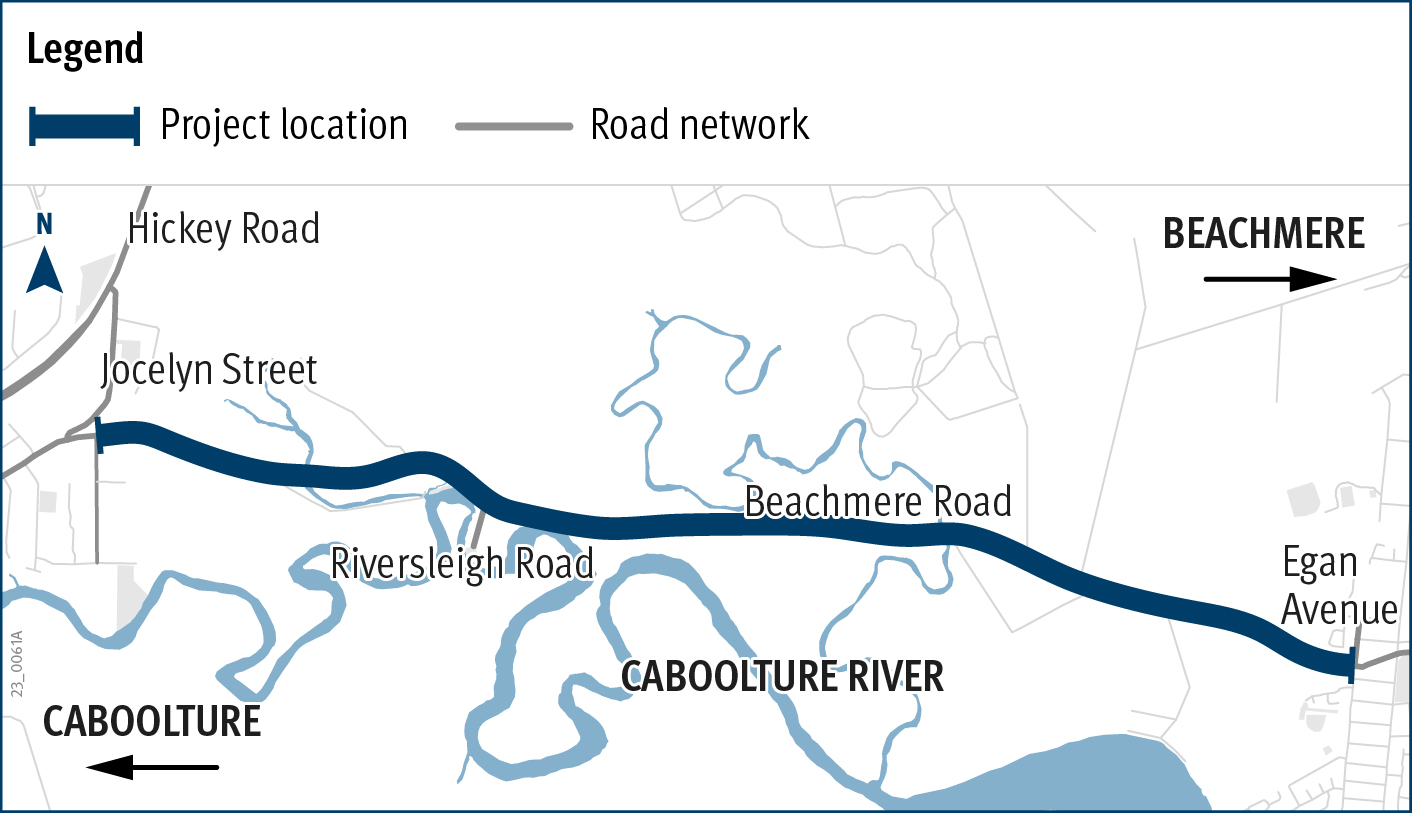
Caboolture - Beachmere Road, improve safety location map
Beachmere Road safety improvements project final design