Coorparoo Level Crossing Precinct Planning
We are investigating safety, accessibility and congestion improvements for the Coorparoo level crossing precinct.
Benefits
- Accessibility
- Better active transport
- Increases capacity
- Improves network efficiency
- Improves network reliability
- Improves safety
- Reduces travel time
Key features
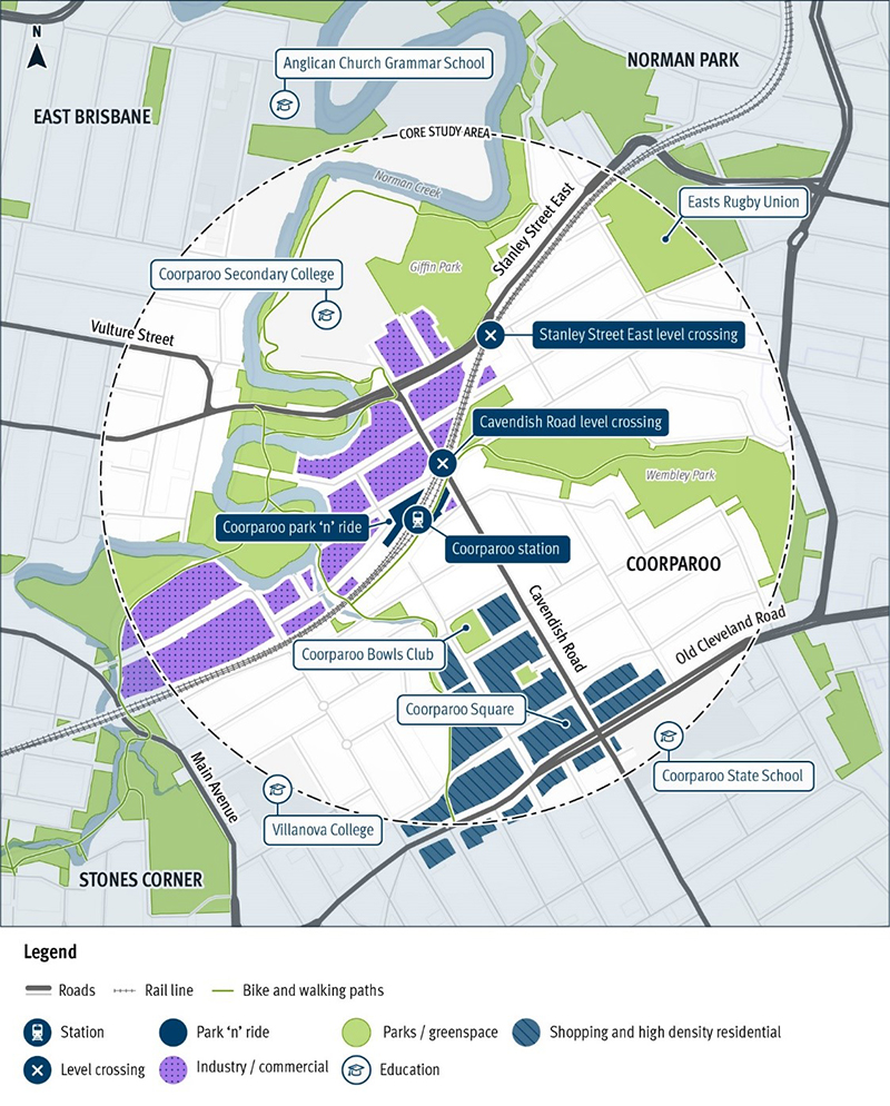
- The study will investigate transport challenges within the level crossing precinct, considering road traffic, bicycle and pedestrian movements, and access to the Coorparoo Station, park ‘n’ ride facilities and nearby bus stops.
- The precinct focus ensures consideration is given to key arterial roads in the area such as Stanley Street, Vulture Street and Old Cleveland Road. These roads are important connections to the Brisbane CBD, supporting thousands of daily trips for commuters and business.
- The study will investigate a range of available options, including intersection upgrades, pedestrian and cycle improvements, traffic management treatments and other network planning changes, and grade separating road from rail.
Funding
This project is a planned investment. The Australian and Queensland Governments have allocated funding towards planning for Coorparoo Level Crossing precinct, Cavendish Road and Stanley Street East, planning.
Investment ID: 2420128
Current status
Cavendish Road level crossing
The Cavendish Road level crossing is located adjacent to the Coorparoo Train Station and is used by a number of high frequency bus services. Due to its inner city location and proximity to busy roads, high density residential, education and commercial land uses, the Cavendish Road level crossing experiences high vehicle, bike and pedestrian volumes.
Stanley Street East level crossing
The Stanley Street East level crossing is approximately 350 metres north-east of the Cavendish Road crossing. While the crossing experiences less traffic than the Cavendish Road crossing, it is an important local access route for residential communities and recreational uses.
Next steps
Planning and technical investigations including community consultation to understand the current and future transport challenges and opportunities in the precinct.
Location map