Bruce Highway, (Ingham – Innisfail) Ingham to Cardwell Range Deviation, plan and preserve corridor
The department has been actively working with the community to address the challenges associated with the Bruce Highway from South of Ingham to the Cardwell Range.
This 16km section is prone to flooding, which affects the reliability of this critical link between Townsville and Cairns. Recognising the significance of the highway connecting the far north with south-east Queensland and the southern states, the department has undertaken various measures to find a long-term solution.
Between 2008 and 2011, an options for future highway corridors were investigated. The primary objective was to find the best solution to improve the flood immunity of the Bruce Highway, enhance safety and level of service, and accommodate current and future traffic needs. Throughout the study extensive community engagement took place, involving landowners, businesses, local government, elected representatives and other stakeholders.
In addition, the department conducted:
- environmental reviews
- cultural heritage reviews
- economic impact assessment
- extensive flood modelling
- environmental studies
- engineering assessments
- traffic assessments.
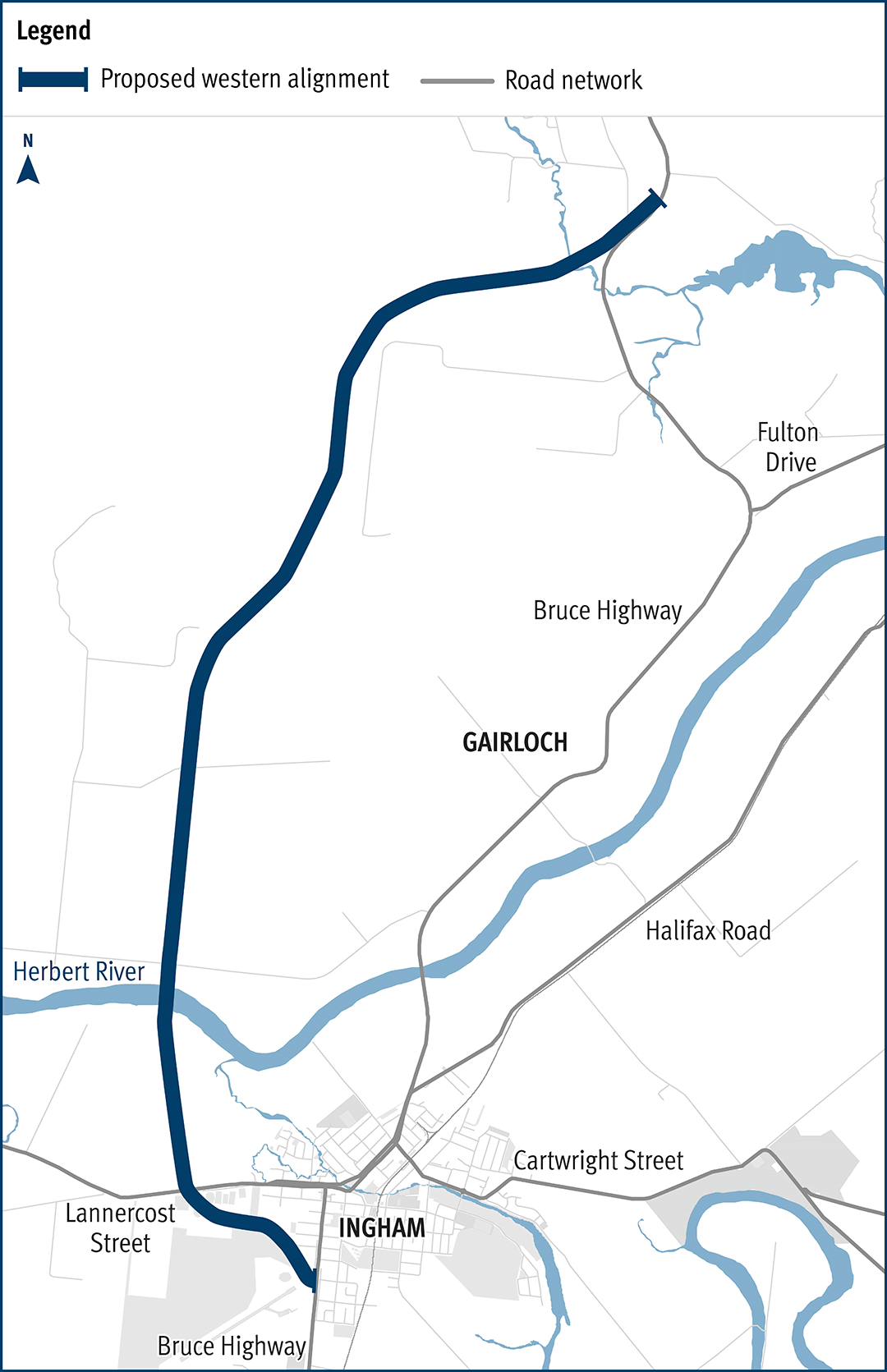
The investigation, reviews and assessment determined a preferred alignment, known as the Western 2A Deviation.
This alignment provided the best solution across a range of social, cultural, economic, engineering, cost, environment, and flooding considerations, and was found to have the lowest impact on the community. This alignment was gazetted as a future state-controlled road by the department in 2015.
Benefits
- Improves safety
- Improves flood immunity
- Increases capacity
- Improves network efficiency
Key features
- A new alignment secured for the Bruce Highway from south of Ingham to the Cardwell Range.
- Changes to this critical link of the highway to improve access in the wet season.
- Progress the project toward a Business Case, after considering further community feedback.
Funding
This planning project is jointly funded by the Australian and Queensland governments.
Investment ID: 399270
- Total investment
- $7.4 million
- Australian Government
- $5.92 million
- Queensland Government
- $1.48 million
Current status
The planning project will update findings from the previous planning study, completed between 2008 and 2011, and will carefully consider potential economic and social impacts on Hinchinbrook Shire.
The department anticipates it will take around 2 years to carry out further investigations and engagement activities to confirm broad corridor options for detailed investigation.
There is no allocated funding for the design or construction of the project.
Western 2A Deviation proposed alignment map