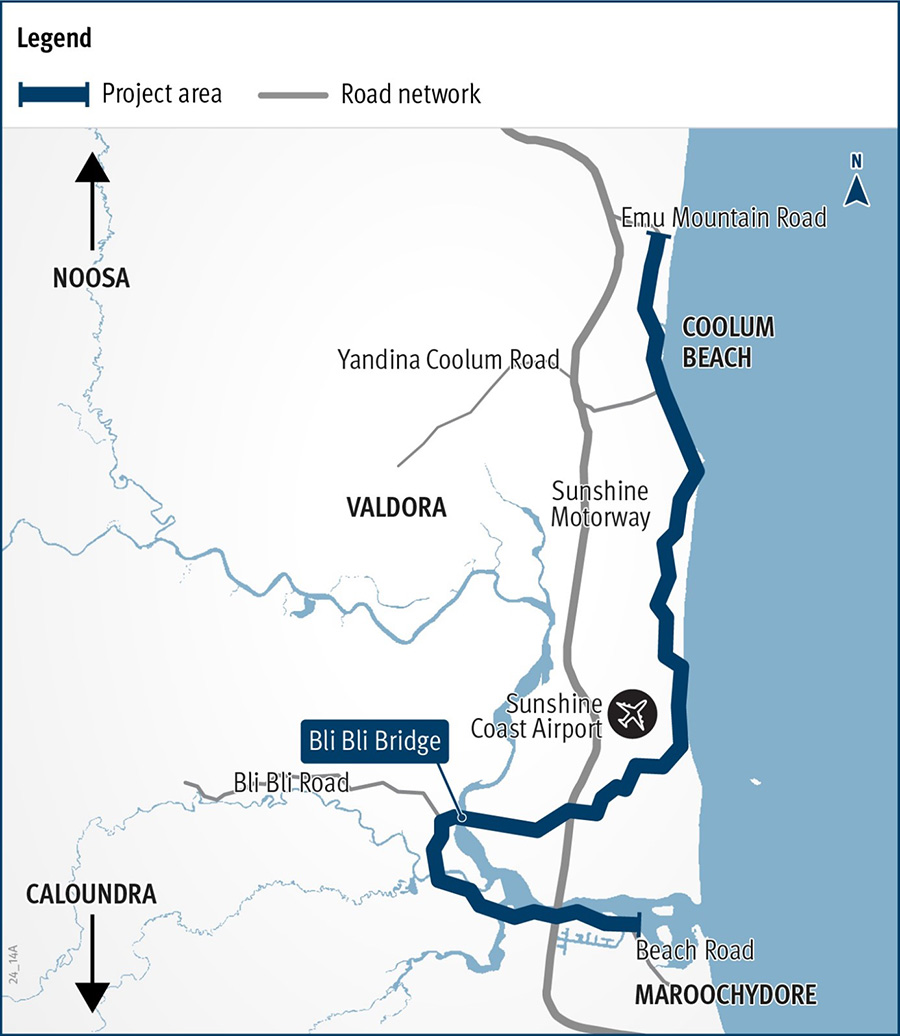
Maroochydore–Noosa Road Route Strategy and Link Plan
The department is undertaking planning for the full length of Maroochydore–Noosa Road which runs from Ocean Street, Maroochydore to Emu Mountain Road, Peregian Springs.
This work will investigate options to improve network capacity, safety efficiency, and active transport facilities on:
- Beach Road
- Duporth Avenue
- Bradman Avenue
- David Low Way
- Jubilee Esplanade
- Coolum Esplanade.
This combination of roads is formally called Maroochydore–Noosa Road and stretches 28km as a 2-lane, 2-way road used by up to 15,000 vehicles per day. These roads provide access to communities that have experienced significant growth, act as a popular tourist route, and form a key part of the Sunshine Coast active and public transport network.
The Route Strategy will investigate the future requirements of Maroochydore–Noosa Road to guide possible future planning investment.
Maroochydore-Noosa Road from Ocean Street to Petrie Creek
The department is also undertaking a more detailed Link Plan for the section of Maroochydore-Noosa Road from Ocean Street to Petrie Creek.
This work will consider in more detail the needs and opportunities for all transport modes in this section, which has high recreational, transport and parking demands. The study considers how to best balance these demands while maintaining the area's appeal.
Benefits
- Improves safety
- Improves network efficiency
- Accessibility
- Contributes to economy
- Better active transport
Key features
- Develop a long-term vision for the route.
- Identify potential future investment opportunities.
Funding
A total of $650,000 has been allocated under the Transport System Planning Program to undertake high level planning, including $300,000 towards the Route Strategy, an assessment of Maroochydore-Noosa Road, and $350,000 towards the Link Plan between Ocean Street and Petrie Creek Road.
- Total investment
- $650,000
- Queensland Government
- $650,000
Current status
Planning is underway.
These are high-level planning projects that will identify opportunities for consideration of future funding. There is currently no funding to progress any projects beyond this planning phase.
Community consultation for the Maroochydore–Noosa Road Route Strategy and Link Plan was undertaken from October to November 2022. The feedback received informed the planning process to help define the future needs for Maroochydore–Noosa Road. View a summary of community consultation feedback.
Maroochydore-Noosa Road Route Strategy and Link Plan map


