
Moggill Sub - Arterial Road, Centenary Motorway to Rafting Ground Reserve, active transport planning
Planning to improve active transport infrastructure and safety on Moggill Road between the Centenary Motorway and Kilkivan Avenue, Kenmore is now complete.
Moggill Road is a Principal Cycle Route in the South East Queensland Principal Cycle Network Plan and provides a bike riding connection from Kenmore, Pinjarra Hills and Chapel Hill towards Brisbane City, also linking to the Centenary Motorway and key centres at Indooroopilly and Toowong.
A major planning challenge for Moggill Road is providing for a range of transport modes in a narrow and winding road corridor, with homes and businesses, multiple access points, vegetation, and undulating topography in a large study area.
To improve project delivery, planning was divided into 3 sections:
- Section 1 - Moggill Road, Centenary Motorway to Chapel Hill Road
- Section 2 - Moggill Road, Chapel Hill Road to Kilkivan Avenue
- Section 3 - Moggill Road, Kilkivan Avenue to Rafting Ground Reserve.
Informed by community consultation in 2023 which sought to understand community concerns and priorities, the business cases for Sections 1 and 2, from the Centenary Motorway, Chapel Hill, to Kilkivan Avenue Kenmore, are complete.
Further planning stages are subject to approval and competing statewide funding priorities.
Benefits
- Improves safety
- Better active transport
- Improves ride quality
Funding
The Queensland Government allocated $2.35 million towards this planning project in Queensland Transport and Roads Investment Program (QTRIP) 2023-24 to 2026-27.
Investment ID: 1133302
- Total investment
- $2.35 million
- Queensland Government
- $2.35 million
Current status
Detailed planning for Sections 1 and 2 is finalised.
Planning for Moggill Sub-Arterial Road, Witton Road to Centenary Motorway off-ramp (Chapel Hill), active transport design and construction is complete.
Moggill Sub - Arterial Road, Centenary Motorway to Rafting Ground Reserve, active transport planning project map
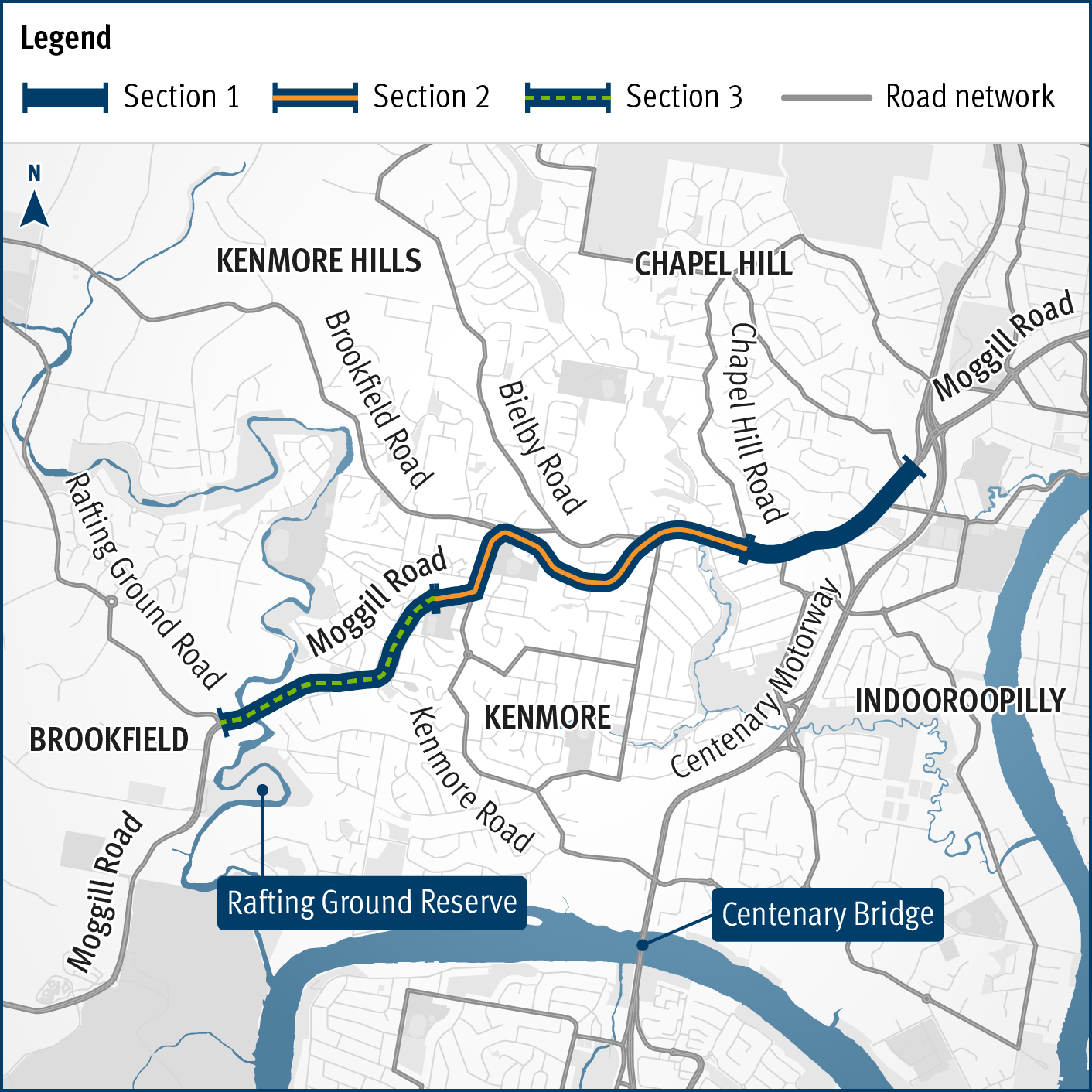
Moggill Sub-Arterial Road, Centenary Motorway to Rafting Ground Reserve, active transport planning location map.
The location map shows the study area, which is divided into 3 sections:
- Section 1 - from the Centenary Motorway to Chapel Hill Road
- Section 2 - from Chapel Hill Road to Kilkivan Avenue
- Section 3 - from Kilkivan Avenue to Rafting Ground Reserve.