


Rockhampton–Yeppoon Road, Yeppoon Road Upgrade
Rockhampton-Yeppoon Road is a regional road linking the Capricorn Coast, including tourist locations, such as Great Keppel Island to Rockhampton and beyond.
The road forms part of the designated state freight network and fulfils an important role in supporting defence, forestry, freight, tourism and commuter traffic demands in the region.
This project enhanced the efficiency and connectivity of key freight roads, particularly those connecting agricultural regions, ports, airports and other transport hubs and provide better access for sectors like tourism and mining.
Rockhampton-Yeppoon Road is approximately 35.6km in length, with 2 distinct sections:
- 4.03km section traversing the Rockhampton Central Business District urban area (Fitzroy Street, Queen Elizabeth Drive and Musgrave Street)
- 31.6km section from the Bruce Highway intersection in Parkhurst to Tanby Road roundabout at Yeppoon (rural area).
The section from the Bruce Highway to the Tanby Road roundabout is made up of a 4-lane section and a 2-lane section for the remainder of the road from Ironpot through to the Tanby Road roundabout.
Current traffic volumes on this section of the Rockhampton-Yeppoon Road range from 10,700 to 11,600 vehicles per day, which includes approximately 1000 heavy vehicles.
Benefits
- Improves safety
- Increases capacity
- Improves network efficiency
- Increases traffic flow
- Reduces peak hour congestion
- Improves flood immunity
- Better road access
- Contributes to economy
- Contributes to regional growth
- Better active transport
- Reduces maintenance
Key features
- Widen to 4 lanes between Ironpot and Hedlow Creek
- Rationalise private accesses onto Rockhampton-Yeppoon Road
- Realign Old Byfield Road connection onto Artillery Road
- Provide left-in and left-out access at both Artillery Road and Dairy Inn Road
- Construct U-turn facilities east and west of the Artillery Road and Dairy Inn Road intersection with protected right turns into Artillery Road and Dairy Inn Road
- Include extensive storage and deceleration facilities at the protected right turns into Artillery Road and Dairy Inn Road
- Provide through movements from side roads with the use of a modified left-out U-turn combination that has extensive vehicle storage and deceleration facilities
- Upgrade the Cabbage Tree Creek Road and Iron Pot Road intersections with dedicated protected left and right turn lanes
- Incorporate safe roadway design including recoverable batters, barriers (guardrails) and clear zone clearing
- Provide a 2.5m wide shoulder to facilitate on-road bicycle riding
Funding
The project was jointly funded by the Australian and Queensland governments.
Investment ID: 1192019
- Total investment
- $155 million
- Australian Government
- $107.99 million
- Queensland Government
- $47.01 million
Project timeline
- July to August 2020: Community consultation to identify community priorities for targeted upgrades
- February 2021 to March 2022: Detailed design
- April 2023: Construction contract awarded to Civil Mining and Construction Pty Ltd
- June 2023: Construction started
- December 2025: Construction completed
Current status
Construction was completed in December 2025.
Project location map
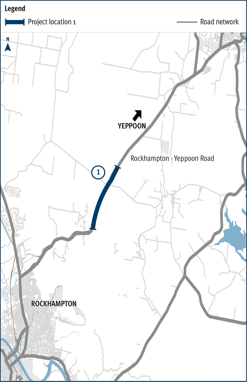
1. Location of Rockhampton—Yeppoon Road, Yeppoon Road upgrade project between Ironpot and Hedlow Creek.