
Gateway Motorway, Bracken Ridge to Pine River upgrade
The Queensland Government is upgrading the Gateway Motorway from Bracken Ridge to the Pine River to improve traffic flow and safety.
Planning
The Queensland Government is upgrading the Gateway Motorway from Bracken Ridge to the Pine River to improve traffic flow and safety.
Planning
The Queensland Government is upgrading the Bruce Highway, where it joins the Gateway Motorway and Gympie Arterial Road, south of the Pine River to improve traffic flow and safety.
Detailed design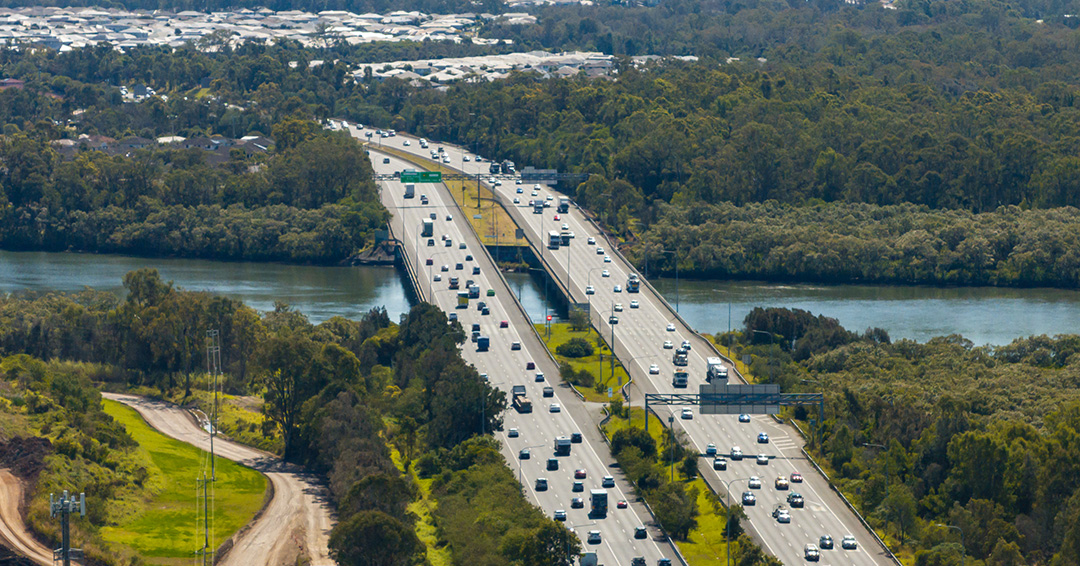
The Queensland Government is upgrading the Bruce Highway (Brisbane-Gympie), Gateway Motorway to Dohles Rocks Road in stages to improve traffic flow and safety.
Detailed designThe Queensland Government has completed integrated planning for the Gateway Motorway and Bruce Highway Upgrades in north Brisbane and the Moreton Bay Region.
Each day, around 160,000 vehicles travel between the Moreton Bay Region and north Brisbane on the Gateway Motorway, Bruce Highway and Gympie Arterial Road.
Significant population growth is increasing travel demand through this road corridor, with current traffic levels expected to increase by around 50% by 2041.
The following upgrades were recommended as part of integrated planning:
Consultation with the community has been ongoing since planning commenced in 2020. View a summary of feedback received about the recommended planning for the upgrades.
Read the latest community update to learn more about design underway.
The department recognises these upgrades will create changes in the local areas and we are committed to minimising these as much as possible as planning progresses.
Property acquisition is required to deliver the upgrades. We are engaging with impacted property owners.
There will be impacts on some surrounding wetlands and park areas. We are working to minimise these impacts as much as practically possible.
Potential changes to road traffic noise from the upgrades is being considered as the upgrades progress. This will include identifying possible noise treatment such as noise barriers.

The Queensland Government is upgrading the Bruce Highway, where it joins the Gateway Motorway and Gympie Arterial Road, south of the Pine River to improve traffic flow and safety.
The Queensland Government is upgrading the Bruce Highway (Brisbane-Gympie), Gateway Motorway to Dohles Rocks Road in stages to improve traffic flow and safety.
The department is delivering staged upgrades to manage increasing traffic demands on this section of the Bruce Highway. Stage 1 includes extended north-facing ramps from Dohles Rocks Road to Anzac Avenue.

The Queensland Government is upgrading the Gateway Motorway from Bracken Ridge to the Pine River to improve traffic flow and safety.
Last updated: 8 July 2026