Bruce Highway (Ingham – Innisfail), Gairloch Floodway, improve safety
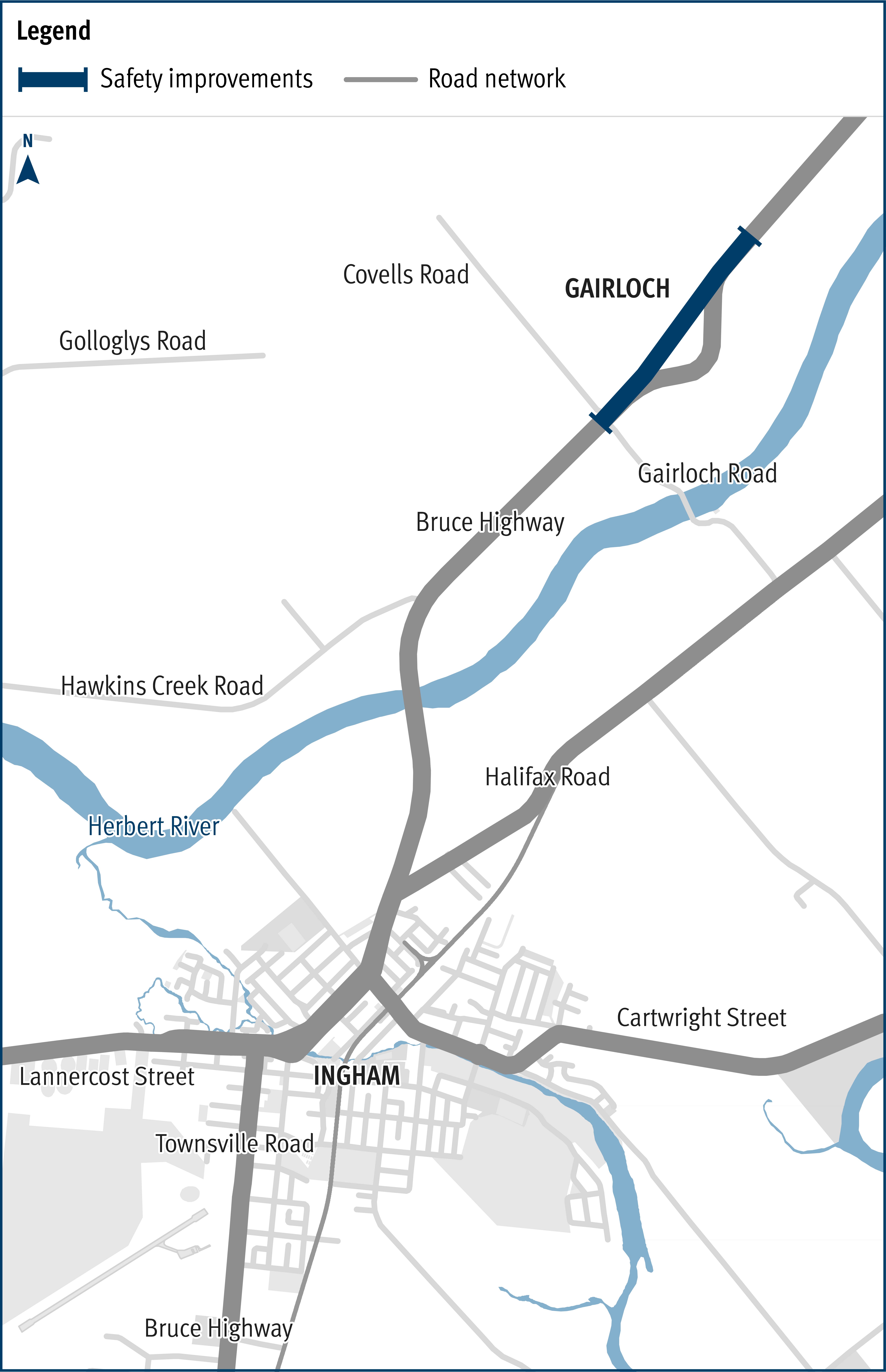
Planning has started to improve safety and reduce the time of closure due to flooding on a complex section of the Bruce Highway at the Gairloch floodway, approximately 6km north of Ingham.
The department is currently undertaking planning for safety improvements of the Gairloch section of the Bruce Highway, through the proposed implementation of wide centre line treatment and upgrading the road (removing the sharp curve) at this location.
Planning will also include aiming to reduce highway closures due to flooding by targeting a comparable immunity level at the highway immediately north and south of the Gairloch section.
The Gairloch floodway is located in the centre of a 16km flood-prone section of the Bruce Highway from the southern outskirts of Ingham to the foothills of Cardwell Range.
Historically, flooding closes the Bruce Highway at one or more locations along this 16km section every 2 years during the wet season, often multiple times, with closures varying from hours to several days.
The Gairloch floodway normally closes the highway first, and also keeps the highway closed for a longer period of time.
While the focus has been on more long-term solutions to address closures along the entire 16km section to date, both the Australian and Queensland governments recognise the benefits of reducing the time of highway closures at Gairloch due to flooding.
Benefits
- Improves safety
- Improves network efficiency
- Improves flood immunity
- Contributes to economy
Key features
- Improve safety through the delivery of wide centre line treatment
- Improve safety by upgrading the road geometry through the approximate 2.5km section of the Bruce Highway to remove the curve and straighten the road
- Reduce the time of Bruce Highway closures due to flooding through the Gairloch floodway
Funding
This project is funded by the Australian Government. Project scope, cost and timing are subject to further planning, consideration and negotiation with the Australian Government. Investment ID 2129809
A revised project cost of $48 million was announced on 22 December 2023.
Funding figures as at QTRIP 2023-24 to 2026-27 (June 2023).
- Total investment
- $40 million
- Australian Government
- $40 million
Current status
Planning started November 2021. Initial site investigations will involve survey, geotechnical investigations, cultural heritage and environmental assessment, and identification and location of public utility plant. Consultation with key stakeholders and the wider community will continue in 2023.
As part of the 2023-24 Federal Budget delivery, the Australian Government announced it is undertaking a 90-day review of Australian Government funded infrastructure projects. The department is awaiting the outcomes of this review, in order to determine impacts on our jointly funded projects.
Bruce Highway (Ingham – Innisfail), Gairloch Floodway, improve safety location map


