Gold Coast Highway (Broadbeach to Coolangatta) Currumbin Creek Cycleway, planning

Planning has started on the proposed Currumbin Creek Active Transport Bridge between Palm Beach and Currumbin.

The proposed Currumbin Creek Active Transport Bridge seeks to improve the active transport connection between Palm Beach and Currumbin over Currumbin Creek. 

Active transport users currently use a narrow, steep footpath on the existing Currumbin Creek Estuary Bridge with no place to stop, rest and enjoy the view. The current path is also close to traffic on the Gold Coast Highway making it difficult for those using mobility devices, like wheelchairs and prams, to access the footpath safely and conveniently. 

The new bridge will provide a separated, dedicated, wider and less steep shared active transport path across Currumbin Creek, resulting in a safer and more accessible pathway for pedestrians and bicycle riders.

Benefits

  • Improves safety
  • Accessibility
  • Contributes to economy
  • Contributes to regional growth
  • Better active transport

Key features

  • A new dedicated pathway and bridge crossing for active transport users, such as pedestrians and bike riders, between Palm Beach and Currumbin over Currumbin Creek. The path is proposed to travel from Palm Beach over Currumbin Creek to Currumbin along the Gold Coast Highway.
  • An opportunity to upgrade the existing Oceanway (active transport path) between the Gold Coast suburbs of Palm Beach and Currumbin. It will provide a new separated, dedicated, wider and less steep active transport bridge to allow a smoother and safer journey path and attract more active transport users due to the continuation of quality of the Oceanway experience.
  • Potential new connections into Duringan St, Currumbin to join the Currumbin Creek foreshore area as well as back into the Gold Coast Highway in both Palm Beach and Currumbin. 
  • Opportunity to provide viewing and rest areas, potentially with shading.

Funding

This project is funded for planning by the Queensland Government. Investment ID 1765284

Total investment
$1.5 million
Queensland Government
$1.5 million

Current status 

The business case, originally due for completion by June 2023, has been placed on hold to allow further planning, a re-design of the proposed bridge and to conduct another round of stakeholder and community consultation. 

Any further detailed planning or construction would be subject to future funding approval.

Community consultation 

Community consultation on the Currumbin Creek Active Transport Bridge took place from 3 to 27 March 2023. 

Community feedback indicated support for an improved active transport connection in the area, however, concerns were raised regarding the height and visual amenity of the proposed design presented to the community in March 2023. 

The department will now conduct further investigations into additional options and, will conduct another round of community consultation.

All feedback collected will be considered in the development of the business case. 

Project background

The proposed project is part of the Gold Coast Oceanway; a 36km network of active transport paths along or near the coast between Main Beach and Coolangatta. The Oceanway is designed to make walking and bike riding more attractive as alternatives to driving.

In 2020, the department completed a multi-modal corridor study for the Gold Coast Highway between Burleigh Heads and Tugun which recommended provision of a new separated active transport bridge east of the existing Currumbin Creek Estuary Bridge of the Gold Coast Highway.

The below concept designs and flythrough were presented to the community in March 2023. These are being refined further following community feedback.

Artist's impressions 

The artist's impressions and video fly through were developed to aid community consultation held in March 2023. These will be updated once further planning has been conducted and additional options have been investigated.
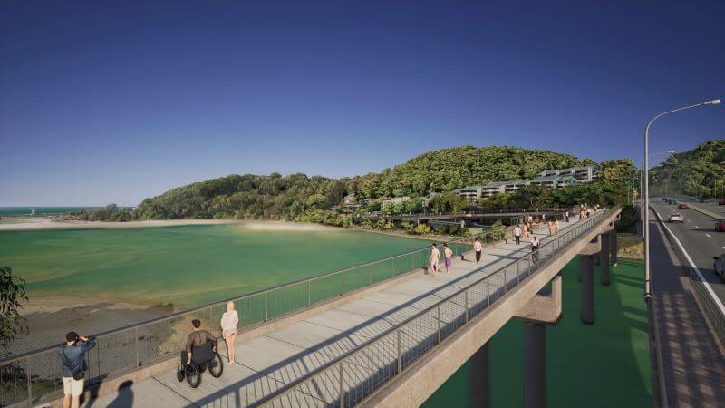
Looking south from Palm Beach at the proposed Active Transport Bridge crossing Currumbin Creek to Currumbin. Opportunities to provide viewing and rest areas (potentially with shading).
Looking south from Palm Beach at the proposed Active Transport Bridge crossing Currumbin Creek to Currumbin. Opportunities to provide viewing and rest areas (potentially with shading).


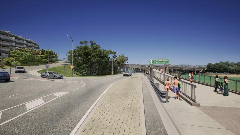
Facing west down Duringan Street, Currumbin, looking towards proposed Currumbin Creek Active Transport Bridge.
Facing west down Duringan Street, Currumbin, looking towards proposed Currumbin Creek Active Transport Bridge.


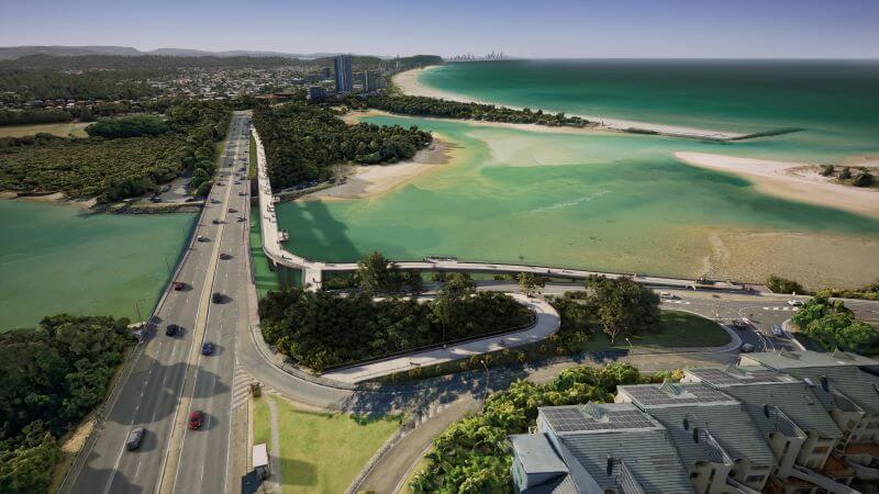
Aerial view looking north from Currumbin over Currumbin Creek at existing Currumbin Creek Estuary Bridge/Gold Coast Highway (left) and proposed Active Transport Bridge (right). Subject to change.

Aerial view looking north from Currumbin over Currumbin Creek at existing Currumbin Creek Estuary Bridge/Gold Coast Highway (left) and proposed Active Transport Bridge (right). Subject to change.

Currumbin Creek Active Transport Bridge fly through of artist's impression

Video Transcript

Aerial shot of Currumbin Creek, facing southbound towards Tugun. The new proposed Currumbin Creek Active Transport Bridge runs to the left of and adjacent to the existing Gold Coast Highway Currumbin Creek Estuary Bridge. [On screen text: Concept only – subject to change]

A reconfigured bus stop sits at the start of the bridge. Flythrough starts to travel across the proposed bridge towards the south, depicting active transport users, including walkers, cyclists, mobility device users and people with prams, utilising the new bridge. The Gold Coast Highway sits to the right of the bridge with vehicles driving across it. [On screen text: Reconfigured bus stop]

Flythrough continues to travel south across the new proposed Currumbin Creek Active Transport Bridge. [On screen text: Reconfigured vegetation along Gold Coast Highway road corridor]

An additional section for resting and viewing, with shade, is available on the left of the bridge. [On screen text: Opportunities to provide viewing and rest areas with shade]

Pedestrians are crossing the bridge and enjoying the viewing platforms. 

The flythrough follows the bridge as it curves to the left to show an intersecting pathway for users. Pedestrians can either continue straight-ahead toward Duringan Street or take the new path to the right that could potentially reconnect with the Gold Coast Highway.[On screen text: Retain vegetation along Duringan Street road corridor]

Flythrough continues to travel south across the bridge with Currumbin Beach on the left and Duringan Street on the right. 

Flythrough zooms out to show an aerial view of southern side of the bridge as well as depicting a view of the beach and northern Gold Coast in the distance. [On screen text: proposed connection to Gold Coast Highway south of Currumbin Creek Bridge]

Aerial shot of the proposed bridge and Currumbin Creek facing northern Gold Coast. [On screen text: Currumbin Creek Active Transport Bridge, Queensland Government]