Rockhampton Ring Road
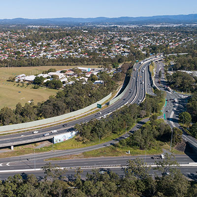
The Rockhampton Ring Road is a transformative project for the Bruce Highway, designed to support future economic growth and deliver key benefits such as improved flood resilience, freight efficiencies, reduced travel times and enhanced road safety.
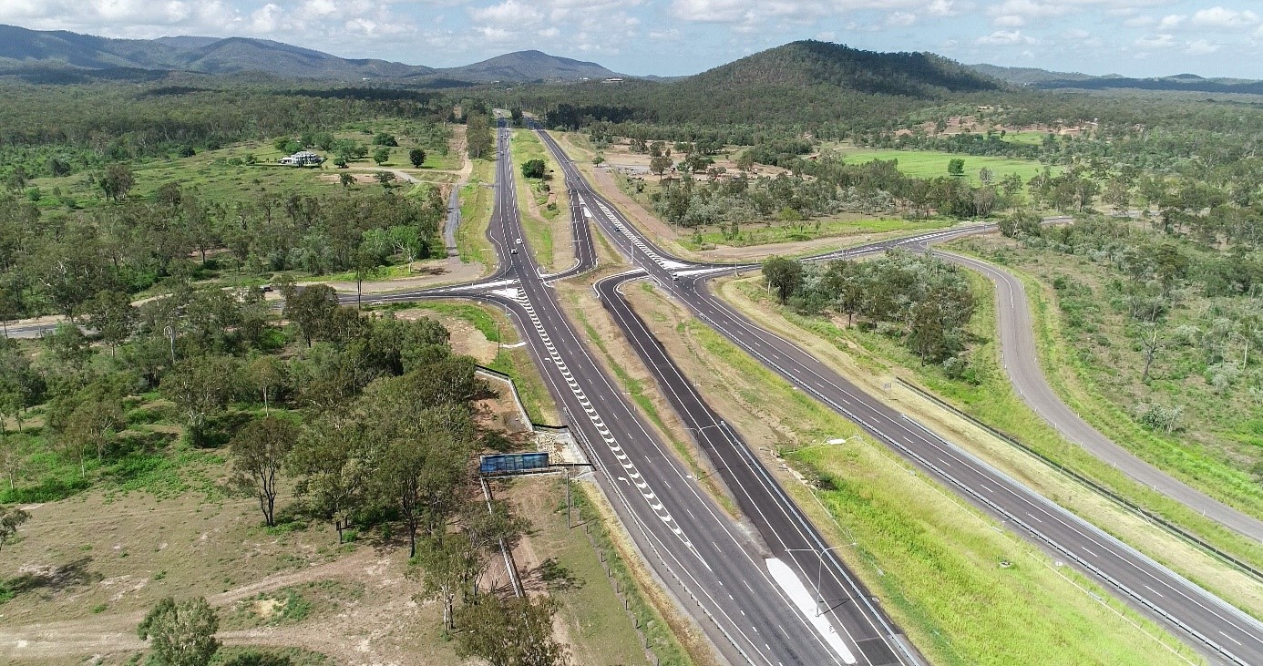
The project involves 17.4km of new roadway, including a 14.7km western link of the Bruce Highway. It extends from the Capricorn Highway (at Nelson Street) in the south to Bruce Highway and Rockhampton–Yeppoon Road intersection in the north.
A critical feature is the construction of a third Fitzroy River crossing, connecting Pink Lily to Parkhurst, along with additional access points to the city of Rockhampton. These upgrades will improve connectivity to key locations, such as the Rockhampton Airport, the Rockhampton Hospital, defence, education and leisure precincts in Wandal and Rockhampton City, and industrial precincts in North Rockhampton.
The Bruce Highway is Queensland's major north-south freight and commuter corridor spanning over 1671.3km from Brisbane to Cairns.
The current highway through Rockhampton is a bottleneck, with 19 sets of traffic signals and significant traffic volumes, including an average of 3,020 heavy vehicles daily.
Benefits
- Improves safety
- Increases capacity
- Improves network efficiency
- Increases traffic flow
- Reduces peak hour congestion
- Better road access
- Reduces travel time
- Contributes to regional growth
- Improves ride quality
- Improves flood immunity
- Contributes to economy
Key features
- 17.4km of new roadway including approximately 14.7km of ring road alignment commencing from a new southern roundabout on the Capricorn Highway.
- A new 435m long third bridge over the Fitzroy River between Pink Lily and Parkhurst, with shared active transport facilities.
- New Access Points:
- West Rockhampton via a flood-resilient connection road from the ring road alignment to the Rockhampton airport and hospital precincts via the Rockhampton–Ridgelands Road roundabout.
- North Rockhampton at Alexandra Street with a grade-separated overpass including on and off ramps to access the local road network.
- The Bruce Highway intersection with Rockhampton—Yeppoon Road at Parkhurst, improving travel time to and from the Capricorn Coast.
- Continued access to the road network during major flood events via a high-level connection from the Capricorn Highway to the ring road alignment, building Rockhampton's flood resilience during weather events.
- A total of 18 bridges along the main ring road alignment, including 8 road overpasses and 7 water crossings.
Funding
The Australian Government and the Queensland Government are funding the project.
Investment ID: 1167108
- Total investment
- $1.98 billion
- Australian Government
- $1.4 billion
- Queensland Government
- $580 million
Current status
Construction of an early works program commenced in November 2023. The project transitioned to the main construction program in mid-2025.
Key achievements for the project to date are:
- Completion of a 204m long bridge over Limestone Creek in Parkhurst.
- Northern entry to the Ring Road alignment, including, new access for the emergency services precinct and Dreamtime Cultural Centre.
- Rockhampton–Ridgelands Road roundabout operational since April 2025, improving traffic flow and safety.
- A 61.1m long bridge over Lion Creek completed in May 2025.
- Realignment of Nine Mile Road and Rockhampton–Ridgelands Road intersection.
Early works underway to enable construction of the new Fitzroy River bridge
Construction of the Rockhampton Ring Road includes building a new bridge across the Fitzroy River between Pink Lily and Parkhurst, about 4.5km upstream of the Fitzroy River Barrage.
To safely construct the new bridge, a 270m-long temporary bridge is being built across the river as a work platform to stage construction of the permanent bridge. This means a section of the Fitzroy River will be temporarily excluded from all river traffic during construction.
The implementation of a temporary exclusion zone along a 250m section of the river, between Pink Lily and Parkhurst, has been implemented in two stages. The exclusion zone is an active construction site.
Stage 1—Partial exclusion zone ends 12 July 2026
- The 50m navigation channel for public access adjacent to the Stage 1 partial exclusion zone on the Parkhurst side of the river will close on 12 July 2026.
Stage 2—Full river-width exclusion zone from 13 July 2026 to 30 June 2028
- No access permitted through the exclusion zone.
- Closure of the navigation channel on the Parkhurst side of the river.
- Access only permitted for emergency response.
Exclusion zone map

We understand the Fitzroy River is an important community asset used for recreation, boating, fishing and training activities. These Frequently Asked Questions explain why an exclusion zone is required, how long it will last, what areas remain accessible, and how safety and environmental issues will be managed.


Design
The design incorporates flood immunity equivalent to a 1-in-100-year flood event (9.86m on the Rockhampton flood gauge).
Features such as bridges and culverts are included to manage water flow and minimise flood impacts.
Environment
The project prioritises environmental sustainability and protection of the Fitzroy River Flood Plain. Measures include:
- Environmental Management Plans to minimise construction impacts.
- Compliance with the Environment Protection and Biodiversity Conservation Act 1999 (EPBC Act).
- Compliance reports for Rockhampton Ring Road, as per Condition 17 of approval 2020/8286.
View all EPBC Act compliance reports associated with this project.
Culture and heritage
The project acknowledges the cultural significance of the area and actively engages with the Darumbal People to address cultural considerations.
Measures are in place to protect Aboriginal heritage and conserve sites listed in the Queensland Heritage Register.
Rockhampton Ring Road – alignment map