Eton Range Realignment Project
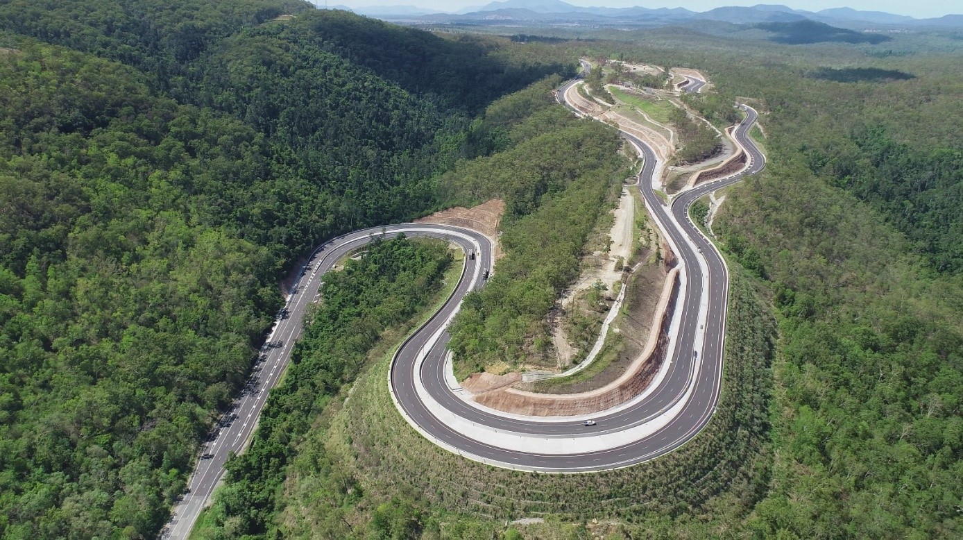
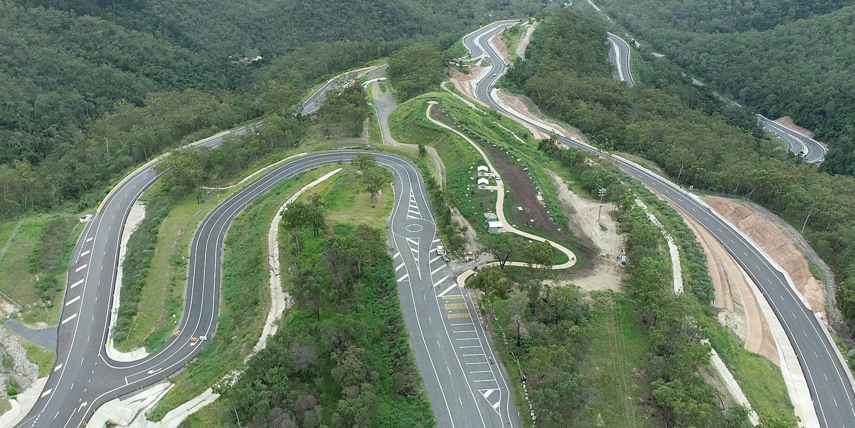
Eton Range fully opened to traffic on 1 October 2020. The existing range has been upgraded to 4 lanes, added a split carriageway for part of the range and reduced the grade to improve safety and efficiency.
The Peak Downs Highway is a key transport route connecting the regional city of Mackay to the mining and agricultural areas of Central Queensland. Eton Range is used heavily by oversize vehicles servicing mining and agricultural industries, as well as general motorists travelling to and from work centres.
The Eton Range Realignment Project upgrades the existing range crossing to 2 lanes in each direction, with a split carriageway for part of the range. The project reduces the current grade to improve safety for heavy vehicles and introduces other measures to help control approach and departure speeds.
Benefits
- Improves safety
- Increases capacity
- Improves network efficiency
- Increases traffic flow
- Reduces peak hour congestion
- Better road access
- Reduces travel time
- Contributes to economy
- Contributes to regional growth
- Reduces maintenance
- Improves ride quality
Key features
- Provides 4 lanes, with 2 lanes in each direction.
- Widens the crossing bottom of the range and realigns the top section to provide a split carriageway.
- Separates traffic lanes.
- Increases road safety and reduces road closures due to traffic incidents.
- Accommodates type 1 road trains.
- Reduces gradient.
- Increases capacity and efficiencies for current and future traffic levels.
Funding
The project is jointly funded by the Australian and Queensland governments. Investment ID 10565
- Total investment
- $189.26 million
- Australian Government
- $166.17 million
- Queensland Government
- $23.09 million
Eton Range Realignment Project drone footage
Current status
Construction completed.

Sustainability
Before construction, it was identified that koalas were on Eton Range and the project may impact on the population. In September 2015 the Federal Department of the Environment determined the Eton Range Realignment Project a controlled action under the Environment Protection and Biodiversity Conservation Act 1999 (EPBC Act) due to potential significant impacts on koalas (EPBC Ref 2015/7552). In December 2015 the Department of Transport and Main Roads then supplied the Australian Department of the Environment with preliminary documentation outlining how the department plans to mitigate these impacts.In March 2016 the Department of Environment granted the project approval with conditions under the Environment Protection and Biodiversity Conservation Act 1999.
EPBC Act Compliance Reports
Condition 16 of the approval requires the department to prepare and publish an annual report that addresses compliance with each of the conditions of the approval.
- EPBC 2015 7552 Compliance Report 2016-2017
- EPBC 2015_7552 Compliance Report 2017-2018
- EPBC 2015_7552 Compliance Report 2018-2019
- EPBC 2015_7552 Compliance Report 2019-2020
- EPBC 2015_7552 Compliance Report 2020-2021
- EPBC 2015_7552 Compliance Report 2021-2022
Mitigation strategies
Koala research project
We engaged Koala Research CQ, hosted by Central Queensland University, to conduct a research project to understand the biology and population dynamics of koalas in Central Queensland’s hinterland ranges. The findings were then used to recommend investment options for installing wildlife barrier, underpasses or other measures along the Peak Downs Highway between Eton and Nebo.
The study started in August 2016 with field work concluding in August 2018.
View the fact sheet to read a summary of the research and findings. The final research reports on the koala study are available:
- Overview: Koalas of the Clarke-Connors Ranges and associated landscapes
- Attachment 1: Koalas of the St Lawrence Region
- Attachment 2: Koalas of the Clarke-Connors Range
- Attachment 3: Managing CQs Clarke-Connors Range koala population
- Attachment 4: Fauna sensitive infrastructure investment opportunities, Peak Downs Highway, Nebo to Eton
- Attachment 5: Wildlife mortality on the Peak Downs Highway, Nebo to Eton.
We put the study recommendations into action by installing fauna exclusion fencing at Denison Creek and Stockyard Creek.
Construction of exclusion fencing was completed in April 2019 at Denison Creek and at Stockyard Creek in June 2020. Both sites were then monitored to determine its effectiveness. View the Monitoring and Assessment Plan.
The monitoring determined that the fencing assisted in preventing or reducing koala road deaths along the fenced areas.
View the fact sheet for a summary of the monitoring project. The final report is available:
Design alterations
We altered the design of the Eton Range Realignment project to incorporate a dedicated fauna underpass to allow animals to safely cross the road without any interaction with traffic. Exclusion fencing and fauna furniture such as habitat logs are located within the underpass to encourage use by koalas and other animals.
Monitoring of the underpass has been undertaken to determine its successfulness. Download the Eton Range Realignment - Fauna Underpass Monitoring Final Report.
The construction contractor also prepared a specialised Environmental Management Plan to protect the local fauna during construction. Processes included:
- using specialised fauna spotters to identify koalas and other animals that live in trees, and only removing trees after the animals have vacated
- sequential clearing of habitat to minimise stress for wildlife and enable animals to move away from cleared areas.

