Isisford-Blackall Road, pavement rehabilitation
Works are underway to progressively rehabilitate about 26km of high priority sections of the Isisford - Blackall Road with completion expected in mid-2022...
Works are underway to progressively rehabilitate about 26km of high priority sections of the Isisford - Blackall Road with completion expected in mid-2022...

We are preparing a business case to replace the rollingstock on the long distance passenger rail fleet that services western regional Queensland...
Around 35km of the 185km road is being sealed to improve safety, connectivity and wet weather access...
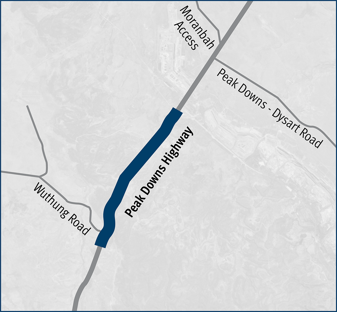
The Peak Downs Highway Wuthung to Caval Ridge project strengthened and widened a 14-km section of highway from Wuthung Road to the Caval Ridge mine turnoff...
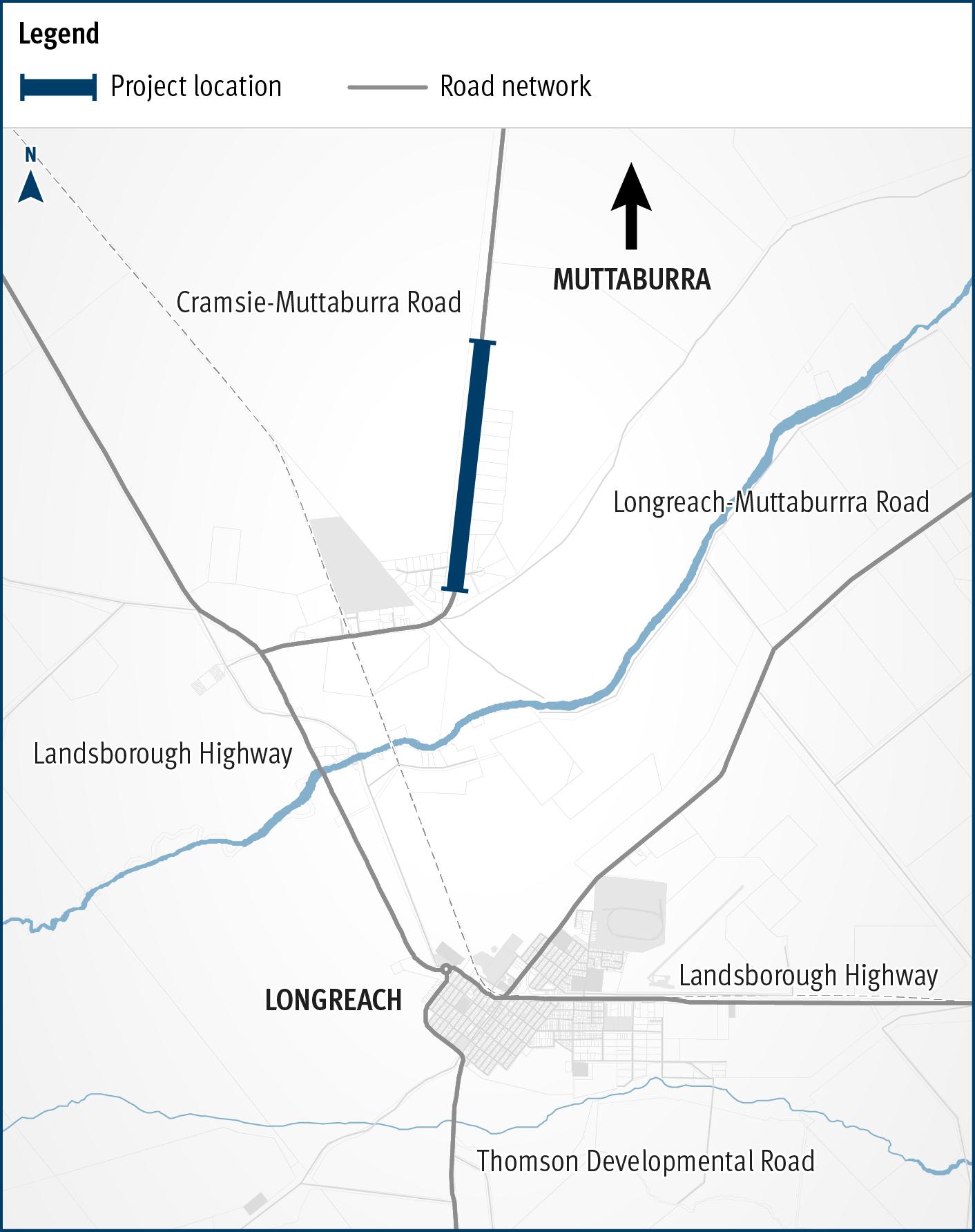
This project will widen and rehabilitate a 3km section of aged, narrow pavement on the Cramsie-Muttaburra Road to a width of 8m, improving safety, overtaking opportunities and travel times...
Planning is underway to identify potential future upgrades to Mackay – Bucasia Road to improve congestion, safety, and flooding impacts on this vital link to the Northern Beaches...
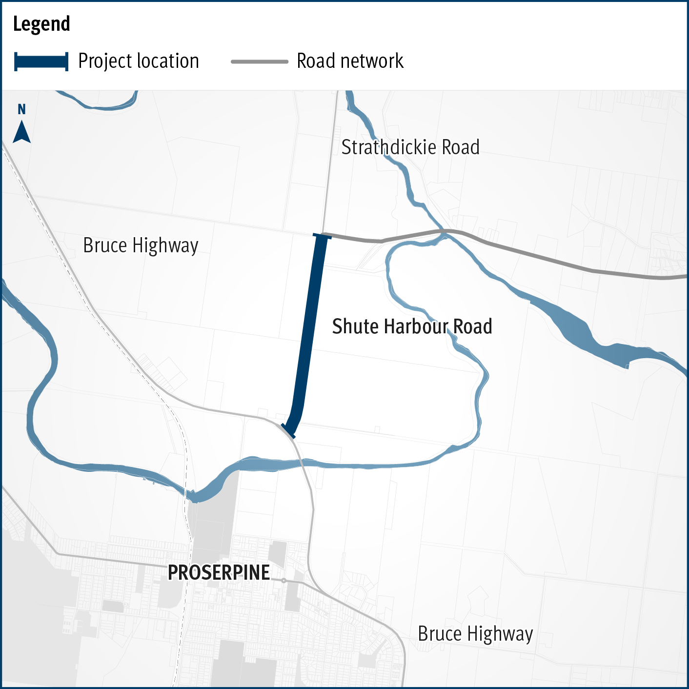
This upgrade will improve safety and increase capacity along a 1.5-km section of Proserpine - Shute Harbour Road by widening from 2 to 4 lanes, upgrading key intersections, and installing a new shared...
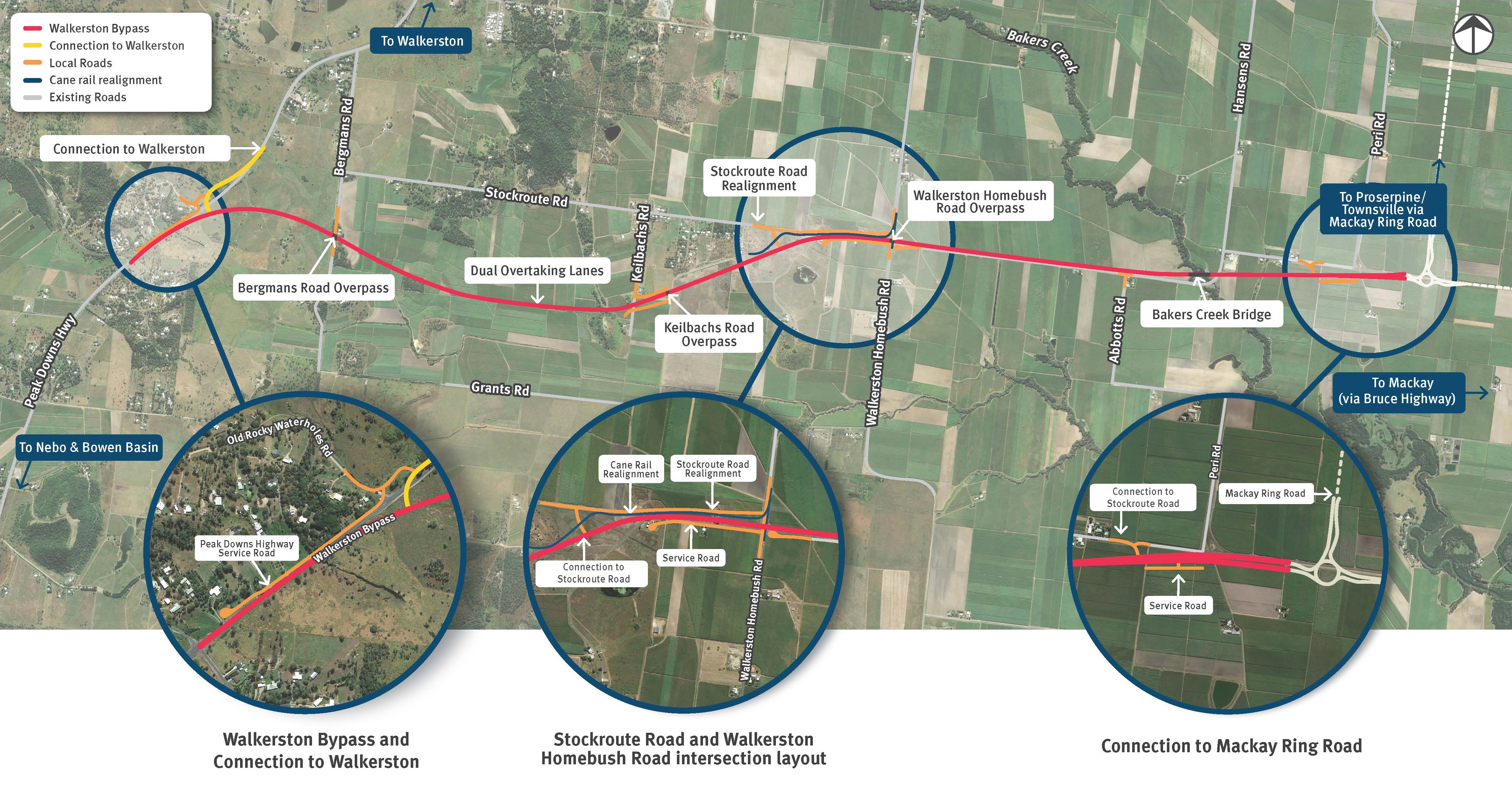
We are building a new 2-lane rural highway to connect Peak Downs Highway west of Walkerston to the Mackay Ring Road near Paget...
Flood immunity on the Bruce Highway at Jumper Creek, north of Mackay is being upgraded to improve the safety and reliability of this section of the highway and minimise disruption through flood...
Proserpine – Shute Harbour Road will benefit from a $21 million flood immunity upgrade at Hamilton Plains between the Bruce Highway turn-off and Strathdickie Road...