
Burdekin River Bridge, rehabilitation program
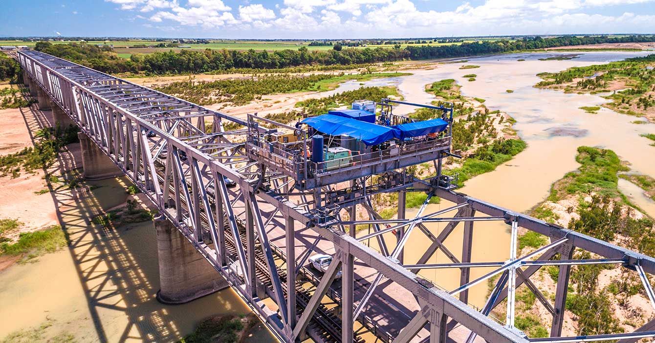
Rehabilitation and maintenance program to preserve the structural integrity of the Burdekin River Bridge. The ongoing program will ensure a safe and durable crossing is maintained for the long-term...
Rehabilitation and maintenance program to preserve the structural integrity of the Burdekin River Bridge. The ongoing program will ensure a safe and durable crossing is maintained for the long-term...
Bowen State Boat Harbour is 1 of 8 state-owned and managed boat harbours on the Queensland coast that form a network of important strategic maritime public assets which: provide safe and efficient all...

We are progressing a project to upgrade the Bruce Highway at Dallachy Road, near Tully to improve flood immunity on this section of the highway...
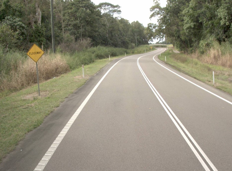
Planning has commenced to improve safety and reduce the time of closure due to flooding on a complex section of the Bruce Highway at the Gairloch floodway, 5km north of Ingham...
A planning study is currently being undertaken to identify and preserve a corridor for a future bypass of Innisfail...
Planning for the Bruce Highway, Cairns Southern Access Corridor, (Stage 5) Foster Road upgrade intersection project will assess and recommend options to upgrade this intersection...
The Burke Developmental Road (Normanton – Dimbulah), flood resilience projects...
The Cairns Bruce Highway Upgrade master plan was released in 2010. It was the result of a planning study that investigated long term, multi-modal transport planning options to address the impacts of...
We are reinvesting project savings to deliver a new off-road cycleway adjacent to the Bruce Highway consistent with the Cairns Bruce Highway Upgrade Masterplan...
We have commenced planning for a new transit network for Cairns. This planning includes building a network to deliver dedicated public transport spines that will connect the length and breadth of...
The Cairns Transport Study will develop a strategy for the Cairns transport network that supports sustainable, efficient, equitable and affordable transport outcomes consistent with economic, social...
The department is undertaking a $300 million project is being undertaken to duplicate the Cairns Western Arterial Road between Redlynch Connector Road and Captain Cook Highway...
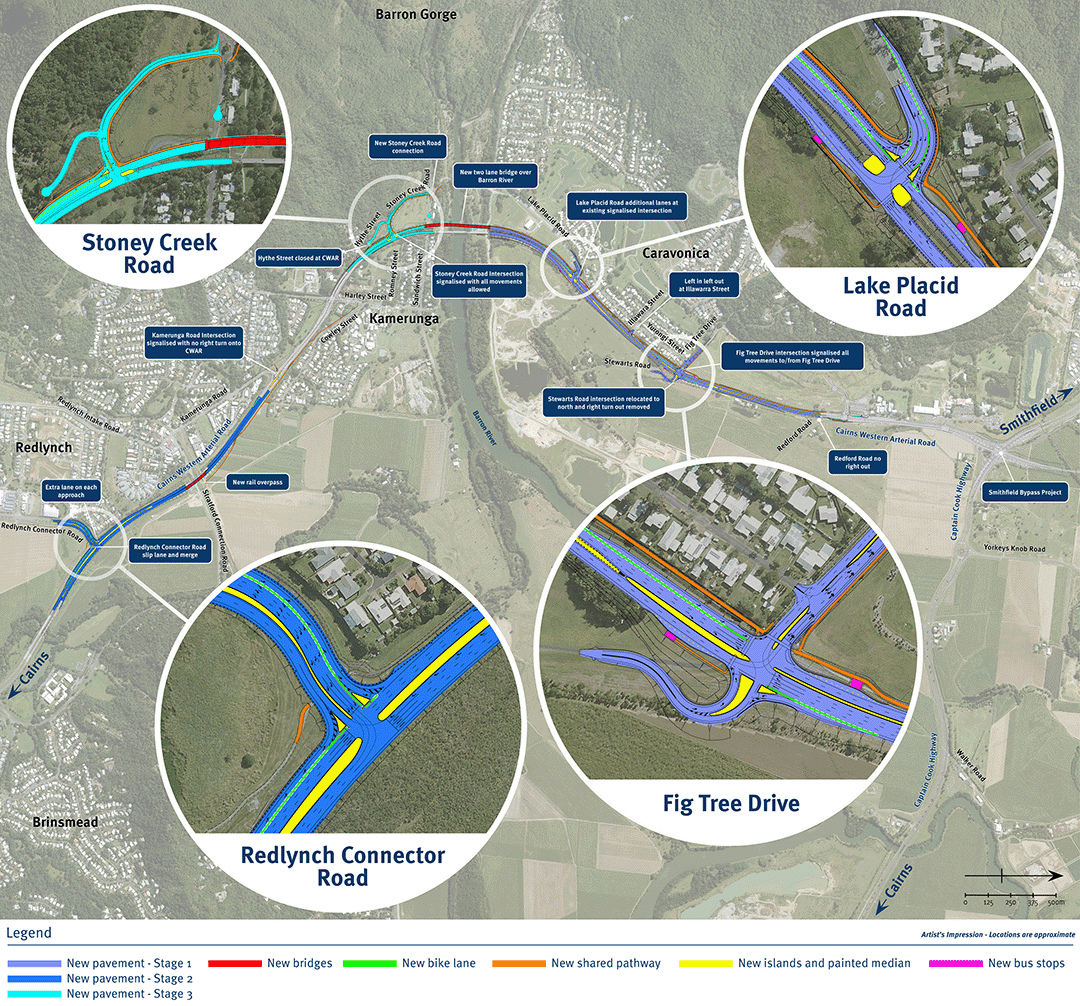
The department is conducting a planning study which will identify future upgrades for the Cairns Western Arterial Road. The project,will examine strategic connections for the Cairns Western Arterial...
Cape York Regional Package Stage 2 is a $237.5 million program of works to deliver road infrastructure upgrades on Cape York Peninsula between 2019-2020 and 2023-2024...
These works are part of a long-term disaster recovery program to restore critical infrastructure and ensure the safety of road users. As part of a comprehensive disaster recovery program, these works...
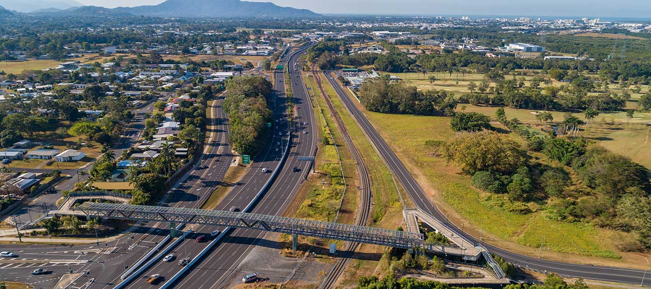
We are progressing the planning for a $359 million program of road upgrades on Captain Cook Highway between Cairns and Smithfield...
The Queensland Government is upgrading Cloncurry – Dajarra Road to improve the reliability and safety of the Malbon River floodway...
Repairs are underway across Far North Queensland after extensive, severe damage to the state-controlled road network was caused by record rainfall as a result of Tropical Cyclone Jasper in December...

Improving the flood immunity and resilience of the state-controlled road network at 27 priority sites...
The Riverway Drive Stage 2 project will improve the safety, capacity and efficiency of Riverway Drive between Allambie Lane and Dunlop Street in Kelso, Townsville...
Last updated: 4 October 2023