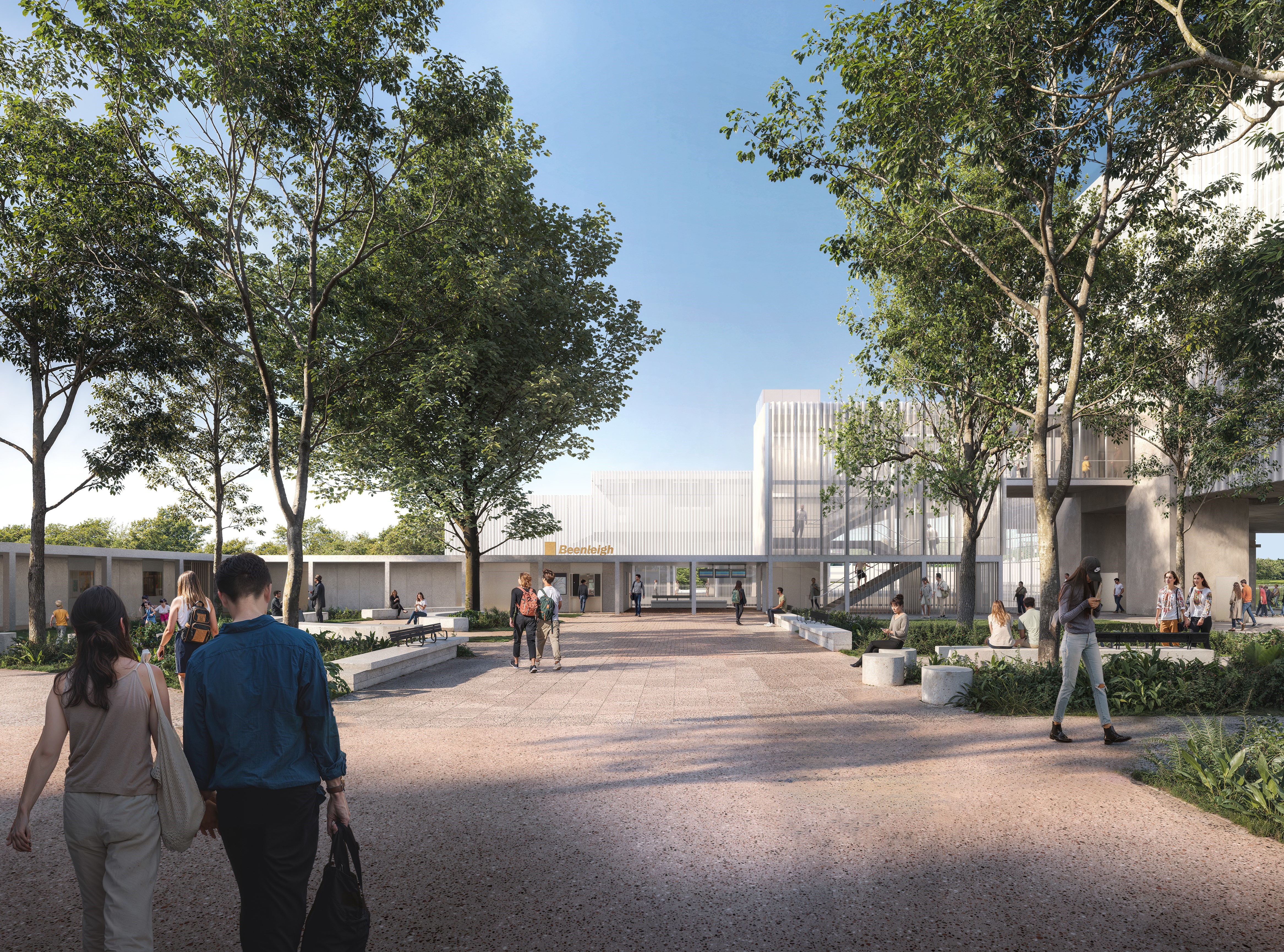
Logan and Gold Coast Faster Rail

We're connecting our growing communities with more frequent and reliable train services between Brisbane, Logan and the Gold Coast.

South East Queensland (SEQ) has experienced significant growth over the last 2 decades. This growth is expected to continue with an extra 1.5 million people living in the region by 2036. To harness this growth and support our region's thriving communities we must keep evolving the rail network so that it plays a bigger role in moving people around SEQ.

To support our growing population and rail patronage demand between Brisbane, Logan and the Gold Coast, we need to double the number of Beenleigh and Gold Coast train services over the next 20 years.

The rail line between Kuraby and Beenleigh is a key capacity bottleneck on the network. Currently, trains between Kuraby and Beenleigh share a single track in each direction, limiting the number of peak services that can run. During peak periods, all-stop Beenleigh trains need to be held to one side to allow Gold Coast express trains to pass through. 

The Logan and Gold Coast Faster Rail project will address this problem by doubling the number of tracks between Kuraby and Beenleigh to allow the free movement of both all-stops and express trains. The project will also upgrade stations to improve accessibility, remove 5 level crossings, improve park ‘n’ ride facilities and provide a new continuous active travel path connecting to stations along the 20km section of upgraded tracks.

Key features

Logan and Gold Coast Faster Rail will deliver:

  • double the capacity of the Gold Coast rail line and reduce waiting times at stations between Brisbane, Logan and the Gold Coast
  • approximately 20km of new tracks and rail systems between Kuraby station and Beenleigh station, increasing the corridor from 2 to 4 tracks
  • better connected communities through accessible upgrades at stations and dedicated active transport facilities and paths along the corridor 
  • improved road network efficiency and reduced peak hour traffic congestion through intersection upgrades and level crossing removals at Kuraby, Woodridge, Bethania, Holmview, and Beenleigh
  • new train signalling technology between Salisbury and Varsity Lakes
  • extension of the cattle siding at Holmview.

Logan and Gold Coast Faster Rail flythrough video

Video Transcript
0:00:00.600-->0:00:03.712
The words Logan and Gold Coast Faster Rail appear on the screen, over a map of South East Queensland.

0:00:04.000-->0:00:10.640
Orange markers identify Kuraby station and Beenleigh station on the map.

0:00:10.640-->0:00:14.320
A dark blue line traces the existing rail line and the location of the Logan and Gold Coast Faster Rail project corridor.

0:00:14.320-->0:00:17.607
A light blue line extends north and south showing the Gold Coast rail line and Cross River Rail project.

0:00:17.607-->0:00:27.050
Green boxes then appear which show the location of Brisbane, Logan, and the Gold Coast in relation to the project.

0:00:27.417-->0:00:36.417
An aerial map appears with a line travelling south along the existing rail line.

0:00:39.000-->0:00:45.000
A marker for Kuraby station appears and green shading shows the project footprint along the rail line.

0:00:45.000-->0:00:48.000
Markers on the map pick out nearby Kuraby State School, Wally Tate Park, the Gateway Motorway, Beenleigh Road Park and Beenleigh Road.

0:00:48.000-->0:00:52.000
A concept design for Kuraby station, which is modern and coloured white and beige. There are covered areas for shade.

0:00:52.000-->0:00:54.000
The building is supported by V shaped pillars and there is a lift and steps to the platform.

0:00:55.000-->0:00:59.000
A marker for Trinder Park station appears on an aerial map showing the local area.

0:00:59.000-->0:01:01.520
Green shading highlights the project footprint in the surrounding area

0:01:01.520-->0:01:04.520
and markers showing the nearby park ‘n’ ride, road over rail bridge and level crossing closure at Trinder Crossing.

0:01:04.520-->0:01:06.520
Markers show Woodridge North State School, Logan Metro Football Club, Karawatha Forest Discovery Centre and Trinder Park current station in relation to the project.

0:01:06.520-->0:01:09.640
A concept design for Trinder Park station, which is modern and coloured white and beige. There is a covered area to the right.

0:01:09.640-->0:01:12.060
The roof is supported by V shaped pillars with steps to the platform.

0:01:12.060-->0:01:15.000
A marker for Woodridge station appears on an aerial map showing the local area.

0:01:15.000-->0:01:19.295
Green shading highlights the project footprint in the surrounding area and the new park ‘n’ ride.

0:01:19.295-->0:01:23.379
Markers show the location of Railway Parade, Wembley Road, Woodridge State School,

0:01:23.379-->0:01:26.052
Logan City Council and Jacaranda Avenue in relation to the project footprint.

0:01:26.052-->0:01:30.800
A concept design for the new widened underpass at Woodridge station which is light, bright, and modern.

0:01:30.920-->0:01:35.799
A marker for Kingston station appears on an aerial map showing the local area.

0:01:35.799-->0:01:38.947
Green shading now shows the project footprint around the station.

0:01:38.947-->0:01:41.924
Markers show nearby Collin Park, Kingston Road, Mary Street, Kingston Butter Factory and Gould Adams Park

0:01:42.000-->0:01:45.289
A concept design for Kingston station, which is modern and coloured white and beige. There is a covered area to the right.

0:01:45.289-->0:01:47.080
The roof is supported by V shaped pillars with steps to the platform.

0:01:47.080-->0:01:50.080
A marker for Loganlea station appears on an aerial map showing the local area.

0:01:50.080-->0:01:52.080
Green shading shows the project footprint around the station.

0:01:52.080-->0:01:59.828
Markers show nearby Meadowbrook Shopping Centre, Loganlea current station, Logan Hospital, TAFE Qld Loganlea campus and Loganlea High School

0:01:59.828-->0:02:02.480
A concept design for the new Loganlea station which is modern and coloured grey and beige. There are covered areas for shade.

0:02:02.480-->0:02:05.000
The building is supported by vertical pillars with steps to the platform.

0:02:05.000-->0:02:07.000
A marker for Bethania station appears on an aerial map showing the local area.

0:02:07.000-->0:02:12.000
Green shading shows the project footprint around the station and the new park ‘n’ ride.

0:02:12.000-->0:02:17.480
Markers show nearby Bethania Aquatic Centre, Bethania Waters Shopping Centre, Station Road, Holzheimer Road and Bethania Lutheran Church.

0:02:17.480-->0:02:21.480
A concept design for the new Bethania station which is modern and coloured white and beige. There are covered areas to the right.

0:02:21.480-->0:02:23.240
The roof is supported by V shaped pillars with steps to the platform.

0:02:23.240-->0:02:27.240
A marker for Edens Landing station appears on an aerial map showing the local area.

0:02:27.240-->0:02:30.000
Green shading shows the project footprint.

0:02:30.000-->0:02:34.802
Markers show nearby Edens Landing Shopping Centre, Logan City Hawks Rugby Leagues Club and Edens Parkland.

0:02:34.802-->0:02:38.588
A concept design for the new Edens Landing station which is modern and coloured white and beige. There are covered areas for shade.

0:02:38.588-->0:02:40.680
The building is supported by V shaped pillars with steps to the platform.

0:02:40.680-->0:02:44.880
A marker for Holmview station appears on an aerial map showing the local area.

0:02:44.880-->0:02:47.880
Green shading shows the project footprint including the level crossing closure at Holmview

0:02:47.880-->0:02:50.880
road, the new park ‘n’ ride and the level crossing closure at Spanns Road.

0:02:50.880-->0:02:53.880
Markers show nearby Holmview Park, Holmview Road, the current Holmview station and Spanns Road level crossing.

0:02:53.880-->0:02:56.772
A concept design for the new Holmview station which is modern and coloured white and beige. There are covered areas for shade.

0:02:56.772-->0:02:58.760
The building is supported by V shaped pillars with steps to the platform.

0:02:58.760-->0:03:02.000
A marker for Beenleigh station appears on an aerial map showing the local area.

0:03:02.000-->0:03:04.000
Green shading shows the project footprint including the park ‘n’ ride.

0:03:04.000-->0:03:06.000
Markers show nearby Hammel Park Sporting Facilities, James Street, Beenleigh State School, Beenleigh Library,

0:03:06.000-->0:03:08.000
Beenleigh Town Square, George Street, the current Beenleigh station and the Beenleigh Marketplace.

0:03:13.400-->0:03:15.400
A concept design for the new Beenleigh station which is modern and coloured white and beige. There are covered areas for shade and a multi-story carpark.

0:03:15.400-->0:03:18.400
The building is supported by V shaped pillars. Lifts and stairs lead to the platforms.

0:03:18.400-->0:03:24.400
An aerial map shows the route of the rail line and stations included in the project.

0:03:24.400-->0:03:28.400
The words Logan and Gold Coast Faster Rail appear on the screen along with the Australian Government logo and the Queensland Government logo.
 

Benefits

  • Improves network efficiency
  • Improves safety
  • Better road access
  • Reduces travel time
  • Contributes to regional growth
  • Increases capacity
  • Reduces peak hour congestion
  • Increases car parks
  • Contributes to economy
  • Better active transport

Funding

The Australian Government and Queensland Government are funding the project. Investment ID 2008163.

Funding figures updated December 2023 to reflect increased Australian Government and Queensland Government contributions.

Total investment
$5.75 billion
Australian Government
$2.875 billion
Queensland Government
$2.875 billion

Current status

In late 2023, we completed community engagement on the refined reference design for the project, as well as the detailed design for the Loganlea Station Relocation project.

We started the procurement process in late 2023, and expect to appoint contractors for both the Logan and Gold Coast Faster Rail and Loganlea Station Relocation projects in 2024, subject to government approvals.

Construction timeframes will be confirmed once contractors have been appointed.

Community engagement

We are currently reviewing your feedback from the community engagement we held in November and December 2023.

During the engagement period, we:

  • delivered flyers
  • held community drop-in sessions
  • met with community groups and key stakeholders
  • launched an online engagement platform, where the community could view project materials and provide feedback via an online survey.

The findings will be used to inform the detailed design and we expect to release an engagement summary in early 2024.

Field investigations

You might notice some field investigations being conducted at selected sites throughout the corridor. This information will help us understand more about the existing conditions and environment along the rail corridor.

If we need access to private property, we will contact the owners in advance to make suitable arrangements.

Project timeline

  • September to October 2021: Community engagement on business case
  • 2022–2023: Further refinement of the reference design
  • August 2023: Procurement activities started
  • November to December 2023: Community engagement on refined reference design
  • Late 2024: Expected contract awarded
  • 2025: Expected start of construction

Additional information

Information for property owners

Property owners who have been informed they are directly impacted by this project may be eligible to apply for a strategic purchase of their property. A strategic purchase allows owners to voluntarily apply to sell their property to the department before the formal resumption process.

While there is no difference between the compensation assessment process of a strategic purchase and compulsory acquisition, a strategic purchase can provide property owners with more flexibility in the timing of the sale.

If you have been advised that your property is directly impacted by the project, you may be eligible to apply for a strategic purchase. Contact the project team to understand your eligibility and to apply.

We want to ensure that people interested in buying property in the area are also aware of the project. A Transport and Main Roads property search will show if there is a property requirement for the land. Potential owners can contact the project team with any questions.

Information for local business owners

We've been visiting local businesses along the project corridor to provide an update on the project and to gather information and feedback to inform future planning. 

Local business owners are encouraged to register their details with us by contacting the project team on 1800 957 066 or by emailing LGC.Business@tmr.qld.gov.au.

Logan and Gold Coast Faster Rail location map

Map details the train line from Beenleigh to Kuraby
The project is located along the rail corridor from Kuraby station to Beenleigh station. In the background both the road network and the Logan River are shown. The map identifies the alignment of the tracks and shows stations including (from north to south) Kuraby, Trinder Park, Woodridge, Kingston, Loganlea, Bethania, Edens Landing, Holmview and Beenleigh. The track alignment shows the curved section of track at the existing Trinder Park station location and where the new section of straightened track will run in its place. The map also shows the locations of five level crossings that will be removed as part of the project. These are located at Kuraby, Woodridge, Bethania and Holmview station in Beenleigh.

9 Projects in Logan and Gold Coast Faster Rail

Artist impression of Beenleigh Train station showing carpark, pedestrian overpass and lift and stair access.

Beenleigh train station upgrade

Beenleigh train station is a key transfer location between all-stops and express services on the Beenleigh and Gold Coast train lines.

Artist impression of the Bethania train station from street view.

Bethania train station upgrade

Bethania train station is being upgraded to improve accessibility, safety and customer experience. 

Artist impression of Edens Landing train station from street view showing the street level access with pedestrian bridge.

Edens Landing train station upgrade

Edens Landing station is being upgraded to improve accessibility, safety and customer experience.

Artist impression of the Holmview train station from street view looking at the new station entrance.

Holmview train station upgrade

Holmview train station is being upgraded to improve accessibility, safety and customer experience.

Artist impression of the Kingston train station entrance at street level.

Kingston train station upgrade

Kingston train station is being upgraded to improve accessibility, safety and customer experience for the community. 

Artist impression of how the upgraded Kuraby train station will look. The image shows the the new Kuraby entrance from street view with a train pulled into the station.

Kuraby train station upgrade

Kuraby station is being upgraded to improve accessibility, safety and customer experience for the community. 

Artist impression of the proposed upgraded Loganlea station. Image is looking from Station Road and shows the new wider underpass with people out the front of the new station building and trains pulled up at the platforms.

Loganlea train station and park 'n' ride relocation

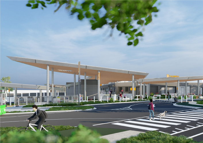
We are relocating Loganlea train station and the park 'n' ride closer to Logan Hospital.

Artist impression of proposed new Trinder Park station with the Translink logo and Trinder Park sign on the front. Image is looking from Alexander Street with people out the front of the new station building and a train pulled up at a platform.

Trinder Park train station upgrade

Trinder Park train station is being relocated further north to be more centrally located between the Kuraby and Woodridge train stations. The relocation will improve safety and network efficiency due to its new straightened section of the track.

Artist impression of the proposed upgraded Woodridge station with the Translink logo and Woodridge sign on the front. Image is looking from Station Road and shows the new wider underpass with people out the front of the new station building and trains pulled up at the platforms.

Woodridge train station upgrade

Woodridge station is being upgraded to improve accessibility, safety and customer experience.