Queensland

282 Projects in Queensland showing 221-240

Filter projects

Filters

Status
Status
Programs
Programs
Type
Type
Reset
  1. Pialba–Burrum Heads Road, O’Regan Creek, upgrade existing floodway

    This project aims to improve the flood immunity and reduce flood closure times at the Pialba–Burrum Heads Road crossing...

    • Southern Queensland Region
    • State Road Network Upgrade Program
    Pialba–Burrum Heads Road, O’Regan Creek, upgrade existing floodway project location map
  2. Port of Brisbane Further Planning

    The Australian and Queensland Governments are investigating improved freight access to the Port of Brisbane...

    • Metropolitan Region
  3. Proserpine - Shute Harbour Road, Valley Drive (Cannonvale), capacity upgrades

    This upgrade will improve safety and increase capacity along a 1.5-km section of Proserpine - Shute Harbour Road by widening from 2 to 4 lanes, upgrading key intersections, and installing a new shared...

    • Central Queensland Region
    No image supplied
  4. Proserpine – Shute Harbour Road upgrades

    Proserpine – Shute Harbour Road will benefit from a $21 million flood immunity upgrade at Hamilton Plains between the Bruce Highway turn-off and Strathdickie Road...

    • Central Queensland Region
  5. Queensland Train Manufacturing Program fleet

    The new, modern train fleet will provide passengers with more efficient, reliable, and accessible travel across South East Queensland...

    • Queensland Train Manufacturing Program
    • North Coast Region
    Concept illustration of a train that will be constructed in Torbanlea, Queensland.
  6. Recreational boating infrastructure

    We own and maintain over 430 pieces of marine infrastructure valued at about $153 million. These include assets such as state boat harbours, boat ramps, jetties, pontoons, floating walkways, channels...

    • Boating facilities
    No image supplied
  7. Redland Bay Road, Taylor Road to Cleveland Redland Bay Road, planning study

    We are undertaking planning for Mount Cotton Road, Redland Bay Road and the Redland Sub-Arterial Road, including the Double Jump Road, Ney Road and Taylor Road intersections...

    • Metropolitan Region
    Map showing roads subject to planning including, Mount Cotton Road (Duncan Road to Double Jump Road), Redland Bay Road (Tingalpa Creek to Cleveland-Redland Bay Road), and Redland Sub-Arterial Road (Mount Gravatt-Capalaba Road to Tingalpa Creek).
  8. Redland Sub-Arterial Road, Mount Gravatt Capalaba Road to Tingalpa Creek, widening, business case (planning)

    We are undertaking planning for Mount Cotton Road, Redland Bay Road and the Redland Sub-Arterial Road, including the Double Jump Road, Ney Road and Taylor Road intersections...

    • Metropolitan Region
    Mount Cotton Road-Redland Bay Road location map
  9. Road Asset Management Contract and Responsive Maintenance Contract—Metropolitan

    Maintenance services for the Metropolitan Region are currently carried out by both Fulton Hogan and RoadTek under a new Road Asset Management Contract (RAMC) and Responsive Maintenance Contract (RMC...

    • Metropolitan Region
    No image supplied
  10. Road Asset Management Contract and Responsive Maintenance Contract—South Coast

    The generation 2 RAMC contract includes routine and programmed maintenance and rehabilitation activities in addition to stewardship and asset management services for much of the TMR network in South...

    • South Coast Region
    No image supplied
  11. Road Asset Management Contracts—North Coast

    Maintenance services for the North Coast Region are carried out by TMR Contractors, RoadTek under a Responsive Maintenance Contract (RMC) and Downer under a Road Asset Management Contract (RAMC)...

    • North Coast Region
    No image supplied
  12. Rockhampton Railyards Rejuvenation, Heritage Precinct

    Work to preserve the significant heritage value of the Roundhouse is progressing, with structural repair works underway to help stabilise the 112-year-old roundhouse building...

    • Central Queensland Region
    Close-up view of the historic, disused roundhouse at the Rockhampton Railyards Heritage site, featuring a circular structure with a stationary turntable in the center
  13. Rockhampton Railyards Rejuvenation, Industrial Precinct

    We are undertaking significant remediation work to rejuvenate the old railyards and restore this precinct. The precinct features more than 20 different warehouses and storage sheds, some of which have...

    • Central Queensland Region
    Aerial view of the Rockhampton Railyards industrial precinct, showcasing rail tracks, various structures, and the historic circular roundhouse
  14. Rockhampton Ring Road

    The Rockhampton Ring Road is a major infrastructure project within the Central Queensland region...

    • Bruce Highway Upgrade Program
    • Central Queensland Region
  15. Rockhampton–Yeppoon Road, Yeppoon Road Upgrade

    We are committed to delivering targeted upgrades between the connection with the Bruce Highway in Parkhurst and the Tanby Road roundabout in Yeppoon...

    • Central Queensland Region
    Yeppoon Road Upgrade project complete, showing Rockhampton–Yeppoon Road duplication and Artillery Road, Dairy Inn Road and Old Byfield Road
  16. Ross River Road, Mabin Street to Rolfe Street, improve safety

    The department is undertaking safety improvement works at various locations across Ross River Road from the Mabin Street intersection to the Rolfe Street intersection...

    • North Queensland Region
    • High Risk Roads Targeted Road Safety Program
    No image supplied
  17. Rosslyn Bay State Boat Harbour master plan

    Rosslyn Bay State Boat Harbour is one of Queensland's 8 state-owned and managed state boat harbours that form a network of important strategic maritime public assets which: provide safe and efficient...

    • Central Queensland Region
    No image supplied
  18. Salisbury to Beaudesert Passenger Rail

    The Australian and Queensland Governments are investigating future rail requirements between Salisbury and Beaudesert...

    • South Coast Region
    • Metropolitan Region
    No image supplied
  19. Samford Sub-Arterial Road (Samford Road) and Glen Holm Street, upgrade intersection and Samford Sub-Arterial Road (Samford Road) and Osborne Road intersection planning (known as the Samford Road intersection improvements)

    We are currently undertaking community consultation on proposed safety and traffic improvement works at key intersections along Samford Road, at Pickering Street, Glen Holm Street and Osborne Road...

    • Metropolitan Region
    Map of Samford Road interection improvements
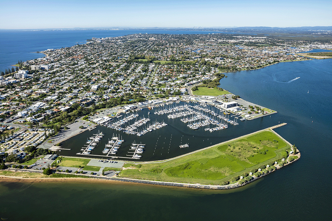
  20. Scarborough State Boat Harbour Master Plan

    Scarborough Boat Harbour is vibrant part of the Redcliffe Peninsula community...
    • North Coast Region
    Aerial view of Scarborough Harbour

Last updated: 19 July 2024