
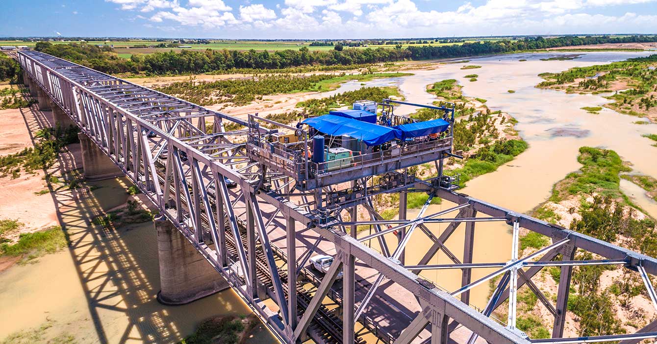
Burdekin River Bridge, rehabilitation program
Rehabilitation and maintenance program to preserve the structural integrity of the Burdekin River Bridge. The ongoing program will ensure a safe and durable crossing is maintained for the long-term...
Rehabilitation and maintenance program to preserve the structural integrity of the Burdekin River Bridge. The ongoing program will ensure a safe and durable crossing is maintained for the long-term...
The Department of Transport and Main Roads undertaking safety improvements on Beaudesert–Beenleigh Road...
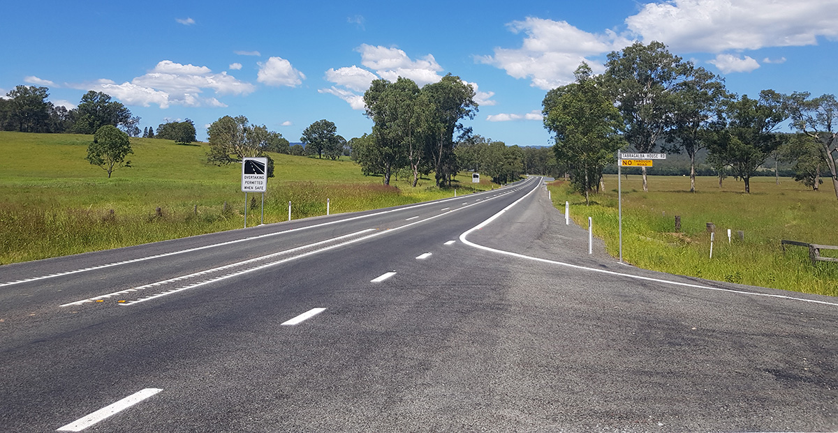
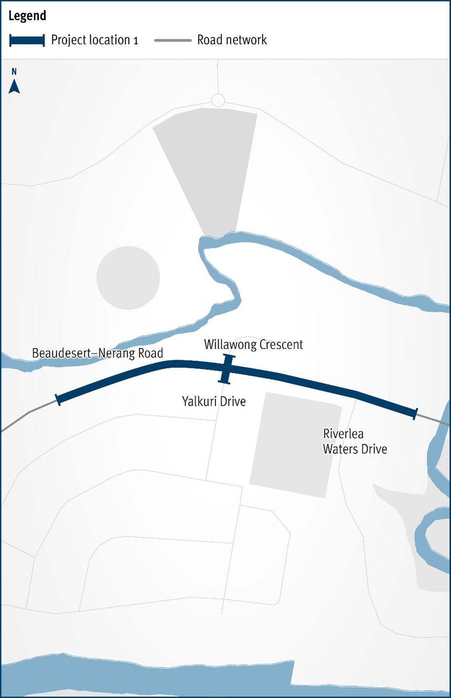
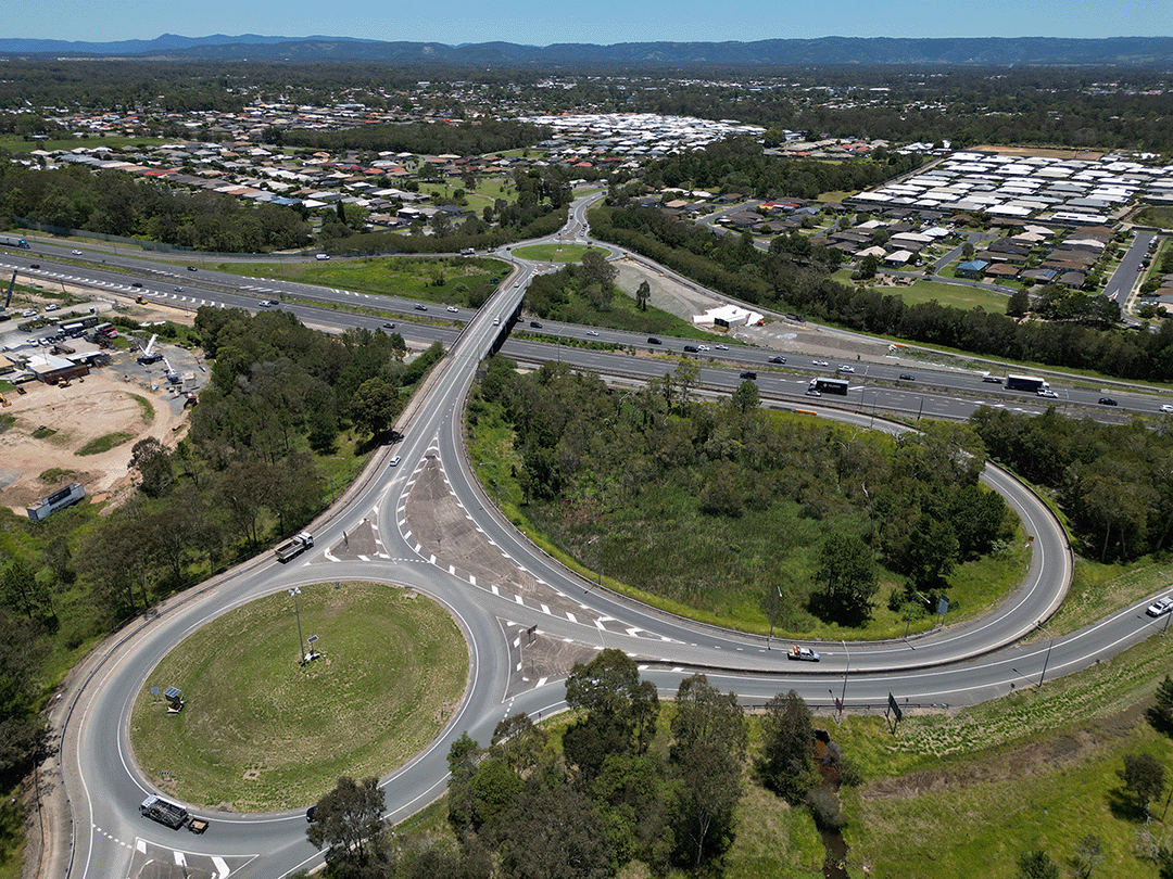
The Department of Transport and Main Roads will be improving the safety and efficiency of the Beaudesert–Nerang Road, Yalkuri Drive and Willawong Crescent intersection at Nerang...
The Beerburrum to Nambour Rail Upgrade (B2N) project covers about 40km of the North Coast Line...
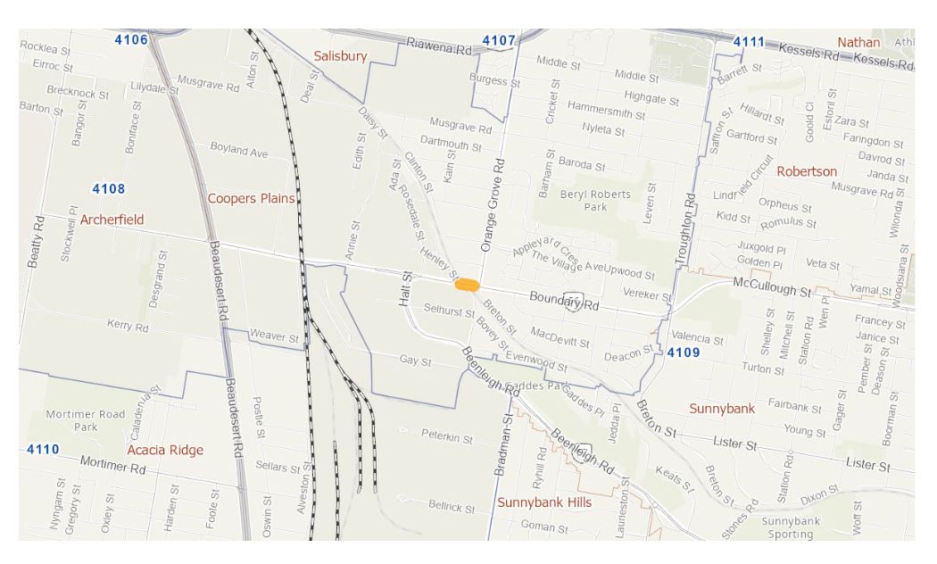
We are completing a business case to investigate options to reduce congestion and address safety concerns at Boundary Road, Coopers Plains rail level crossing...
The department is undertaking a business case for a potential future project on Brisbane–Beenleigh Road, between the intersections of Loganlea Road and Waterford–Tamborine Road. The community is...

The project will deliver safety upgrades to almost 6 kilometres of the Bruce Highway between the Bowen Connection Road and Champion Street intersections. Additionally, the Bruce Highway and Don Street...
The department is undertaking a planning study for the upgrade to the Bruce Highway from Uhlmann Road to Buchanan Road...
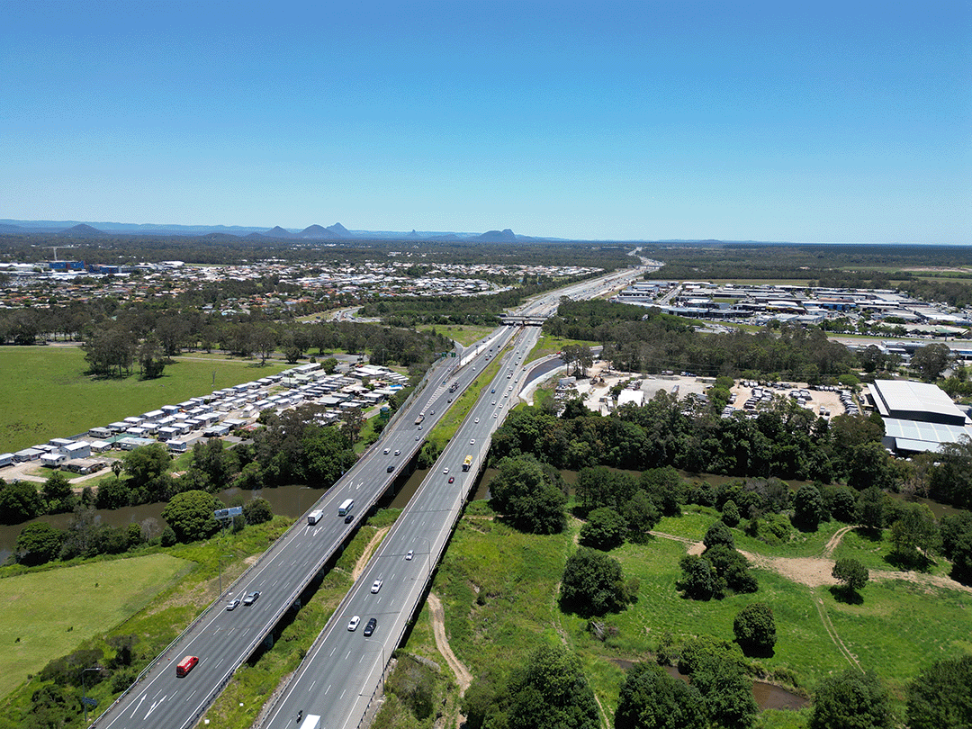
We are upgrading the Bruce Highway to 6-lanes between Caboolture-Bribie Island Road and Steve Irwin Way (Exit 163)...
Planning study for the upgrade to the Bruce Highway from Uhlmann Road to Buchanan Road...
We are improving flood immunity, safety and efficiency on the Bruce Highway at Tiaro...
We are progressing a project to upgrade the intersection of the Bruce Highway and Munro Street at Babinda...
This project involves preparing a business case to upgrade the immunity of the Bruce Highway at the Goorganga and Myrtle Creek floodplains, located 4kms south and 6kms north of Proserpine...
The project will deliver safety upgrades to almost 6 kilometres of the Bruce Highway between the Bowen Connection Road and Champion Street intersections. Additionally, the Bruce Highway and Don Street...
Planning project to investigate and prioritise upgrades to the Bruce Highway between the Pine River and Caloundra Road...
We are undertaking a planning study to investigate future upgrade requirements on the Bruce Highway between Deception Bay Road and Caboolture-Bribie Island Road...
We have completed early planning to determine future upgrade needs for the Bruce Highway between the Sunshine Motorway and Maroochydore Road...
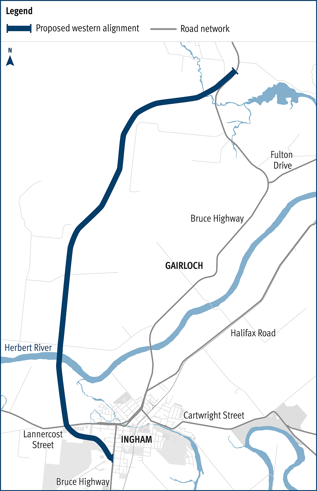
The department has been actively working with the community to address the challenges associated with the Bruce Highway from South of Ingham to the Cardwell Range...
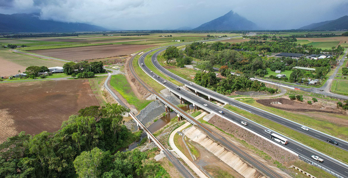
A 10.5km upgrade and duplication of the Bruce Highway between Edmonton and Gordonvale is being delivered. The project is Stage 3 of the Cairns Bruce Highway Upgrade Master Plan released in 2010...
This project involves a 62km realignment and upgrade of the Bruce Highway to 4 lanes between Cooroy and Curra and is among Queensland's highest priority road projects...
Last updated: 6 February 2024