
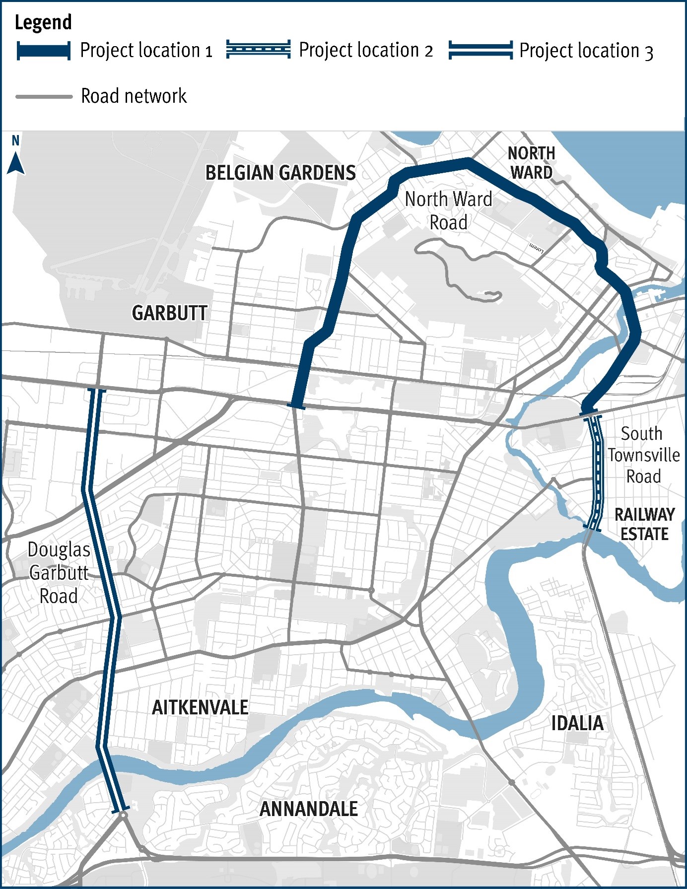
Douglas – Garbutt Road (Townsville), various locations (Stage 1), improve intersections
Safety upgrades will be carried out at various locations along Douglas – Garbutt Road.
Construction
Safety upgrades will be carried out at various locations along Douglas – Garbutt Road.
Construction
Safety upgrades will be carried out at various locations along North Ward Road.
ConstructionThe Department of Transport and Main Roads (TMR) is undertaking safety improvement works at various locations across three state-controlled roads in Townsville:
The works are being delivered under the High Risk Roads program which is a state-funded initiative to address key safety concerns for the whole of a road segment or route.
Construction works started in late March 2023 and will continue until late 2023.
These projects are funded by the Queensland Government through the High Risk Roads Program. 1. South Townsville Road, (Stage 1) various locations, improve intersections with $3.012 million invested by the Queensland Government. 2. North Ward Road (Townsville), various locations, (Stage 1) improve intersections with $9.191 million invested by the Queensland Government. 3. Douglas Garbutt Road (Townsville), various locations, (Stage 1) improve intersections with $13.562 million invested by the Queensland Government.
Beenleigh station is a key transfer location between all-stops and express services on the Beenleigh and Gold Coast train lines.

The Bethania station precinct is being upgraded to improve accessibility, safety and customer experience.

The department has completed design of a new rail overpass to reduce congestion and address safety concerns at Boundary Road (Coopers Plains) rail level crossing.

We're upgrading Cleveland-Redland Bay Road, between Anita Street and Giles Road in Redland Bay.
The intersection of Currumbin Creek Road and Bienvenue Drive, at Currumbin Waters will be upgraded.
Safety upgrades will be carried out at various locations along Douglas – Garbutt Road.
Edens Landing station precinct is being upgraded as part of the Logan and Gold Coast Faster Rail project to improve accessibility, safety and customer experience.

The Queensland Government has developed a preliminary design for active transport bridges and pathways to connect Southside to Gympie's CBD and surrounds.
Holmview train station is being upgraded to improve accessibility, safety and customer experience.

Pre-construction work has commenced to replace the ageing Barron River bridge at Kuranda to improve network reliability and safety for all road users, while minimising potential environmental and cultural heritage impacts.

The Kingston station precinct is being upgraded as part of the Logan and Gold Coast Faster Rail project to improve accessibility, safety and customer experience for the community.

The Queensland Government is committed to improving road safety, reducing congestion, and supporting the growing needs of the Bald Hills community.
The department has identified a preferred option for the future upgrade of Maroochydore Road, Kunda Park to improve the existing transport network by enhancing network reliability and improving access options.
Safety upgrades will be carried out at various locations along North Ward Road.
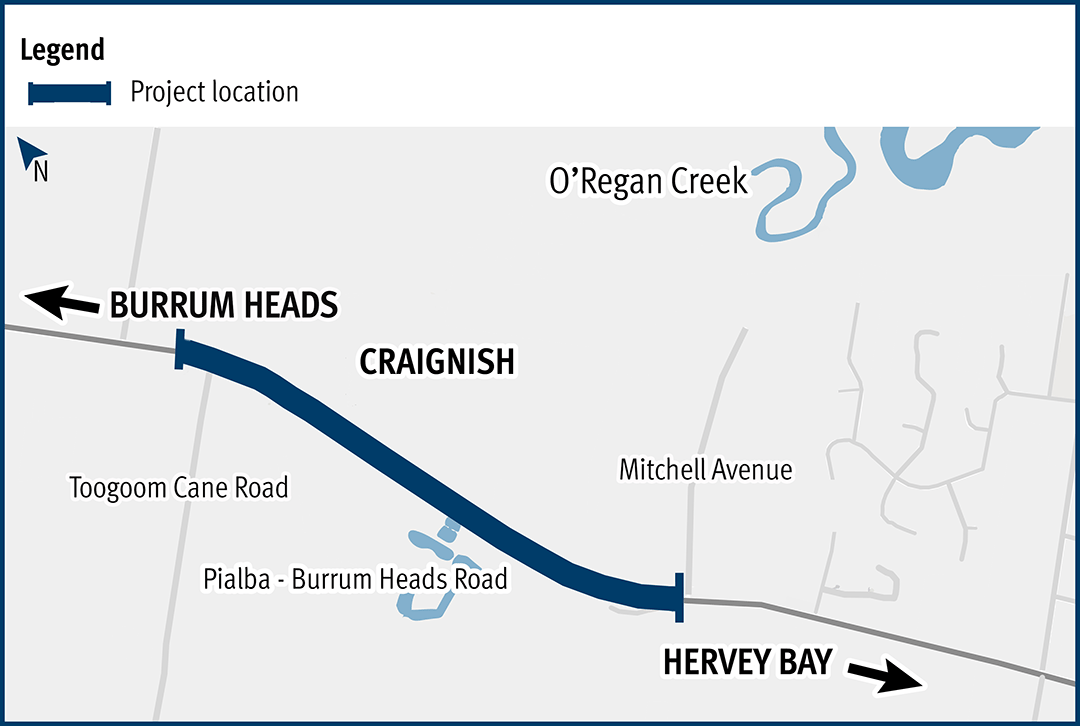
This upgrade will improve flood resilience for Hervey Bay and surrounding communities and involves pavement realignment, widening, and culvert upgrades.
Safety upgrades are planned for Ross River Road, between the Mabin Street and Rolfe Street intersections, under the High Risk Roads program.
We’re directly connecting the eastern communities of the Sunshine Coast to South East Queensland’s passenger rail network, making it easier to travel locally, and to and from the Sunshine Coast.
The Trinder Park station precinct is being upgraded as part of the Logan and Gold Coast Faster Rail project to improve accessibility, safety and customer experience.

The Veloway 1 (V1) is a dedicated cycleway running between South Brisbane and Underwood. The V1 Birdwood Road velobridge will improve safety, traffic flow and network connectivity.
The department has completed planning to identify a preferred option for the upgrade of the Warrego Highway – Mount Crosby Road interchange.

The Woodridge station precinct is being upgraded as part of the Logan and Gold Coast Faster Rail project to improve accessibility, safety and customer experience.

Last updated: 19 July 2024