
Bruce Highway—Cooroy to Curra
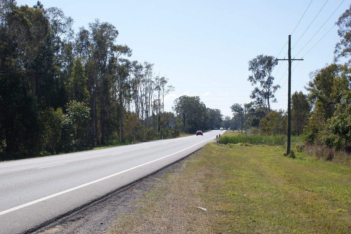
This project involves a 62km realignment and upgrade of the Bruce Highway to 4 lanes between Cooroy and Curra and is among Queensland's highest priority road projects...
This project involves a 62km realignment and upgrade of the Bruce Highway to 4 lanes between Cooroy and Curra and is among Queensland's highest priority road projects...

A multimodal study of the ongoing and increasing transport pressures relating to road, active transport and public transport modes on the Bulimba Peninsula...
The project will develop a strategic level transport plan for local and state roads in the Bundaberg Regional Council area...
The study report determined that protection of the corridor within the local government planning scheme was not warranted at the time, and the project was closed...
Planning will investigate capacity, safety and efficiency of the road and to determine recommended future upgrades...
The department is undertaking planning for the future duplication of Caboolture-Bribie Island Road between King Johns Creek and Hickey Road...
The Queensland Government is finalising planning for the duplication of Caboolture-Bribie Island Road between Old Toorbul Point Road and Saint Road, including signalisation of the Volz Road...
We are undertaking a business case for a new bridge to Bribie Island that will improve safety and reliability for all road users...
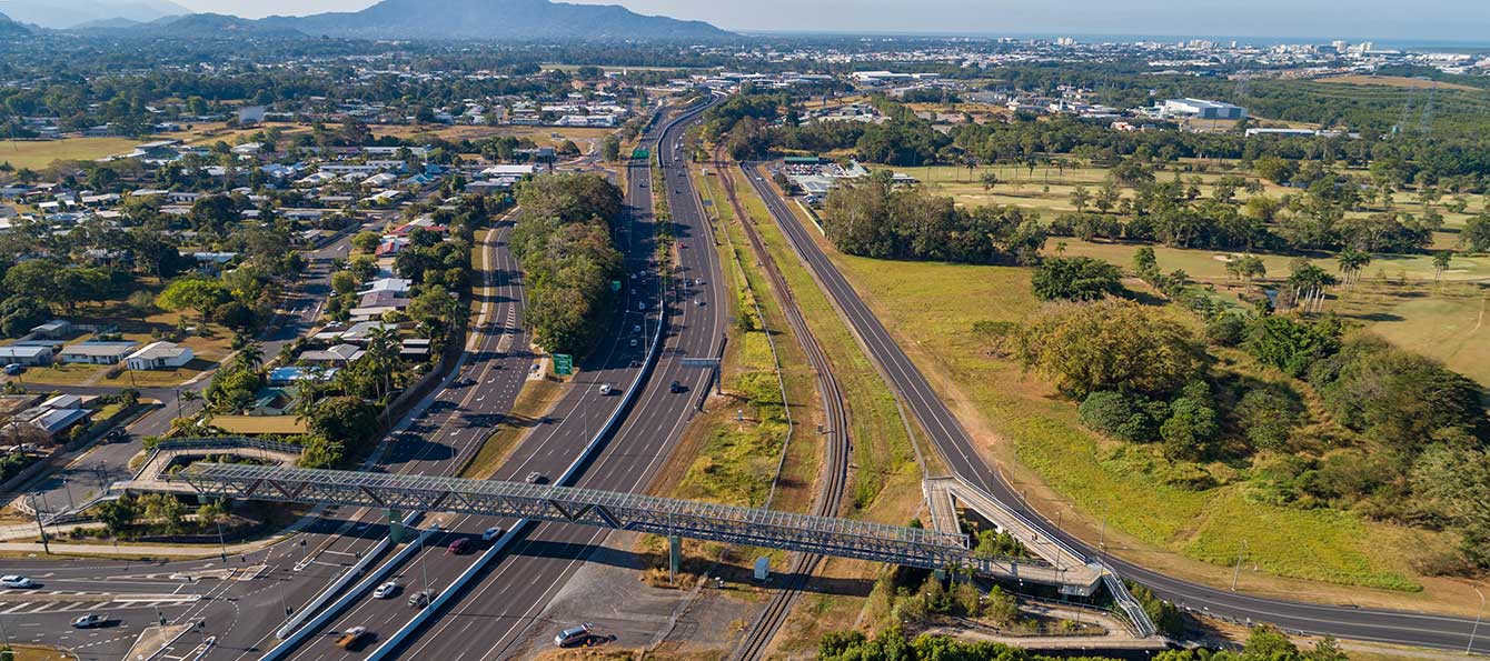
The Cairns Bruce Highway Upgrade master plan was released in 2010. It was the result of a planning study that investigated long term, multi-modal transport planning options to address the impacts of...
We are reinvesting project savings to deliver a new off-road cycleway adjacent to the Bruce Highway consistent with the Cairns Bruce Highway Upgrade Masterplan...
We have commenced planning for a new transit network for Cairns. This planning includes building a network to deliver dedicated public transport spines that will connect the length and breadth of...
The Cairns Transport Study will develop a strategy for the Cairns transport network that supports sustainable, efficient, equitable and affordable transport outcomes consistent with economic, social...
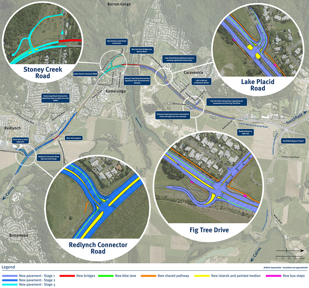
The department is undertaking a $300 million project is being undertaken to duplicate the Cairns Western Arterial Road between Redlynch Connector Road and Captain Cook Highway...
We are undertaking a $1.25 million planning study to look at improving the capacity and efficiency of transport routes between Cairns and the Northern Tablelands...
We are investigating options to improve safety and reduce congestion at the Caloundra Road, Kawana Way Link Road and Bells Creek Arterial Road intersection in Caloundra...
The department is planning for a safe off-road active transport link for approximately 3.5km of Caloundra Road...
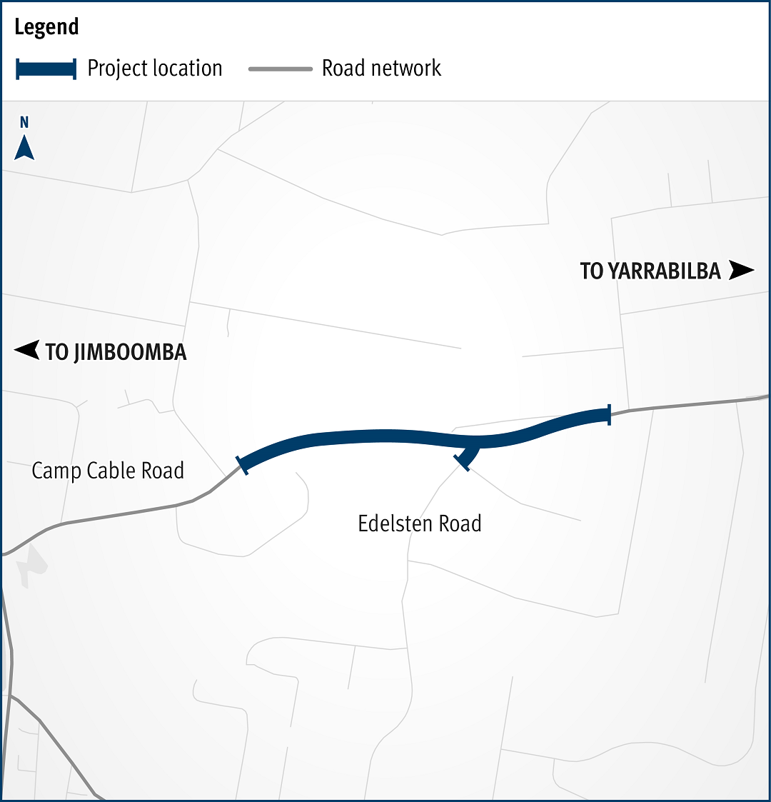
The detailed design to improve safety at the intersection of Camp Cable Road and Edelsten Road at Jimboomba is now complete...
The bus station at Cannon Hill Shopping Centre will be upgraded...
Cape York Regional Package Stage 2 is a $237.5 million program of works to deliver road infrastructure upgrades on Cape York Peninsula between 2019-2020 and 2023-2024...
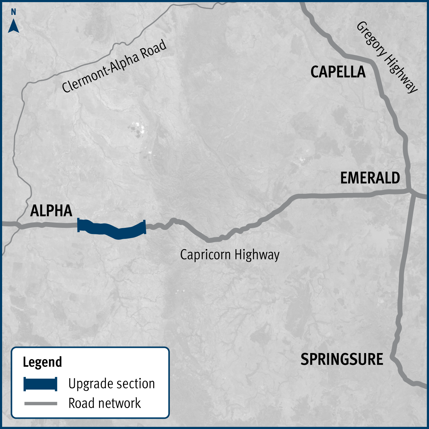
Works are underway to widen 3 high priority sections of the Capricorn Highway between Emerald and Alpha...
Last updated: 6 February 2024