
Mackay Ring Road
The Mackay Ring Road to Bald Hill Road Connection Project delivers a significant upgrade to the Brue Highway.
Completed
The Mackay Ring Road to Bald Hill Road Connection Project delivers a significant upgrade to the Brue Highway.
Completed
The Queensland Government has completed integrated planning for the Gateway Motorway and Bruce Highway Upgrades in north Brisbane and the Moreton Bay Region.

The Queensland Government is committed to improving the 1,671.3km Bruce Highway from Pine River to Cairns, focusing on capacity, safety, and flood resilience.
One of the key priorities of the Queensland Government is to deliver a long-term upgrade plan for the Bruce Highway.
Since July 2013, $10,107 billion in works has been delivered along the Highway, with 8 projects currently under construction, 15 in development and 13 in planning.
Key outcomes to date include:
The Bruce Highway Upgrade focuses on the 3 priority areas during its 15-year course:
As with any major construction program, there might be delays that could affect travel. It is advised to plan ahead and check for up-to-date details on QLDTraffic ( https://qldtraffic.qld.gov.au/ ) to help you plan your journey.
|
District / Region |
Investment name |
Status |
|
Far North |
Bruce Highway (Innisfail - Cairns), Munro Street (Babinda), upgrade intersection |
Construction |
|
Fitzroy |
Bruce Highway (Rockhampton - St Lawrence), Rockhampton Ring Road, construction |
Construction |
|
Far North |
Cairns Southern Access Cycleway, construct cycleway |
Construction |
|
Fitzroy |
Bruce Highway (Gin Gin - Benaraby), Station Creek and Boyne River, upgrade bridges |
Construction |
|
North Coast |
Bruce Highway (Brisbane - Gympie), Dohles Rocks Road to Anzac Avenue upgrade (Stage 1) |
Construction |
|
Northern |
Bruce Highway (Bowen - Ayr), Burdekin River Bridge, rehabilitation program |
Construction |
|
Far North |
Bruce Highway (Ingham - Innisfail), Dallachy Road, install floodway |
Construction |
|
Fitzroy |
Bruce Highway (Rockhampton - St Lawrence), Pine Mountain Creek to Kooltandra Road intersection, formation widening for wide centre line treatment |
Construction |
|
Wide Bay/Burnett |
Bruce Highway (Gympie - Maryborough), Tiaro Bypass, construct four lane bypass |
Development |
|
Northern |
Bruce Highway (Ingham - Innisfail), Ingham-Halifax-Bemerside Road - Cardwell Range, Bruce Highway Safety Package Tranche 2a (W111, W112 & B55) |
Development |
|
Northern |
Bruce Highway (Ingham - Innisfail) and Lannercost Street, upgrade intersection |
Development |
|
Metropolitan |
Linkfield Connection Road, Linkfield Road overpass upgrade |
Development |
|
Wide Bay/Burnett |
Bruce Highway (Maryborough - Gin Gin), Buxton Road and BP service station intersection upgrade |
Development |
|
North Coast |
Bruce Highway (Brisbane - Gympie), Gateway Motorway to Dohles Rocks Road |
Development |
|
Wide Bay/Burnett |
Bruce Highway (Gympie - Maryborough), Curra to Gunalda, various locations, improve safety |
Development |
|
Northern |
Bruce Highway (Ingham - Innisfail), Gairloch Floodway, safety improvements |
Development |
|
Mackay/Whitsunday |
Bruce Highway (Mackay - Proserpine), O'Connell River to Proserpine, upgrade flood immunity (Goorganga Floodplain) |
Development |
|
Mackay/Whitsunday |
Bruce Highway (Mackay - Proserpine), Goorganga, construct overtaking lanes |
Development |
|
Metropolitan |
Bruce Highway (Brisbane - Gympie), Gateway Motorway to Dohles Rocks Road upgrade (Stage 2) |
Development |
|
Fitzroy |
Bruce Highway (Benaraby ‐ Rockhampton), Various sections, Pavement reconstruction of high priority sections |
Development |
|
Fitzroy |
Bruce Highway (Benaraby ‐ Rockhampton), Gladstone ‐ Mt Larcom Road, intersection upgrade |
Development |
|
Fitzroy |
Bruce Highway (Benaraby ‐ Rockhampton), Gladstone ‐ Mt Larcom Road to Dart Creek Road, Overtaking lanes |
Development |
|
Fitzroy |
Bruce Highway (Benaraby ‐ Rockhampton), South of Marmor, overtaking lanes |
Development |
|
Northern |
Bruce Highway (Ingham - Innisfail), Ingham to Cardwell Range Deviation, plan and preserve corridor |
Planning |
|
Northern |
Bruce Highway (Ayr - Townsville), Burdekin Deviation, plan and preserve corridor |
Planning |
|
Far North |
Bruce Highway (Innisfail-Cairns), Innisfail Bypass preserve corridor |
Planning |
|
Fitzroy |
Bruce Highway (Rockhampton - St Lawrence), Bolsover Street, Intersection upgrade |
Planning |
|
Mackay/Whitsunday |
Mackay Port Access, Bruce Highway to Mackay - Slade Point Road (Stage 1) |
Planning |
|
Far North |
Bruce Highway, Cairns Southern Access Corridor (Stage 5), Foster Road, upgrade intersection |
Planning |
|
Statewide |
Bruce Highway Capacity Upgrade Strategy |
Planning |
|
North Coast |
Bruce Highway (Brisbane - Gympie), Buchanan Road to Caboolture - Bribie Island Road upgrade, business case |
Planning |
|
North Coast |
Bruce Highway (Brisbane - Gympie), Uhlmann Road to Buchanan Road upgrade, business case |
Planning |
|
North Coast |
Bruce Highway (Brisbane - Gympie), Redcliffe Road (Anzac Avenue) to Uhlmann Road upgrade, business case |
Planning |
|
North Coast |
Bruce Highway (Brisbane - Gympie), Redcliffe Road (Anzac Avenue) to Uhlmann Road, construct additional lanes |
Planning |
|
Wide Bay/Burnett |
Bruce Highway (Maryborough – Gin Gin), Walker Street intersection improvement, planning & preconstruction |
Planning |
|
Fitzroy |
Bruce Highway (Benaraby - Rockhampton), Gavial - Gracemere Road to Burnett Highway, capacity upgrades |
Planning |
|
Fitzroy |
Bruce Highway (Benaraby ‐ Rockhampton), Bajool, pavement reconstruction |
Planning |
The department is undertaking the rehabilitation and maintenance program for the Burdekin River Bridge to preserve the structural integrity of the bridge. The ongoing program will ensure a safe and durable crossing is maintained for the long-term use of vehicles, heavy transport operators, rail operations, bicycle riders and pedestrians.

An upgrade is planned for the Bruce Highway from Anzac Avenue, North Lakes to Uhlmann Road, Burpengary.
An upgrade is planned for the Bruce Highway from Buchanan Road, Morayfield to Caboolture-Bribie Island Road, Caboolture.

An upgrade is planned for the Bruce Highway from Uhlmann Road, Burpengary to Buchanan Road, Morayfield.

The department is delivering staged upgrades to manage increasing traffic demands on this section of the Bruce Highway. Stage 1 includes extended north-facing ramps from Dohles Rocks Road to Anzac Avenue.

The Queensland Government is improving flood immunity, safety, and efficiency of the Bruce Highway and future-proofing the road to cater for growing traffic volumes. The Tiaro Bypass will also remove a significant number of heavy vehicles from Tiaro township, improving safety and liveability for residents.

The Queensland Government has upgraded the Bruce Highway at Dallachy Road near Tully, improving flood resilience on this section of the highway.
The Queensland Government is delivering an upgrade of the Bruce Highway at Gairloch Floodway to enhance safety and flood resilience along this complex and flood-prone section of the highway. Key improvements include road realignment, wide centre line treatment, and removal of a sharp curve to improve traffic flow and reduce flood-related disruptions.

The Queensland Government is progressing a $9 million planning and corridor preservation project for a potential bypass around Innisfail.
Planning is underway for around 2km of overtaking opportunities and upgrades to pavement and lighting at the Gunyarra Road intersection.
This project has been completed and provides Intelligent Transport System infrastructure at various locations along the Bruce Highway between Pine River and Cairns.
The Bruce Highway is a critical link for Queensland, connecting coastal and regional communities from Cairns to Brisbane. Safety upgrades have been completed at Twelve Mile Creek bridge and John Murphy Bridge.
Planning for the Bruce Highway and Bolsover Street intersection upgrade in Rockhampton will investigate safety and capacity improvements between the Neville Hewitt Bridge and Cambridge Street.
The Queensland Government is implementing cost-effective safety measures to minimise the risk of vehicle and pedestrian incidents, as well as rear-end collisions caused by vehicles turning right across oncoming traffic at this intersection.
This project is delivering safety improvements to provide a better driving experience for all road users and aims to reduce the risk of fatal and serious injury crashes.
The project involved upgrading infrastructure to improve safety, provide a better driving experience for all road users and reduce the risk of fatal and serious injury crashes.
The Queensland Government is investigating ways to improve safety for motorists on the D’Aguilar Highway in the Toowoomba Region.
This project involves replacing a failing culvert on Esk-Hampton Road at Perseverance Creek.
The Queensland Government is undertaking an upgrade of the Spencer Street and William Street intersection in Gatton to improve traffic movement, safety and rideability for road users, pedestrians and bike riders.
A large slow-moving landslide is affecting a section of Gatton–Clifton Road at Mount Whitestone.
This planning project aims to develop long-term strategies to manage the impacts of a slow-moving landslide at Mount Whitestone.

Planning is underway to improve flood immunity of Gatton–Esk Road at Lockyer Creek.
Traffic flow and safety has been improved on Gatton–Helidon Road.
The Queensland Government is installing safety treatments to reduce the frequency of vehicle incidents due to driver fatigue.
This project involves safety upgrades to the Gore Highway (Toowoomba – Millmerran) and Toowoomba–Athol Road.
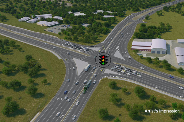
The Queensland Government is committed to improving road safety, reducing congestion, and supporting the growing needs of the Bald Hills community.
The proposed Mackay Port Access will provide a direct link for freight movements from the Mackay Port to the Mackay Ring Road, and west to the Bowen Basin coal fields via the Walkerston Bypass and Peak Downs Highway.
The Mackay Ring Road to Bald Hill Road Connection Project delivers a significant upgrade to the Brue Highway.
The Queensland Government is improving safety on the New England Highway to reduce the risk of fatal and serious injury crashes for all road users.
The Queensland Government is investigating future road infrastructure requirements to provide a better driving experience for all road users and to reduce the risk of fatal and serious injury crashes.
The Queensland Government is committed to improving safety and efficiency on the New England Highway at Cooyar.
Design is underway to improve safety for people walking and bike riding when crossing at the Chalk Drive, Ruthven and Victoria streets intersection and the Chalk Drive and Neil Street intersection.
The New England Highway Bikeway aims to provide a safe and accessible route for walking and cycling between Highfields and Toowoomba.

The Next Generation Traffic Signalling Program is an initiative aimed at transforming traffic signal infrastructure across Queensland.
The Rockhampton Ring Road is a transformative project for the Bruce Highway, designed to support future economic growth and deliver key benefits such as improved flood resilience, freight efficiencies, reduced travel times and enhanced road safety.
Repairs have been completed across southern Queensland after extensive and severe damage to the state-controlled road network was caused by multiple heavy rainfall and flooding events in 2022.

A separated cycle track is being designed along Taylor Street, between Tor and Boundary streets, as part of the Toowoomba–Cecil Plains Road (Taylor Street) bikeway project.
The Queensland Government has completed the business case for the Toowoomba Central Active Transport Link project.
The Queensland Government has successfully completed the Toowoomba City Cycle Paths project. This project, delivered under the Active Transport Investment Program, has transformed Karrool Street and Goode Street into safer, more accessible, and connected transport routes for pedestrians and cyclists.
The Australian and Queensland governments have worked together to deliver the Toowoomba to Brisbane Passenger Rail Strategic Business Case.
The Australian and Queensland governments worked together to deliver the Toowoomba to Gladstone Inland Rail Extension Strategic Business Case.

The Queensland Government has commenced planning to investigate ways to upgrade Toowoomba–Athol Road (locally known as Anzac Avenue) between and including the Toowoomba–Karara Road (locally known as Wyreema Road) and Boundary Street South intersections.
The Queensland Government is upgrading the intersection of Toowoomba–Cecil Plains, Deuble, and Heinemann roads to meet future transport needs.
Toowoomba-Cecil Plains Road is a critical transport route for the Darling Downs region, connecting agricultural communities to markets and essential services.
The Queensland Government is improving safety along 60km of the Warrego Highway between Toowoomba and Dalby. This includes widening the road, flattening batter/roadside edges, adding new signage and line markings, removing roadside hazards, and installing turning lanes at Speed Road, Oakey.
The Warrego Highway East master plan project will determine the future requirements of the Warrego Highway transport corridor.
Last updated: 20 May 2026