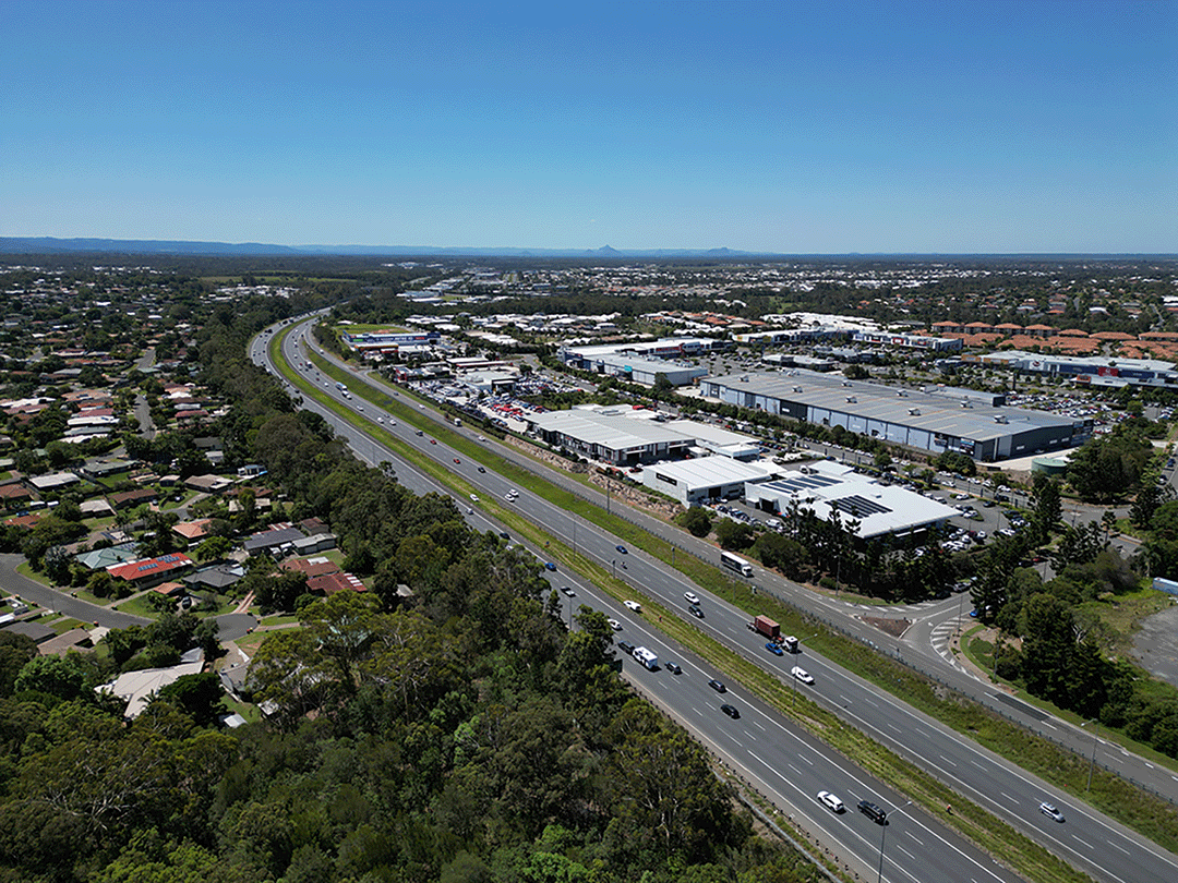
Bruce Highway Upgrade - Anzac Avenue to Caboolture-Bribie Island Road

Planning investigations have confirmed a preferred option for future upgrades that includes the following:

  • Bruce Highway from Anzac Avenue to Uhlmann Road:
    • adding an additional northbound and southbound lane in this section of the Bruce Highway, expanding capacity to accommodate increased traffic demands and future growth. These new lanes will be built in the existing median, increasing lanes from three to four in each direction.
  • Bruce Highway from Uhlmann Road to Caboolture-Bribie Island Road:
    • adding multi-lane, one-way collector-distributor roads on both sides of the existing Bruce Highway. Collector-distributor roads were identified as the most viable solution for this section of the highway, which has three interchanges and a service centre in close proximity.

Collector-distributor roads are built alongside and separate to a highway carriageway. Collector-distributor roads will enhance highway operation and safety by removing traffic undertaking local or short distance trips from the highway and by reducing the need for lane changes to merge or weave through highway traffic.

Benefits

  • Improves safety
  • Increases capacity
  • Improves network efficiency
  • Reduces peak hour congestion
  • Reduces interchange queuing
  • Improves flood immunity
  • Accessibility
  • Reduces travel time
  • Contributes to economy
  • Contributes to regional growth

Funding

The Australian and Queensland governments have committed $34 million to develop business cases for planned upgrades to the Bruce Highway between Anzac Avenue and Caboolture–Bribie Island Road:

Bruce Highway Upgrade—Anzac Avenue to Uhlmann Road Investment ID 2349359.

Bruce Highway Upgrade—Uhlmann Road to Buchanan Road Investment ID 2349159.

Bruce Highway Upgrade—Buchanan Road to Caboolture-Bribie Island Road Investment ID 2348820.

Due to the interdependent nature of the upgrades between Uhlmann Road and Caboolture-Bribie Island Road, planning is being completed as one study.

The Anzac Avenue to Uhlmann Road section will progress to detailed design phase early next year. Scoping and early works (detailed onsite investigations) commenced mid-2025. Construction staging, timeframes and duration will be confirmed as the design progresses.

Funding for the completion of detailed design and construction of the upgrades in the remaining sections has not been committed at this time.

Total investment
$34 million
Australian Government
$27.2 million
Queensland Government
$6.8 million

Current status

Planning for these upgrades started in early 2023 and is nearing completion.

We have confirmed a preferred option for future upgrades to the Bruce Highway between Anzac Avenue and Caboolture-Bribie Island Road which includes a combination of additional lanes and collector-distributor roads.

Bruce Highway Upgrade - Anzac Avenue to Caboolture-Bribie Island Road project location map

Bruce Highway Upgrade Anzac Avenue to Caboolture Bribie Island Road project map ( https://sc-p-cm.tmr.saas.dataweavers.io/_/media/21e60286ecb8438d9e206a9a11f87def.ashx )

Uhlmann Road interchange

The upgrade will replace the existing two-lane overpass bridge with a new higher and longer overpass. Additional lanes will be provided at new signalised ramp intersections to improve traffic flow efficiency. The upgrade will include significantly improved active transport connections.

Buchanan Road interchange

The upgrade will replace the existing overpass bridge with a new higher and longer overpass. The existing roundabout ramp intersections will be upgraded to new signalised intersections to better control traffic flow and provide capacity where it is most needed. The upgrade will include significantly improved active transport connections.

Caboolture-Bribie Island Road interchange

The upgrade will replace the existing overpass with two new higher and longer overpass bridges, with additional traffic lanes plus new signalised ramp intersections to improve traffic flow efficiency. A new loop ramp connection will provide uninterrupted flow for traffic travelling from Caboolture towards Brisbane. The upgrade will include significantly improved active transport connections.

Bruce Highway Upgrade Anzac Avenue to Caboolture-Bribie Island Road

Video Transcript

The words Bruce Highway Upgrades – Anzac Avenue to Caboolture-Bribie Island Road appear on the screen, over a map of north Brisbane to Caboolture.

A green line identifies the project on the Bruce Highway from Anzac Avenue to Uhlmann Road and an orange line identifies the project area from Uhlmann Road to Caboolture-Bribie Island Road.

The project benefits are listed as improves safety, improves network efficiency, reduces interchange queuing, improves flood immunity, increases capacity and reduces congestion, improves active transport connectivity and access.

The section from Anzac Avenue to Caboolture-Bribie Island Road is highlighted and the key features noted. These are an upgrade to four lanes northbound and southbound, potential separate active transport corridor beside the highway, Anzac Avenue interchange to remain, Plantation Road overpass to remain and Boundary Road interchange to remain. The location of Westfields North Lakes is noted.

The flythrough moves north to highlight the following project features. Potential future active transport corridor along Old Gympie Road. Local realignment and upgrade of Frawley Avenue – Potassium Street and new Frawley Avenue overpass with active transport facility. Upgrade to four lanes northbound and southbound. Deception Bay Road interchange to remain. New active transport corridor and heavy vehicle interception site relocation location.

The flythrough moves further north showing the new Arthur Drewett Drive overpass, realignment of Arthur Drewett Drive with a new intersection with Progress Road and removal of Arthur Drewett Drive connection from the Progress Road roundabout.

The words “New and upgraded active transport facilities” appear and green lines highlight the location of these facilities at Arthur Drewett Drive overpass and adjacent to the Bruce Highway. New bridges over Burpengary Creek are highlighted.

The flythrough moves north to show the exit at the Uhlmann Road interchange for Morayfield and Burpengary East and the entry to the Bruce Highway from a signalised ramp from the Uhlmann Road interchange.

The words “Uhlmann Road interchange” appear and highlight the upgraded overpass, duplication of Uhlmann Road to the west and realignment of Uhlmann Road to the east. The location of the start of the collector-distributor road northbound is highlighted north of the Uhlmann Road interchange and new active transport facilities including an underpass under Uhlmann Road west of the interchange and paths either side of the overpass are highlighted.

North of the Uhlman Road interchange, the northbound exit to the Service Centre and Morayfield is shown and the southbound exit to Morayfield and Burpengary East is shown.

As the flythrough moves north the location of new active transport corridor is shown, along with the northbound collector-distributor road and the southbound collector-distributor road. The words “three lanes northbound” and “four lanes southbound” appear on the highway lanes along with the words “noise barrier” on the eastern side of the corridor.

Moving further north, the words “Access to Service Centre via collector-distributor road” appears on the northbound collector distributor roads and the words “Underground fauna crossing spanning the highway” appear to the south of the service centres.

The words Northbound Service Centre appear west of the highway and Southbound Service Centre appear east of the Bruce Highway. A label showing the location of a continuing active transport path appears just north of the Northbound Service Centre location.

Another fauna crossing label depicts a structure spanning the highway and an access to the Service Centre via collector-distributor road is shown on the southbound lanes.

The vision shows three lanes northbound and four lanes southbound on the main highway. A green directional sign points east showing the exit ramp to Morayfield and North Harbour. The ramp connects to Buchanan Road which is labelled and connects to the Buchanan Road interchange. A signalised intersections are shown and labelled on both sides of the interchange which shows an overpass spanning the highway.

A signalised intersection is labelled on the eastern side of the highway. It connects to a road labelled North Harbour Boulevard connection.

At the Buchanan Road interchange a new active transport underpass is shown under a run that runs east-west on the western side of the interchange and active transport facilities are also labelled on the eastern side of the interchange. As the words New active transport facilities appear green lines highlight the location of these facilities on the Buchanan Road overpass and alongside roads east and west of the highway and continuing parallel to the highway on the western side.

Continue to travel north along the highway a new label appears showing four lanes southbound. The visions zooms out to show an extended stretch of highway stretching northwards and in the distance another interchange is shown. In the foreground, braided highway ramps are shown as grade-separated roads.

Green directional signage appears on the screen showing exit points and pointing to locations where the exit ramps begin. The signs appearing from south to north are: Exit Caboolture-Bribie Island Road and D’Aguilar Highway. Three flashing lines appear on screen with each one showcasing available routes. A light blue and white flashing line is used to showcase the route that motorists would take to follow the Caboolture-Bribie Island Road and D’Aguilar Highway exit.

Further north another green directional sign points to D’Aguilar Highway and a green and white flashing line showcases the route that motorists would follow to reach that destination. It ends with motorists travelling north on a service road. Another green directional sign includes an arrow showing the direction to Caboolture and a dark blue and white flashing line indicates the route that motorists would travel to access Caboolture. Three flashing lines move at once to showcase the three route options that motorists have available, and the main highway has moving traffic, some cars and some trucks to simulate how the highway and collector-distributor roads will operate under traffic.

A green directional sign shows with a north-east pointing arrow and the words Bruce Highway showing the entry point for motorists to access the Bruce Highway. The blue and white and green and white flashing lines appear again. They are showcasing the two roues available for motorists to travel northbound and access the Bruce Highway. The flashing lines disappear, and the vision perspective slowly pans and switches to focus on the Buchanan Road interchange overpass that crosses the Bruce Highway.

The concept for the future Bruce Highway Upgrade from Buchanan Road showing the additional southbound lane, a new, separate active transport path, multi-lane, one-way collector-distributor roads on both sides of the existing Bruce Highway with signalised entry ramp on the eastern side. A signalised entry ramp is also shown on the western side of the Bruce Highway where northbound traffic joins the highway. A green directional sign with an arrow pointing north-east shows and the words Bruce Highway is shown at the merge point.

The concept continues showing the Bruce Highway and collector-distributor roads near Morayfield. Three new bridges across the Caboolture River are shown with blue shading and an existing northbound highway bridge is highlighted in a light blue colour to show it will be retained and modified for use as part of the northbound collector-distributor road.

The concept shows an exit ramp from the northbound lane verging westbound and a green directional sign pointing to Caboolture via an intersection and a separate sign north of the intersection pointing to Bribie Island. Labels and markers point to the Caboolture-Bribie Island Road interchange overpass across the Bruce Highway with signalised intersections at both ends.

Concept shows markers pointing to two new active transport overpasses on the eastern side of the Caboolture-Bribie Island Road interchange overpass and an underpass on the western side.

Concept showing the future Caboolture-Bribie Island Road interchange with green flashing lines to showcase new active transport facilities.

Marker appears showing the D’Aguilar Highway connection to southbound collector-distributor road and a green directional sign with a north-west arrow pointing towards the D’Aguilar Highway and Bruce Highway.

Concept switches to southbound viewing and a green directional sign marks the exit ramp to Caboolture-Bribie Island Road pm the eastern side pf the highway.

Concept from Caboolture-Bribie Island Road interchange looking south towards Uhlmann Road overpass. Green directional signs marking exit points to Morayfield, Burpengary, Service Centre; Burpengary East exit; Service Centre and Burpengary West. Light blue and white flashing line shows route to Burpengary West, green and white flashing line shows route to Burpengary East, and dark blue and white flashing line shows route from overpass to Bruce Highway southbound lanes.

Concept showing dark blue and white flashing line to highlight route from Caboolture-Bribie Island Road to Bruce Highway entry including green directional sign. Green and white flashing line marks route from collector-distributor road to Bruce Highway southbound lanes.

Concept shows intersection on Caboolture-Bribie Island Road overpass and markers at Lower King Street, active transport path beside the road, U-turn facilities near the Mewett Street intersection, upgraded intersection to include traffic signals and realignment of Mewett Street.

The words Bruce Highway Upgrade – Anzac Avenue to Caboolture-Bribie Island Road appear on the screen appear on the screen along with the Australian Government logo, the Queensland Government logo and Delivering for Queensland logo.

63 Projects in Bruce Highway Upgrade - Anzac Avenue to Caboolture-Bribie Island Road

Barcaldine-Aramac Road, rehabilitate and widen pavement

An additional 5km of Barcaldine-Aramac Road has been widened to improve travel conditions.

  • Central West District
  • Completed
No image supplied

Beaudesert – Nerang Road and Yalkuri Drive, upgrade intersection

Beaudesert – Nerang Road, Yalkuri Drive and Willawong Crescent intersection has been upgraded with traffic signals to improve safety and operational functionality. This also includes on-road designated and shared bicycle infrastructure.

  • Completed
The map shows the locality of the proposed Beaudesert-Nerang Road, Yalkuri Drive and Willawong Crescent intersection upgrade. Beaudesert is located to the west and Nerang to the east of the project location. A solid dark blue line indicates the project extent, which encompasses Yalkuri Drive south of the intersection and Willawong Crescent north of the intersection, as well as Beaudesert–Nerang Road, which is located west and east of the intersection. The local road network, Riverlea Waters Drive is also highlighted on the map.

Brisbane Valley Highway (Ipswich - Harlin), Warrego Highway to Fernvale, improve safety

This project involved improvements to approximately 14km of the Brisbane Valley Highway to reduce the rate and severity of crashes and improve traffic efficiency.

  • North Coast District
  • Completed

Brisbane-Beenleigh Road, Kingston Road and Compton Road, upgrade intersection

Construction is now complete for the upgrade of Brisbane-Beenleigh Road (Kingston Road) and Compton Road intersection.

  • Completed
No image supplied

Bruce Highway (Brisbane - Gympie), Anzac Avenue to Uhlmann Road upgrade, business case

An upgrade is planned for the Bruce Highway from Anzac Avenue, North Lakes to Uhlmann Road, Burpengary.

  • North Coast District
  • Planning
Aerial view of Anzac Avenue to Uhlmann Road

Bruce Highway (Brisbane - Gympie), Buchanan Road to Caboolture-Bribie Island Road upgrade, business case

An upgrade is planned for the Bruce Highway from Buchanan Road, Morayfield to Caboolture-Bribie Island Road, Caboolture.

  • North Coast District
  • Planning
Aerial view of Buchannan Road to Caboolture-Bribie Island Road

Bruce Highway (Brisbane - Gympie), Caboolture - Bribie Island Road to Steve Irwin Way upgrade

Major construction was completed for the Bruce Highway Upgrade — Caboolture-Bribie Island Road to Steve Irwin Way project in April 2024. This project widened the 11km stretch of the Bruce Highway from 4 to 6 lanes between Caboolture-Bribie Island Road and Steve Irwin Way (Exit 163). This also included upgrading creek crossings to improve flood immunity at Lagoon, King Johns, Six Mile, Un-named and Beerburrum Creeks.

  • North Coast District
  • Completed
No image supplied

Bruce Highway (Brisbane - Gympie), Uhlmann Road to Buchanan Road upgrade, business case

An upgrade is planned for the Bruce Highway from Uhlmann Road, Burpengary to Buchanan Road, Morayfield.

  • North Coast District
  • Planning
Aerial view of Uhlmann Road to Buchanan Road

Bruce Highway (Cooroy to Curra) Section D

The $1.162 billion Section D: Woondum to Curra project is a new 26km, 4-lane divided highway between the existing Bruce Highway interchange at Woondum, south of Gympie and Curra.

  • Wide Bay Burnett District
  • Completed
Looking north towards an 8 span, 260 metre long concrete bridge structure over Deep Creek with construction crews on the bridge completing the final layer of pavement in preparation for linemarking. There is a bio-retention basin (like a sediment pond) in the foreground.

Bruce Highway (Ingham - Innisfail), Dallachy Road, install floodway

The Queensland Government has upgraded the Bruce Highway at Dallachy Road near Tully, improving flood resilience on this section of the highway.

  • Far North District
  • Completed
No image supplied

Bruce Highway (Rockhampton-St Lawrence), various locations, upgrade bridges

The Bruce Highway is a critical link for Queensland, connecting coastal and regional communities from Cairns to Brisbane. Safety upgrades have been completed at Twelve Mile Creek bridge and John Murphy Bridge.

  • Fitzroy District
  • Completed
No image supplied

Bruce Highway – Pine River to Caloundra Road Smart Motorways (Stage 2)

The Bruce Highway - Pine River to Caloundra Road Smart Motorways (Stage 2) project has delivered additional Smart Motorways technology along the 60km section of the Bruce Highway between the Pine River and Caloundra Road.

  • North Coast District
  • Completed
No image supplied

Bruce Highway—Cooroy to Curra

This project involved a 62km realignment and upgrade of the Bruce Highway to 4 lanes between Cooroy and Curra.

  • Wide Bay Burnett District
  • Completed
No image supplied

Caboolture - Beachmere Road, improve safety

Construction is complete on safety improvements for Caboolture – Beachmere Road (locally known as Beachmere Road) to enhance overall driving conditions.

  • North Coast District
  • Completed
No image supplied

Caboolture-Bribie Island Road, Old Toorbul Point Road to Saint Road

Construction to duplicate Caboolture-Bribie Island Road to a 4-lane, dual carriageway from Old Toorbul Point Road to just east of Saint Road has been completed. This included signalising the Volz Road/Browns Road intersection.

  • North Coast District
  • Completed
Side of Old Toorbul Point Road

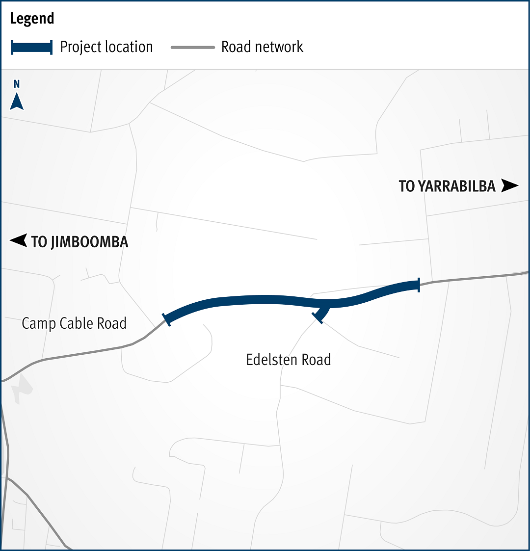
Camp Cable Road and Edelsten Road, improve intersection

This intersection is identified for an upgrade due to the rapid expansion of local urban areas, increased traffic volumes and crash history.
  • South Coast District
  • Completed
Map showing safety improvement works located at the intersection of Camp Cable Road and Edelsten Road in Jimboomba. The northern side of Camp Cable Road will be widened to allow for a dedicated right turn lane into Edlesten Road, so motorists can safely wait before turning, and through-traffic can continue ahead towards Yarrabilba. Camp Cable Road will have new formalised bus stops on both sides of the road along with an extra 2 metres of shoulder width for bicycle riders.  The existing left turn lane from Camp Cable Road onto Edelsten Road will be relinemarked as a shared left turn lane to improve traffic flow. New Stop signs will be installed on Edelsten Road at the intersection replacing the existing Give Way signs.

Capricorn Highway (Duaringa–Emerald), undertake road safety improvements

The Capricorn Highway is a key freight route and supports a wide range of industries including agriculture, resources and mining. It plays an important role in connecting Rockhampton with central and western communities in Queensland.

  • Fitzroy District
  • Completed
No image supplied

Carnarvon Highway (Roma - Injune), major culvert upgrades

The Queensland Government has improved safety and network efficiency by replacing the 3 major culverts with larger structures and widening the pavement to 10m approximately 6km north of Roma.

  • South West District
  • Completed
No image supplied

Centenary Motorway (Yamanto – Ellen Grove) and Springfield Greenbank Arterial exit ramp, upgrade intersection

The department worked with Ipswich City Council to upgrade the Centenary Motorway exit ramp (Exit 32), and the Main Street and Springfield Greenbank Arterial Road intersection, to manage congestion and improve safety at the exit ramp.

  • Metropolitan District
  • Completed
No image supplied

Chermside Bus Layover, Gympie Road and Murphy Road intersection, construct bus facilities

The Queensland Government has improved public transport access and efficiency in Brisbane's northern corridor by delivering the Chermside Bus Layover.

  • Metropolitan District
  • Completed
No image supplied

Clump Point Mission Beach boating infrastructure project

Works were undertaken to upgrade the public boating facilities at Mission Beach Clump Point.

  • Completed
No image supplied

Cunningham Highway (Warwick – Inglewood), improve safety

The project involved upgrading infrastructure to improve safety, provide a better driving experience for all road users and reduce the risk of fatal and serious injury crashes.

  • Darling Downs District
  • Completed
No image supplied

D'Aguilar Highway (Yarraman – Kingaroy), various locations, improve safety

The Queensland Government has improved safety and traffic efficiency on 24km of the D’Aguilar Highway between Nanango and Kingaroy.

  • Wide Bay Burnett District
  • Completed
No image supplied

Gatton–Clifton Road planning, Mount Whitestone

This planning project investigated long-term strategies to manage the impacts of a slow-moving landslide at Mount Whitestone.

  • Darling Downs District
  • Completed
Gatton–Clifton Road Realignment Planning, Mount Whitestone location

Gatton–Helidon Road, improve safety

Traffic flow and safety has been improved on Gatton–Helidon Road.

  • Darling Downs District
  • Completed
No image supplied

Isis Highway (Biggenden - Coalstoun Lakes), upgrade Biggenden railway crossing

Construction to improve the Isis Highway at Biggenden and remove the ageing timber bridge rail overpass and construct an at-grade road (a new road that will be at the same level as the existing road) is complete.

  • Wide Bay Burnett District
  • Completed
No image supplied

Kawana Motorway (Mooloolah River Interchange to Kawana Way Link Road)

Early planning is complete for a new motorway link (Kawana Motorway) between Parrearra and Meridan Plains to help cater for the growing population.

  • North Coast District
  • Completed
Kawana Motorway project map

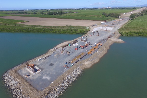
Mackay Ring Road

The Mackay Ring Road to Bald Hill Road Connection Project delivers a significant upgrade to the Brue Highway.
  • Mackay Whitsunday District
  • Completed
Pioneer River crossing

Mackay – Bucasia Road, capacity upgrades and duplication planning

Planning is complete and has identified future upgrades to Mackay – Bucasia Road to improve congestion, safety, and flooding impacts on this vital link to the Northern Beaches.

  • Mackay Whitsunday District
  • Completed
No image supplied

Maryborough-Hervey Bay Road intersection upgrades and safety works – Noble Road, Stockman Way and Sunnyside Drive

The Maryborough–Hervey Bay Road intersection upgrades and safety works involved upgrading the Noble Road, Stockman Way and Sunnyside Drive intersections at Susan River to improve safety for all road users.

  • Wide Bay Burnett District
  • Completed
No image supplied

Monto–Mount Perry Road progressive sealing

The department has progressively upgraded and sealed the gravel sections of Monto–Mount Perry Road to improve road user safety and comfort and reduce future maintenance requirements. 

  • Wide Bay Burnett District
  • Completed
No image supplied

Mount Cotton Road, Duncan Road to Double Jump Road, planning study

Planning to improve safety and congestion at key intersections on Mount Cotton Road, Redland Bay Road and Redland Sub-Arterial Road is complete.

  • Metropolitan District
  • Completed
Map showing roads subject to planning including, Mount Cotton Road (Duncan Road to Double Jump Road), Redland Bay Road (Tingalpa Creek to Cleveland-Redland Bay Road), and Redland Sub-Arterial Road (Mount Gravatt-Capalaba Road to Tingalpa Creek).

Mount Lindesay Highway (Brisbane - Beaudesert), Johanna Street to South Street (Jimboomba), duplication

The Mount Lindesay Highway at Jimboomba has been upgraded to improve safety, reduce congestion and improve shared path connectivity.

  • Completed

Northgate station park 'n' ride business case

The department has completed planning which investigated expansion of parking facilities at Northgate station in response to high demand for parking in the local area.

  • Metropolitan District
  • Completed

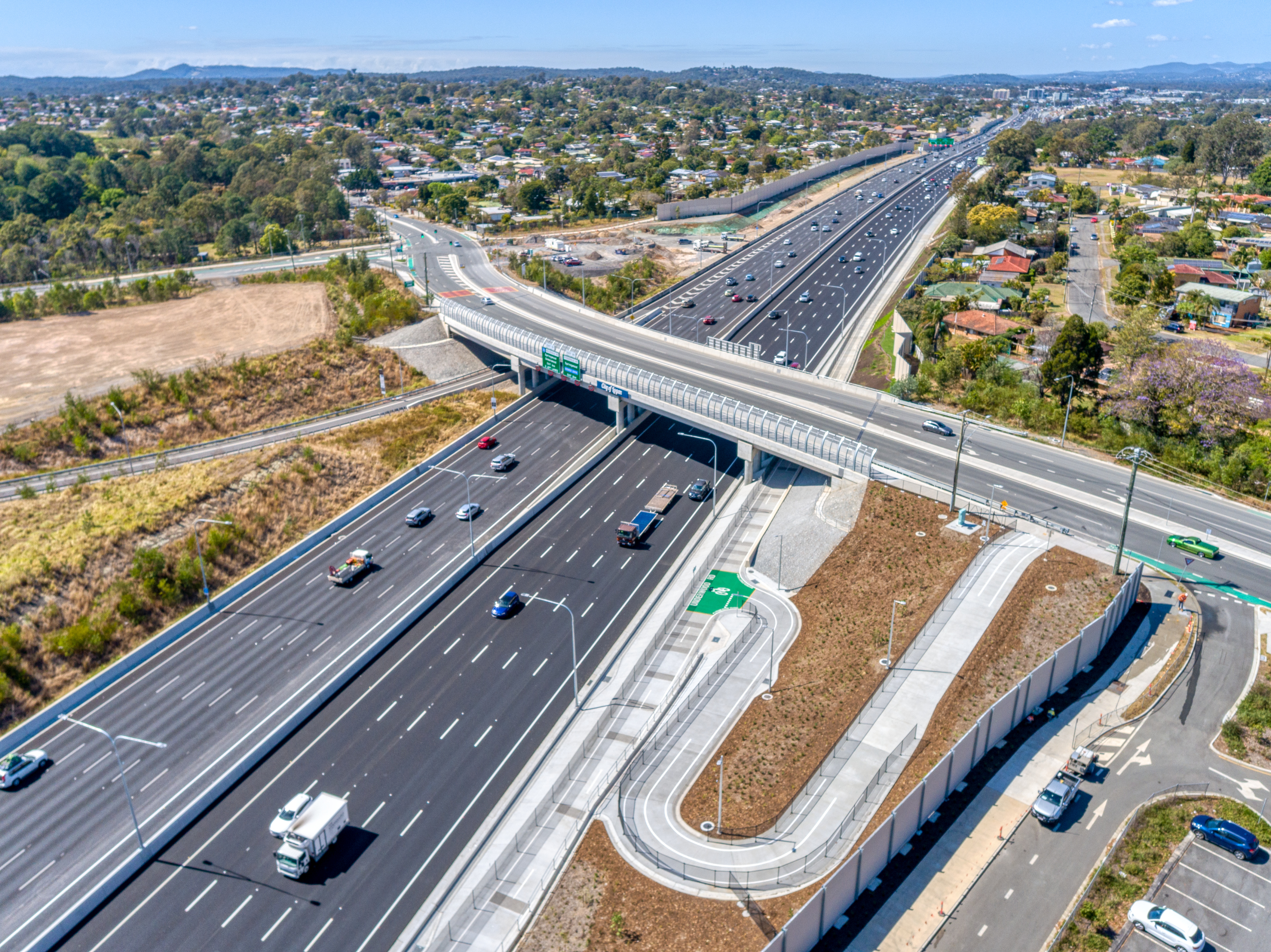
Pacific Motorway Eight Mile Plains to Daisy Hill Upgrade (Sports Drive to Gateway Motorway Upgrade)

The Sports Drive to Gateway Motorway Upgrade was part of a rolling program of upgrades between the Gateway and Logan Motorways.
  • South Coast District
  • Completed
Aerial of Pacific Motorway looking southbound at Eight Mile Plains

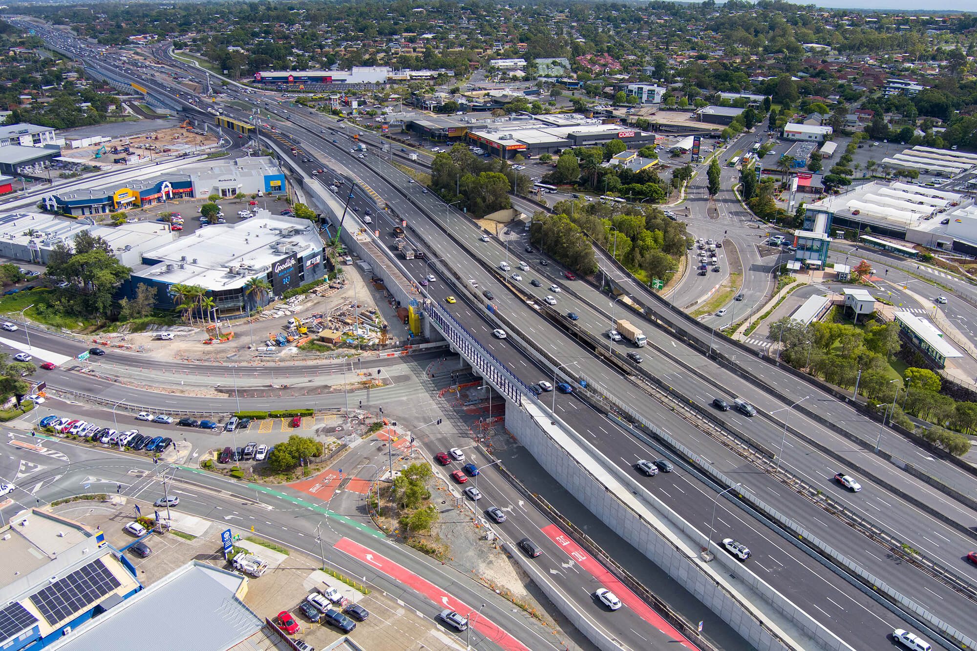
Pacific Motorway Eight Mile Plains to Daisy Hill Upgrade (Watland Street to Sports Drive Upgrade)

The Pacific Motorway (M1) between Watland Street and Sports Drive was upgraded as part of a rolling program of upgrades between the Gateway and Logan motorways.
  • South Coast District
  • Completed
An aerial view of the Pacific Motorway Eight Mile Plains to Daisy Hill upgrade project.

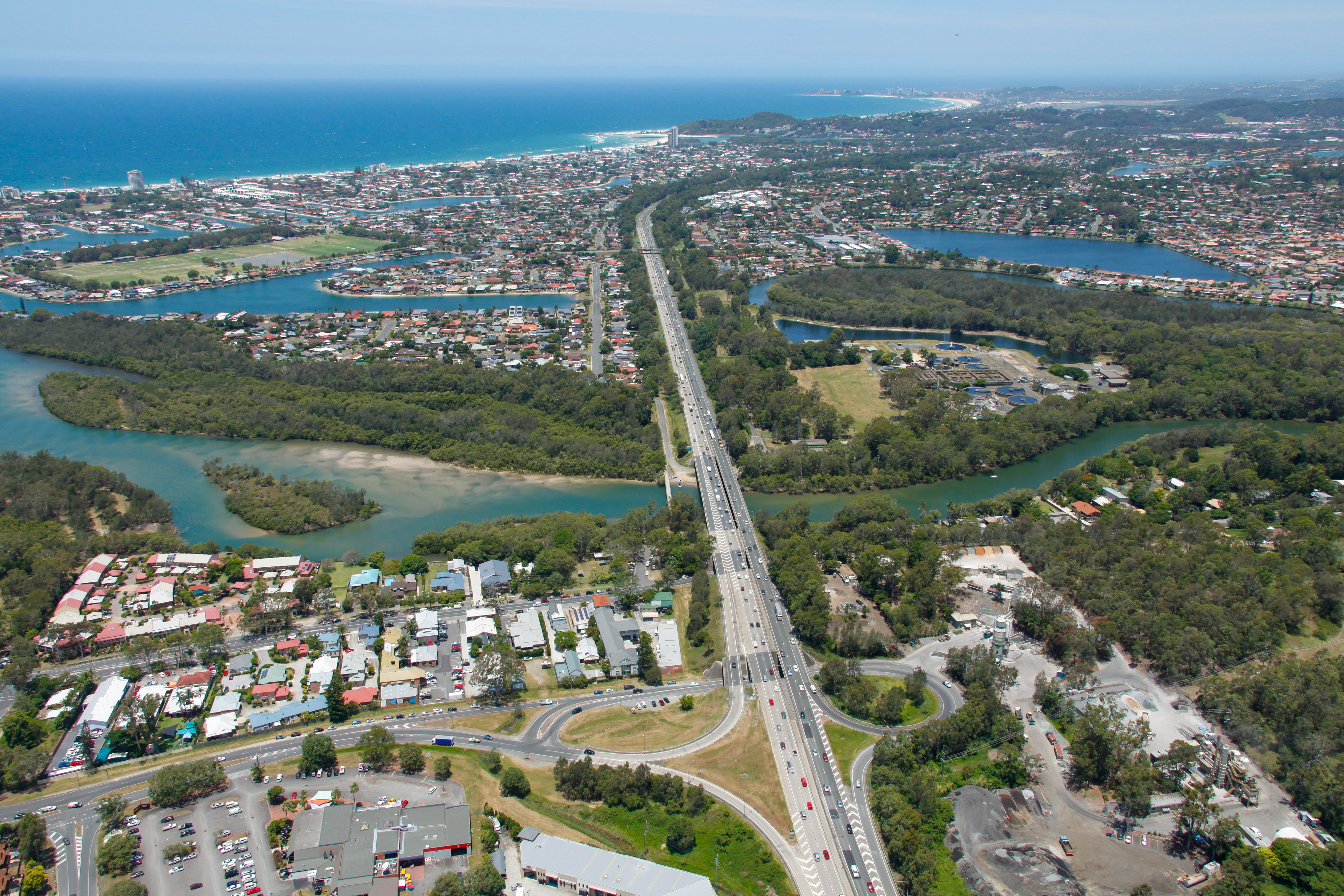
Pacific Motorway M1 Burleigh to Palm Beach (Nineteenth Avenue)

The M1 between Burleigh and Palm Beach (Package B) has been upgraded as part of the Varsity Lakes to Tugun (VL2T) upgrade. Package B included significant environmental features through this section of the upgrade.
  • South Coast District
  • Completed
Pacific Motorway M1 Burleigh to Palm Beach Nineteenth Avenue Exit 89 Tallebudgera interchange

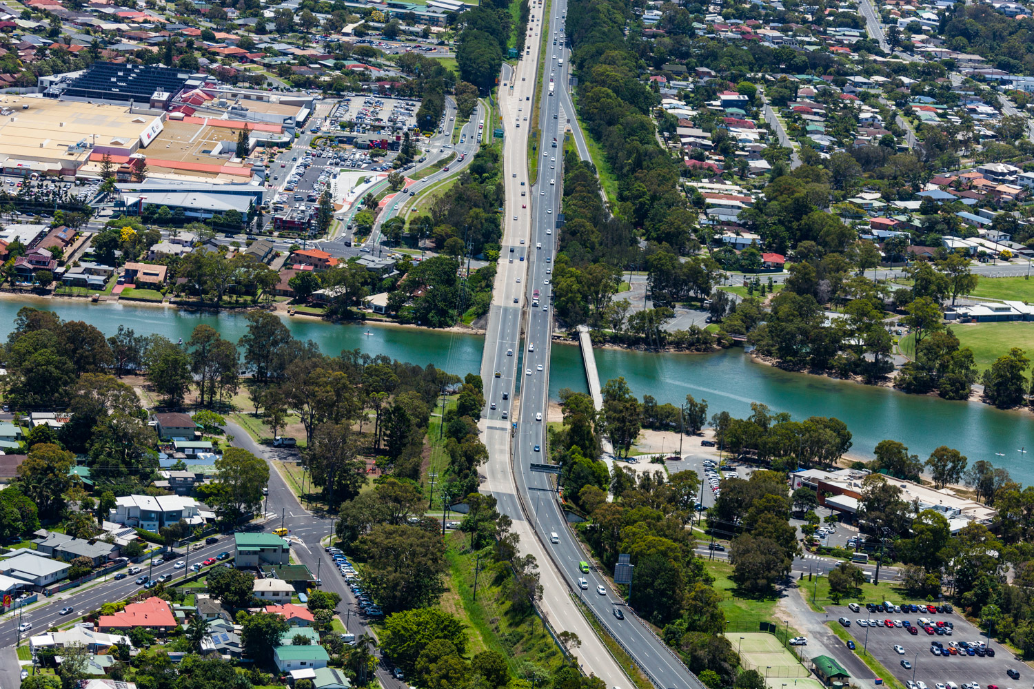
Pacific Motorway M1 Palm Beach (Nineteenth Avenue) to Tugun

The Pacific Motorway (M1) has been upgraded between Palm Beach and Tugun (Package C) as part of the Varsity Lakes to Tugun (VL2T) upgrade.
  • South Coast District
  • Completed
Pacific Motorway M1 Palm Beach Nineteenth Avenue to Tugun Currumbin Creek bridge

Pacific Motorway M1 Varsity Lakes to Tugun upgrade

The $1.5 billion Pacific Motorway Varsity Lakes to Tugun (VL2T) project to upgrade 10km of the M1 has been completed.

  • South Coast District
  • Completed
Aerial view of M1 at Varsity Lakes and Tugun section

Pacific Motorway, Eight Mile Plains to Daisy Hill Upgrade

Work is now complete on the Pacific Motorway, Eight Mile Plains to Daisy Hill Upgrade, which has improved 8kms of the Pacific Motorway (M1) between the Gateway Motorway and Watland Street.

  • South Coast District
  • Detailed design
An aerial view of the Pacific Motorway Eight Mile Plains to Daisy Hill upgrade project.

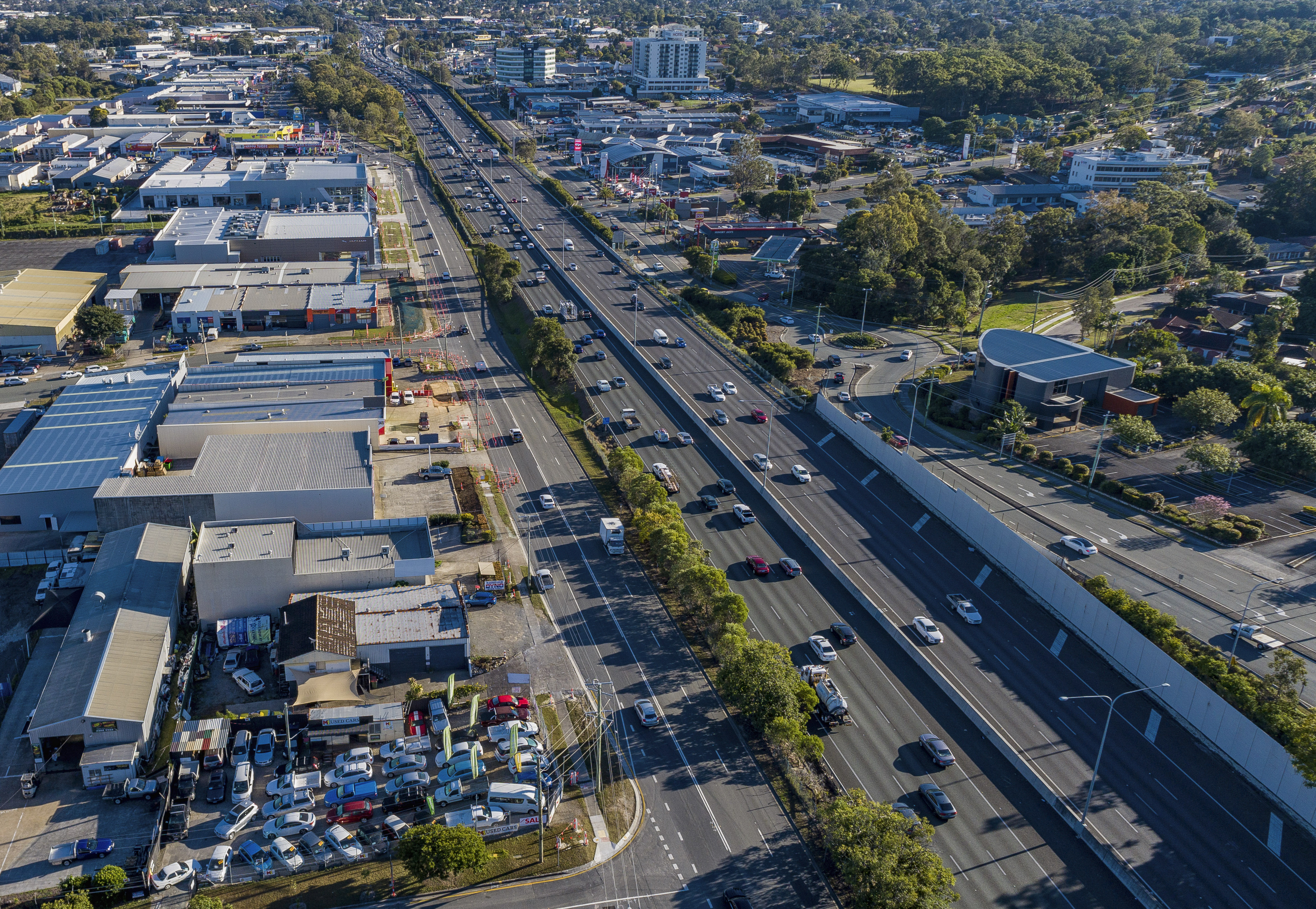
Pacific Motorway, Eight Mile Plains to Daisy Hill Upgrade (Pacific Highway early works upgrade)

The Pacific Highway (western service road) in Slacks Creek was realigned and upgraded as part of the Pacific Motorway, Eight Mile Plains to Daisy Hill Upgrade.
  • South Coast District
  • Completed
Aerial photo of Pacific Highway early works location

Pacific Motorway, Eight Mile Plains to Daisy Hill Upgrade (Rochedale bus station and park 'n' ride)

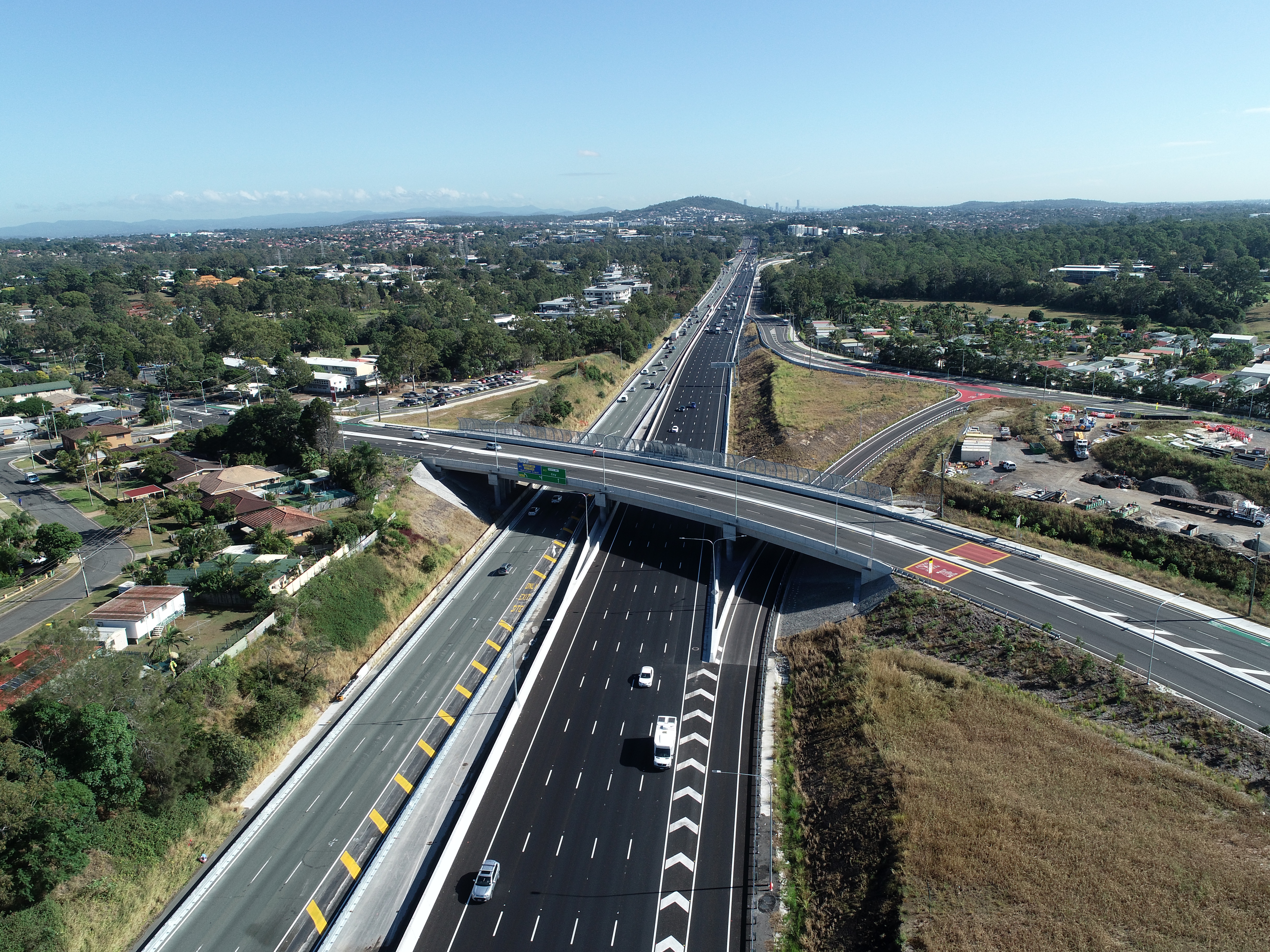
The Rochedale bus station and park ‘n’ ride was upgraded as part of a rolling program of upgrades between the Gateway and Logan motorways.
  • South Coast District
  • Completed
Rochedale bus station and park n ride

Pacific Motorway, Exit 49, upgrade interchange

The Exit 49 interchange upgrade has delivered significant improvements in safety and traffic flow efficiency by keeping traffic moving through the improved interchange and reducing queuing.

  • South Coast District
  • Completed
No image supplied

Palmerston Highway cyclone reconstruction works

Tropical Cyclone Jasper reconstruction works have been completed on the Palmerston Highway (Millaa Millaa-Innisfail).

  • Far North District
  • Completed
No image supplied

Redland Bay Road, Taylor Road to Cleveland Redland Bay Road, planning study

Planning to improve safety and congestion at key intersections on Mount Cotton Road, Redland Bay Road and Redland Sub-Arterial Road is complete.

  • Metropolitan District
  • Completed
Map showing roads subject to planning including, Mount Cotton Road (Duncan Road to Double Jump Road), Redland Bay Road (Tingalpa Creek to Cleveland-Redland Bay Road), and Redland Sub-Arterial Road (Mount Gravatt-Capalaba Road to Tingalpa Creek).

Redland Sub-Arterial Road, Mount Gravatt Capalaba Road to Tingalpa Creek, widening, business case (planning)

Planning to improve safety and congestion at key intersections on Mount Cotton Road, Redland Bay Road and Redland Sub-Arterial Road is complete.

  • Metropolitan District
  • Completed
Mount Cotton Road-Redland Bay Road location map

Richmond - Winton Road, strengthen and widen pavement

The Queensland Government has improved all weather access, travel reliability and safety along Richmond — Winton Road by widening and strengthening this section.

  • North West Direct
  • Completed
No image supplied

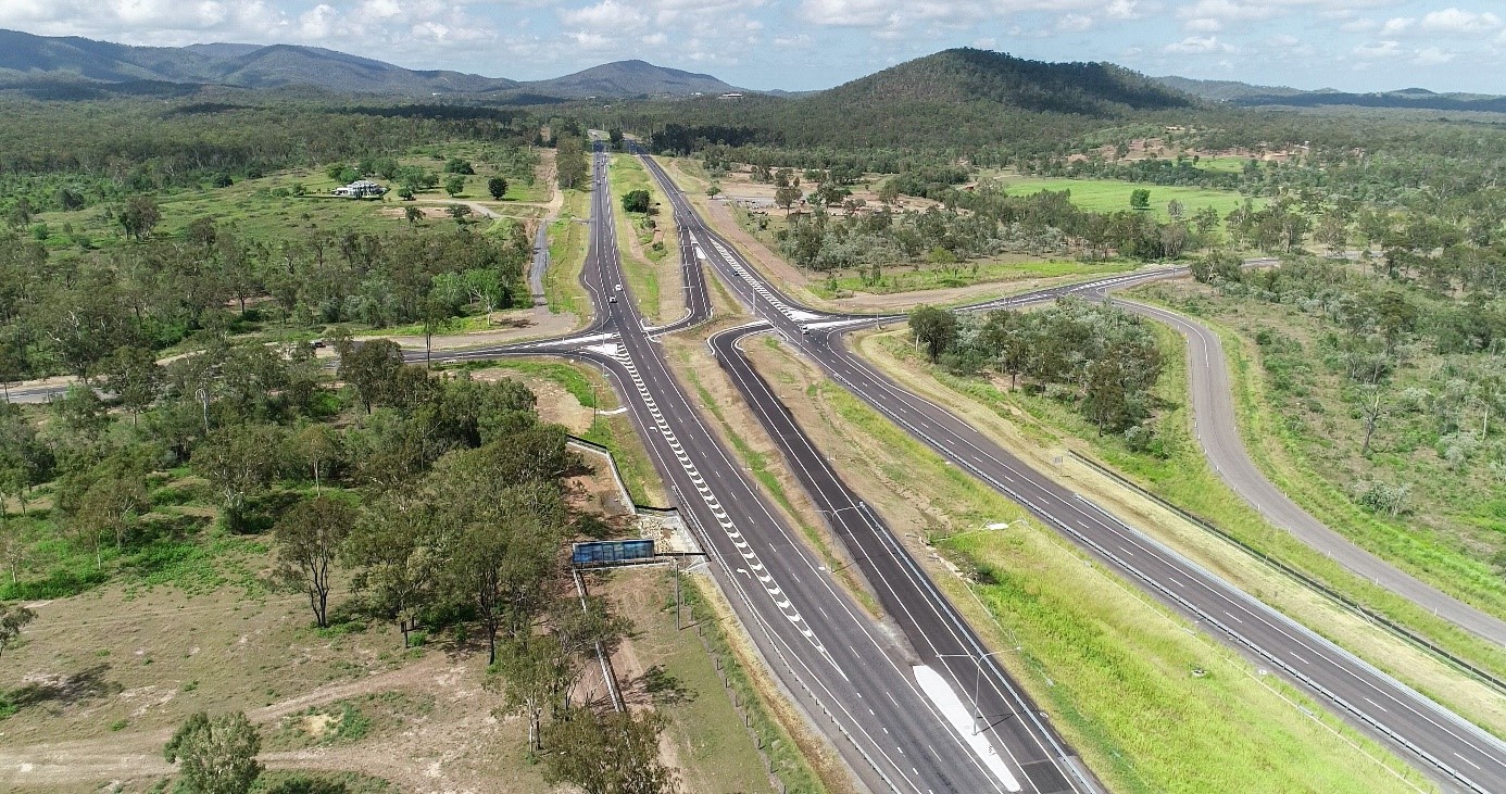
Rockhampton–Yeppoon Road, Yeppoon Road Upgrade

Rockhampton-Yeppoon Road is a regional road linking the Capricorn Coast, including tourist locations, such as Great Keppel Island to Rockhampton and beyond. 
  • Fitzroy District
  • Completed
Yeppoon Road Upgrade project complete, showing Rockhampton–Yeppoon Road duplication and Artillery Road, Dairy Inn Road and Old Byfield Road

Samford Road safety improvements

The safety improvement project along Samford Road, covering a 1.5 km section between the Lomandra Access Road picnic area and Camp Mountain Road, inclusive of the intersection at Camp Mountain Road, is now complete.

  • North Coast District
  • Completed
No image supplied

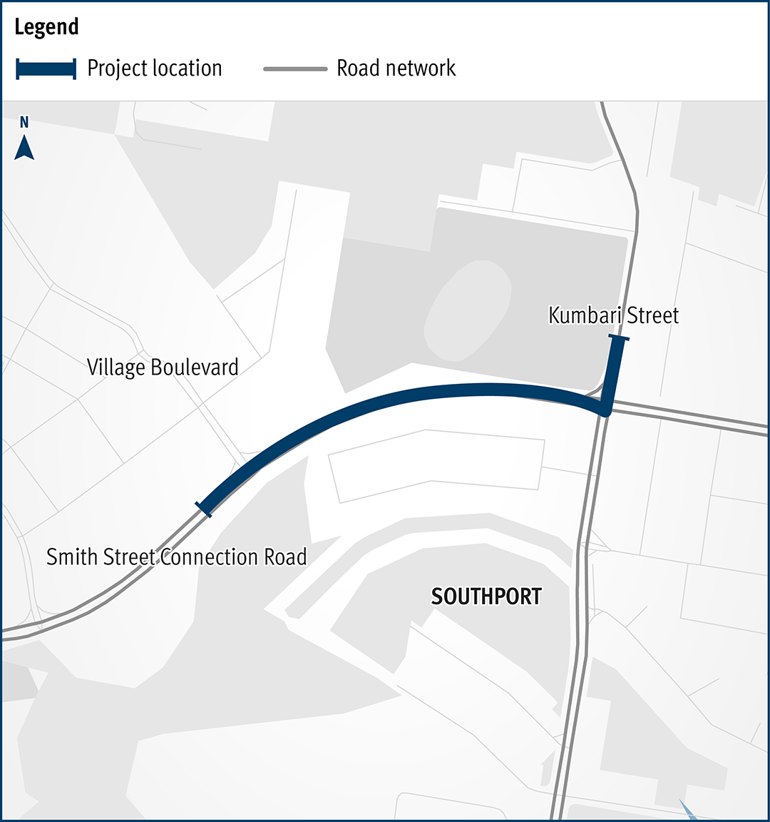
Smith Street Connection Road, Olsen Avenue to Kumbari Avenue, construct cycleway

The Queensland Government has delivered new bicycle facilities to connect to local health, education, business, and tourist areas. 
  • South Coast District
  • Completed
The map shows the locality of the proposed Smith Street Connection Road, Olsen Avenue to Kumbari Avenue, construct cycleway works. Kumbari Avenue is located to the north of the project location in Southport. A solid dark blue line indicates the project extent, which encompasses Smith Street Connection Road west of the intersection and Kumbari Avenue, which is located north and south of the intersection. Village Boulevard is also highlighted on the map, west of the project location.

South Brisbane Transport and Mobility Study

We conducted a multi-modal study of the ongoing and increasing transport pressures relating to road, active transport and public transport modes in Brisbane’s inner south.

  • Metropolitan District
  • Completed
No image supplied

Southern Freight Rail Corridor Study

The Southern Freight Rail Corridor has been identified as a future route connecting the Western Rail line near Rosewood to the interstate railway north of Beaudesert. The Southern Freight Rail Corridor will serve as a major freight link connecting a future Melbourne to Brisbane Inland Rail line with the existing south-east Queensland rail freight network.

  • Completed
No image supplied

Strathpine - Samford Road (Eatons Crossing Road and Mount Samson Road), improve intersection and route safety

Construction is complete for safety improvements on Strathpine-Samford Road between Eatons Hill and Samford Valley.

  • North Coast District
  • Completed
No image supplied

Strathpine Shopping Centre bus station, upgrade

Construction is complete for the upgrade of the Strathpine Shopping Centre bus station.

  • Completed
No image supplied

Tallebudgera Connection Road Koala Zone Trial

We are deeply committed to protecting native fauna and actively support initiatives and treatments aimed at reducing koala-vehicle collisions. Recognising our responsibility to safeguard vulnerable wildlife, we prioritise measures that mitigate risks to koalas on Queensland roads.

  • South Coast District
  • Completed
No image supplied

Toowoomba Central Active Transport Link, business case

The Queensland Government has completed the business case for the Toowoomba Central Active Transport Link project.

  • Darling Downs District
  • Completed
No image supplied

Toowoomba to Gladstone Inland Rail Extension Strategic Business Case

The Australian and Queensland governments worked together to deliver the Toowoomba to Gladstone Inland Rail Extension Strategic Business Case.

  • Darling Downs District
  • Fitzroy District
  • Completed
Thumbnail image showing map of project area for proposed extension for Inland Rail from Toowoomba to Gladstone

Townsville Connection Road (Stuart Drive), University Road to Bowen Road bridge (Idalia), improve safety

The Queensland Government has upgraded Townsville Connection Road to improve safety, traffic flow, and connectivity between University Road and Bowen Road bridge at Idalia.

  • Northern District
  • Completed
No image supplied

Veloway 1 (V1) Cycleway, O'Keefe Street, construct cycle bridge and approaches

The O’Keefe Street velobridge at Woolloongabba is now open.

  • Metropolitan District
  • Completed
Artist impression of the Veloway 1 at O'Keefe St

Walkerston Bypass

The Walkerston Bypass is a new 2-lane rural highway connecting Peak Downs Highway west of Walkerston to the Mackay Ring Road near Paget.

  • Mackay Whitsunday District
  • Completed
No image supplied

Warrego Highway (Miles – Roma) and Wallumbilla South Road, improve intersection has been successfully completed

The project involved widening the Warrego Highway through Wallumbilla, constructing turning lanes, and implementing safety improvements.

  • South West District
  • Completed
No image supplied

Warrego Highway (Miles – Roma), pavement widening and culverts

This project involved widening a 7-kilometre section of the Warrego Highway west of Wallumbilla.

  • South West District
  • Completed
No image supplied

Last updated: 8 July 2026