
Caboolture–Bribie Island Road, Bribie Island bridge, design and early works
A business case has been completed, and the project is now progressing through the detailed design phase for the new Bribie Island Bridge
Detailed design
A business case has been completed, and the project is now progressing through the detailed design phase for the new Bribie Island Bridge
Detailed design
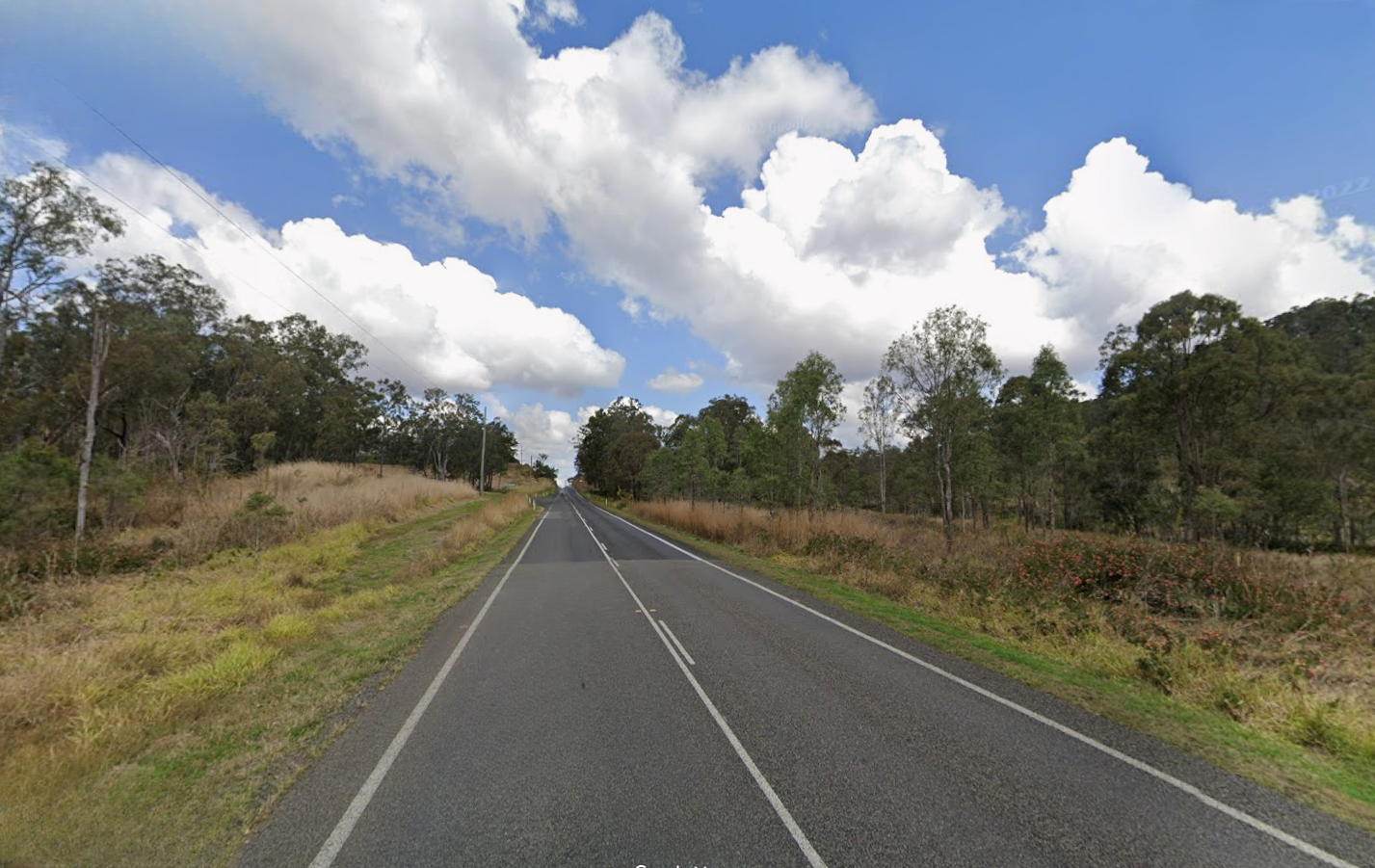
Design is progressing for the future duplication of Caboolture-Bribie Island Road from west of Hickey Road to west of King Johns Creek. The project includes signalising the Hickey Road intersection.
Detailed design
Construction to duplicate Caboolture-Bribie Island Road to a 4-lane, dual carriageway from Old Toorbul Point Road to just east of Saint Road has been completed. This included signalising the Volz Road/Browns Road intersection.
CompletedThe Queensland Government has developed the Bribie Island Road Upgrade Strategy to identify a program of works to sequentially upgrade Caboolture-Bribie Island Road to provide a 4-lane, median-divided road.
Consultation with key stakeholders and the community will continue as projects progress.

The Australian Government and Queensland Government are funding projects under the Caboolture-Bribie Island Road Upgrade Program. There are three projects currently underway – Investment IDs 1773573 (Hickey Road to King Johns Creek), 1158882 (Old Toorbul Point Road to Saint Road), 1862714 (Bribie Island bridge planning).
The intersection of Beerburrum Road, Twin View Road, and English Street in Elimbah is being upgraded as part of the Queensland Government's Targeted Road Safety Program. The upgrade will include the installation of traffic signals to improve safety and provide safer turning movements and crossing opportunities for all road users.

The Beerburrum to Nambour (B2N) Rail Upgrade (Stage 1) project will increase the capacity and reliability of the North Coast Line, enabling more efficient travel and improved passenger and freight connections between the Sunshine Coast, Moreton Bay, Brisbane and beyond.

The Beerburrum to Nambour Rail Upgrade Duplication Study will investigate the long-term infrastructure and operational needs of the North Coast Line.

This project involved improvements to approximately 14km of the Brisbane Valley Highway to reduce the rate and severity of crashes and improve traffic efficiency.
Dedicated right-turn lanes, pedestrian refuges, reduced speed limits, and town entry treatments will improve safety for road users through Main Street in Fernvale.
Planning is complete for a northbound and a southbound overtaking lane along the Brisbane Valley Highway between Fernvale and Esk.
The Brisbane Valley Highway pavement strengthening project will improve ride quality for motorists.
Planning is now underway for the next phase of upgrades to improve safety along the Brisbane Valley Highway.

The Brisbane Valley Highway upgrade intersections project is part of the South East Queensland (SEQ) City Deal—an agreement between the Australian Government, Queensland Government, and Somerset Regional Council. This project aims to enhance connectivity and safety along the Brisbane Valley Highway, a critical freight and commuter corridor linking Somerset with Greater SEQ.
With increasing traffic volumes, the highway has seen a rise in intersection crashes. This project will deliver targeted safety improvements to reduce crash risks, improve traffic flow, and support the region’s long-term growth and connectivity.

We are developing a rail corridor vision and a staged program of rail priorities to 2051 on the North Coast Line between Brisbane and Gympie North.
The Queensland Government is undertaking planning to identify and prioritise potential future upgrade locations for Mount Mee Road.
An upgrade is planned for the Bruce Highway from Anzac Avenue, North Lakes to Uhlmann Road, Burpengary.

An upgrade is planned for the Bruce Highway from Buchanan Road, Morayfield to Caboolture-Bribie Island Road, Caboolture.

Major construction was completed for the Bruce Highway Upgrade — Caboolture-Bribie Island Road to Steve Irwin Way project in April 2024. This project widened the 11km stretch of the Bruce Highway from 4 to 6 lanes between Caboolture-Bribie Island Road and Steve Irwin Way (Exit 163). This also included upgrading creek crossings to improve flood immunity at Lagoon, King Johns, Six Mile, Un-named and Beerburrum Creeks.
The Queensland Government is upgrading the Bruce Highway, where it joins the Gateway Motorway and Gympie Arterial Road, south of the Pine River to improve traffic flow and safety.

The Queensland Government is upgrading the Bruce Highway (Brisbane-Gympie), Gateway Motorway to Dohles Rocks Road in stages to improve traffic flow and safety.
An upgrade is planned for the Bruce Highway from Uhlmann Road, Burpengary to Buchanan Road, Morayfield.

The department is delivering staged upgrades to manage increasing traffic demands on this section of the Bruce Highway. Stage 1 includes extended north-facing ramps from Dohles Rocks Road to Anzac Avenue.

This project has been completed and provides Intelligent Transport System infrastructure at various locations along the Bruce Highway between Pine River and Cairns.
The Bruce Highway - Pine River to Caloundra Road Smart Motorways (Stage 2) project has delivered additional Smart Motorways technology along the 60km section of the Bruce Highway between the Pine River and Caloundra Road.
Early planning is underway to investigate a future upgrade to the last remaining 2-lane section of Morayfield Road from Aquatic Centre Drive to Graham Road.
Construction is complete on safety improvements for Caboolture – Beachmere Road (locally known as Beachmere Road) to enhance overall driving conditions.
Design is progressing for the future duplication of Caboolture-Bribie Island Road from west of Hickey Road to west of King Johns Creek. The project includes signalising the Hickey Road intersection.
Construction to duplicate Caboolture-Bribie Island Road to a 4-lane, dual carriageway from Old Toorbul Point Road to just east of Saint Road has been completed. This included signalising the Volz Road/Browns Road intersection.
The Caboolture-Dakabin Station Access Study seeks to improve access to and around Caboolture, Morayfield, Burpengary, Narangba and Dakabin train stations.
A business case has been completed, and the project is now progressing through the detailed design phase for the new Bribie Island Bridge
A major upgrade of the Caloundra Road, Kawana Way Link Road, and Bells Creek Arterial Road intersection is progressing to deliver significant congestion relief and safety improvements for the Sunshine Coast region.

The department has started planning for an off-road cycle link along approximately 3.5km of Caloundra Road.
Planning is in progress to determine upgrade options to the Caloundra Road, Nicklin Way, and Pelican Waters Boulevard intersection to increase safety, reduce congestion, and improve active transport facilities and connectivity.

The Buaraba Creek timber bridge replacement project will improve safety and network reliability by replacing the existing narrow, timber bridge (Neithe Bridge) with a new wider, two-lane, concrete structure in the same location.
The Queensland Government is committed to improving safety, traffic flow, and active transport options at the intersections of Diamond and Elm Streets and Myall and Elm Streets in Cooroy.
Planning is now complete to develop a long-term vision for the future of Brisbane-Woodford Road (known as Dayboro Road) between Gympie Road and Youngs Crossing Road.

Safety improvements to the intersection of Deception Bay, Bay Avenue and Moreton Downs Drive intersection, Deception Bay.
The Queensland Government is planning for a future road from Aura Boulevard to Pelican Waters Boulevard in Caloundra West.
Construction is complete for safety improvements to the Glass House Mountains Road (known locally as Steve Irwin Way) and Caloundra Street intersection, Landsborough.
Early planning is complete for a new motorway link (Kawana Motorway) between Parrearra and Meridan Plains to help cater for the growing population.

Design to rehabilitate and widen priority sections of Kin Kin Road (locally known as Pomona Kin Kin Road) is progressing. This will improve safety and ride quality and reduce maintenance costs.
We have identified and preserved a new rail corridor between Landsborough and Nambour, which will replace the existing North Coast line through this section.
Planning for a future upgrade of Bli Bli bridge has proposed a new bridge to the north of the existing bridge.
Key features include a wider bridge deck with two lanes of traffic (one in each direction), road shoulders and dedicated active transport facilities.
Active transport improvements include a wider path for pedestrians, bike riders and mobility device users on the southern side of the new bridge with active transport paths connecting to Bli Bli village and Muller Park.
The proposed planning layout includes the ability to convert the bridge to four lanes should traffic demands require this in the future.
The Queensland Government remains committed to maintaining the existing Bli Bli bridge to allow continued safe operation for all users.
Regular inspections are conducted as part of the structures maintenance program to monitor its condition and enable any necessary repairs.
Planning has been completed and the project is now closed.
Timeframes for future stages are unknown and will depend on future funding commitments and competing statewide priorities.
Project priorities and funding needs are reviewed and re-evaluated regularly by the department to ensure that as many positive road outcomes as possible are obtained within a finite budget.

The department has identified a preferred option for the future upgrade of Maroochydore Road, Kunda Park to improve the existing transport network by enhancing network reliability and improving access options.
The department is undertaking planning for the full length of Maroochydore–Noosa Road which runs from Ocean Street, Maroochydore to Emu Mountain Road, Peregian Springs.
Construction has started on the Mooloolaba Road, Syd Lingard Drive to Tantula Road West intersections upgrade project. This project is designed to improve traffic flow and reduce delays, congestion, and queuing in this busy area.
The department is partnering with Sunshine Coast Council to deliver the Mooloolaba to Maroochydore cycleway which will provide a bicycle path connecting Mooloolaba to Maroochydore.

The Queensland Government is progressing the Mooloolah River Interchange (MRI) Upgrade to improve safety, reduce congestion and enhance connectivity on the Sunshine Coast's transport network.
The Queensland Government is expanding the parking facilities at Narangba train station.
The Next Generation Traffic Signalling Program is an initiative aimed at transforming traffic signal infrastructure across Queensland.
The Queensland Government, in partnership with Sunshine Coast Council (Council), has finalised the design for the Caloundra Transport Corridor Upgrade, including the Nicklin Way, Third Avenue extension.

We are working with Queensland Rail to expand train stabling facilities across the rail network. Stabling yards are used to park trains when they are not in use.
The department is working towards an improved public transport system for the Sunshine Coast.
In April 2024, Fulton Hogan was awarded a 5-year contract to provide routine and programmed maintenance services across North Coast Region.
The safety improvement project along Samford Road, covering a 1.5 km section between the Lomandra Access Road picnic area and Camp Mountain Road, inclusive of the intersection at Camp Mountain Road, is now complete.
Scarborough State Boat Harbour is a vibrant part of the Redcliffe Peninsula community. The Harbour hosts dry standings and wet berths, as well as two public boat ramps, offering boating and cruising yacht facilities of particular significance for Australia's eastern seaboard.

Planning to identify and prioritise road network connectivity and safety improvements to increase road capacity within the growing southern Sunshine Coast area is now complete.
Construction is complete for safety improvements on Strathpine-Samford Road between Eatons Hill and Samford Valley.
A detailed business case has been developed to improve the public transport system for the Sunshine Coast.
The Queensland Government is planning to duplicate the Sunshine Motorway between David Low Way to just north of Yandina-Coolum Road.
The Queensland Government is planning two new south-facing motorway ramps at West Coolum Road, Mount Coolum as part of a broader staged approach to upgrading the Sunshine Motorway.
The department is planning to improve efficiency, capacity and safety on the Sunshine Motorway between the Mooloolah River and the Maroochy River.
The department is planning to improve a section of the Sunshine Motorway between Dixon Road, Buderim and the Mooloolah River Interchange.
Planning is underway for a long-term, staged solution to improve safety and traffic flow between Cooroy-Noosa Road and Eumundi-Noosa Road within the Beckmans Road corridor.
The Wave Stage 3 (Metro) will improve travel across the Sunshine Coast by delivering a high-capacity, high-frequency service from he Sunshine Coast University Hospital in Birtinya to Sunshine Coast Airport.

We’re directly connecting the eastern communities of the Sunshine Coast to South East Queensland’s passenger rail network, making it easier to travel locally and between the Sunshine Coast, Moreton Bay and Brisbane.
Last updated: 16 January 2026