
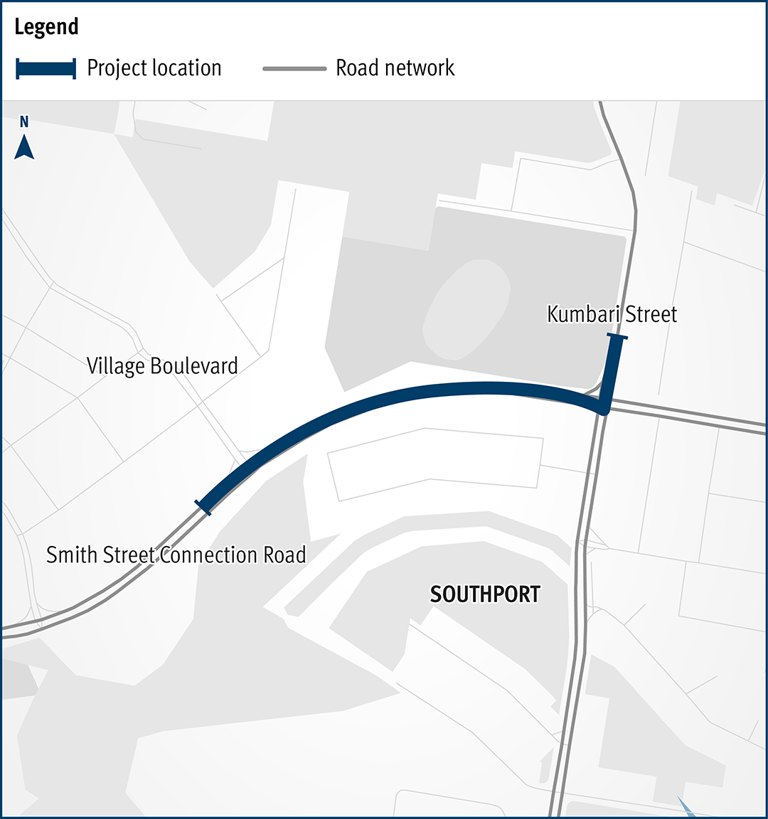
Mackay Ring Road
The Mackay Ring Road to Bald Hill Road Connection Project delivers a significant upgrade to the Brue Highway.
Completed
The Mackay Ring Road to Bald Hill Road Connection Project delivers a significant upgrade to the Brue Highway.
Completed
The Queensland Government has completed integrated planning for the Gateway Motorway and Bruce Highway Upgrades in north Brisbane and the Moreton Bay Region.

The Queensland Government is committed to improving the 1,671.3km Bruce Highway from Pine River to Cairns, focusing on capacity, safety, and flood resilience.
One of the key priorities of the Queensland Government is to deliver a long-term upgrade plan for the Bruce Highway.
Since July 2013, $10,107 billion in works has been delivered along the Highway, with 8 projects currently under construction, 15 in development and 13 in planning.
Key outcomes to date include:
The Bruce Highway Upgrade focuses on the 3 priority areas during its 15-year course:
As with any major construction program, there might be delays that could affect travel. It is advised to plan ahead and check for up-to-date details on QLDTraffic ( https://qldtraffic.qld.gov.au/ ) to help you plan your journey.
|
District / Region |
Investment name |
Status |
|
Far North |
Bruce Highway (Innisfail - Cairns), Munro Street (Babinda), upgrade intersection |
Construction |
|
Fitzroy |
Bruce Highway (Rockhampton - St Lawrence), Rockhampton Ring Road, construction |
Construction |
|
Far North |
Cairns Southern Access Cycleway, construct cycleway |
Construction |
|
Fitzroy |
Bruce Highway (Gin Gin - Benaraby), Station Creek and Boyne River, upgrade bridges |
Construction |
|
North Coast |
Bruce Highway (Brisbane - Gympie), Dohles Rocks Road to Anzac Avenue upgrade (Stage 1) |
Construction |
|
Northern |
Bruce Highway (Bowen - Ayr), Burdekin River Bridge, rehabilitation program |
Construction |
|
Far North |
Bruce Highway (Ingham - Innisfail), Dallachy Road, install floodway |
Construction |
|
Fitzroy |
Bruce Highway (Rockhampton - St Lawrence), Pine Mountain Creek to Kooltandra Road intersection, formation widening for wide centre line treatment |
Construction |
|
Wide Bay/Burnett |
Bruce Highway (Gympie - Maryborough), Tiaro Bypass, construct four lane bypass |
Development |
|
Northern |
Bruce Highway (Ingham - Innisfail), Ingham-Halifax-Bemerside Road - Cardwell Range, Bruce Highway Safety Package Tranche 2a (W111, W112 & B55) |
Development |
|
Northern |
Bruce Highway (Ingham - Innisfail) and Lannercost Street, upgrade intersection |
Development |
|
Metropolitan |
Linkfield Connection Road, Linkfield Road overpass upgrade |
Development |
|
Wide Bay/Burnett |
Bruce Highway (Maryborough - Gin Gin), Buxton Road and BP service station intersection upgrade |
Development |
|
North Coast |
Bruce Highway (Brisbane - Gympie), Gateway Motorway to Dohles Rocks Road |
Development |
|
Wide Bay/Burnett |
Bruce Highway (Gympie - Maryborough), Curra to Gunalda, various locations, improve safety |
Development |
|
Northern |
Bruce Highway (Ingham - Innisfail), Gairloch Floodway, safety improvements |
Development |
|
Mackay/Whitsunday |
Bruce Highway (Mackay - Proserpine), O'Connell River to Proserpine, upgrade flood immunity (Goorganga Floodplain) |
Development |
|
Mackay/Whitsunday |
Bruce Highway (Mackay - Proserpine), Goorganga, construct overtaking lanes |
Development |
|
Metropolitan |
Bruce Highway (Brisbane - Gympie), Gateway Motorway to Dohles Rocks Road upgrade (Stage 2) |
Development |
|
Fitzroy |
Bruce Highway (Benaraby ‐ Rockhampton), Various sections, Pavement reconstruction of high priority sections |
Development |
|
Fitzroy |
Bruce Highway (Benaraby ‐ Rockhampton), Gladstone ‐ Mt Larcom Road, intersection upgrade |
Development |
|
Fitzroy |
Bruce Highway (Benaraby ‐ Rockhampton), Gladstone ‐ Mt Larcom Road to Dart Creek Road, Overtaking lanes |
Development |
|
Fitzroy |
Bruce Highway (Benaraby ‐ Rockhampton), South of Marmor, overtaking lanes |
Development |
|
Northern |
Bruce Highway (Ingham - Innisfail), Ingham to Cardwell Range Deviation, plan and preserve corridor |
Planning |
|
Northern |
Bruce Highway (Ayr - Townsville), Burdekin Deviation, plan and preserve corridor |
Planning |
|
Far North |
Bruce Highway (Innisfail-Cairns), Innisfail Bypass preserve corridor |
Planning |
|
Fitzroy |
Bruce Highway (Rockhampton - St Lawrence), Bolsover Street, Intersection upgrade |
Planning |
|
Mackay/Whitsunday |
Mackay Port Access, Bruce Highway to Mackay - Slade Point Road (Stage 1) |
Planning |
|
Far North |
Bruce Highway, Cairns Southern Access Corridor (Stage 5), Foster Road, upgrade intersection |
Planning |
|
Statewide |
Bruce Highway Capacity Upgrade Strategy |
Planning |
|
North Coast |
Bruce Highway (Brisbane - Gympie), Buchanan Road to Caboolture - Bribie Island Road upgrade, business case |
Planning |
|
North Coast |
Bruce Highway (Brisbane - Gympie), Uhlmann Road to Buchanan Road upgrade, business case |
Planning |
|
North Coast |
Bruce Highway (Brisbane - Gympie), Redcliffe Road (Anzac Avenue) to Uhlmann Road upgrade, business case |
Planning |
|
North Coast |
Bruce Highway (Brisbane - Gympie), Redcliffe Road (Anzac Avenue) to Uhlmann Road, construct additional lanes |
Planning |
|
Wide Bay/Burnett |
Bruce Highway (Maryborough – Gin Gin), Walker Street intersection improvement, planning & preconstruction |
Planning |
|
Fitzroy |
Bruce Highway (Benaraby - Rockhampton), Gavial - Gracemere Road to Burnett Highway, capacity upgrades |
Planning |
|
Fitzroy |
Bruce Highway (Benaraby ‐ Rockhampton), Bajool, pavement reconstruction |
Planning |
The department is undertaking the rehabilitation and maintenance program for the Burdekin River Bridge to preserve the structural integrity of the bridge. The ongoing program will ensure a safe and durable crossing is maintained for the long-term use of vehicles, heavy transport operators, rail operations, bicycle riders and pedestrians.

This project will duplicate Beaudesert–Beenleigh Road between Mount Warren Boulevard and Tallagandra Road.

The department is planning for a future upgrade of the intersection of Beenleigh Connection Road (Logan Street) and City Road.
Beenleigh station is a key transfer location between all-stops and express services on the Beenleigh and Gold Coast train lines.

The department has released a planning layout for the Beenleigh-Redland Bay Road (California Creek Road to Mount Cotton Road) upgrade.
The Bethania station precinct is being upgraded to improve accessibility, safety and customer experience.

An upgrade is planned for the Bruce Highway from Anzac Avenue, North Lakes to Uhlmann Road, Burpengary.
An upgrade is planned for the Bruce Highway from Buchanan Road, Morayfield to Caboolture-Bribie Island Road, Caboolture.

An upgrade is planned for the Bruce Highway from Uhlmann Road, Burpengary to Buchanan Road, Morayfield.

The department is delivering staged upgrades to manage increasing traffic demands on this section of the Bruce Highway. Stage 1 includes extended north-facing ramps from Dohles Rocks Road to Anzac Avenue.

The Queensland Government is improving flood immunity, safety, and efficiency of the Bruce Highway and future-proofing the road to cater for growing traffic volumes. The Tiaro Bypass will also remove a significant number of heavy vehicles from Tiaro township, improving safety and liveability for residents.
The Queensland Government is progressing an $18 million project to upgrade the Bruce Highway at Dallachy Road, near Tully, to improve flood immunity on this section of the highway.
The Queensland Government is delivering an upgrade of the Bruce Highway at Gairloch Floodway to enhance safety and flood resilience along this complex and flood-prone section of the highway. Key improvements include road realignment, wide centre line treatment, and removal of a sharp curve to improve traffic flow and reduce flood-related disruptions.

The Queensland Government is progressing a $9 million planning and corridor preservation project for a potential bypass around Innisfail.
Planning is underway for around 2km of overtaking opportunities and upgrades to pavement and lighting at the Gunyarra Road intersection.
This project has been completed and provides Intelligent Transport System infrastructure at various locations along the Bruce Highway between Pine River and Cairns.
The Bruce Highway is a critical link for Queensland, connecting coastal and regional communities from Cairns to Brisbane. Safety upgrades have been completed at Twelve Mile Creek bridge and John Murphy Bridge.
Planning for the Bruce Highway and Bolsover Street intersection upgrade in Rockhampton will investigate safety and capacity improvements between the Neville Hewitt Bridge and Cambridge Street.
This intersection is identified for an upgrade due to the rapid expansion of local urban areas, increased traffic volumes and crash history.

Coomera Connector (Future Stages), between Loganholme and Coomera, is around 29km and will connect with Coomera Connector Stage 1.

Stage 2 of the Coomera Connector, between Pimpama and Coomera, is around 5km and is the next priority section for planning and design.
Stage 1 of the Coomera Connector, between Coomera and Nerang, is around 16km and is now open to traffic between Shipper Drive and Helensvale Road.
The department is committed to restoring the damaged section of the Cunningham Highway at Cunninghams Gap. This 2km stretch, leading up to the Allan Cunningham monument, suffered significant road damage during the bushfires in 2019.

Planning is underway to upgrade the Cunningham Highway.
The intersection of Currumbin Creek Road and Bienvenue Drive, at Currumbin Waters will be upgraded.
Edens Landing station precinct is being upgraded as part of the Logan and Gold Coast Faster Rail project to improve accessibility, safety and customer experience.

The European Train Control System (ETCS) is a digital signalling system being progressively installed to key parts of the South East Queensland (SEQ) rail network.
ETCS plays an important part in the future of our rail network, delivering increased safety, capacity, efficiency, and reliability for a sustainable transport network.
ETCS will soon be installed on the Gold Coast line between Beenleigh and Varsity Lakes stations.
We are continuing to protect and plan for the Gold Coast heavy rail corridor between Varsity Lakes and Gold Coast Airport.
Planning has started on the proposed Currumbin Creek Active Transport Bridge between Palm Beach and Currumbin.
The department is continuing planning for future upgrades to the Gold Coast Highway at the intersection of Captain Cook Drive/Pine Ridge Road due to the high volume of traffic causing congestion and delays. The future upgrade aims to improve traffic flow and safety at the intersection.
Gold Coast Light Rail is a world class public transport system for residents and visitors to the Gold Coast.

The Gold Coast Light Rail is a world class public transport system for residents and visitors to the Gold Coast. The system is being delivered in stages to manage the demands of a growing population and reduce traffic congestion, especially in the southern areas of the Gold Coast.
The Mudgeeraba Creek Causeway on Gold Coast–Springbrook Road is being replaced.
Gold Coast—Springbrook Road sustained a significant number of landslips, rock falls and tree falls during the South Queensland Severe Storms and Rainfall events in December 2023 and January 2024.
Holmview train station is being upgraded to improve accessibility, safety and customer experience.

The Kingston station precinct is being upgraded as part of the Logan and Gold Coast Faster Rail project to improve accessibility, safety and customer experience for the community.

The Kuraby station precinct is being upgraded as part of the Logan and Gold Coast Faster Rail project to improve accessibility, safety and customer experience.

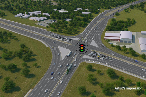
The Queensland Government is committed to improving road safety, reducing congestion, and supporting the growing needs of the Bald Hills community.
We are relocating Loganlea train station and the park 'n' ride to better connect customers with nearby health, education, and community services.
The M1 Pacific Motorway at Exit 45 (North) Ormeau is experiencing heavy congestion as rapid population growth transforms Ormeau and Pimpama from rural areas into dense urban communities.
The proposed Mackay Port Access will provide a direct link for freight movements from the Mackay Port to the Mackay Ring Road, and west to the Bowen Basin coal fields via the Walkerston Bypass and Peak Downs Highway.
The Mackay Ring Road to Bald Hill Road Connection Project delivers a significant upgrade to the Brue Highway.
We're investigating the east-west public transport route connecting Nerang Station with Broadbeach South. This route will make travel faster, easier and more reliable for communities in the central Gold Coast.
The Next Generation Traffic Signalling Program is an initiative aimed at transforming traffic signal infrastructure across Queensland.
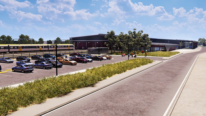
A rail facility is being constructed on a 66ha site in the Gold Coast region.
Planning is underway for the Pacific Motorway (M1) – Daisy Hill to Logan Motorway upgrade. This section of the M1 cannot accommodate current traffic volumes and, as a result, experiences frequent and prolonged periods of congestion and poor travel time reliability.

The Sports Drive to Gateway Motorway Upgrade was part of a rolling program of upgrades between the Gateway and Logan Motorways.

The Pacific Motorway (M1) between Watland Street and Sports Drive was upgraded as part of a rolling program of upgrades between the Gateway and Logan motorways.

The M1 between Burleigh and Palm Beach (Package B) has been upgraded as part of the Varsity Lakes to Tugun (VL2T) upgrade. Package B included significant environmental features through this section of the upgrade.

Planning and construction is underway for short and long-term upgrades of various interchanges on the Pacific Motorway (M1)
The Pacific Motorway (M1) has been upgraded between Palm Beach and Tugun (Package C) as part of the Varsity Lakes to Tugun (VL2T) upgrade.

The Pacific Motorway (M1) has been upgraded between Varsity Lakes and Burleigh (Package A) as part of the Varsity Lakes to Tugun (VL2T) upgrade.

The $1.5 billion Pacific Motorway Varsity Lakes to Tugun (VL2T) project to upgrade 10km of the M1 has been completed.

Work is now complete on the Pacific Motorway, Eight Mile Plains to Daisy Hill Upgrade, which has improved 8kms of the Pacific Motorway (M1) between the Gateway Motorway and Watland Street.
The Pacific Highway (western service road) in Slacks Creek was realigned and upgraded as part of the Pacific Motorway, Eight Mile Plains to Daisy Hill Upgrade.

The Rochedale bus station and park ‘n’ ride was upgraded as part of a rolling program of upgrades between the Gateway and Logan motorways.

The Exit 49 interchange upgrade has delivered significant improvements in safety and traffic flow efficiency by keeping traffic moving through the improved interchange and reducing queuing.
We are preserving the Park Ridge Connector, a future transport corridor to connect communities planned at Park Ridge, Flagstone and Yarrabilba to services and employment.
We are delivering continual maintenance and rehabilitation of state-controlled roads and assets in the South Coast region.
The Rockhampton Ring Road is a transformative project for the Bruce Highway, designed to support future economic growth and deliver key benefits such as improved flood resilience, freight efficiencies, reduced travel times and enhanced road safety.
We are planning for future transport needs between Salisbury and Beaudesert.
The Queensland Government has delivered new bicycle facilities to connect to local health, education, business, and tourist areas.
Repairs have been completed across southern Queensland after extensive and severe damage to the state-controlled road network was caused by multiple heavy rainfall and flooding events in 2022.

The department has released a planning layout for the Stapylton-Jacobs Well Road Upgrade.

We are deeply committed to protecting native fauna and actively support initiatives and treatments aimed at reducing koala-vehicle collisions. Recognising our responsibility to safeguard vulnerable wildlife, we prioritise measures that mitigate risks to koalas on Queensland roads.
The Trinder Park station precinct is being upgraded as part of the Logan and Gold Coast Faster Rail project to improve accessibility, safety and customer experience.

The Woodridge station precinct is being upgraded as part of the Logan and Gold Coast Faster Rail project to improve accessibility, safety and customer experience.

Last updated: 20 May 2026