South Brisbane Transport and Mobility Study
We are conducting a multi-modal study of the ongoing and increasing transport pressures relating to road, active transport and public transport modes in Brisbane’s inner south...
We are conducting a multi-modal study of the ongoing and increasing transport pressures relating to road, active transport and public transport modes in Brisbane’s inner south...

We have finalised a preferred concept plan for the intersection of Stafford Road and South Pine Road, Everton Park...
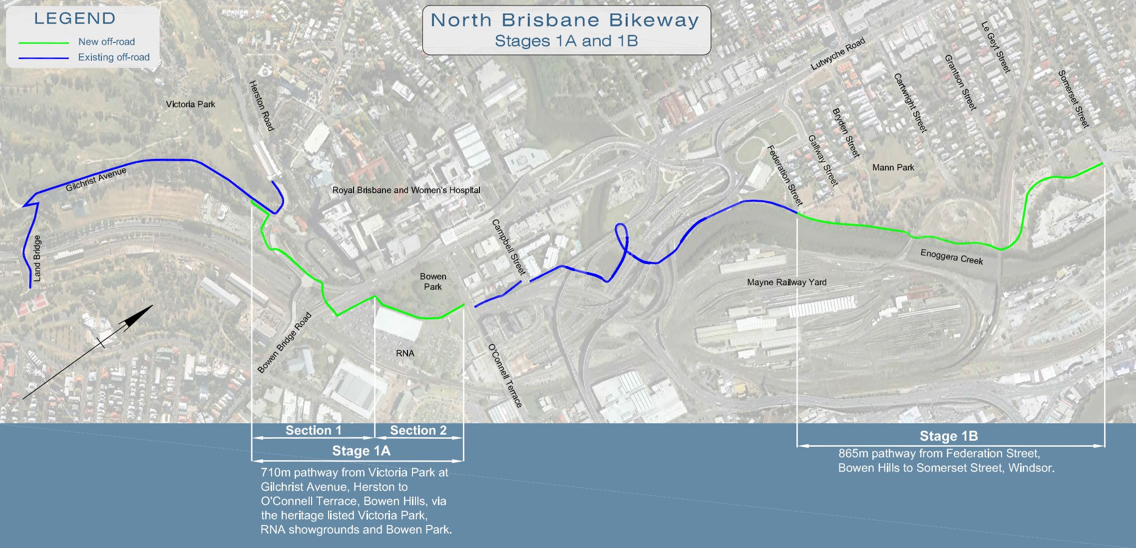
We have delivered the North Brisbane Bikeway in partnership with Brisbane City Council, and the new bikeway will encourage more cycling, more often, across all ages...
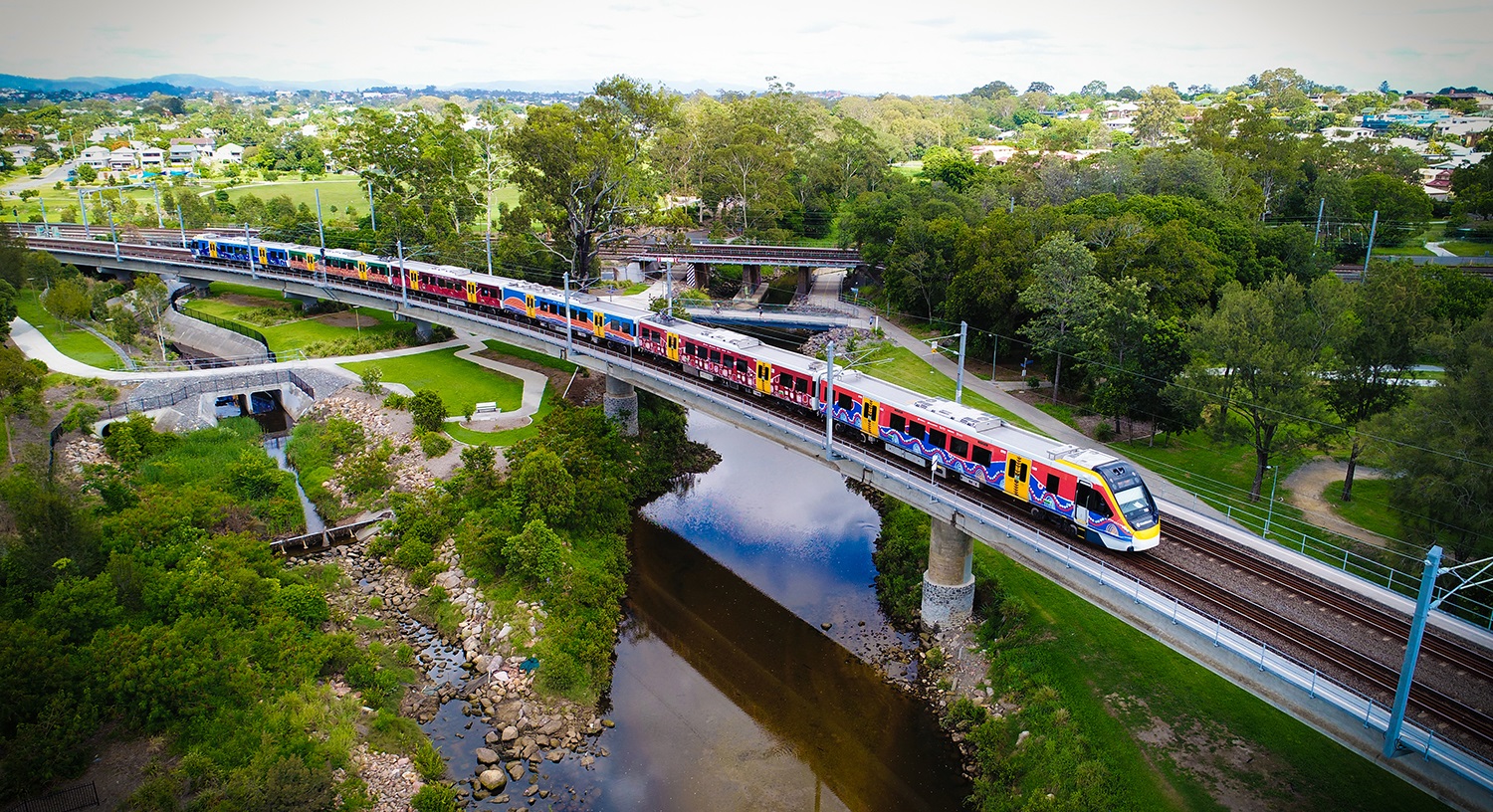
The Queensland Government’s New Generation Rollingstock (NGR) project trains are providing will see aa significant increase to the capacity of the South East Queensland train fleet to meet the growing...
Rocklea to Darra Stage 1 is the 3km upgrade of the Ipswich Motorway between Granard Road, Rocklea and Oxley Road, Oxley...
We have upgraded the Gateway Motorway between Nudgee and Deagon, with additional pavement and safety works through to Bracken Ridge...
The Department of Transport and Main Roads (TMR) undertook community consultation on a proposed Warrego Highway – Mount Crosby Road interchange upgrade in mid-2020...
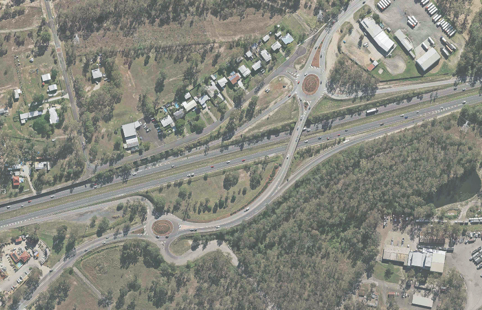
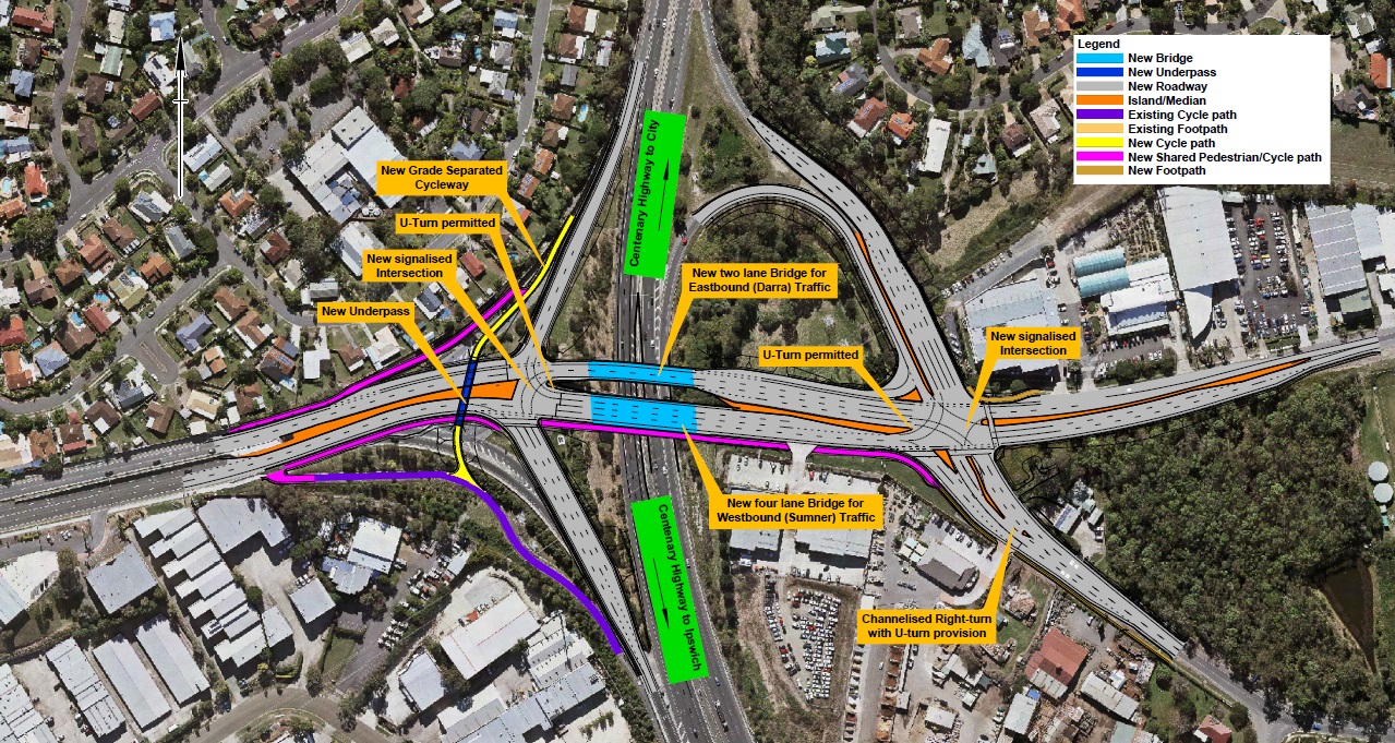
The Sumners Road Interchange Upgrade has become fully operational to the public...
A multimodal study of the ongoing and increasing transport pressures relating to road, active transport and public transport modes on the Bulimba Peninsula...
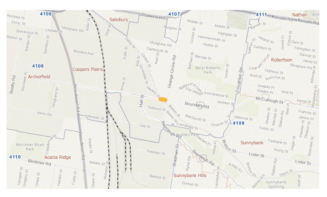
We are completing a business case to investigate options to reduce congestion and address safety concerns at Boundary Road, Coopers Plains rail level crossing...