Showing results 1-5 of 5

Sort results
Sort results
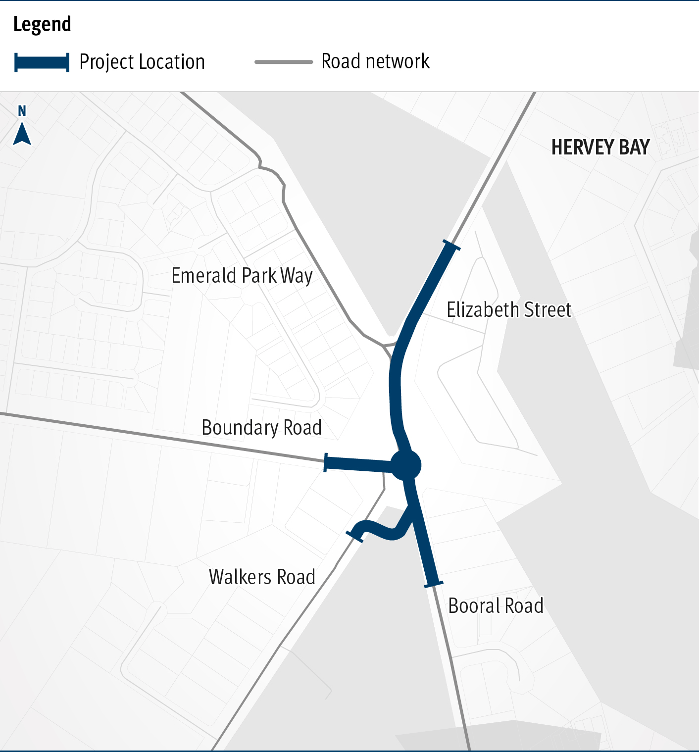
  1. Booral Road and Boundary Road (Urangan), intersection upgrade

    Detailed design is underway for a proposed upgrade of the Booral Road and Boundary Road intersection...

    The map shows the locality of the proposed Booral Road and Boundary Road intersection upgrade. Hervey Bay is located north-east of the project location. A solid blue line indicates the project extent, which encompasses the Booral Road and Boundary Road intersection, and also extends along Booral Road to the north past the Emerald Park Way intersection and to the south along Booral Road past the proposed new Walkers Road intersection. Walkers Road has been realigned to access Booral Road to the south of the Booral Road and Boundary Road intersection. The local road network, including where Booral Road turns into Elizabeth Street, is also highlighted on the map.
  2. Gympie – Brooloo Road, design active transport crossings

    Detailed design is underway for active transport bridge structures and pathway to provide connectivity of the Principal Cycle Network from Gympie's southside into the Gympie CBD and surrounds...

    No image supplied
  3. Pialba–Burrum Heads Road, O’Regan Creek, upgrade existing floodway

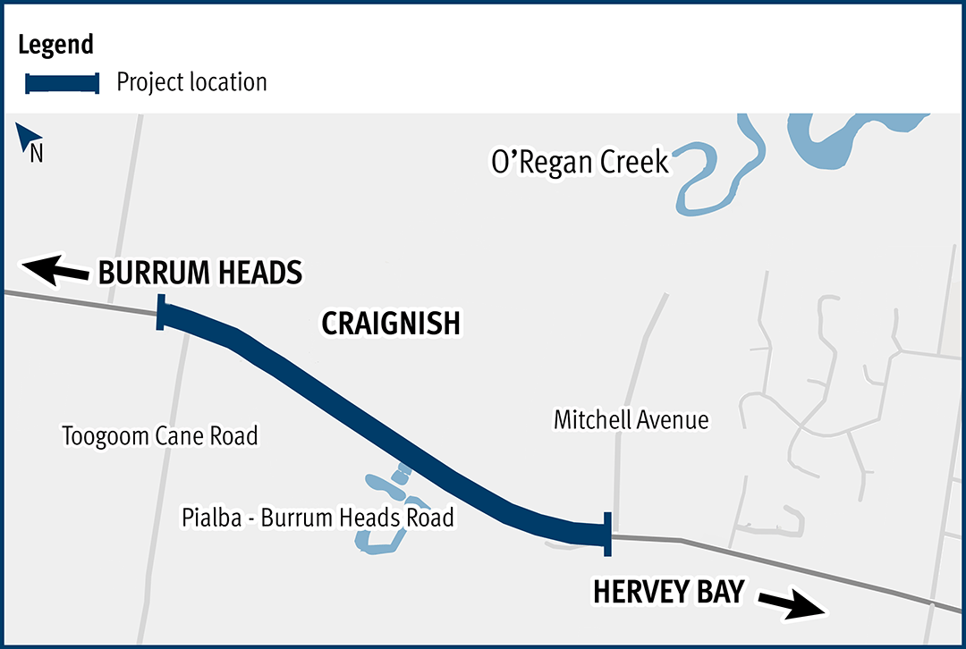
    This project aims to improve the flood immunity and reduce flood closure times at the Pialba–Burrum Heads Road crossing...

    Pialba–Burrum Heads Road, O’Regan Creek, upgrade existing floodway project location map
  4. Maryborough - Hervey Bay Road and Pialba - Burrum Heads Road, upgrade intersection

    The Department of Transport and Main Roads is undertaking detailed design for an upgrade of the Maryborough-Hervey Bay Road and Pialba-Burrum Heads Road intersection in Eli Waters...

    No image supplied
  5. Bruce Highway (Gympie – Maryborough), Tiaro Bypass, construct four lane bypass

    We are improving flood immunity, safety and efficiency on the Bruce Highway at Tiaro...

    No image supplied