
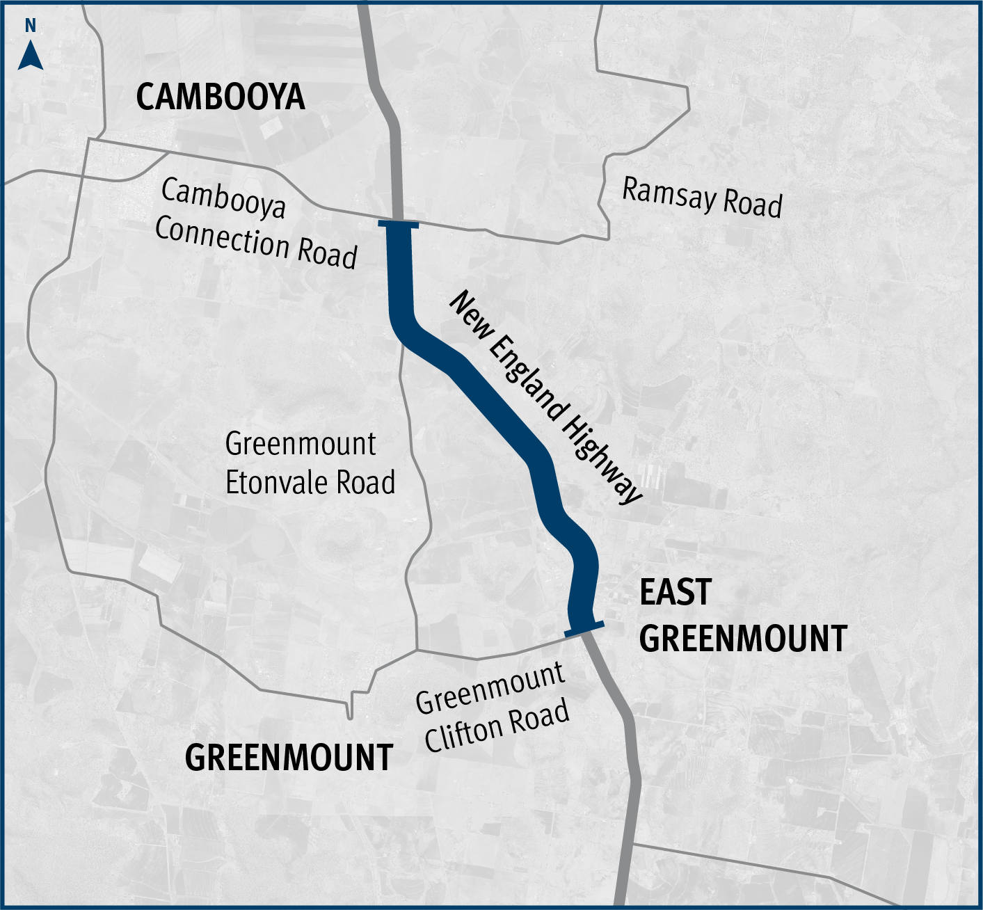
Landsborough to Nambour Rail Corridor Study
The department has identified and preserved a new rail corridor between Landsborough and Nambour, which will replace the existing North Coast line through this section...
The department has identified and preserved a new rail corridor between Landsborough and Nambour, which will replace the existing North Coast line through this section...

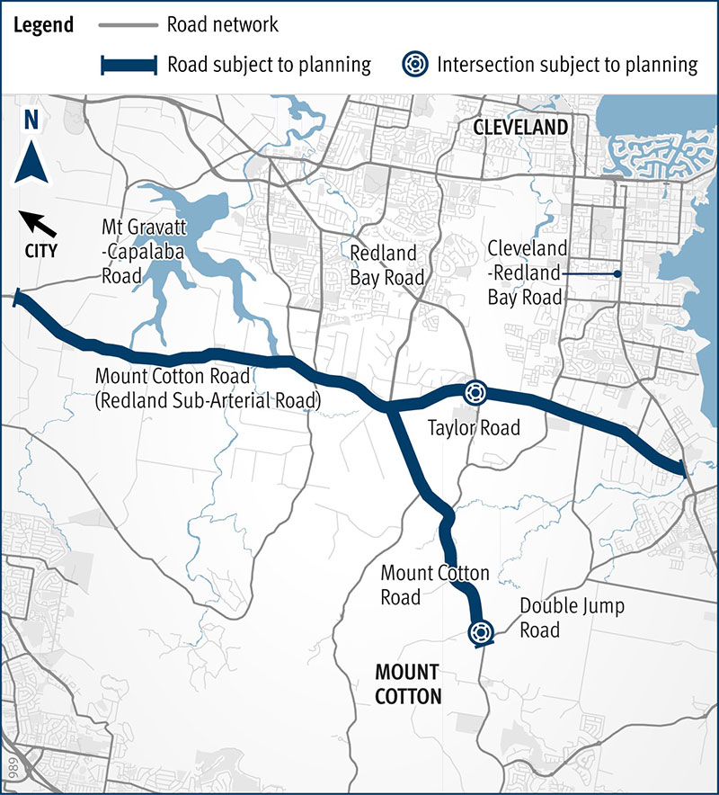
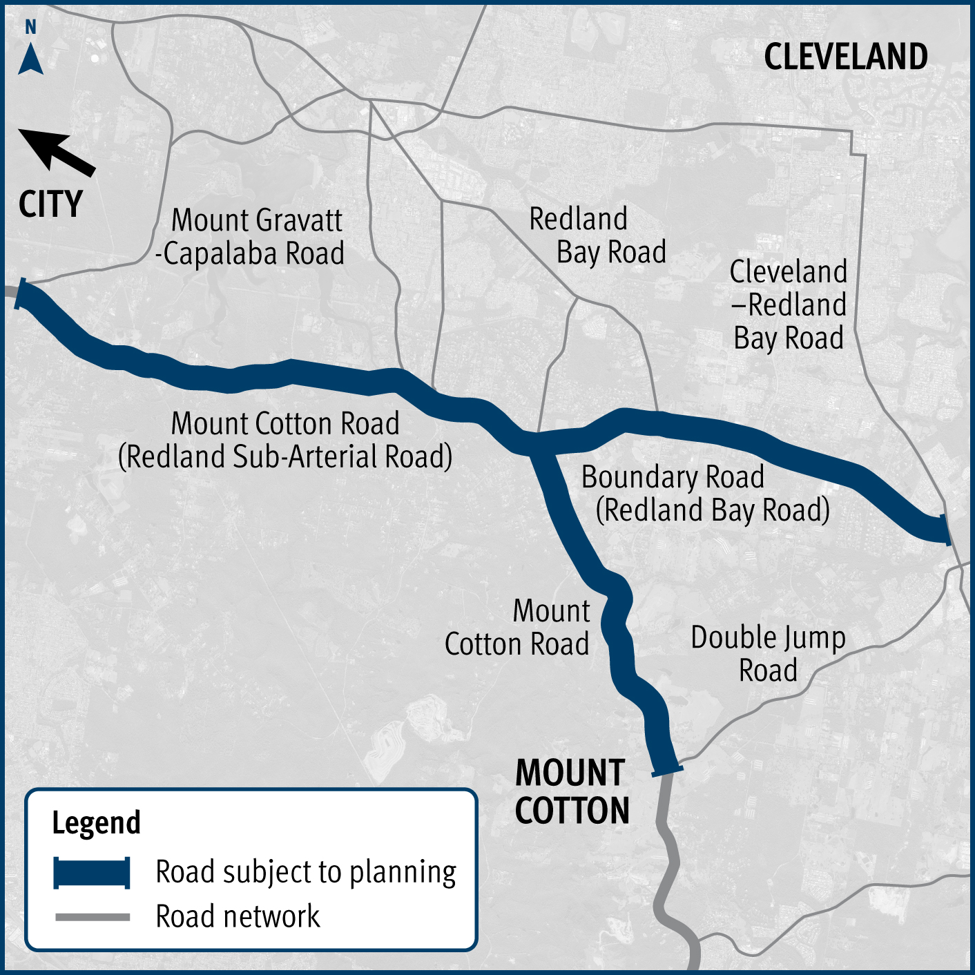
We are undertaking planning for Mount Cotton Road, Redland Bay Road and the Redland Sub-Arterial Road, including the Double Jump Road, Ney Road and Taylor Road intersections...
Find out more about the detailed business case we are developing to help improve the public transport system for the Sunshine Coast...
These planning projects will investigate future infrastructure needs such as road widening to accommodate wide centre lines and overtaking lanes, as well as replacing the Emu Creek culverts...
We are undertaking planning for Mount Cotton Road, Redland Bay Road and the Redland Sub-Arterial Road, including the Double Jump Road, Ney Road and Taylor Road intersections...

We are undertaking planning for Mount Cotton Road, Redland Bay Road and the Redland Sub-Arterial Road, including the Double Jump Road, Ney Road and Taylor Road intersections...
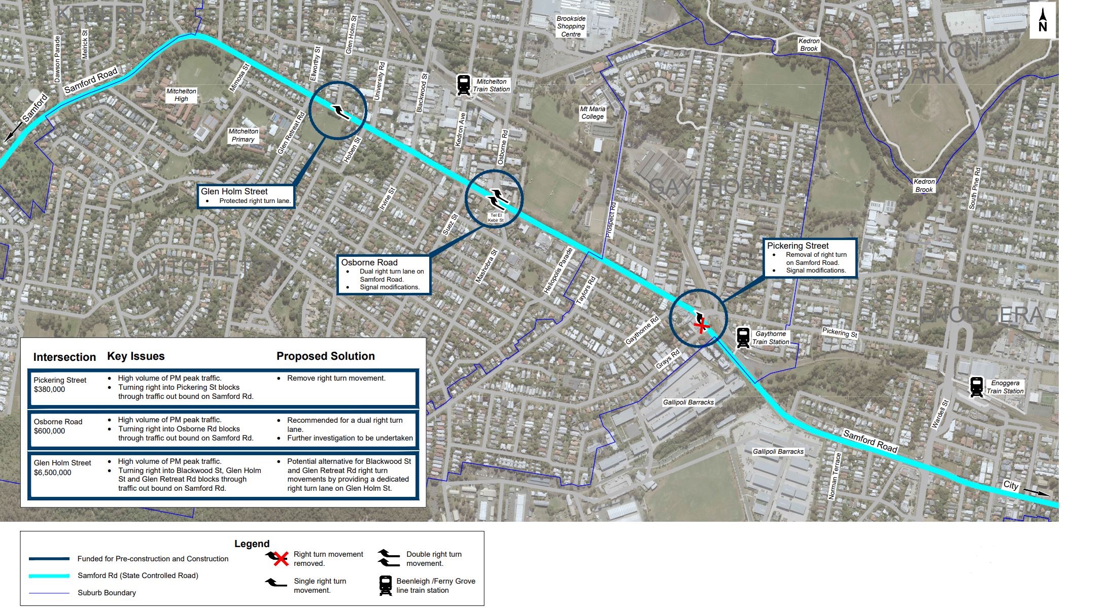
We are currently undertaking community consultation on proposed safety and traffic improvement works at key intersections along Samford Road, at Pickering Street, Glen Holm Street and Osborne Road...
The Department of Transport and Main Roads (TMR) is undertaking planning to identify preferred options that address safety issues at the Warrego Highway and Haigslea-Amberley Road intersection...
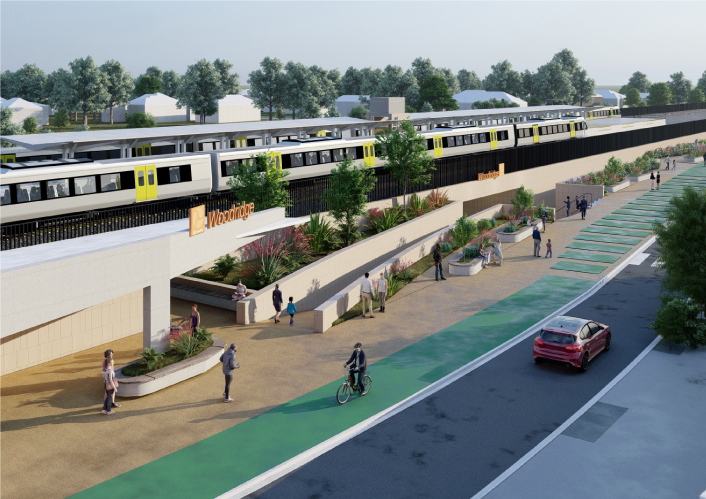
We're upgrading the Woodridge train station to improve accessibility, safety, and overall customer experience as part of the Logan and Gold Coast Faster Rail project...
We are planning for a future upgrade of the Mudgeeraba Creek Causeway on Gold Coast–Springbrook Road, Austinville...