
Mount Cotton Road, Duncan Road to Double Jump Road, planning study
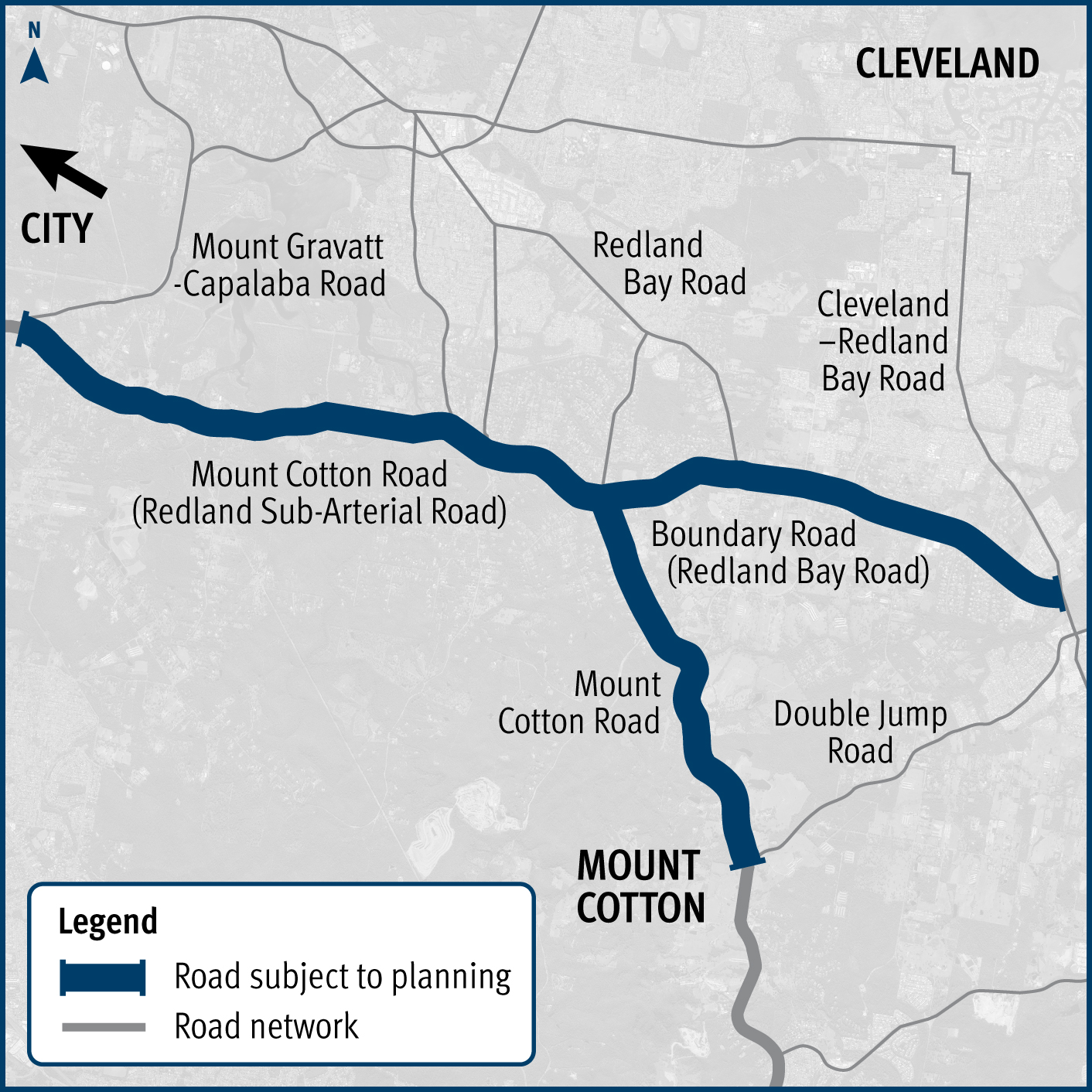
We are undertaking planning for Mount Cotton Road, Redland Bay Road and the Redland Sub-Arterial Road, including the Double Jump Road, Ney Road and Taylor Road intersections...
We are undertaking planning for Mount Cotton Road, Redland Bay Road and the Redland Sub-Arterial Road, including the Double Jump Road, Ney Road and Taylor Road intersections...
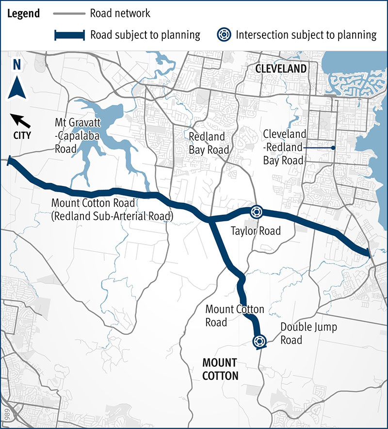
We are undertaking planning for Mount Cotton Road, Redland Bay Road and the Redland Sub-Arterial Road, including the Double Jump Road, Ney Road and Taylor Road intersections...

We are undertaking planning for Mount Cotton Road, Redland Bay Road and the Redland Sub-Arterial Road, including the Double Jump Road, Ney Road and Taylor Road intersections...
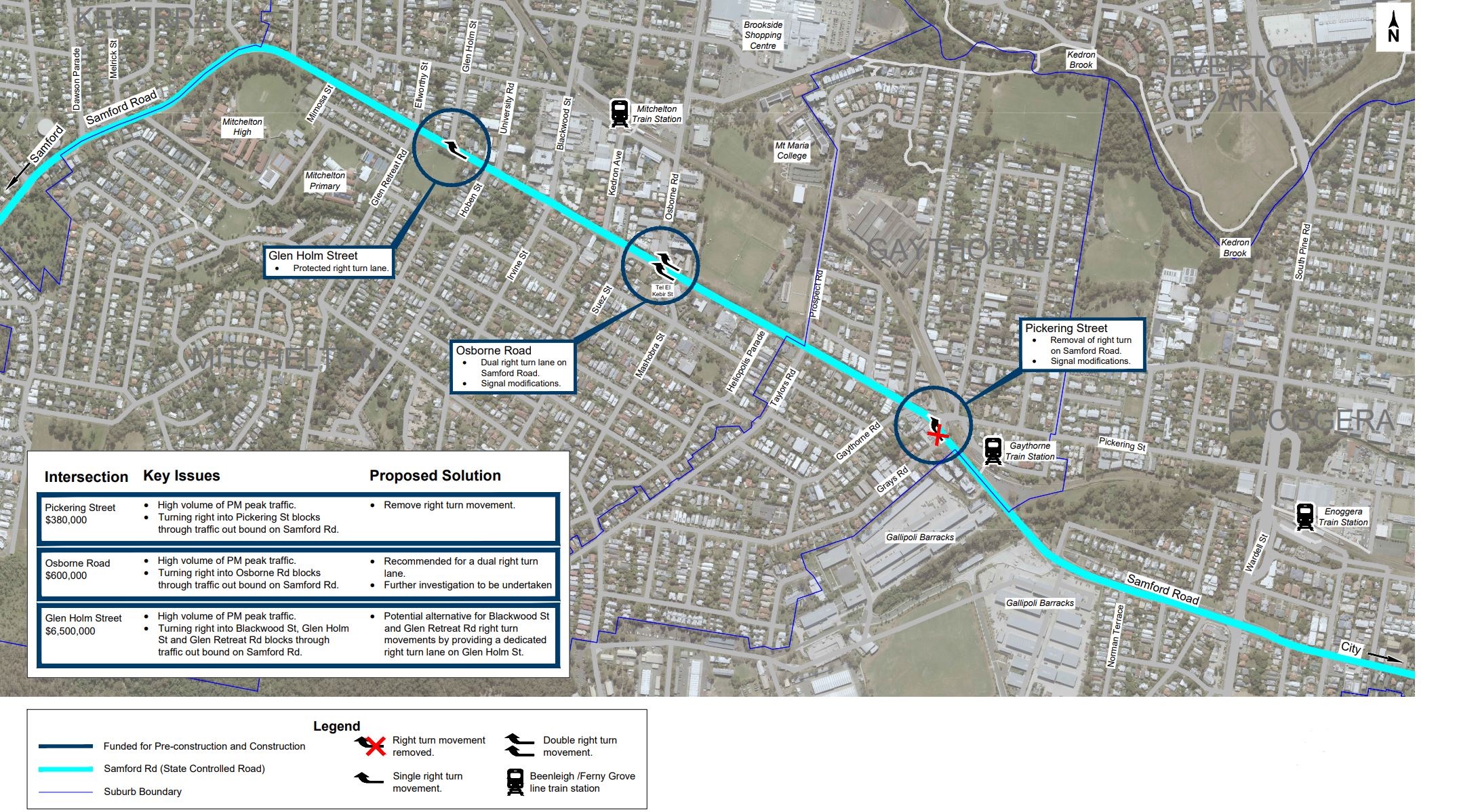
We are currently undertaking community consultation on proposed safety and traffic improvement works at key intersections along Samford Road, at Pickering Street, Glen Holm Street and Osborne Road...
The Department of Transport and Main Roads (TMR) is undertaking planning to identify preferred options that address safety issues at the Warrego Highway and Haigslea-Amberley Road intersection...

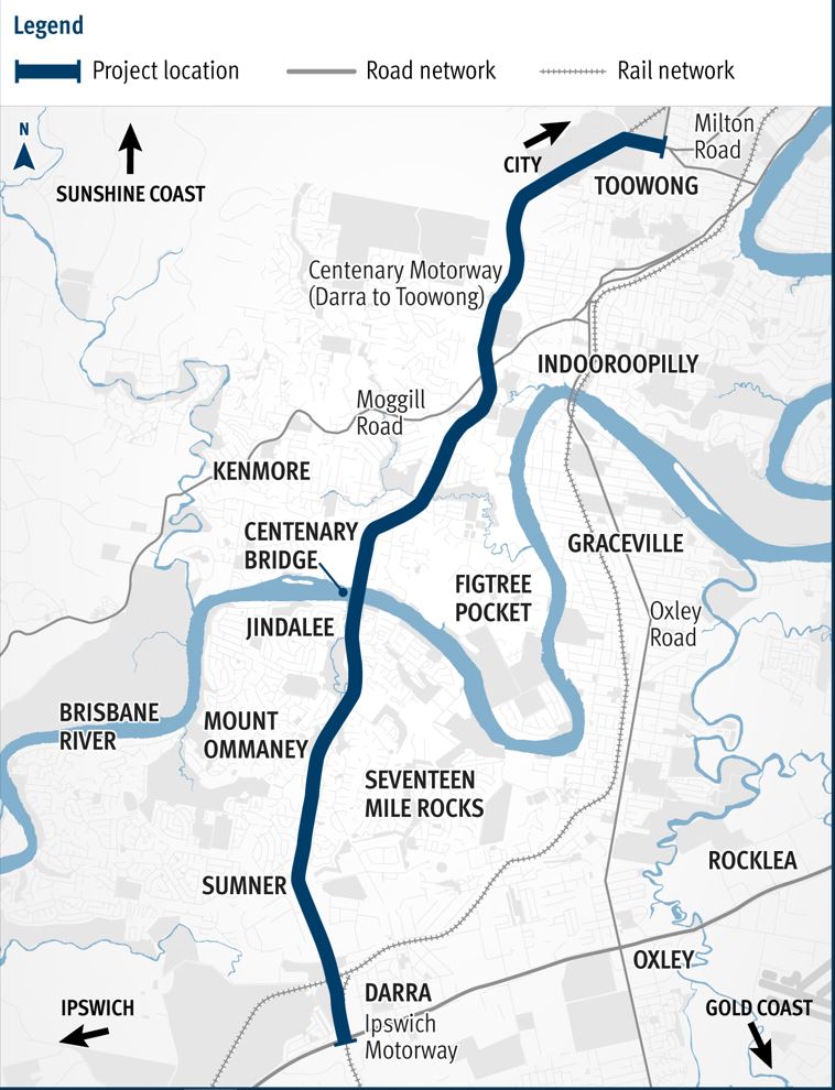
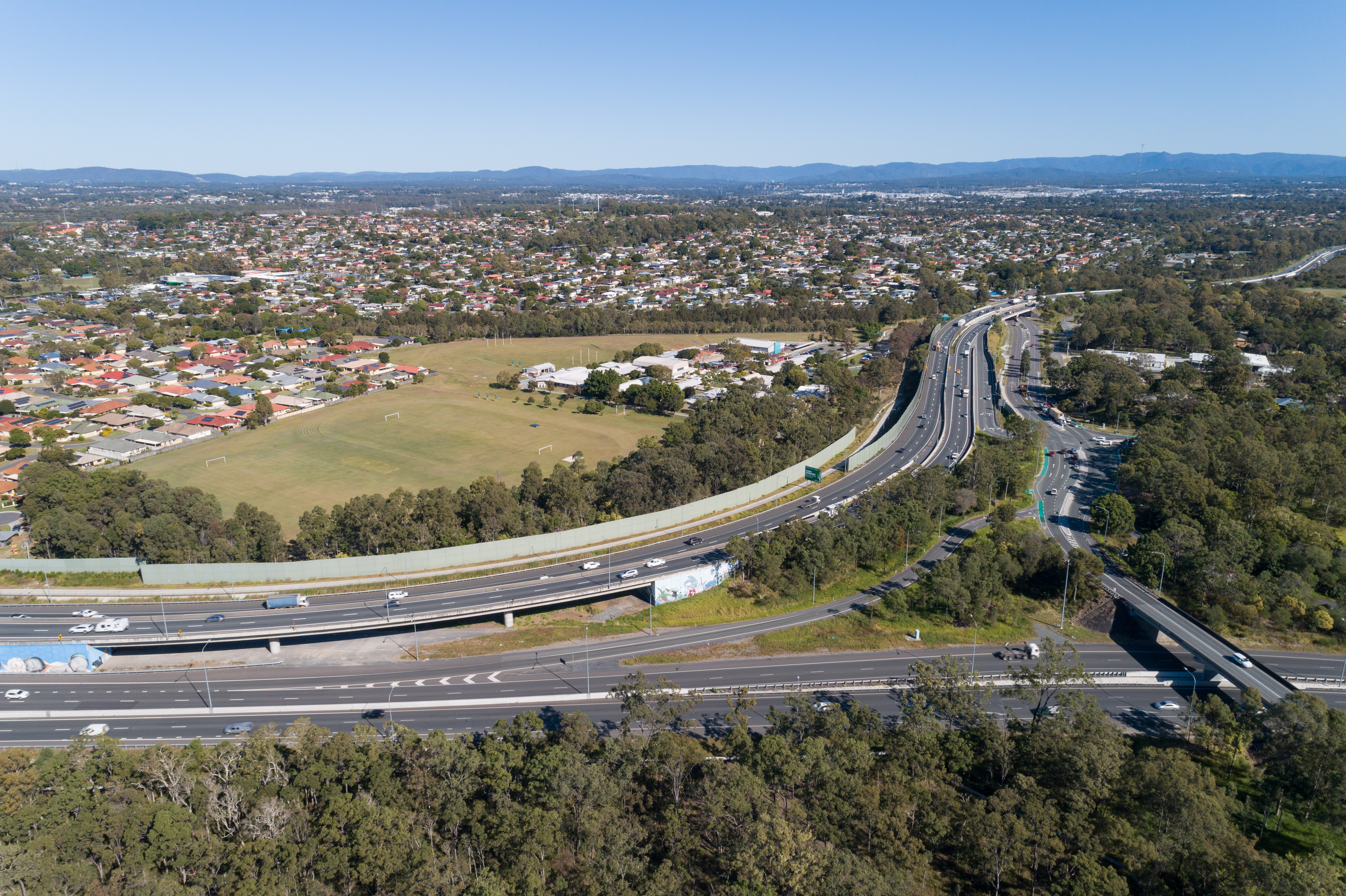
The department is planning an upgrade of the Centenary Motorway between Toowong and Darra to meet the changed transport demands of the corridor...
We have started the next stage of planning for a future Ipswich to Springfield Public Transport Corridor...
Planning for the Gympie Arterial Road and Murphy Road intersection, including Downfall Creek Bridge, to improve safety and reduce congestion...
We are undertaking integrated planning for the Gateway Motorway and Bruce Highway Upgrades in north Brisbane and the Moreton Bay Region...
Planning is underway to expand the southern side of the park ‘n’ ride at Bald Hills station...