Gympie Arterial Road and Murphy Road intersection, Downfall Creek Bridge, planning
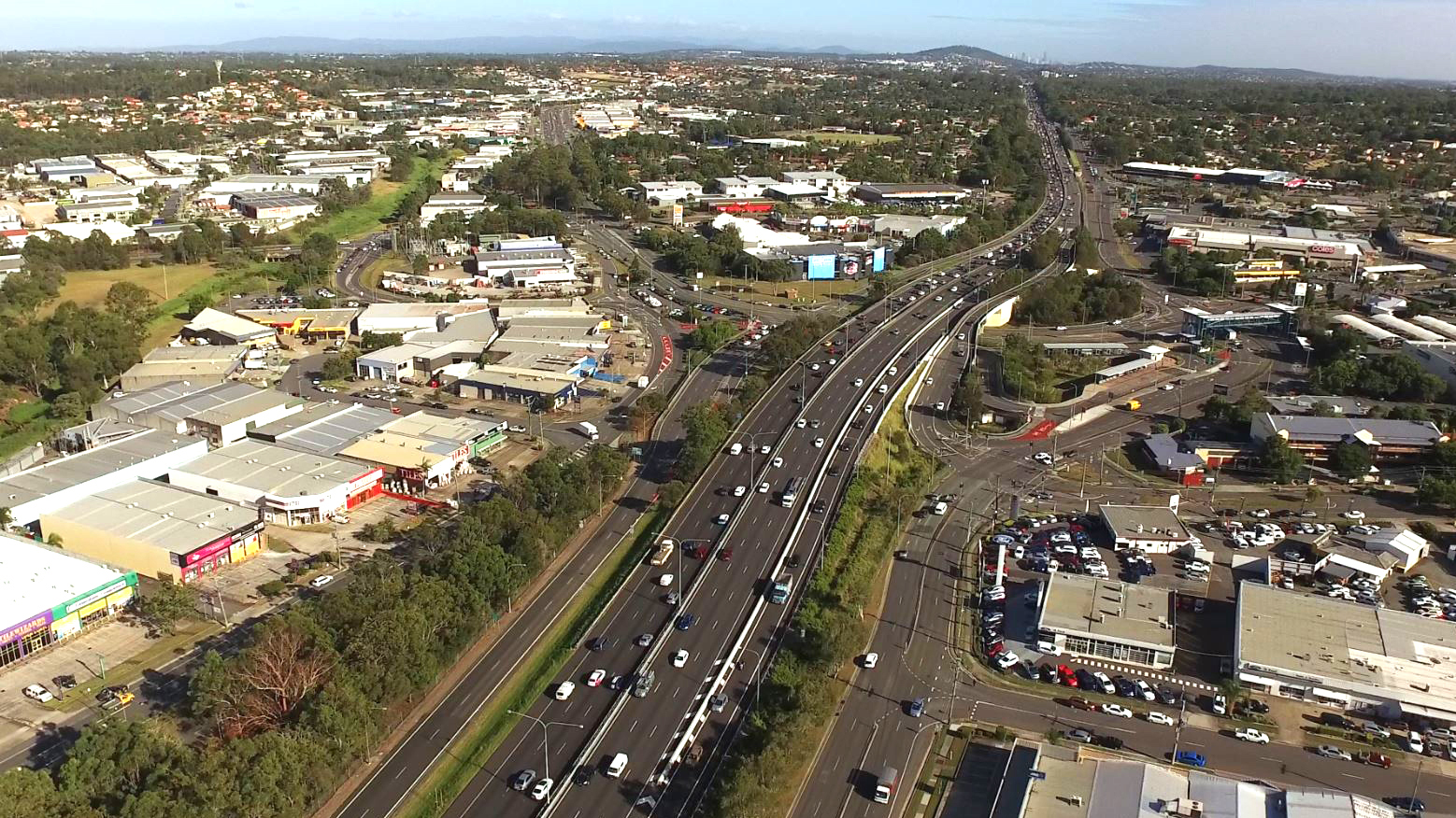
Planning for the Gympie Arterial Road and Murphy Road intersection, including Downfall Creek Bridge, to improve safety and reduce congestion...
Planning for the Gympie Arterial Road and Murphy Road intersection, including Downfall Creek Bridge, to improve safety and reduce congestion...

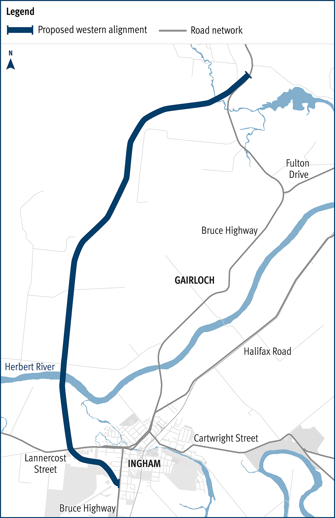
The department has been actively working with the community to address the challenges associated with the Bruce Highway from South of Ingham to the Cardwell Range...
The Gowrie to Grandchester Rail Corridor Study investigated a rail corridor that would help mitigate the constraints on rail operations caused by the Toowoomba and Little Liverpool Range crossings...
The department has developed a plan to upgrade the Cunningham Highway...
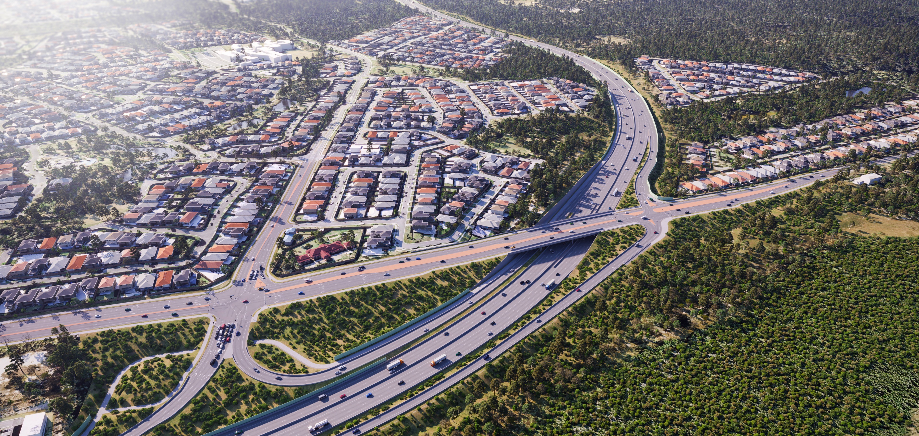
Park Ridge Connector is a preserved future transport corridor to connect communities planned at Park Ridge, Flagstone and Yarrabilba to services and employment...
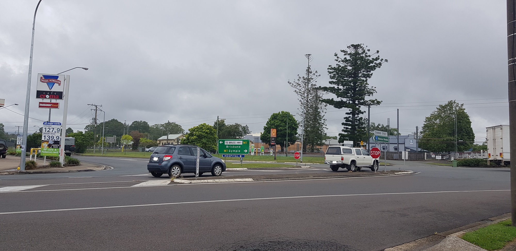
We are finalising planning for the upgrade of the intersections at Diamond and Elm Streets and Myall and Elm Streets at Cooroy...
Lindum Station, Lindum railway station, safety study, community engagement, Lindum study...
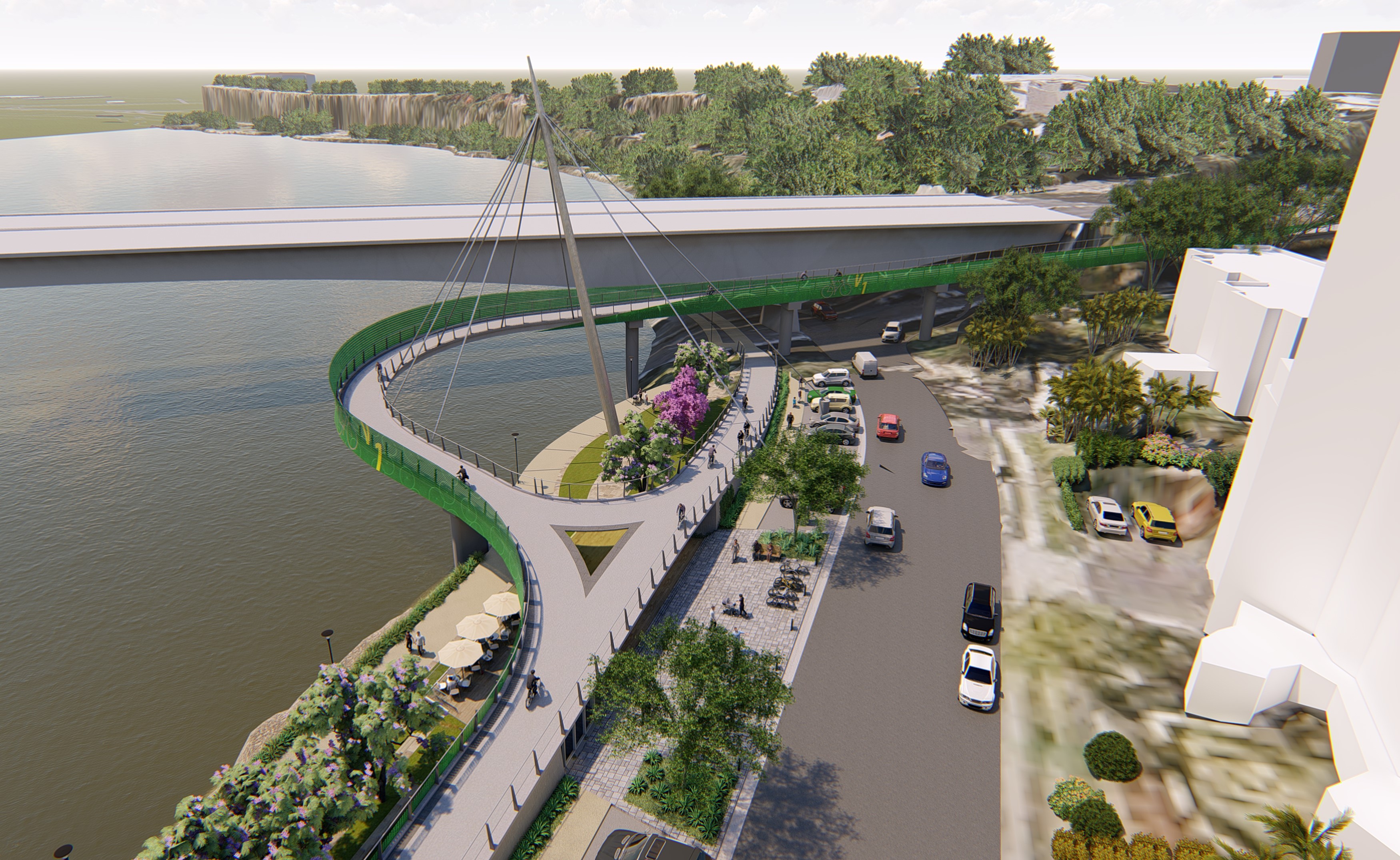
The Veloway 1 (V1) is a dedicated bikeway designed to connect people riding bikes between Lower River Terrace, South Brisbane and Eight Mile Plains, adjacent to the Pacific Motorway...
We have started work on the business case for the Pacific Motorway (M1) – Daisy Hill to Logan Motorway upgrade...
Planning is now underway for future stages of the Coomera Connector - the remaining 29kms between Loganholme and Coomera...