
Nerang-Murwillumbah Road, safety treatments
Nerang-Murwillumbah Road...
Nerang-Murwillumbah Road...

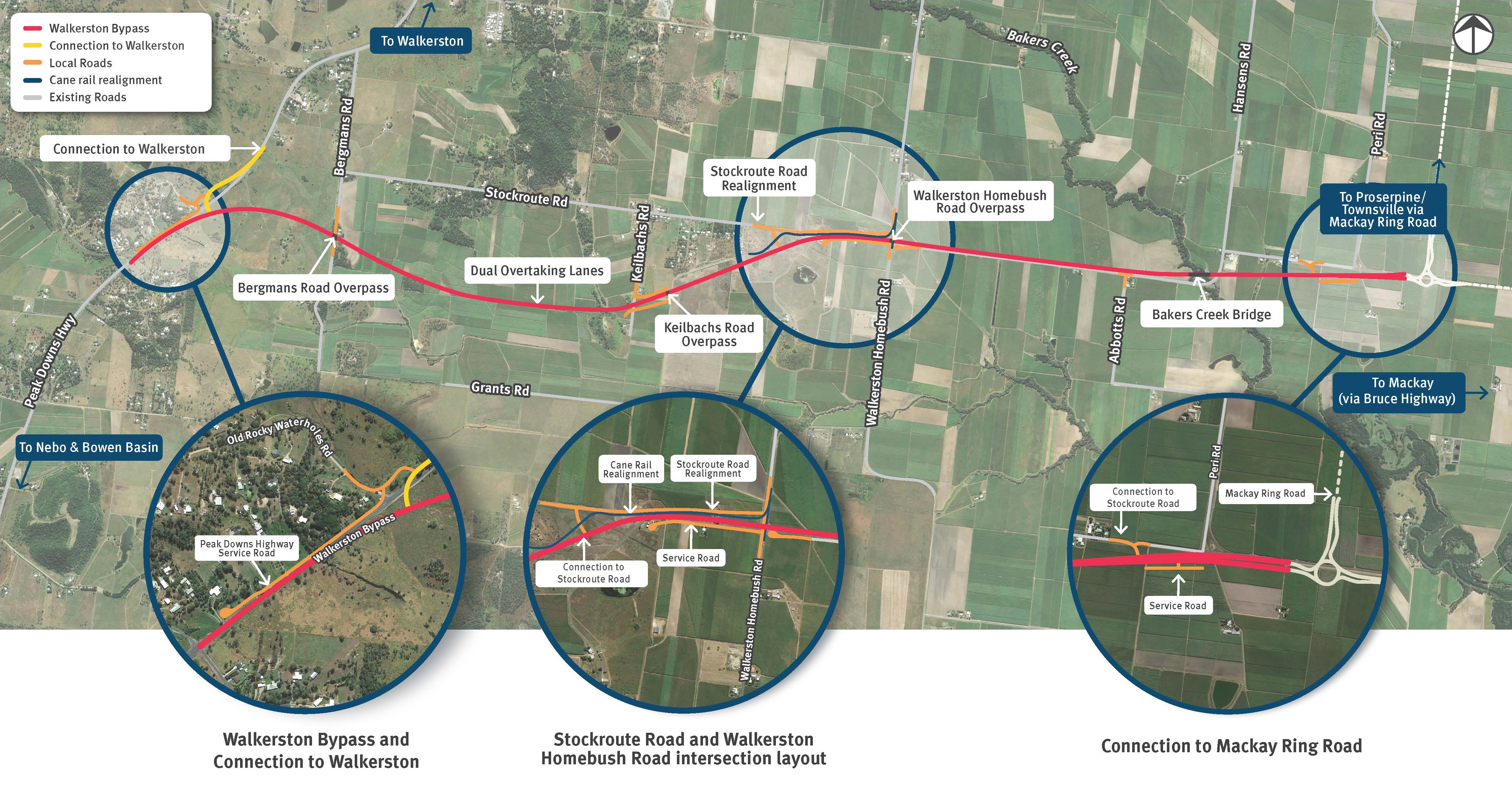
We are building a new 2-lane rural highway to connect Peak Downs Highway west of Walkerston to the Mackay Ring Road near Paget...
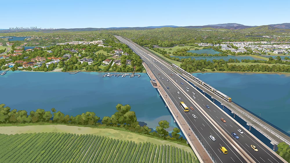
The Coomera Connector is a future state-controlled north-south corridor between Loganholme and Nerang, east of the Pacific Motorway (M1)...
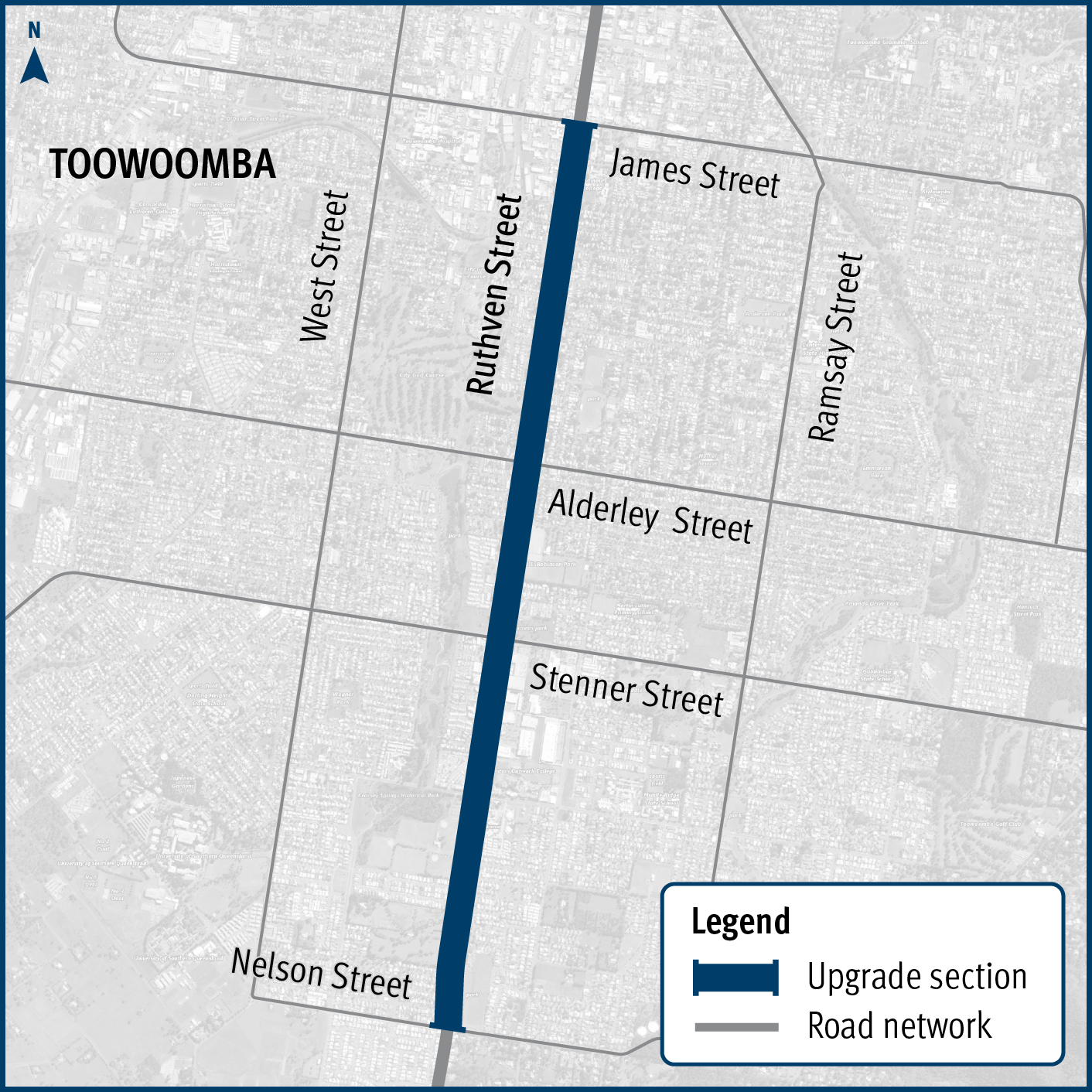
Improving safety and reduce the risk of crashes on Ruthven Street in Toowoomba’s south, between James and Nelson streets...
The Cairns Bruce Highway Upgrade master plan was released in 2010. It was the result of a planning study that investigated long term, multi-modal transport planning options to address the impacts of...
A new bridge at Wyaga Creek on the Gore Highway will improve flood immunity, safety and efficiency on one of Queensland's most important transport links...
We've completed extensive investigations on our operational management of Kin Kin Road in response to community concerns around heavy vehicle traffic...
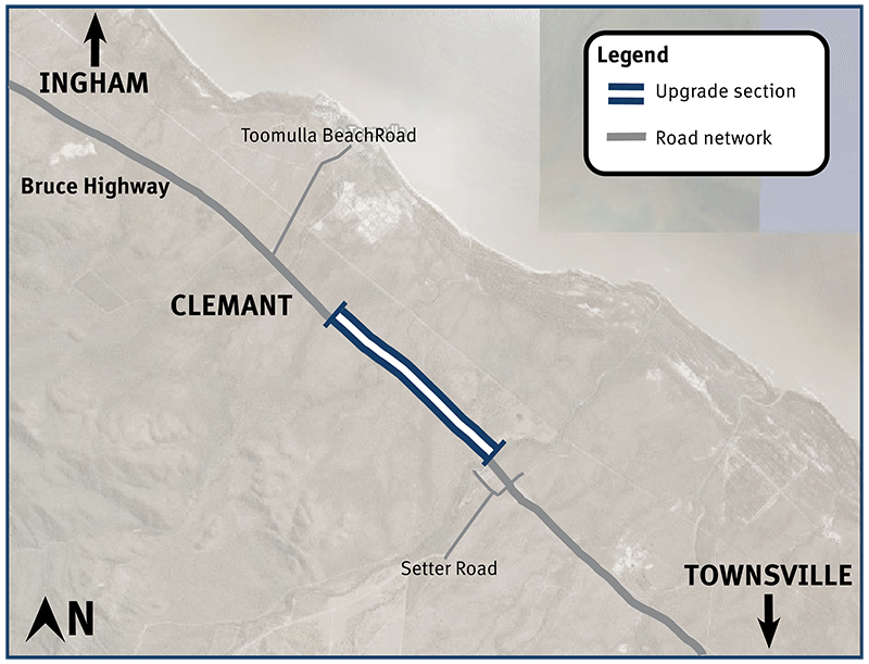
Bruce Highway safety upgrades at Clemant...
We are upgrading 4-intersections on the Mount Lindesay Highway between Jimboomba and Beaudesert...
Construction has started on flood immunity and road safety upgrades on Torbanlea – Pialba Road between Beelbi Creek and Takura...