
Cairns to Northern Tablelands Access Strategy
We are undertaking a $1.25 million planning study to look at improving the capacity and efficiency of transport routes between Cairns and the Northern Tablelands...
We are undertaking a $1.25 million planning study to look at improving the capacity and efficiency of transport routes between Cairns and the Northern Tablelands...

The department is undertaking a planning study for the upgrade to the Bruce Highway from Uhlmann Road to Buchanan Road...
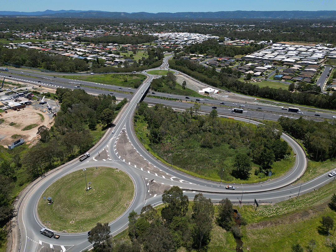
The Pacific Motorway southbound in the vicinity of the Gateway Motorway merge at Eight Mile Plains has often experienced high levels of congestion. The upgrade will increase capacity and safety for...
We are conducting a multi-modal study of the ongoing and increasing transport pressures relating to road, active transport and public transport modes in Brisbane’s inner south...
The Pacific Motorway M1 is one of Australia’s busiest highways and is a national freight route...
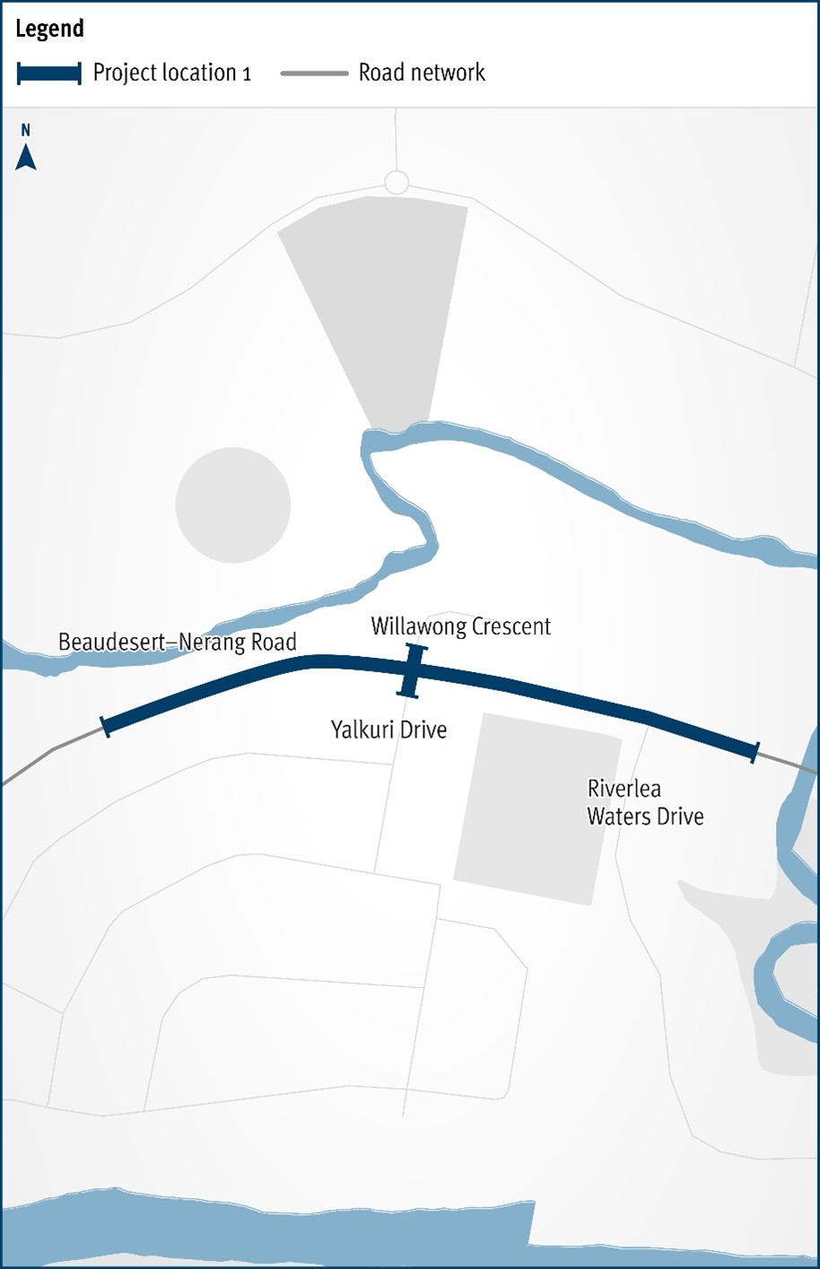
The Department of Transport and Main Roads will be improving the safety and efficiency of the Beaudesert–Nerang Road, Yalkuri Drive and Willawong Crescent intersection at Nerang...
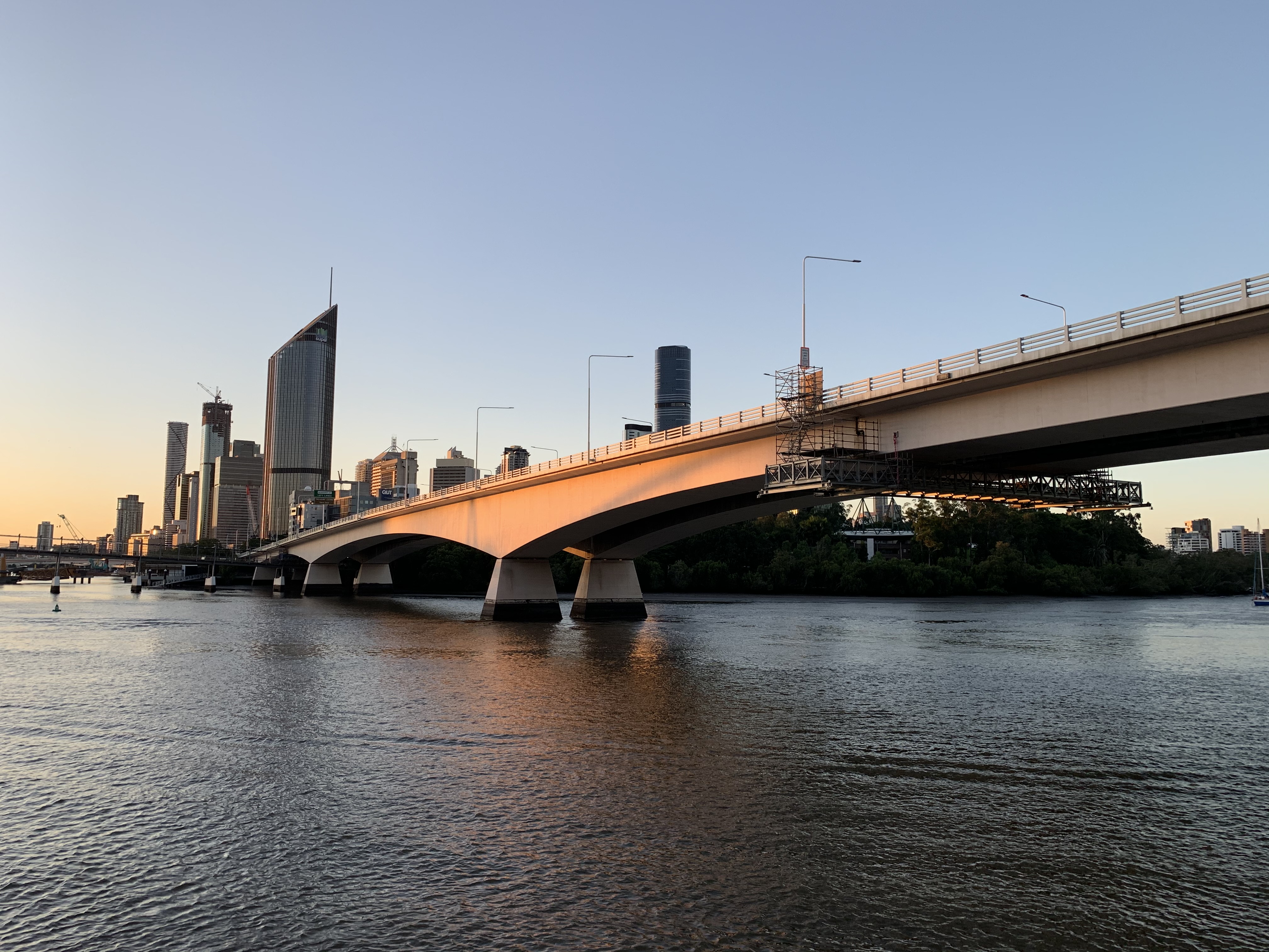
The Department of Transport and Main Roads is currently undertaking maintenance works on the Captain Cook Bridge...
Planning for the Gympie Arterial Road and Murphy Road intersection, including Downfall Creek Bridge, to improve safety and reduce congestion...
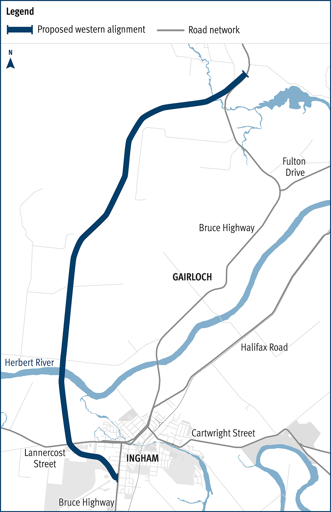
The department has been actively working with the community to address the challenges associated with the Bruce Highway from South of Ingham to the Cardwell Range...
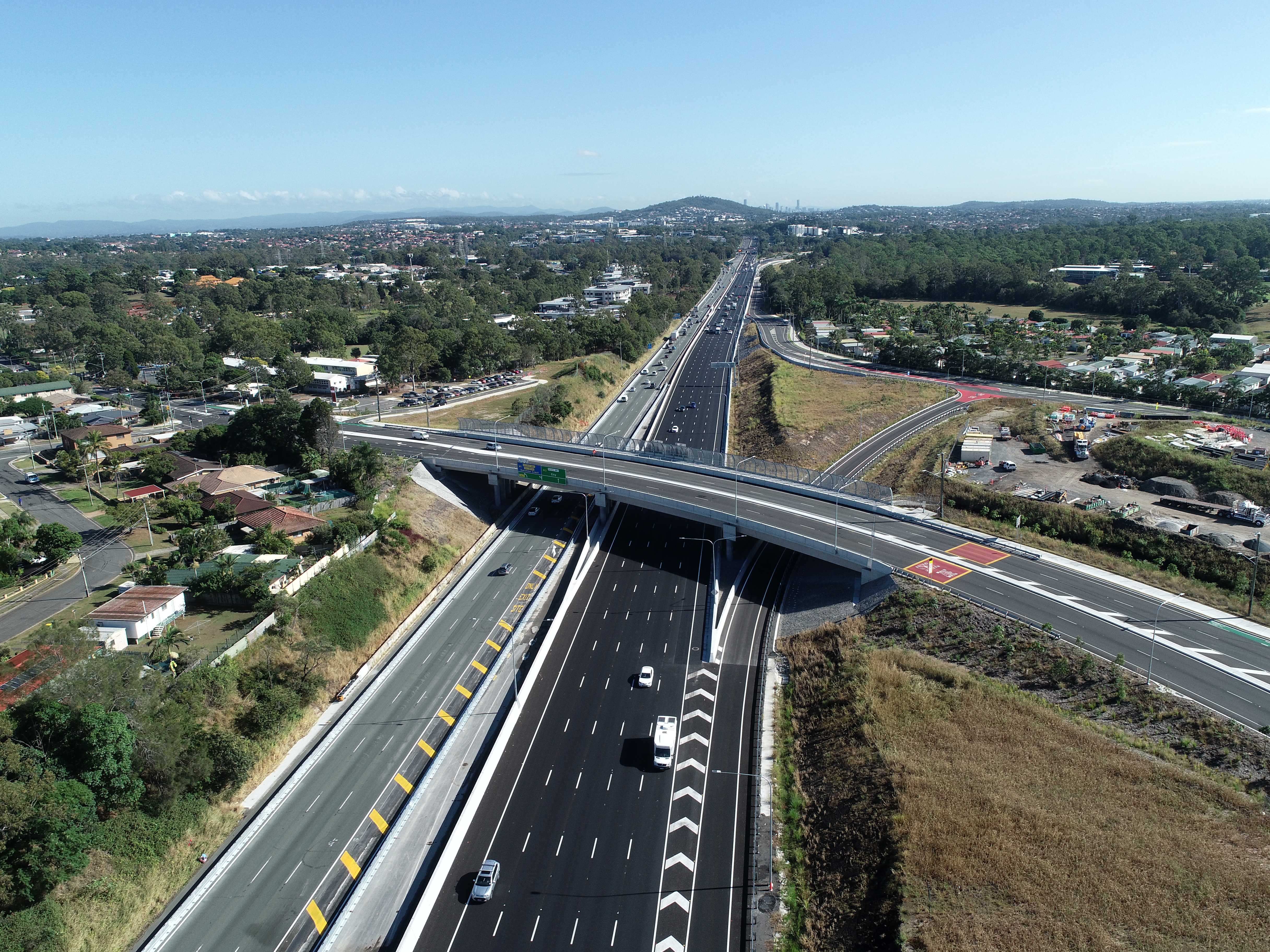
Rocklea to Darra Stage 1 is the 3km upgrade of the Ipswich Motorway between Granard Road, Rocklea and Oxley Road, Oxley...