
Bruce Highway (Brisbane - Gympie), Buchanan Road to Caboolture-Bribie Island Road upgrade, business case
The department is undertaking a planning study for the upgrade to the Bruce Highway from Uhlmann Road to Buchanan Road...
The department is undertaking a planning study for the upgrade to the Bruce Highway from Uhlmann Road to Buchanan Road...
Planning for the Gympie Arterial Road and Murphy Road intersection, including Downfall Creek Bridge, to improve safety and reduce congestion...

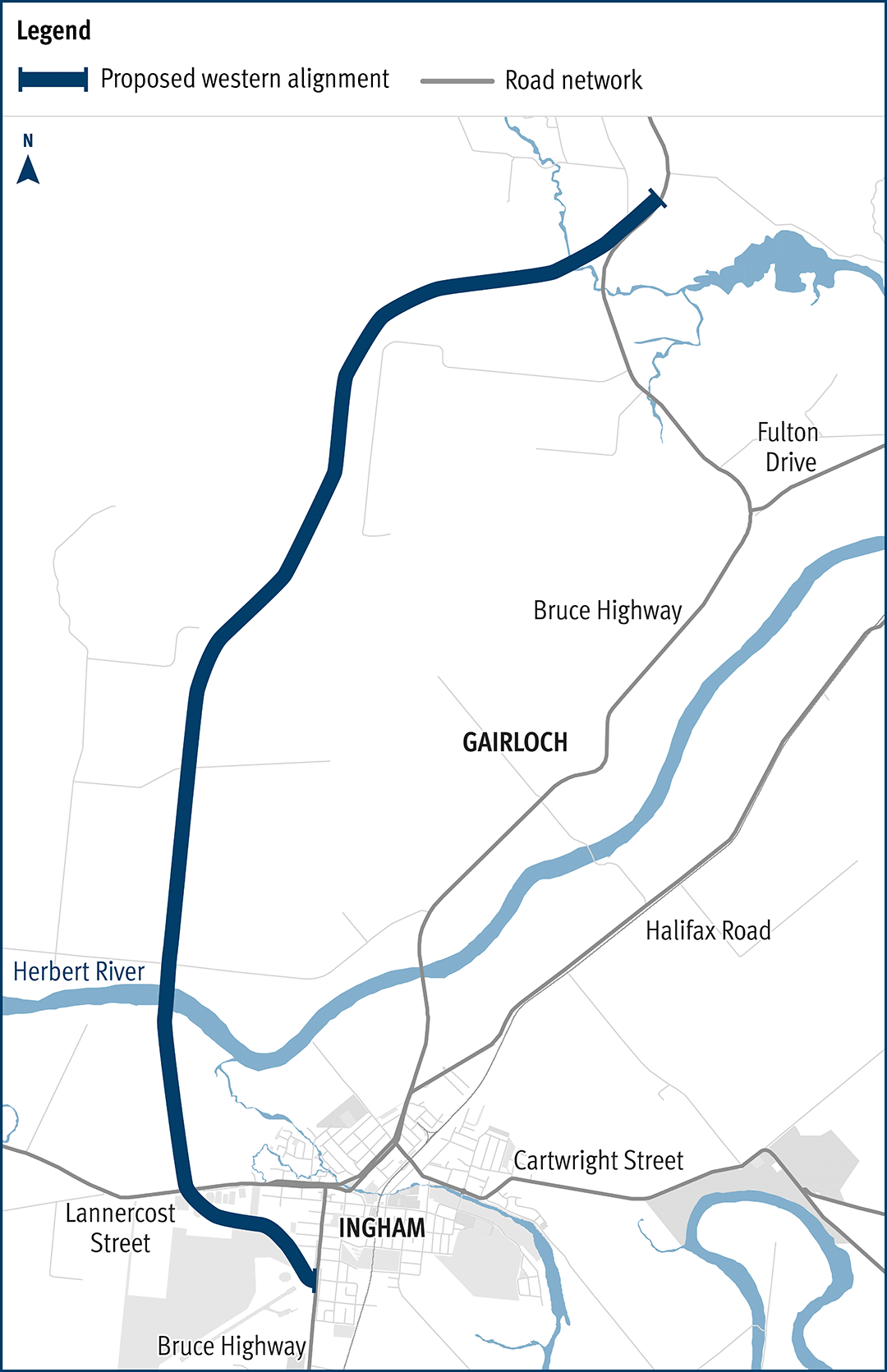
The department has been actively working with the community to address the challenges associated with the Bruce Highway from South of Ingham to the Cardwell Range...
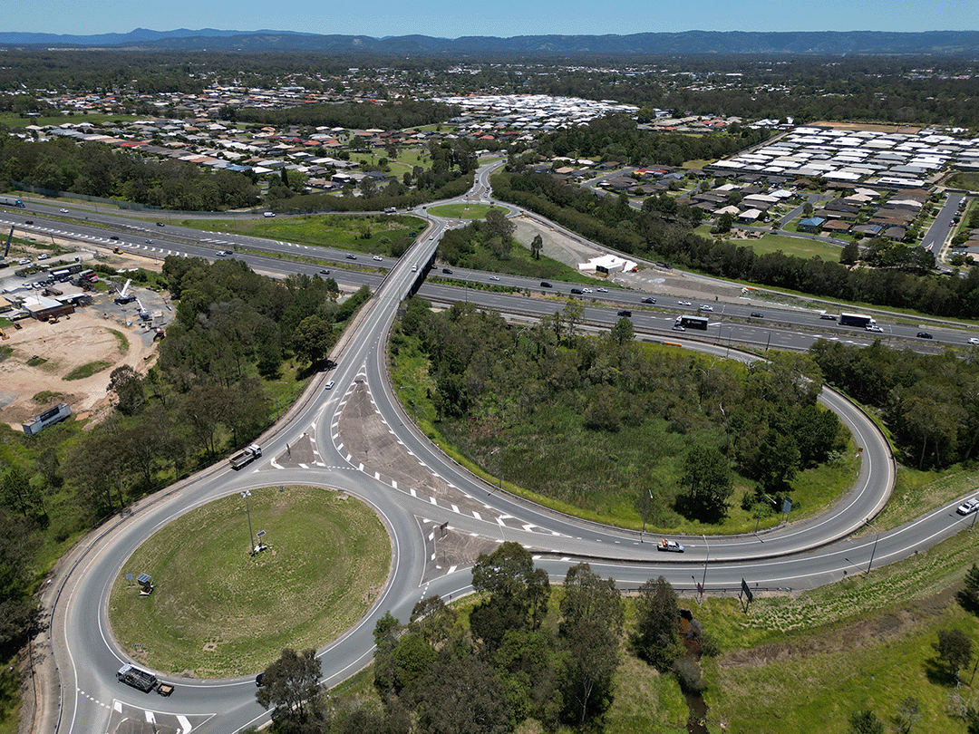
We have finalised a preferred concept plan for the intersection of Stafford Road and South Pine Road, Everton Park...
The department is undertaking a business case for a potential future project on Brisbane–Beenleigh Road, between the intersections of Loganlea Road and Waterford–Tamborine Road. The community is...
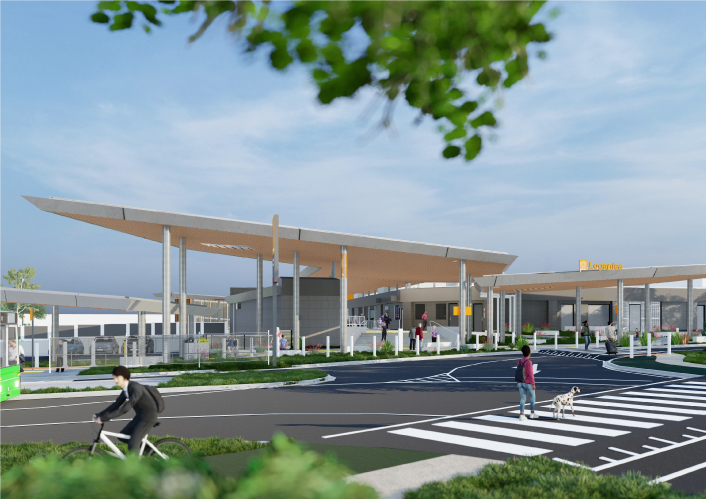
We are relocating Loganlea Station and the park ‘n’ ride closer to Logan Hospital...
The department has identified and preserved a new rail corridor between Landsborough and Nambour, which will replace the existing North Coast line through this section...
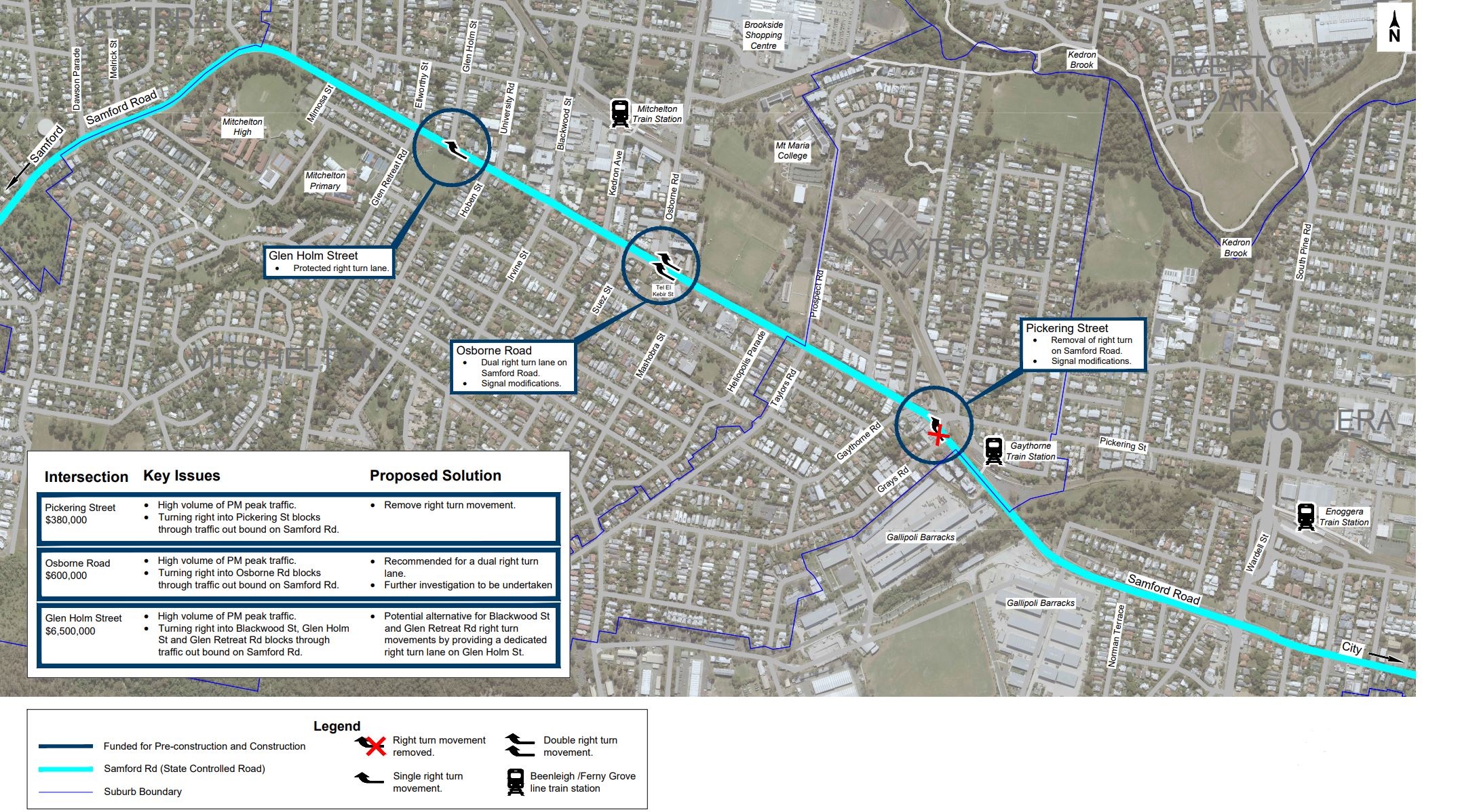
We are currently undertaking community consultation on proposed safety and traffic improvement works at key intersections along Samford Road, at Pickering Street, Glen Holm Street and Osborne Road...
The Department of Transport and Main Roads (TMR) is undertaking planning to identify preferred options that address safety issues at the Warrego Highway and Haigslea-Amberley Road intersection...
The department has developed a plan to upgrade the Cunningham Highway...