Edens Landing train station upgrade
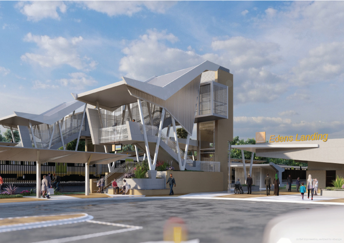
We're upgrading the Edens Landing train station to improve accessibility, safety, and overall customer experience as part of the Logan and Gold Coast Faster Rail project...
We're upgrading the Edens Landing train station to improve accessibility, safety, and overall customer experience as part of the Logan and Gold Coast Faster Rail project...
Maryborough-Hervey Bay Road/Ibis Boulevard/Fairway Drive intersection upgrade...

Community feedback is being sought to plan improvements to the New England Highway at Cooyar...
We are planning the Gold Coast Light Rail Stage 4, a world class public transport system for residents and visitors to the Gold Coast...
Planning will be undertaken for Beenleigh–Redland Bay Road between Logandale Boulevard and Mount Cotton Road...
We are progressing the planning for a $359 million program of road upgrades on Captain Cook Highway between Cairns and Smithfield...
Planning for the Gympie Arterial Road and Murphy Road intersection, including Downfall Creek Bridge, to improve safety and reduce congestion...
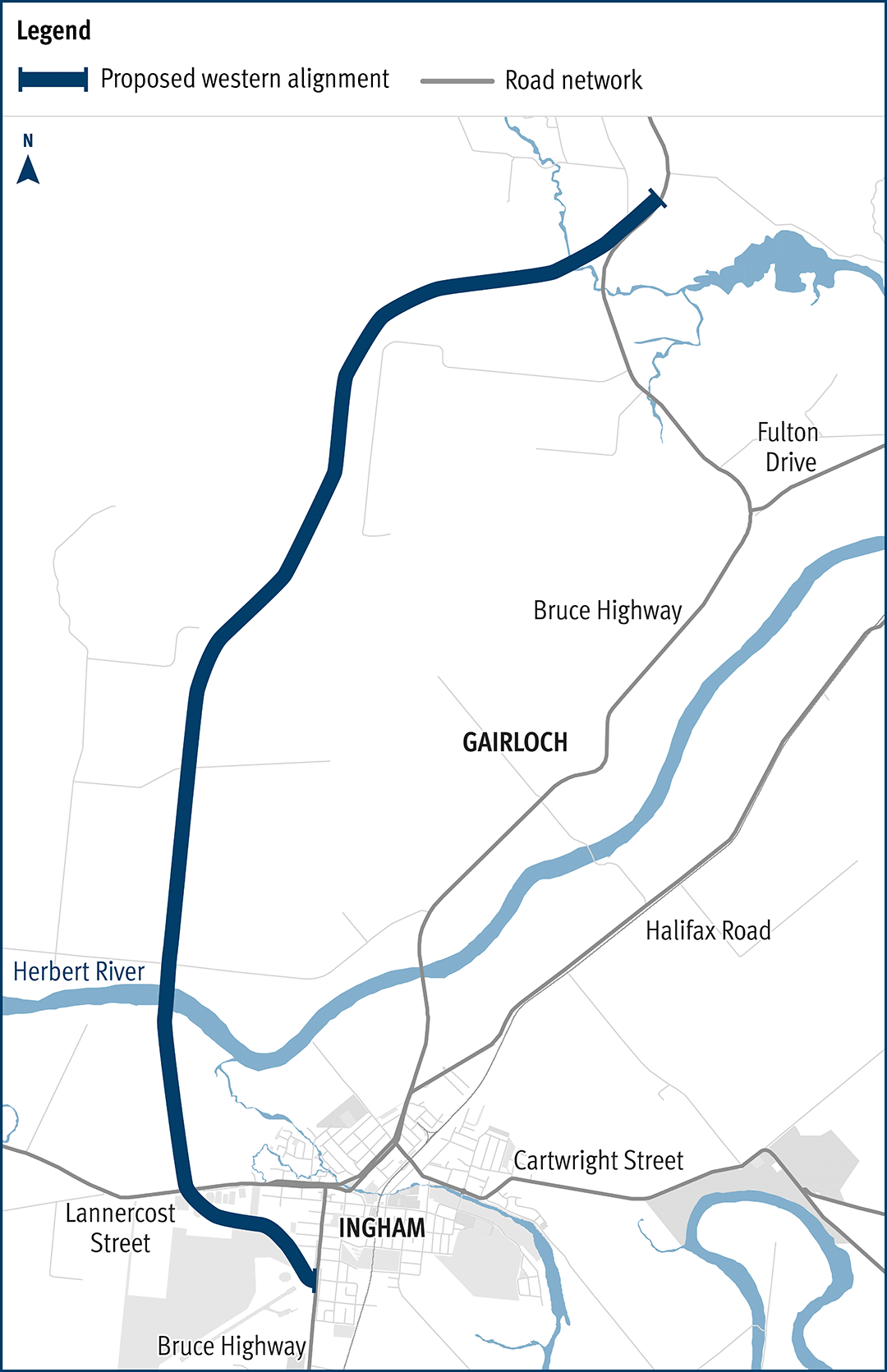
The department has been actively working with the community to address the challenges associated with the Bruce Highway from South of Ingham to the Cardwell Range...
We are working with the Gold Coast City Council to identify recommendations for the future strategic passenger transport network in the central Gold Coast over the next 25 years...
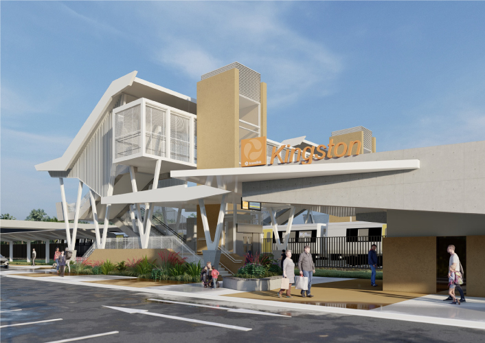
We're upgrading the Kingston train station to improve accessibility, safety, and overall customer experience as part of the Logan and Gold Coast Faster Rail project...