Showing results 71-78 of 78

Sort results
Sort results
  1. Kennedy Highway (Cairns - Mareeba), Kuranda Range, Intelligent Transport System

    Installation of additional Intelligent Transport Systems (ITS) treatments on Kuranda Range Road is underway...

  2. Pacific Motorway, Eight Mile Plains to Daisy Hill Upgrade (Pacific Highway early works upgrade)

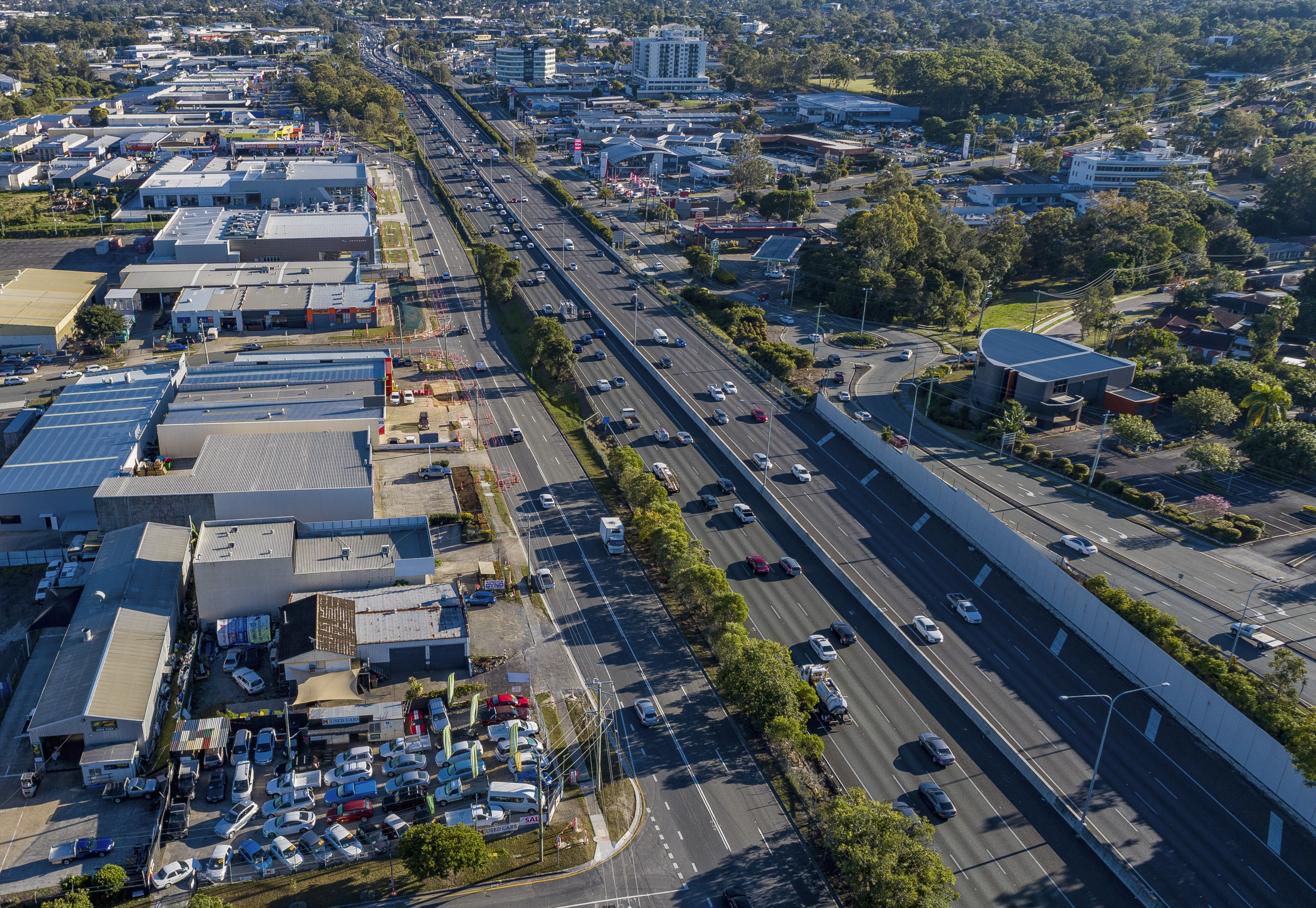
    We are upgrading the Pacific Highway (western service road) between Moss Street and Carlyle Street, Slacks Creek...

    Aerial photo of Pacific Highway early works location
  3. Pacific Motorway, Exit 41, upgrade interchange

    The project has delivered a number of safety benefits to motorists using the M1 and the surrounding local road network, including Lahrs Road, Eastern Service Road, Computer Road, and Cuthbert Drive...

    No image supplied
  4. Bundaberg Port Rail Link Study

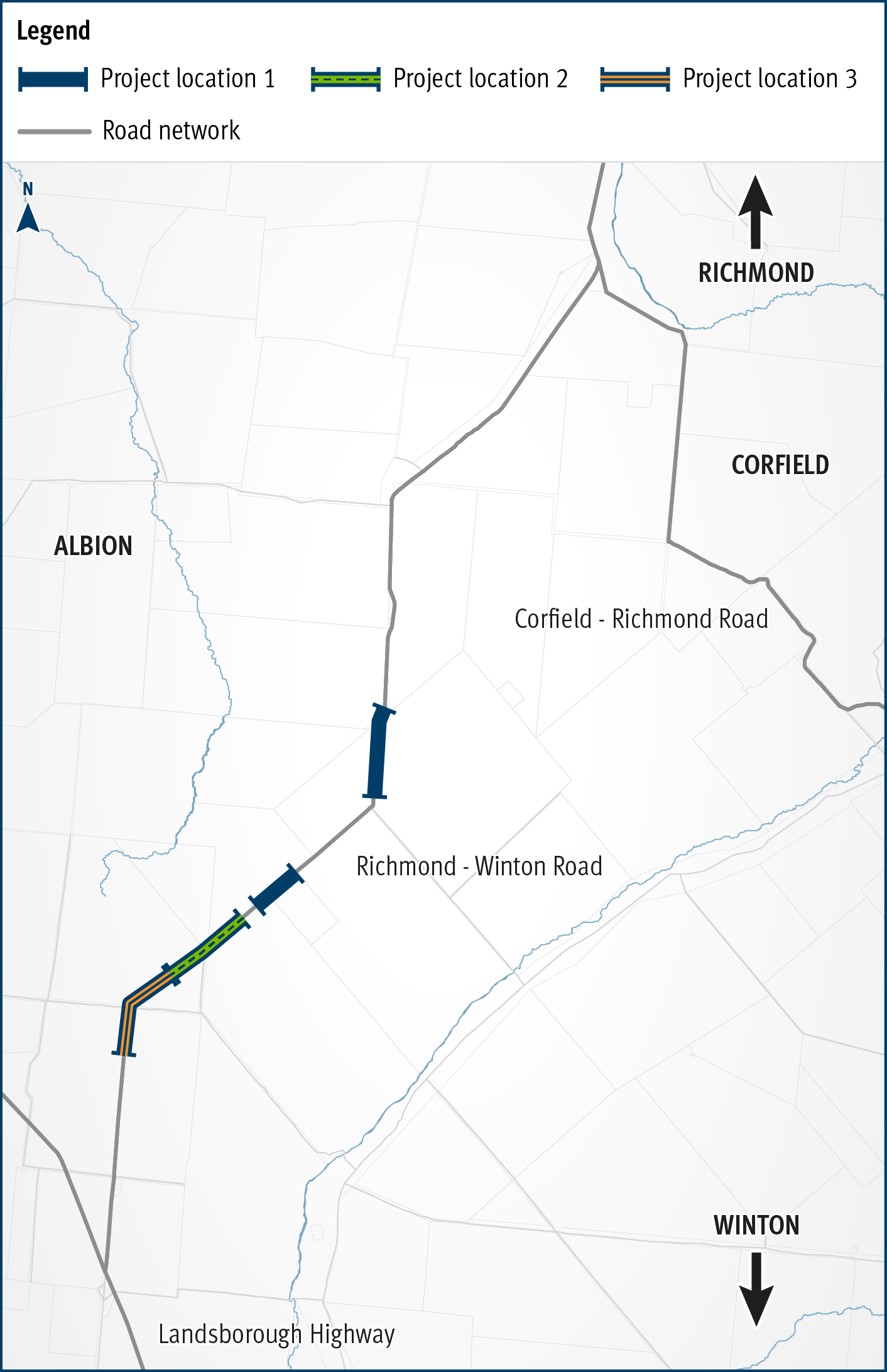
    The study report determined that protection of the corridor within the local government planning scheme was not warranted at the time, and the project was closed...

    No image supplied
  5. May Downs Road, pave and seal

    The May Downs Road, pave and seal project is delivering $8 million in road improvements to boost connectivity between the western and eastern parts of the Isaac Regional Council area...

    Map showing the location of work to be completed on the May Downs Road.
  6. Richmond-Winton Road, pave and seal

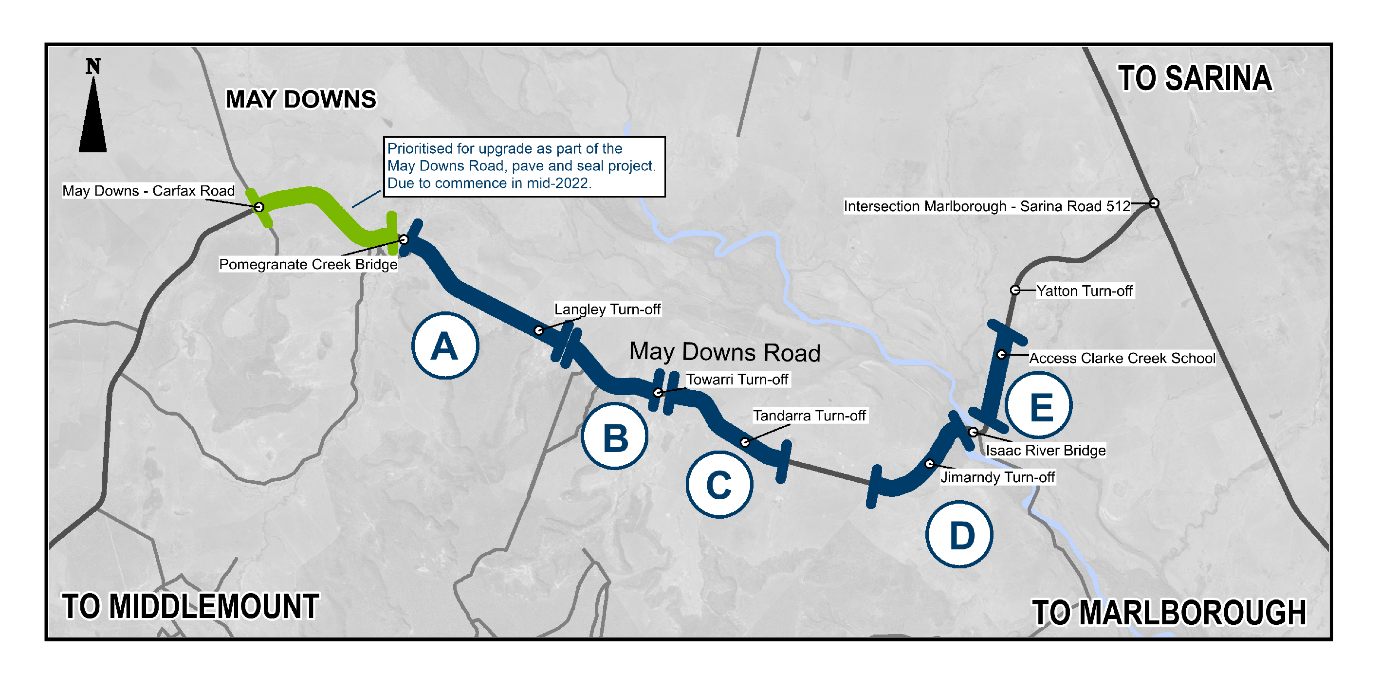
    Another 3km of the road is being sealed to improve safety and travel times on this key transport link...

    The map shows the locality of three separate projects on the Richmond-Winton Road delivered as part of a progressive approach to sealing this road. The road is located between Richmond and Winton in western Queensland, with the three projects closest to Winton. Project location 1 is shown by a solid blue line. Project location 2 is shown by a green line with a broken blue line in the centre. Project location 3 is shown by an orange line with a blue line in the centre. The surrounding road network, including the Landsborough Highway and local government owned Corfield-Richmond Road are also shown on the map.
  7. Warwick principal cycle network plan, business case

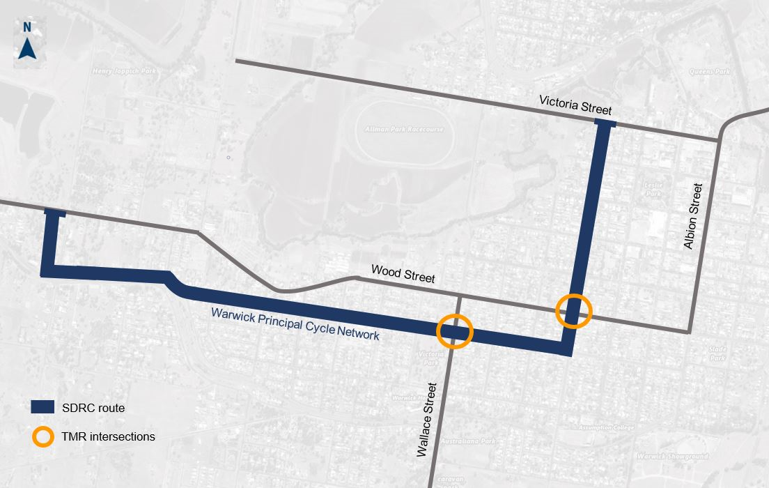
    The planning project will establish a long-term vision to provide fit-for-purpose bike facilities along a desirable principal bike route in Warwick that encourages more people to ride more often...

    Image of Warwick principal cycle network plan, business case locations. Cunningham Highway and Dragon Street intersection, and the New England Highway and Pratten Street intersection.  Dragon, Pratten and Easey streets.
  8. Bruce Highway, Cairns Southern Access Corridor (Stage 3), Edmonton to Gordonvale

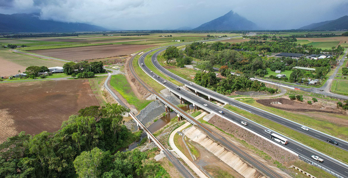
    A 10.5km upgrade and duplication of the Bruce Highway between Edmonton and Gordonvale is being delivered. The project is Stage 3 of the Cairns Bruce Highway Upgrade Master Plan released in 2010...

    John Davies Bridge, Bruce Highway, between Edmonton to Gordonvale
  1. Page 1
  2. ...
  3. Page 7
  4. Page 8
Next Page (disabled)