Showing results 1-10 of 78

Sort results
Sort results
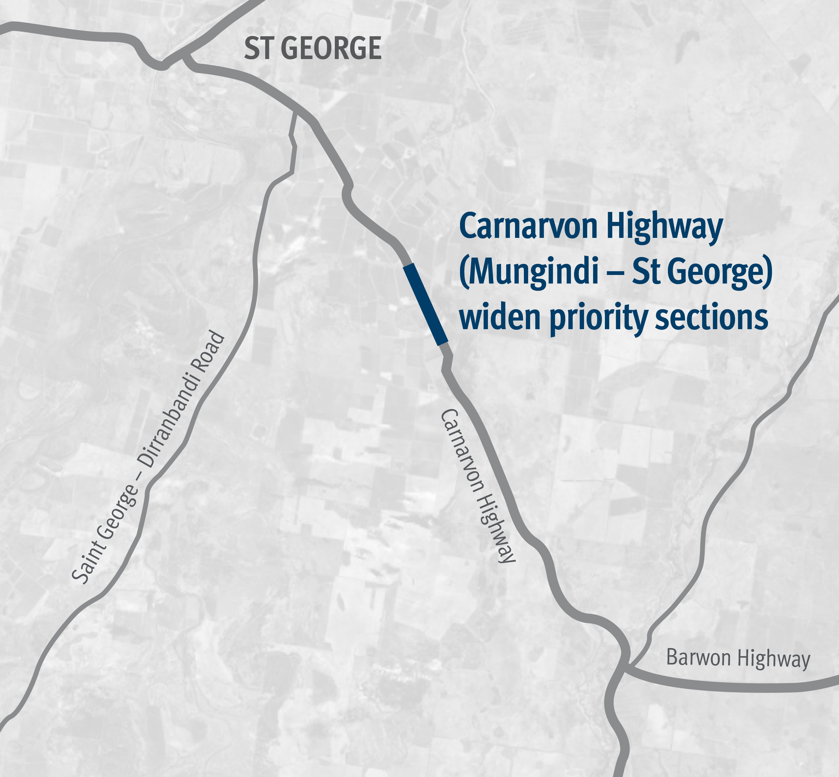
  1. Carnarvon Highway (Mungindi – St George), widen and seal

    Works involved pavement widening and sealing between 81.71km and 84.99km east of St George...

    Carnarvon Highway Mungindi St George project map
  2. Townsville Northern Access Intersections Upgrade (Bruce Highway, Veales Road to Pope Road)

    The Townsville Northern Access Intersections Upgrade project will improve road safety, efficiency and travel time reliability for freight and passenger vehicles on the Bruce Highway in Townsville...

    No image supplied
  3. Varsity Lakes train station park 'n' ride upgrade

    We are currently undertaking the business case phase to upgrade the park 'n' ride at Varsity Lakes train station...

    No image supplied
  4. Southern Queensland 2022 flood reconstruction works

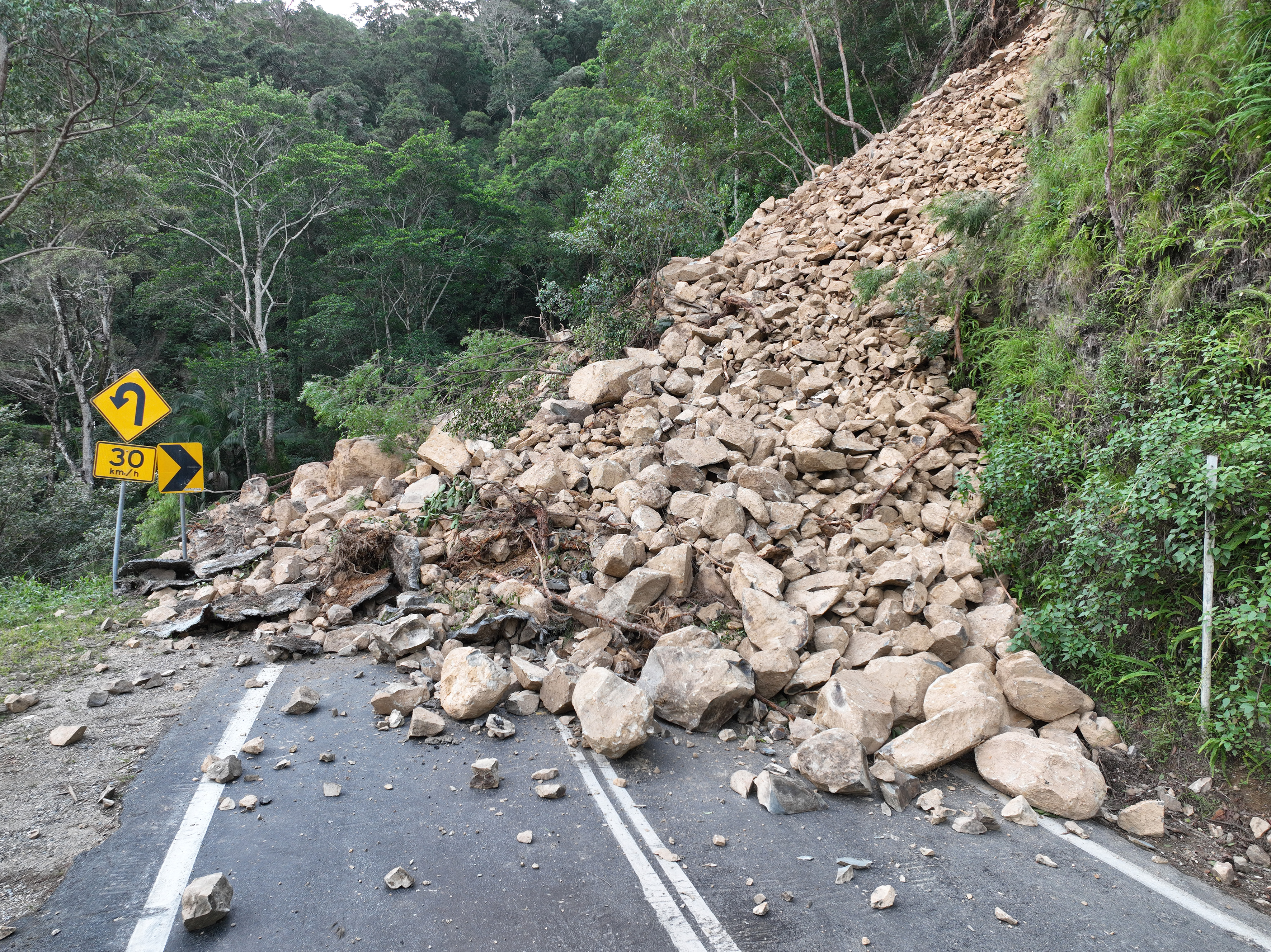
    Repairs are underway across South East Queensland after extensive and severe flooding was caused by sustained heavy rainfall in late February 2022...

    Landslip on Gold Coast - Springbrook Road
  5. Beaudesert – Nerang Road and Yalkuri Drive, upgrade intersection

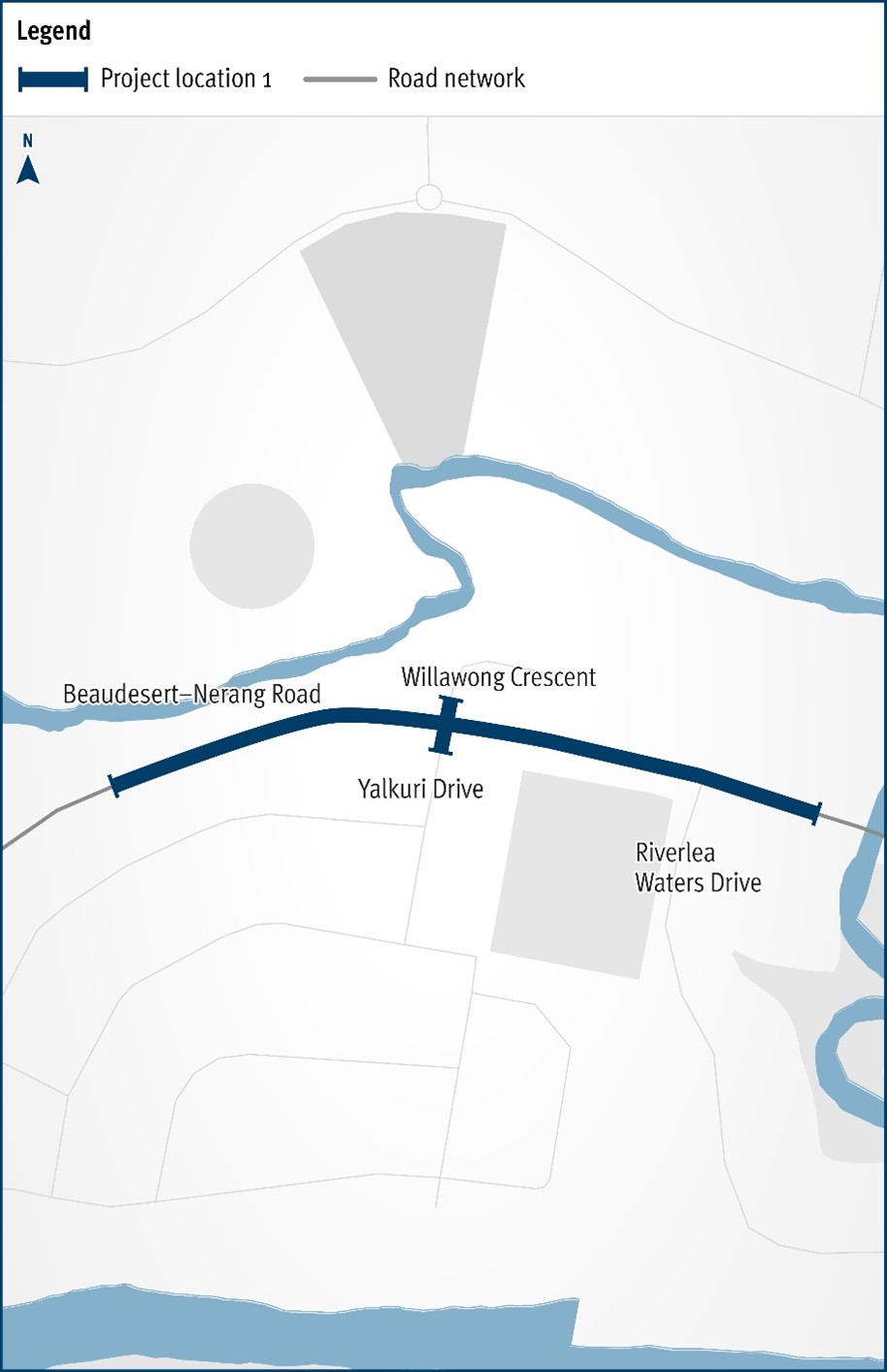
    The Department of Transport and Main Roads will be improving the safety and efficiency of the Beaudesert–Nerang Road, Yalkuri Drive and Willawong Crescent intersection at Nerang...

    The map shows the locality of the proposed Beaudesert-Nerang Road, Yalkuri Drive and Willawong Crescent intersection upgrade. Beaudesert is located to the west and Nerang to the east of the project location. A solid dark blue line indicates the project extent, which encompasses Yalkuri Drive south of the intersection and Willawong Crescent north of the intersection, as well as Beaudesert–Nerang Road, which is located west and east of the intersection. The local road network, Riverlea Waters Drive is also highlighted on the map.
  6. Gore Highway (Pittsworth - Millmerran), various locations, rehabilitate pavement

    This project will rehabilitate sections of the Gore Highway between Pittsworth and Millmerran...

    No image supplied
  7. Captain Cook Bridge maintenance works

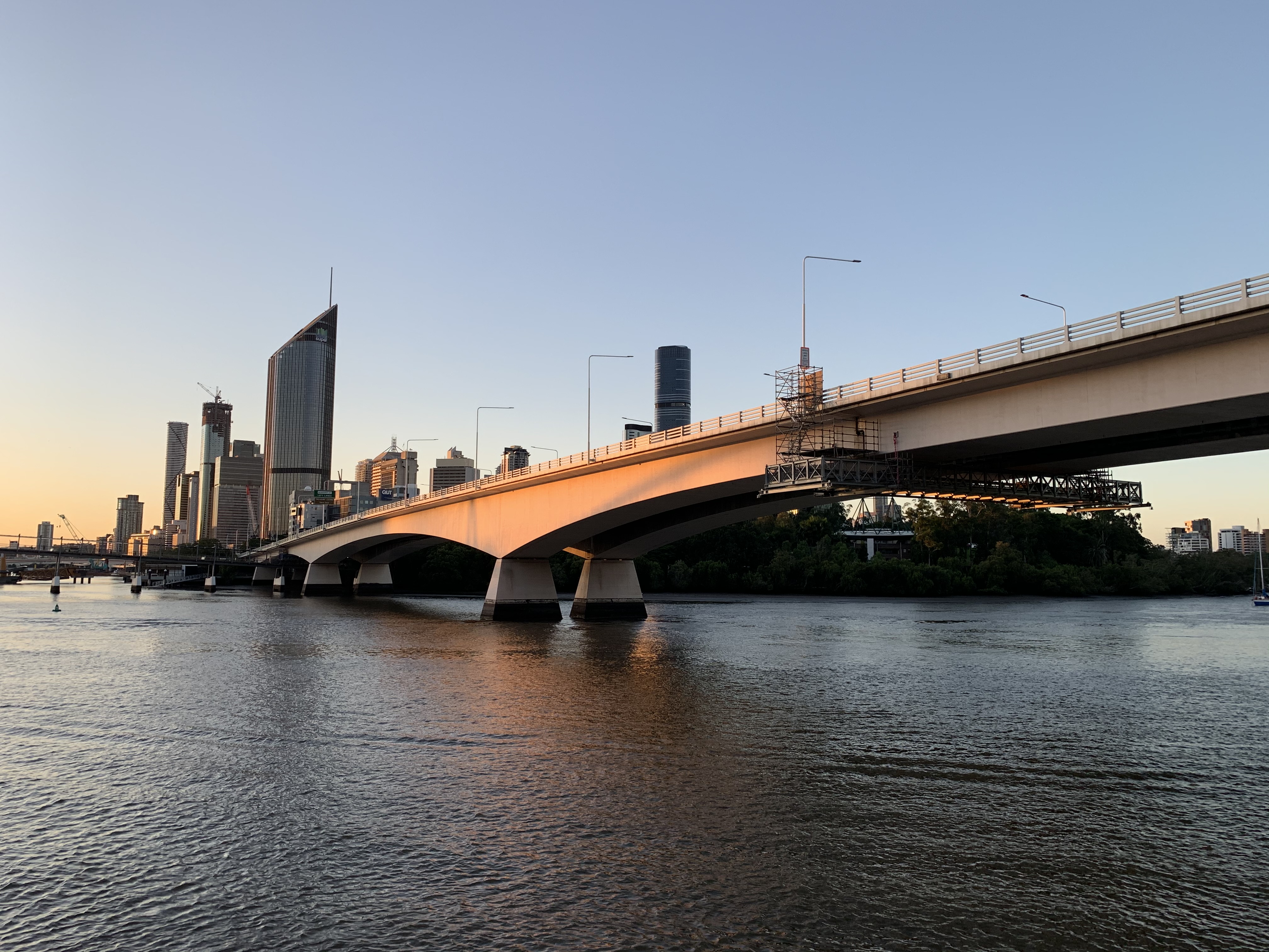
    The Department of Transport and Main Roads is currently undertaking maintenance works on the Captain Cook Bridge...

    Captain Cook Bridge
  8. Cramsie-Muttaburra Road, rehabilitate and widen pavement

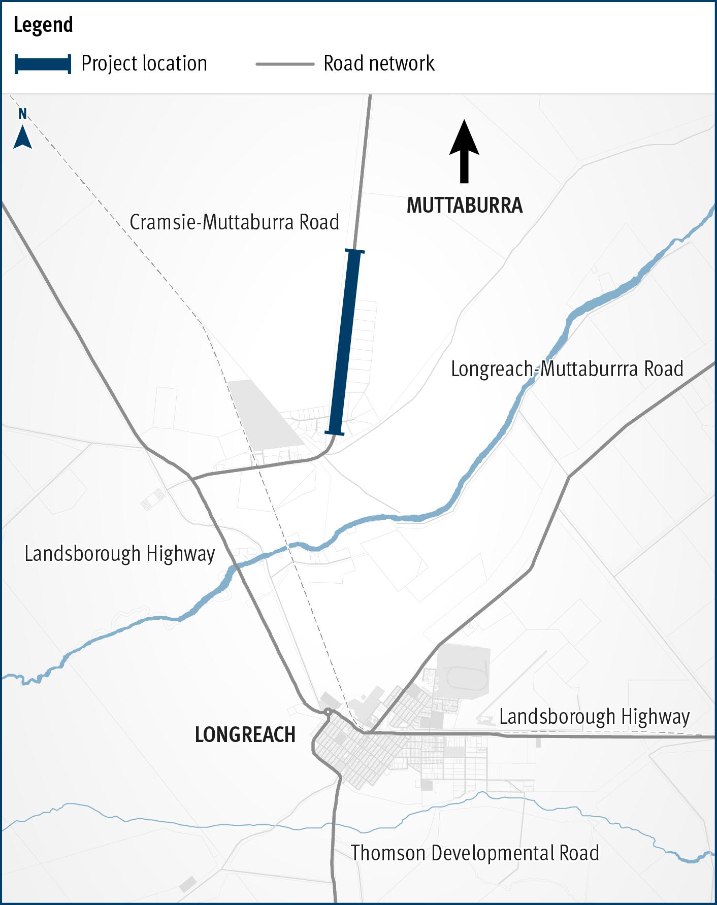
    This project will widen and rehabilitate a 3km section of aged, narrow pavement on the Cramsie-Muttaburra Road to a width of 8m, improving safety, overtaking opportunities and travel times...

    The map shows the location of rehabilitation and widening works underway on a three kilometre section of the Cramsie-Muttaburra Road. The road is situated between Longreach and Muttaburra in Central West Queensland. The map shows the proximity of the works to the Longreach township and includes the surrounding road network, such as the Landsborough Highway and local government-owned Longreach-Muttaburra Road.
  9. Walkerston Bypass

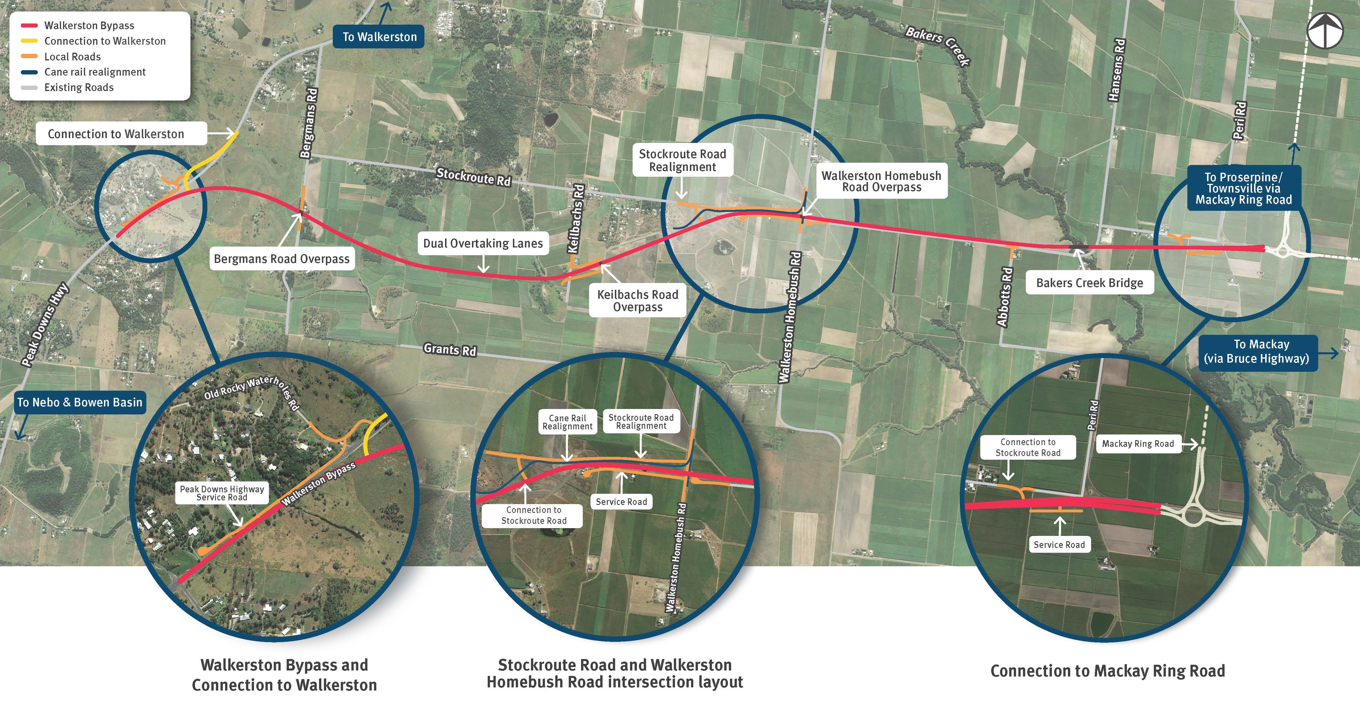
    We are building a new 2-lane rural highway to connect Peak Downs Highway west of Walkerston to the Mackay Ring Road near Paget...

    Walkerston Bypass map detail several upgrades
Previous Page (disabled)
  1. Page 1
  2. Page 2
  3. ...
  4. Page 8